As part of our Modernizing Census 2030 with GIS webinar series, we recently explored how national statistical organizations are beginning to use AI to improve data dissemination and access to official statistics. This webinar answers the question: how can organizations help users find, understand, and use authoritative statistical and geographic information more effectively?
Through examples from Mexico’s National Institute of Statistics and Geography (INEGI) and Kuwait’s Public Authority for Civil Information (PACI), attendees saw how conversational interfaces can help bridge the gap between complex geospatial data and the people who need answers.
Discover the key insights from each presentation below, then access the on-demand webinar to learn how organizations are using AI to transform access to official statistics.
INEGI tests the ArcGIS Hub AI Assistant
Alejandra Figueroa Martinez shared INEGI’s pilot implementation of the ArcGIS Hub Assistant. The project focused on helping users find official statistical and geographic information using natural language rather than requiring detailed knowledge of datasets or GIS workflows.
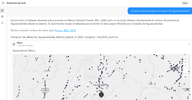
Through the pilot, INEGI identified several key lessons about deploying AI Assistants effectively. One of the most important lessons was that successful AI experiences depend on well-organized data and strong metadata. INEGI improved the assistant’s ability to identify the correct information and provide relevant responses by creating detailed metadata that included descriptions on how similar layers are unique.
INEGI’s testing also found that conversational interfaces can lower barriers to data discovery. Users can ask questions in natural language, visualize results on a map, and review the reasoning behind the assistant’s responses. The assistant was also highly transparent, explaining when questions were out of its’ realm, and acting as a guide suggesting recommended analytical approaches.
Interested? The ArcGIS Hub assistant is now available in public beta for ArcGIS Online. Read the blog.
PACI creates a custom, geospatial AI experience
Maher Abdel Karim presented PACI’s work on a conversational GIS application designed to support government decision-making. The system translates questions asked in Arabic or English into spatial analysis workflows powered by authoritative national datasets from PACI. The application routes questions through specialized agents, performs validated analytical processes, and returns maps, dashboards, rankings, and explanations that document the methodology, data sources, and assumptions behind each result.
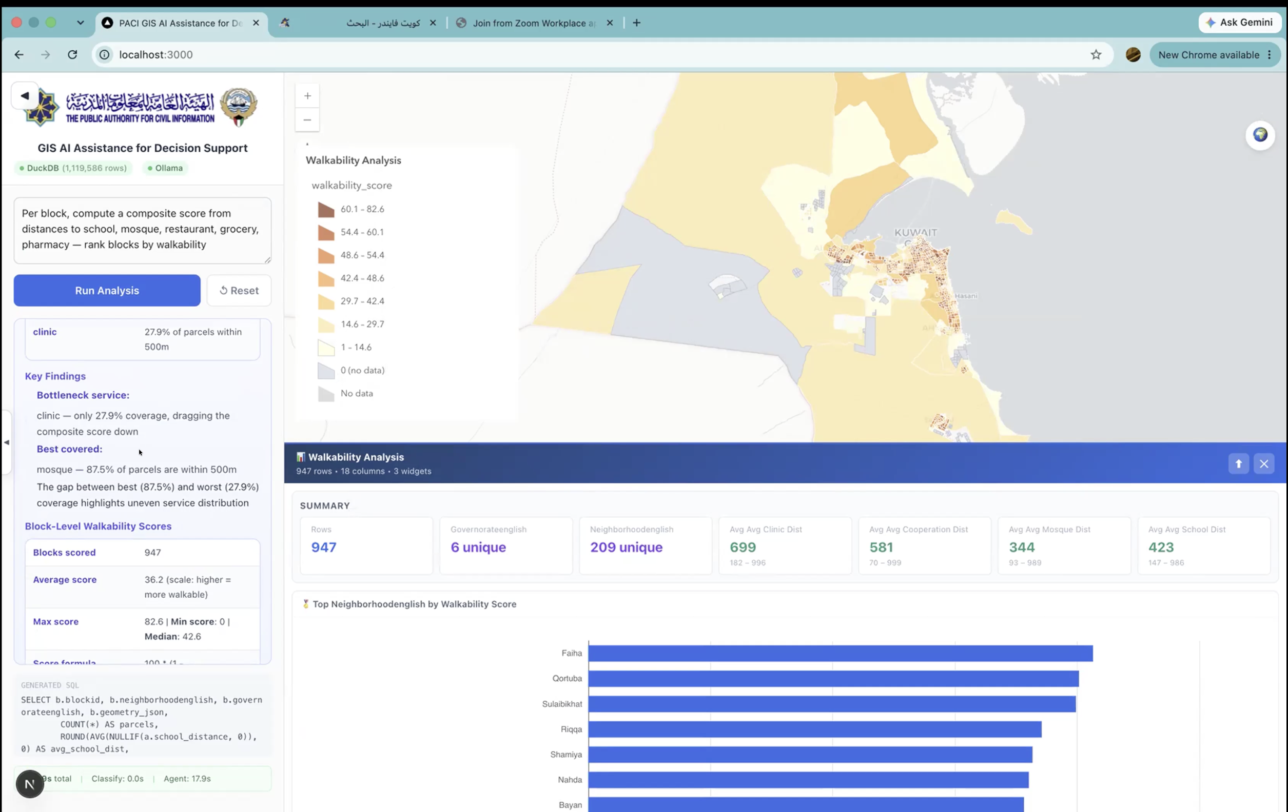
The application transformed questions about demographics, accessibility, services, and neighborhood characteristics into maps, dashboards, rankings, and written explanations. What stood out was the emphasis on explaining the answer, not just generating it. The application documents the methodology, data sources, and assumptions used to produce each result. That level of transparency is especially important when organizations use analysis to inform government decisions.
MCP Overlay for ArcGIS Enterprise
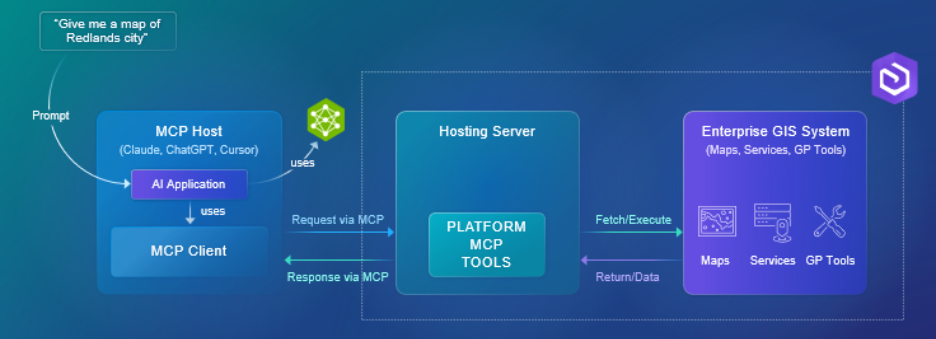
Building on these real-world examples, the webinar concluded with an Esri presentation on the beta MCP Overlay for ArcGIS Enterprise. This MCP overlay acts as a structured integration layer, that allows AI applications to safely discover and invoke ArcGIS capabilities. This isn’t just the data, but the ability to geocode, route, perform some analysis, and these capabilities will only grow.
The demonstration also included a quick vignette on the Item Details Assistant, an AI powered tool to create robust metadata for your layer, fields, and item overview. This assistant was used first to create the metadata needed to help guide AI Agents.
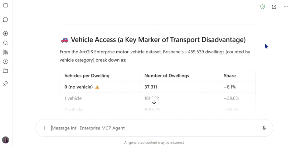
With the MCP overlay, Microsoft Copilot directly referenced data from ArcGIS Enterprise to answer questions about Australia’s demographics. It then supplemented that data with other MCP connections – to Foursquare, and a World Bank data source. Instead of searching the web to answer the question, the agent searched the authoritative data sources, and returned answers with notes on limitations due to data completeness.
To get access to the MCP Overlay, join the Esri Early Adopter Community.
For statistical data dissemination, these examples show that the opportunity is not simply to publish more data, but to make that data easier to access, understand, and use.
Want to learn more about Modernizing Census 2030 with GIS? Access our on-demand webinars: