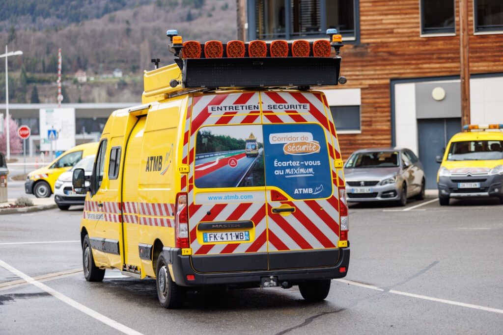
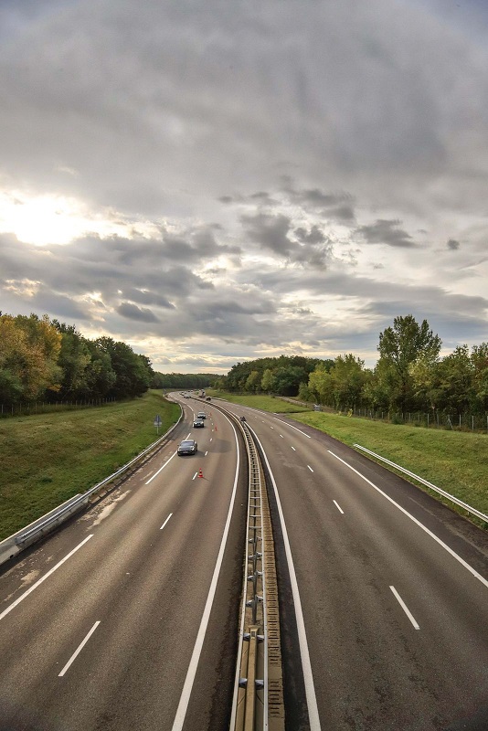
Autoroutes et Tunnel du Mont Blanc (ATMB) is more than just a highway operator. They are best known for overseeing a critical 110-kilometer stretch of road infrastructure, including the iconic Mont Blanc Tunnel. Additionally, ATMB is responsible for managing the complex and growing web of fiber optic cables that support both internal operations and external service providers. These fiber lines enable vital systems like tolling, traffic management, emergency response, and leased communications services for regional telecom providers.
As the fiber network expanded, it became harder to maintain clear, consistent, and accurate records. Teams were relying on disconnected files, formats, and manual updates to manage critical infrastructure. ATMB recognized the risks, ranging from service outages to regulatory noncompliance, and decided it was time to modernize how they managed their telecom assets.
The Challenge: Disconnected Data and Rising Pressure
Managing a fiber optic network across highways and through tunnels presents unique technical and operational challenges. ATMB’s fiber lines are buried beneath complex road systems and rugged terrain, making them hard to access and even harder to map with precision. Yet, the demands on these lines have never been greater.
One of the core issues ATMB faced was the absence of a centralized, up-to-date view of its telecom infrastructure. Asset data lived in many different places: PDFs, AutoCAD drawings, shapefiles, and scattered documentation. Some information existed only in the memories of long-serving technicians. Without a single, accurate source of truth, it was difficult to assign responsibilities, ensure timely maintenance, or assess capacity for leasing unused fiber to local internet service providers.
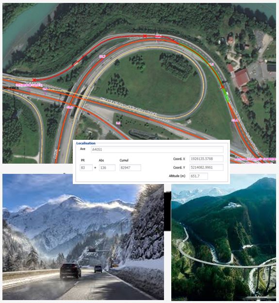
At the same time, French regulations were shifting. The DT-DICT law mandates Class A accuracy for underground utility mapping, which requires network operators to document buried infrastructure with a 40 cm precision in all directions: X, Y, and Z. That level of accuracy couldn’t be achieved without specialized data collection, rigorous validation, and a geospatial system capable of managing it all.
With all the work taking place, there was also a business driver: ATMB had valuable dark fiber available. However, without a reliable way to track usage and availability, commercial leasing was slower and more difficult than it needed to be. Internal teams were burdened by manual processes, and collaboration across departments was inconsistent.
In short, ATMB needed a fiber management solution that was purpose-built, accurate, and easy to use. This is something that could integrate with their existing highway asset systems while adding powerful capabilities for telecom.
The Solution: A Smart Telecom GIS Built on ArcGIS
To meet these challenges, ATMB deployed 1Telecomms, a geospatial solution developed by 1Spatial, tailored specifically for fiber network management. 1Telecomms was selected not only for its telecom-specific features, but also for its seamless integration with ATMB’s existing GIS environment consisting of arcOpole PRO GPV platform by 1Spatial, which is based on Esri’s ArcGIS platform.
This interoperability was essential. ATMB didn’t want a standalone tool. Instead, they needed a unified system where telecom and road infrastructure could be viewed together.
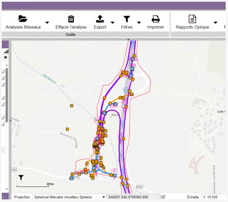
Using 1Telecomms, ATMB brought all telecom data into a centralized, web-accessible GIS environment. The platform offered robust capabilities for visualizing optical routes, tracking fiber strand status, and managing usage. This included details such as whether a strand was active, reserved, or available for leasing.
One of the most transformative parts of the project involved meeting the new underground mapping requirements. ATMB contracted specialized survey firms to detect and map their buried networks with high precision. This Class A data was then processed through an ETL workflow, capable of transforming and integrating multiple file formats, (PDFs, CAD drawings, shapefiles), into a clean and usable geodatabase.
That geodatabase now feeds into 1Telecomms, which delivers a real-time, authoritative view of the entire fiber network. Every telecom asset is visible, searchable, and linked to operational workflows. Teams across departments now access the same consistent, accurate data whether they’re working in the office or out in the field.
As 1Telecomms is built on the Esri ArcGIS platform, ATMB can take advantage of modern GIS capabilities like web mapping, spatial analysis, and mobile access, all within a familiar environment.
The Results: Smarter Operations, Stronger Network, Better Business
Since implementing 1Telecomms, ATMB has completely transformed how it manages fiber infrastructure. The results have been felt across the organization.
Now the company now has a single source of truth for its telecom assets. This centralized GIS has replaced the patchwork of legacy files and disconnected systems. Staff no longer waste time searching for documents or second-guessing outdated maps. Everything they need is available through a modern, easy-to-use interface.
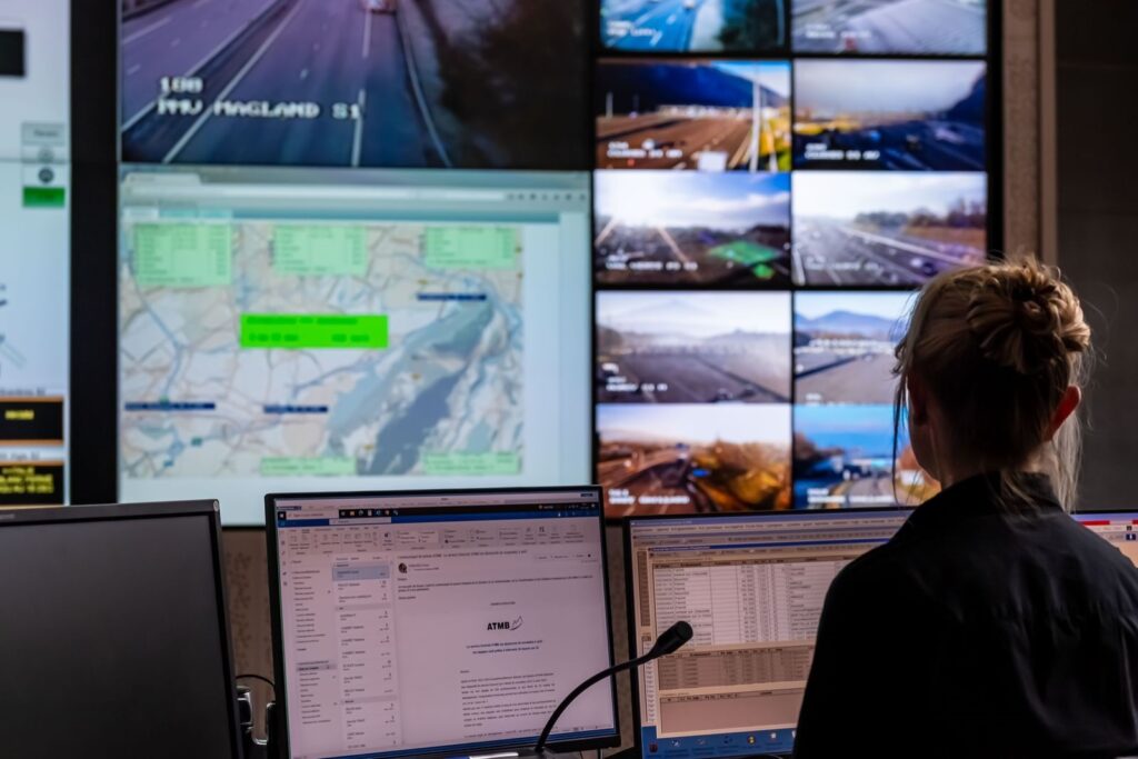
This visibility has led to faster response times when issues arise. When there’s a fiber cut or disruption, teams can instantly assess which routes and customers are affected, identify available capacity, and plan restorations. The days of reactive troubleshooting are gone. Now, the ATMB team operates with foresight and control.
Leasing processes have also improved. With every fiber strand status clearly marked, (whether it’s in use, reserved, or available), commercial teams can quickly respond to inquiries from local providers. That has opened the door to expanded leasing opportunities, helping connect more people to high-speed internet while also generating new revenue streams.
Compliance is no longer a concern. With high-accuracy mapping and up-to-date records, ATMB now meets the strict DT-DICT requirements and can confidently respond to any excavation or infrastructure request. That not only reduces legal risk but also enhances safety and coordination with outside contractors.
And perhaps just as importantly, the solution has been well-received by staff. The intuitive design of the latest version of 1Telecomms makes it easy for all users, bot technical and non-technical alike, to interact with the system. That has boosted adoption, improved training, and helped break down silos across departments.
A Platform for the Future
What began as a project to clean up fiber data has turned into something far more valuable. They gained a strategic platform that supports ATMB’s infrastructure operations, business growth, and regulatory compliance, all in one place.
ATMB now has the confidence to scale its fiber network, engage with partners, and manage complex underground assets without uncertainty. The system is built to evolve, just like the needs of the company. As smart infrastructure and digital services continue to expand across Europe, ATMB is well-positioned to lead the way.
By partnering with Esri and 1Spatial, ATMB has gone beyond solving a data problem. It has taken a bold step toward becoming a modern, data-driven infrastructure operator—where every decision is guided by accurate information, and every asset is connected to the bigger picture.
About 1Spatial
1Spatial helps organizations unlock the full value of their geospatial data. Through software, services, and industry solutions, 1Spatial enables better decision-making across sectors like telecom, utilities, transportation, and government. Their work supports safer, smarter, and more sustainable infrastructure around the world.
About Esri
Esri is the global leader in GIS, empowering organizations to see patterns, relationships, and trends in data through the power of location. With ArcGIS, Esri supports smarter decisions in business, infrastructure, safety, and sustainability across more than 350,000 organizations worldwide