Authored by: Emily Champagne, GISP, Geospatial Manager at Milwaukee Metropolitan Sewerage District
The Milwaukee Metropolitan Sewerage District has implemented scalable and maintainable solutions for Water Reclamation Facility vertical asset management using building information modeling (BIM).
For Senior Construction Manager Megan Dressel, finding and compiling information for a pump replacement project at Milwaukee Metropolitan Sewerage District’s South Shore Water Reclamation Facility (WRF) was time intensive and challenging. She spent many hours visiting the WRF’s records library to find older hard-copy operation and maintenance documents, as well as searching huge databases for other asset information. While information was stored somewhere and accessible, it was very difficult and time-consuming to track down the relevant information she needed for projects.
Background
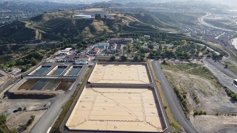
The Milwaukee Metropolitan Sewerage District (MMSD) is a regional government agency that provides water reclamation and flood management services to the Greater Milwaukee area. Twenty-nine different municipal systems convey wastewater to MMSD’s two Water Reclamation Facilities (WRFs) located on Lake Michigan.
Although MMSD has a comprehensive ArcGIS Enterprise system for horizontal assets (e.g., sewer system), the organization relied on 2D drawings and paper-based document workflows to support over 14,000 vertical assets in 120 buildings and structures at its two WRF locations: Jones Island (built-in 1925, celebrating its 100-year anniversary) and South Shore (opened in 1968).
Staff identified the need to establish accessible WRF data, improve digital-based workflows, and create mobile-friendly web solutions to reduce operating costs, avoid data silos, and facilitate both underground and above-ground vertical asset life cycle management.
The following business needs were prioritized through a series of internal meetings:
- Capturing geospatial locations of vertical assets
- Creating an efficient digital-based method to find current information about vertical assets
- Producing 3D visualizations of how design projects affect other planned or current projects
- Improving access to connected systems with WRF information

Building Information Modeling
Building information modeling (BIM) is a process that encourages collaboration between multiple disciplines involved in design, construction, maintenance, and operations. It creates an intelligent 3D model that provides users with a digital representation of a facility’s physical and functional characteristics, along with its assets. The use of BIM software is widely adopted on architecture, engineering, and construction (AEC) projects, and demand is growing.
MMSD recognized it needed to be proactively involved with adoption of 3D modeling and BIM instead of ignoring it and continuing the status quo (i.e., consultants and contractors developing their own proprietary 3D models of MMSD facilities without input, guidance, standards, or specifications).
Developing a BIM Vision
MMSD developed a WRF Building Information Modeling Vision: Create a scalable and maintainable solution for sharing Water Reclamation Facilities data that integrates with other systems.
MMSD’s WRF BIM Vision objectives are to
- Create a maintainable and accurate primary model for facilities and asset management.
- Improve information exchange.
- Reduce errors, conflicts, and unnecessary rework in design, construction, and record drawings.
- Create highly accurate record drawings from 3D scans.
- Create consistent 3D model data standards across engineering disciplines.
- Improve and ensure predictable project outcomes.
- Leverage visualization capabilities to engage WRF stakeholders in decision-making processes and solutions.
After completing a pilot BIM for an effluent pump station at South Shore WRF, MMSD’s Geospatial Services and Solutions Department began implementing BIM projects in a phased, hybrid approach with consultants and in-house staff.

ArcGIS Provides a Solution
MMSD utilizes Autodesk Revit software to create 3D models for BIM projects that follow MMSD’s BIM Standards. GIS staff uses ArcGIS Pro geoprocessing tools to import Autodesk Revit 3D models into GIS format and output populated feature datasets based on MMSD’s primary disciplines (e.g., mechanical, piping, electrical, architectural, structural).
Custom pop-ups are configured to link vertical assets (3D objects) to different internal systems of record. These include document management repositories (OnBase) for 2D construction and as-built drawings, as well as operation manuals. The pop-ups also link to asset management records (BI-Cycle) and Microsoft SharePoint. MMSD uses custom expressions and thumbnail graphics to link assets based on a unique Asset ID. Finally, staff publishes a web scene with a building scene layer to MMSD’s internal ArcGIS Enterprise portal. By combining multiple web scenes, MMSD configures BIM 3D viewer solutions for each WRF.
Staff feedback was instrumental to the user experience design of the BIM 3D viewer solutions. Users preferred preset bookmarks to quickly navigate to different positions inside buildings and underground galleries. Dockable information pop-ups allow users to easily view asset information and links to related system applications. The Building Explorer widget enables users to filter the model to specific disciplines such as electrical or piping, providing an isolated view of assets in those categories. Together, the Scene Viewer tools and widgets support MMSD’s BIM Vision objectives.
These are excellent tools. As more buildings are added and as I get more familiar with navigation, it will only become more useful. – BIM Pilot User

Benfits Realized
Improved Efficiency
- A faster and more efficient method for MMSD staff to find related WRF asset information from different systems of record.
- Familiar ArcGIS tools and user experience reduces staff training time and encourages self-service.
Improved Accuracy
- Documented workflows and standardized links to the BIM allow the MMSD to maintain and adapt models as more vertical asset information is captured and/or changed.
Single Source of Truth
- A highly accurate, scalable model that users can trust and rely on for drawing design, construction, and maintenance.
Improved Access to Related Information
- No need to search multiple, disconnected systems or dig through hard-copy documents housed in WRF library shelves.
Improved Communication
- BIM models and linked asset information can be shared with contractors and consultants for current and future projects, improving communication, reducing design information requests, potential errors, change orders, and project delays.
BIM is able to enhance asset management at MMSD by providing advanced 3D visualizations of vertical assets, showing how design projects interact with existing infrastructure. Combined with efficient, digital access to asset life cycle information, BIM provides an opportunity to enhance a project’s scope by identifying adjacent, near-failure assets. Recognizing these additional assets optimizes resource allocation, enabling a more proactive and strategic approach to asset management. – Todd Minzlaff, Senior Asset Management Analyst
The BIM 3D viewers achieved the goal of providing a web-based interactive solution for BIM. They deliver the ability for staff to easily visualize the exterior and interior of WRF buildings and underground galleries. They also make it quick to find vertical asset information from related systems.
The pump replacement project that Megan Dressel was working on has since been modeled and is included in MMSD’s South Shore WRF BIM. All the updated asset information is now contained within the model. The next time there is a project in that building, Megan won’t have to spend hours looking for asset data; it will all be accessible with a few clicks.
MMSD continues to build on its successful BIM Vision with more in-house modeling projects and consultant deliverables. MMSD has completed BIMs for five buildings and underground galleries, as well as several partial models at both WRFs. There are 10 BIM-related projects in progress. With each new BIM deliverable added to the WRF 3D Viewer solutions, MMSD is realizing its BIM Vision!
Special thanks to the BIM project team members and contributors:
Robert Chavez (Virtual Design Supervisor), Anke Ries-Buschaus (BIM Coordinator), Devin Wermuth (GIS Specialist), Todd Minzlaff (Senior Asset Management Analyst), Dan Talarczyk (Survey Services Supervisor), Zach Albert (Project Surveyor), David Moe (Project Surveyor), Drew Hrobar (Project Manager), Megan Dressel (Senior Construction Manager), Mel Russell (Engineering Aide), and Monique Conley (Administrative Coordinator)
Stay Connected with Esri’s Water Team
ArcGIS is an extensive information system that enables modernization of workflows with easy-to-use applications. Strengthen your organization with GIS-based solutions that will increase efficiency and provide insight for decision-makers. Visit the Esri Water Utilities web site for more information.
Subscribe to the Water Industry newsletter “Esri News for Water Utilities and Water Resources“
Check out this ArcGIS Blog “Optimizing Utility Operations: Leveraging GIS for Enhanced Facility and Vertical Asset Management in the Water Industry”