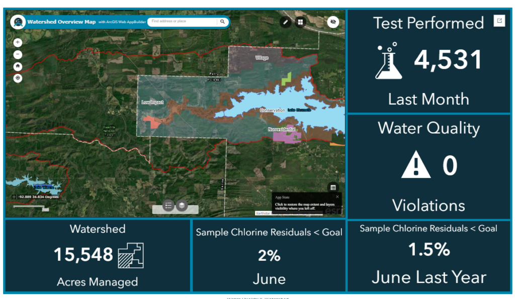
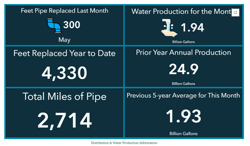
Central Arkansas Water (CAW) is the largest water utility in Arkansas, delivering high-quality drinking water to nearly 500,000 people across eight counties. The utility manages 2,714 miles of pipe, 41,622 valves, more than 202,000 metered connections, two watersheds, three treatment plants, and a 721-square-mile service area.
For nearly three decades, CAW has relied on Esri geographic information system (GIS) technology as the operational foundation for visualizing pipeline networks, analyzing infrastructure conditions, and supporting rapid response when it matters most. Through cloud modernization with CyberTech, CAW has grown its active GIS user base from 75 users to approximately 200, brought valve inspections in-house to save more than $1 million every five years, and built a platform capable of handling 10.3 million GIS requests in its first five months after go-live.
“GIS ensures that employees see the system clearly using updated maps.”
Danny Dunn, Director of Distribution
The Need for a More Resilient GIS Platform
As CAW’s service area and operational demands grew, so did the limitations of its existing GIS environment. The utility relied on an aging on-premises ArcGIS Server deployment that had served well for years but was beginning to show its constraints.
System outages and scheduled maintenance windows disrupted access to critical data and maps, forcing field crews to rely on outdated printed maps. Locating valves, isolating affected mains, and identifying impacted customers required phone calls back to the office and manual coordination between teams. Each hour of system downtime was an hour during which crews operated without reliable geospatial information.

At the same time, demand for GIS access was growing across the organization. What had begun as a specialized tool for a limited group of users was becoming essential to engineering, operations, and field services. The platform needed to support a larger, more distributed user base without sacrificing reliability or performance.

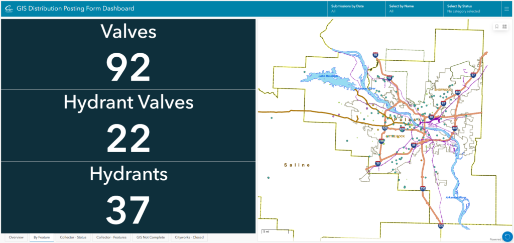
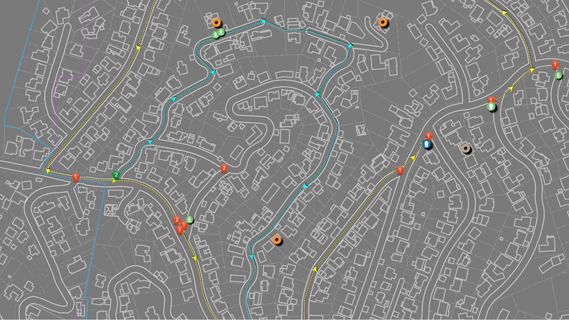
“By mapping existing facilities, proposed expansions, and active breaks, GIS serves as the critical link between office teams and field crews.”
Elizabeth Heiles, PE, Senior Engineer, Central Arkansas Water
Finding the Right Partner
CAW senior information services manager Alex Harper first encountered CyberTech at the Esri User Conference, where CyberTech presented on GIS cloud modernization strategies for utilities. The presentation addressed exactly the operational and infrastructure challenges CAW was facing.
CyberTech is an Esri partner holding two specialty certifications directly relevant to CAW’s needs: the GIS Cloud Specialty and the GIS Network Management Specialty. These credentials, combined with CyberTech’s experience managing complex utility GIS environments, gave CAW confidence that the technical depth and hands-on expertise required for a successful migration were there.
Through its MACS (Managed ArcGIS Cloud Services) White Glove service, CyberTech takes on full responsibility for the underlying infrastructure, including monitoring, maintenance, and support. This model allowed CAW’s GIS team to redirect their focus toward advancing GIS capabilities across the utility rather than managing servers.
Creating a Scalable GIS Platform
CyberTech and CAW began with a Cloud Readiness Assessment. The assessment evaluated CAW’s existing GIS architecture, more than 20 years of accumulated spatial data, and the system dependencies behind daily operations. It produced a clear migration road map designed to minimize operational disruption while modernizing the platform.
The migration was completed in four months. The environment moved to ArcGIS Enterprise in the cloud, the geodatabase was upgraded, and proactive monitoring tools were deployed. The modernized platform is built around the following:
Core Platform Components
- ArcGIS Enterprise—Centralized, cloud-hosted GIS services and data management
- ArcGIS Field Maps—Mobile access to live infrastructure data for field crews
- ArcGIS Monitor—Proactive 24/7 system health monitoring
- ArcGIS Pro—Desktop GIS workflows and data editing
- Single Sign-On (SSO)—Uninterrupted access across applications without additional login steps
The cloud environment is hosted on Microsoft Azure, consistent with CyberTech’s public cloud delivery model for utility clients.
Results and Operational Impact
The most immediate impact of the migration was felt in day-to-day field operations and emergency response.
Crews now use ArcGIS Field Maps on iPads to access valve locations, pipe materials, pressure data, and repair history directly in the field, without having to call the office. During a water main break, ArcGIS software-based outage workflows trace affected service areas and identify impacted customers simultaneously, enabling a faster, more coordinated response.
The impact of CAW’s cloud modernization is reflected not only in improved performance, but also in the way GIS has become embedded across daily utility operations. From stronger platform reliability and measurable cost savings to broader user adoption and new opportunities for innovation, the results show how a modern GIS environment can support both immediate operational needs and long-term strategic growth.
System Reliability
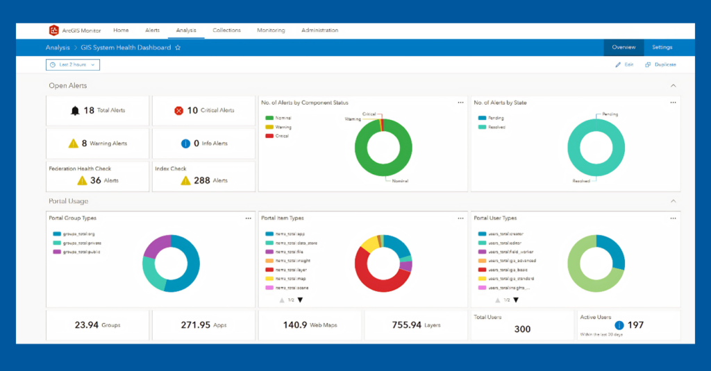
The modernized platform runs at 99.99 percent availability. ArcGIS Monitor watches it around the clock. In the first five months after go-live, it recorded more than 10.3 million GIS service requests across CAW’s published services. These span across map displays, feature queries, and data edits generated each time staff and field applications use the platform, reflecting the scale at which GIS now runs through CAW’s daily operations.
Measurable Return on Investment
One of the most tangible financial outcomes has been the ability to bring valve inspections in-house. Reliable mobile GIS workflows and trusted field data access eliminated the need for outsourced inspection services, saving CAW more than $1 million every five years.
Beyond direct cost savings, the combination of high availability, continuous monitoring, and mobile access has significantly reduced operational risk. Critical GIS information remains available during emergencies, supporting faster service restoration, and more confident decision-making in the field.
Expanded User Adoption
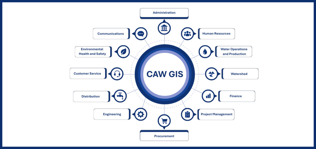
Before migration, approximately 75 people regularly used GIS. Today, that number stands at around 200, out of a total workforce of 350. More than half the organization now relies on GIS as a standard part of their daily work, supported by SSO access that removes friction across field applications, desktop tools, and the enterprise platform.
Regulatory Compliance
The modern GIS platform has also become a key tool for regulatory compliance. Under the Lead and Copper Rule (LCR), CAW uses GIS to compile and analyze service line information from multiple data sources, improving visibility into pipe materials, identifying data gaps, and supporting prioritization of investigation and replacement activities. GIS now functions as an analytical framework for regulatory decision-making rather than a static reference tool.
“Dozens of staff-hours per month [have been] redirected from GIS infrastructure maintenance to GIS innovation.”
Alex Harper, Senior Information Services Manager, Central Arkansas Water
Expanding GIS Capabilities for the Future
With a stable, scalable platform in place, CAW is expanding GIS capabilities across the organization.
CAW has implemented ArcGIS Image Server, extending its ability to manage and analyze imagery alongside vector data. The utility is completing the implementation of ArcGIS Utility Network, which will establish a modern, connected system of record for its water distribution assets, enabling advanced network tracing, improved data integrity, and more accurate modeling of system behavior during both routine operations and emergencies.
CAW is also working with Trinnex and the leadCAST modeling solution, which uses GIS data to proactively identify potential lead service lines ahead of regulatory deadlines. This capability depends directly on the accuracy and accessibility of the modernized ArcGIS environment.
Looking further ahead, CAW plans to develop BIM models of treatment facilities and critical infrastructure, integrating engineering and operational data within the GIS environment. The utility is also exploring geospatial AI applications to support advanced analytics, pattern detection, and predictive insights across its water system.
“By modernizing its GIS platform, Central Arkansas Water reduced operational risk, improved emergency response, cut long-term costs, and repositioned GIS as a strategic utility service rather than a fragile system dependency.“
Alex Harper, Senior Information Services Manager

ArcGIS is an enterprise geospatial platform that enables modernization of workflows with easy-to-use applications. Strengthen your organization with GIS-based solutions that will increase efficiency and provide insight for decision-makers. Visit the Esri Water Utilities web site for more information.
Stay connected with Esri’s Water Team
- Follow #EsriWater on social media: X | LinkedIn
- Subscribe to the Water Industry newsletter “Esri News for Water Utilities and Water Resources“