For decades, mining companies have relied on GIS to understand critical minerals, optimize operations, and manage risk on land. From exploration targeting to reclamation, geospatial technology has become a business-critical system across the mining lifecycle.
Now, the mining industry is turning its attention offshore.
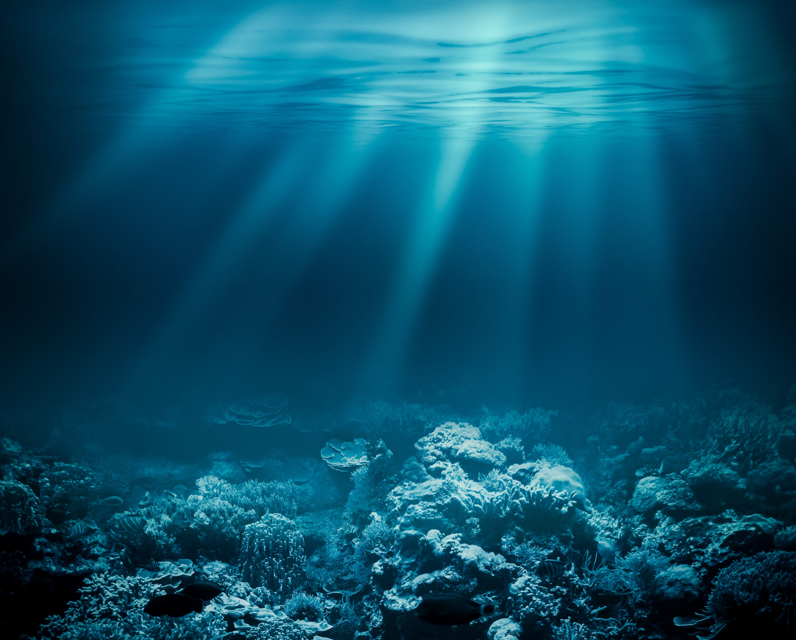
Deep-sea mineral deposits, including polymetallic nodules, seafloor massive sulfides, and cobalt-rich crusts, are emerging as potential sources of critical minerals. But unlike terrestrial mining, where geology is exposed, drilled, and sampled directly, the deep ocean represents a fundamentally different operating environment.
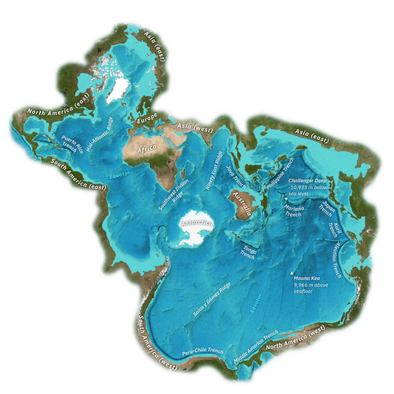
The seafloor is becoming the next strategic frontier for critical minerals. Estimates indicate regions like the Clarion-Clipperton Zone contain billions of tons of polymetallic nodules rich in manganese, nickel, cobalt, and copper, resources that could materially influence global supply chains. Unlike land deposits you can walk, sample, and map directly, deep-sea targets must be discovered and characterized entirely through remote sensing, sonar, and sparse sampling, which makes ArcGIS and location intelligence essential from day one.
The opportunity is significant. So are the challenges. And just like on land, success begins with location intelligence.
Terrestrial vs. Deep-Sea Mining: Same Objective, Different Reality
At their core, both terrestrial and deep-sea mining seek to answer the same fundamental questions:
- Where are the economically viable resources located?
- What is their grade, quality, and lateral and vertical extent?
- How can they be extracted safely and efficiently?
- What are the geological, operational, and environmental risks?
Yet the realities of acquiring those answers differ profoundly between the two domains. On land, geologists benefit from direct ground access. They map outcrops, conduct extensive drilling and sampling programs, utilize established infrastructure, and operate within well-controlled coordinate systems. The subsurface can be systematically tested and verified through physical exposure and conventional fieldwork. In the deep ocean, virtually every insight is indirect and sensor-mediated. Teams must operate in an environment defined by extreme remoteness, crushing pressures, complete darkness, and constant motion.
Key constraints include:
- Complete reliance on remote sensing; no direct visual or physical access without advanced instrumentation
- Highly limited and costly drilling, making precise target selection critical from the earliest stages
- Dynamic operational platforms (vessels, AUVs, and ROVs) subject to shifting sea states and complex water-column variability
- Extreme water depths that introduce significant technical and logistical challenges
Rather than walking the terrain, marine geoscientists interpret a sophisticated array of remote datasets:
- High-resolution multibeam sonar bathymetry
- Acoustic backscatter and sonar imagery
- Video and photographic transects from ROVs and AUVs
- Sparse but high-value physical samples and geochemical analyses
This fundamental shift from direct observation to remote, multi-sensor interpretation elevates the importance of data integration, spatial analysis, and rigorous data management. In the deep sea, these capabilities are not merely supportive, they are foundational. ArcGIS becomes the indispensable framework that unifies disparate datasets, enables accurate spatial context, and transforms fragmented observations into a coherent, actionable understanding of the seafloor. Without robust geospatial intelligence, effective deep-sea exploration and responsible resource development would simply not be possible.
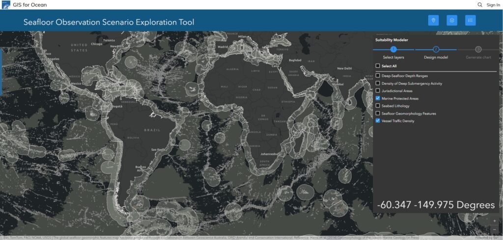
ArcGIS as the System of Record for Seafloor Exploration
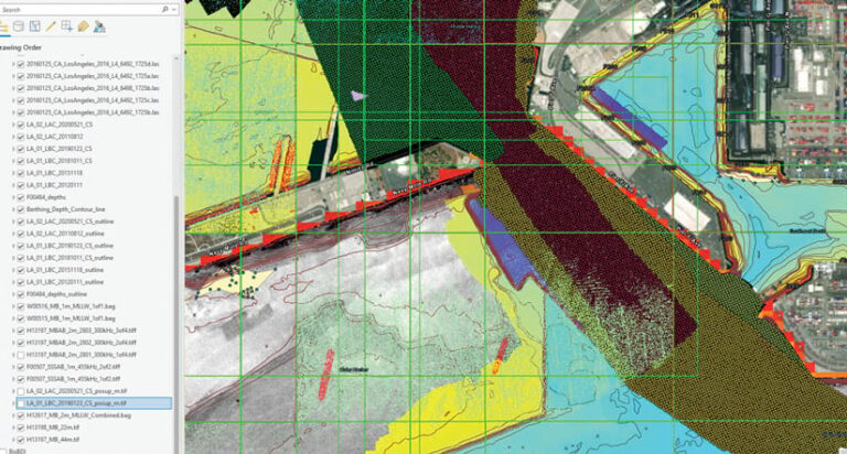
In terrestrial mining, ArcGIS has long served as the authoritative system of record, seamlessly integrating geological models, drillhole data, infrastructure networks, and environmental baselines into a single, reliable spatial framework. In the far more complex domain of deep-sea mining, this role becomes not only essential but transformative. Operating in an environment characterized by extreme depths, high pressure, and limited direct human access, deep-sea exploration generates vast, heterogeneous datasets across multiple campaigns and sensor platforms. Using ArcGIS Pro, multidisciplinary teams can centralize and operationalize these inputs with precision and scalability:
- High-resolution bathymetry grids
- Backscatter mosaics
- AUV and ROV survey tracks
- Sample locations and geochemistry
- Geological interpretations
- Environmental observations
These datasets are often massive, unstructured, and collected across multiple campaigns. ArcGIS Pro enables teams to:
- Build authoritative geodatabases
- Visualize the seafloor in 3D
- Perform advanced spatial analysis
- Create repeatable interpretation workflows
The result is a cohesive spatial model of an otherwise unknown environment.
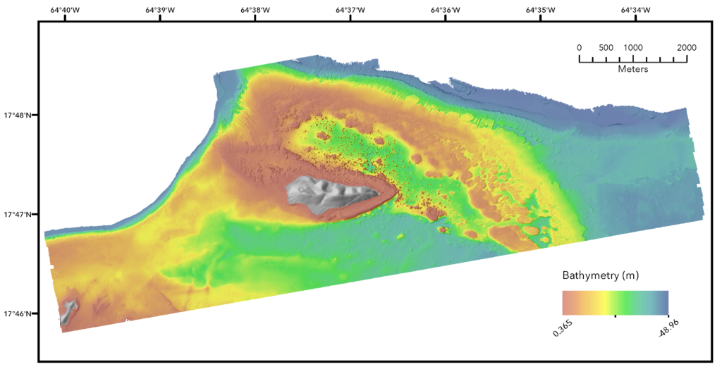
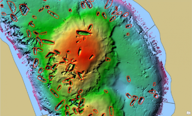
Turning Sonar into Insight: Reality Mapping the Ocean Floor
In terrestrial mining, reality capture technologies such as UAV photogrammetry, terrestrial LiDAR, and mobile mapping systems have revolutionized the creation of high-fidelity digital surface models. These tools deliver centimeter-level accuracy for mine planning, geotechnical analysis, and operational safety. In the deep ocean, where direct observation is impossible and light cannot penetrate, the equivalent is sonar-based reality mapping. Multibeam echosounders, side-scan sonar, and sub-bottom profilers serve as the primary tools for capturing the seafloor’s true form and character. With products like ArcGIS Pro, ArcGIS Bathymetry and the Benthic Terrain Modeler, exploration teams can transform raw acoustic data into rich, actionable intelligence:
- Process bathymetric data into detailed elevation models
- Generate textured surfaces from sonar and imagery
- Create high-resolution representations of seafloor morphology
These outputs allow geoscientists to interpret:
- Seamounts and ridges
- Hydrothermal vent structures
- Sediment pathways
- Potential mineralization zones
Just as drone mapping transformed open-pit operations, sonar-driven mapping transforms how we see the ocean floor.
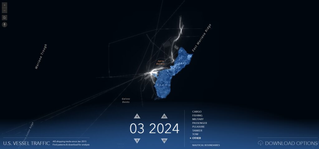
Real-Time Awareness in a Remote Environment
One of the fundamental distinctions between terrestrial and deep-sea operations lies in situational awareness. On land, mine sites are largely static environments with fixed infrastructure and predictable operational footprints. In the deep ocean, the entire operational theater is dynamic and constantly shifting. Survey vessels traverse vast distances, AUVs follow pre-programmed missions across the seafloor, ROVs conduct targeted interventions, and environmental sensors continuously monitor evolving ocean conditions. Maintaining command and control in this fluid, remote setting demands far more than periodic updates.
- Survey vessels
- AUV missions
- ROV deployments
- Environmental sensors
With ArcGIS Velocity, teams can ingest and visualize live data streams, including:
- Vessel positioning
- Survey coverage
- Sensor feeds
- Environmental conditions
This enables:
- Real-time mission tracking
- Immediate identification of coverage gaps
- Rapid response to anomalies
- Improved coordination across teams
In an environment where mobilization costs are high, real-time spatial awareness directly impacts efficiency and decision-making.
GeoAI: Scaling Interpretation in Data-Rich Environments
Both terrestrial and deep-sea mining share a common challenge: the overwhelming volume of data far exceeds what teams can interpret manually. In the deep ocean, however, this challenge is dramatically amplified by the sheer scale, complexity, and inaccessibility of the operating environment. Exploration programs generate continuous high-definition video feeds from ROVs, massive high-density sonar and backscatter datasets, extensive coverage across remote and expansive survey areas, and positioning uncertainties inherent to ultra-deepwater operations. Traditional manual interpretation simply cannot keep pace. ArcGIS GeoAI empowers organizations to move beyond manual bottlenecks by applying advanced machine learning and deep learning models directly within the ArcGIS environment:
- Continuous video feeds
- High-density sonar datasets
- Large, remote survey areas
- Challenging positioning in deep sea and ultra deep-sea environments
With ArcGIS GeoAI, organizations can:
- Automatically classify seafloor substrates
- Detect hydrothermal features
- Identify biological communities
- Highlight patterns associated with mineralization
- Identify anomalies and potential sites for further investigation
These models can be trained on known data and applied across large areas, enabling teams to:
- Reduce interpretation time
- Increase consistency
- Focus experts on high-value analysis
ArcGIS GeoAI does not replace geoscientists. It extends their ability to work at scale.
Environmental Understanding: A Shared Priority
Environmental understanding is fundamental to responsible mining, whether on land or in the deep ocean. While the core objective remains consistent, the data sources and analytical challenges differ profoundly between terrestrial and marine environments. In deep-sea operations, ArcGIS serves as the central platform for synthesizing highly diverse and multidimensional datasets:
- Detailed benthic habitat classifications
- Geological and geomorphological interpretations
- Biological observations and species inventories
- Sediment characteristics and geochemical properties
- Dynamic oceanographic conditions, including currents, stratification, and water chemistry
Authoritative public agencies play a vital role in this ecosystem. Organizations such as the National Oceanic and Atmospheric Administration (NOAA) provide foundational datasets, high-resolution ocean mapping products, and advanced ecosystem research that significantly enhance scientific understanding of the marine environment. In the United States, the Bureau of Ocean Energy Management (BOEM) leverages comprehensive geospatial data to support offshore resource planning, rigorous environmental impact assessments, and evidence-based regulatory decision-making. Across both terrestrial and deep-sea contexts, ArcGIS delivers a unified framework for baseline characterization, operational monitoring, and post-activity evaluation. By integrating multidisciplinary data into a single authoritative spatial environment, teams can track changes over time, assess potential impacts with greater precision, and demonstrate environmental compliance with confidence. Ultimately, ArcGIS transforms environmental data into actionable intelligence, enabling operators to anticipate risks, minimize ecological footprints, and uphold the highest standards of environmental stewardship in even the most remote and sensitive settings.
A Familiar Pattern in a New Frontier
Despite the vast differences between terrestrial and deep-sea environments, a clear and compelling pattern is emerging.The very same geospatial principles that revolutionized modern mining on land are now being successfully extended into the offshore domain:
- Centralized, authoritative spatial data management
- Multidisciplinary data integration and cross-domain analysis
- Advanced 3D visualization and immersive interpretation
- Real-time operational awareness and dynamic decision support
- AI-enhanced insights and automated intelligence
The operating environment may be more extreme, technically demanding, and remote, yet the fundamental approach remains reassuringly familiar.
From Surface to Seafloor
Deep-sea mining stands as one of the most ambitious and complex exploration frontiers the resource industry has ever encountered. It is characterized by extreme remoteness, massive data volumes, and an environment that remains largely unmapped and poorly understood. Yet it is not entirely unknown territory. Mining organizations already possess deep institutional knowledge of ArcGIS and location intelligence. They have relied on these capabilities for decades to reduce geological and operational risk, enhance efficiency, and drive more informed, defensible decision-making. Now, those proven strengths are extending from the familiar surface world into the deep ocean. From continental mines to abyssal plains, the power of spatial intelligence is once again leading the way, bridging the gap between known methodologies and unexplored frontiers. In the end, whether on land or at depth, successful outcomes depend on transforming complex data into actionable knowledge. ArcGIS continues to be the unifying platform that makes that transformation possible.