This story was developed collaborativey by Terri Rogers, GISP – Texarkana Water Utilities, Bill Moss – Texarkana Water Utilities, NewEdge Services, and Kwiver.
Texarkana Water Utilities (TWU) delivers water services across two cities and two states—Texarkana, Texas, and Texarkana, Arkansas—creating a complex, multijurisdictional operating environment. To manage this complexity, TWU needed to modernize its geographic information system (GIS), build cloud resiliency, and integrate systems across the organization.
Establishing a Secure GIS Foundation with ArcGIS Enterprise
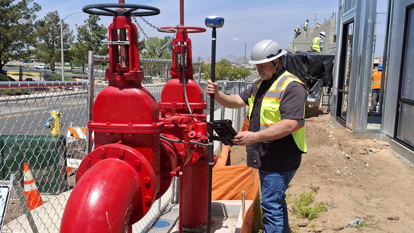
Texarkana Water Utilities engaged NewEdge Services to implement ArcGIS Enterprise, creating a centralized GIS platform capable of managing data across both Texas and Arkansas jurisdictions. The deployment allowed TWU to move away from siloed data systems and establish authoritative datasets to support water utility operations, infrastructure management, and land records.
This GIS foundation became even more critical when TWU experienced a cyberattack that encrypted on-premises systems and disrupted essential services. Working closely with TWU, NewEdge rapidly stood up a temporary ArcGIS Enterprise recovery environment using Amazon Elastic Compute Cloud (Amazon EC2) instances, Amazon Relational Database Service (Amazon RDS), and Amazon WorkSpaces. Restoring access to maps, applications, and critical datasets while on-premises systems remained offline.
Following the recovery period, TWU fully migrated its ArcGIS Enterprise environment into AWS, significantly strengthening security, improving up time, and providing far more flexible access for staff across city departments and state lines. Cloud hosting now enables remote access, streamlined updates, and built-in redundancy that was not possible with the previous on-premises setup. Access to outside data sources has also expanded; for example, parcel data across both states is now updated nightly through automated services that pull directly from Texas and Arkansas county assessor computer-assisted mass appraisal (CAMA) systems, ensuring accurate information for planning, billing, and customer service operations. The cyberattack underscored the importance of secure, flexible operations. For leadership at Texarkana Water Utilities, the new environment reduced operational risk while enabling staff to securely work remotely during recovery efforts. This approach ensured uninterrupted service delivery and positioned the organization with a stronger, more resilient security framework moving forward.
Expanding Cityworks AMS Across Departments
Although TWU had been using Trimble powered by the Cityworks AMS (Asset Management System) for years, adoption was limited to the water and sewer field operations group. Recently, TWU partnered with NewEdge Services on a full Cityworks AMS enterprise expansion, bringing engineering, field services, customer service, and inflow and infiltration (I&I) into the platform. Today, Cityworks AMS, fully integrated with TWU’s GIS, supports more than 33,000 residential and commercial connections through centralized asset management.
This expansion allows TWU to leverage location intelligence across the organization, using Esri-powered GIS layers directly inside Cityworks AMS to better manage work orders, infrastructure assets, inspections, and service requests. Future phases will extend Cityworks to the water and wastewater treatment divisions.

Integrating Utility Billing with GIS and AMS
As part of the AMS expansion, TWU prioritized integrating its utility billing system (CUSI) with GIS and Cityworks AMS. NewEdge developed a custom integration that now allows billing, asset management, and GIS to work together in a seamless workflow. This has resulted in significant workflow improvements.
- Service orders were previously carried out on paper with frequent printing issues, lost/misdirected orders, and no real-time visibility for customer service or field reps. Today, fully digital service orders are synced between CUSI and Cityworks AMS, providing real-time updates, instant visibility for staff, and no paper.
- Data access has improved. TWU moved from on-prem servers with limited redundancy and manual processes for updating data to cloud-hosted GIS with secure, flexible access—plus automated nightly parcel updates from both states.
- Synchronizing billing and work orders eliminated manual data entry between CUSI and Cityworks, removed inconsistent data, and eliminated duplicated effort. This was accomplished using automated API-driven synchronization every few minutes with built-in data validations.
- Before the integration, field operations relied on printed work lists, no linked orders, and stalled work when printers failed. Now, they have real-time mobile access to work orders and GIS maps, faster response, and fewer errors. The integration uses secure APIs and cloud-hosted services to automatically synchronize open and closed service orders between systems every few minutes, allowing field crews, customer service, and billing teams to work with real-time information.

Tangible Results: From Recovery to Resilience
For TWU, the journey from cyberattack recovery to long-term resilience has been shaped by its close partnership with NewEdge Services. Together, they rebuilt systems that were once paper-based, disconnected, and vulnerable, transforming them into an integrated, cloud-hosted environment that supports daily operations across two states.
With automated service order syncing, TWU’s field crews no longer lose time to printing delays or manual dispatching, and customer service can provide same-day answers instead of waiting until the next morning for status updates. Workflows that once required manual data entry or back-and-forth calls have been eliminated entirely, replaced by real-time visibility and automated processes. Today, TWU staff complete tasks faster, respond more quickly to customer needs, and rely on data that is more accurate, more accessible, and more secure than ever—positioning GIS as a foundation for ongoing digital transformation.
Next Steps: Strengthening TWU’s Geospatial Strategy
As part of its long-term geospatial strategy, TWU is focusing on enhancements that address remaining pain points around data accuracy, cross-departmental workflows, and real-time visibility. These initiatives build on the progress already made and continue the shift toward a more resilient, connected operational environment.
Key Areas of Ongoing Improvement:
- Transitioning to Esri’s ArcGIS Parcel Fabric to improve parcel accuracy and support more reliable planning, billing, and asset management
- Migrating to ArcGIS Utility Network for advanced network modeling, better traceability, and faster response to system events
- Expanding dashboards and mobile tools to give supervisors and field staff real-time insight and access to accurate GIS data anywhere
- Automating permitting, document management, and workflows to eliminate manual steps and strengthen collaboration across departments
By fully investing in Esri’s ArcGIS platform, TWU is not only addressing pain points identified in earlier stages; like manual updates, disconnected systems, and limited field visibility, but also creating the foundation for long-term operational resilience across every department it serves.

Stay Connected with Esri’s Water Team
ArcGIS is an extensive information system that enables modernization of workflows with easy-to-use applications. Strengthen your organization with geospatial solutions that will increase efficiency and provide insight for decision-makers. Visit the Esri Water web site for more information.
Follow #EsriWater on social media: X | LinkedIn
Subscribe to the Water Industry newsletter “Esri News for Water Utilities and Water Resources“