I am excited to announce our industry focused equity blog series. Equity has become a common use word but what does it mean when we are talking about data and geographic information system (GIS) technology across industries? In this series we will feature interviews with subject matter experts from various GIS industries ranging from environment to land records, who will showcase that equity can and must be applied throughout each industry. In honor of earth day, we are highlighting the intersection of equity within environment and conservation. It is fitting to start with our industry specialist Sunny Fleming, who focuses on advancing GIS within the environment and conservation industry.
I began my equity and GIS journey as a student and the intersectionality of environment allowed me to see that equity in GIS is about highlighting the role and importance of people in our GIS work.
The definition of equity is to create thriving communities for each individual or group. It is working to understand what your community needs for the residents to live healthy full lives. Now, let’s learn what equity means within the environment and conservation space. Here is my interview with Sunny.
Sophia: How would you define equity within your industry?
Sunny: In 2021, the Environmental Protection Agency (EPA) established, “equity, environmental justice, and civil rights a centerpiece of the agency’s mission.” Recognizing that environmental justice (EJ) is a key component of pursuing equity, they define EJ as “the fair treatment and meaningful involvement of all people regardless of race, color, national origin, or income with respect to the development, implementation and enforcement of environmental laws, regulations and policies.”
I would also argue that age would be important to include here, as we know that there are risks that various age groups face related to environmental hazards, that other age groups may be less at risk of. For example, elderly populations who may be socially isolated are at greater risk of succumbing to heat as they may be unable to or afraid to reach out and ask for help.
Decisions that we make related to our environment also include how and where we choose to conserve lands and water, and how we approach our management practices thereof. EJ and equity have long been defined and executed based on only a handful of perspectives, and there is now increasing recognition that continuing to restrict who can define it has stymied our collective progress. From this we see significant movement to be more inclusive of indigenous knowledge, BIPOC, LGBTQ+ and other communities to provide perspectives on how different definitions and concepts of nature and our relationship with it influence our ability to be effective in providing equitable access to it.
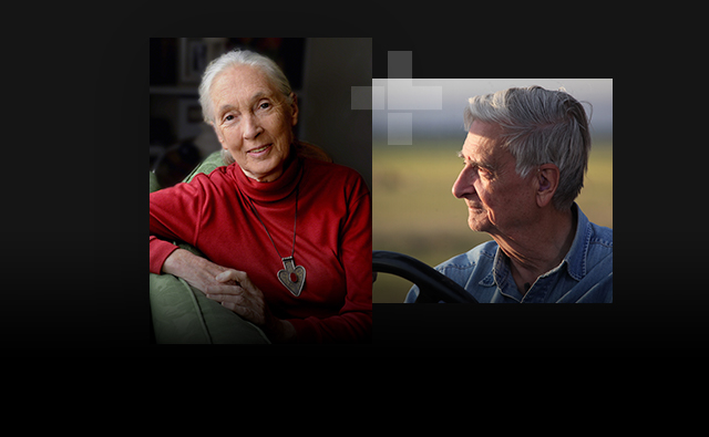
In my work here at Esri I have the great privilege of interacting with a wide variety of communities and as such, my understanding of equity has and continues to evolve. I originally came to environmental work with a very plant-centric empathy, however as my experience across a variety of communities has grown, my empathy for my fellow global citizen has significantly increased. In 2019 there was a fantastic Esri UC plenary session between Jack, Jane Goodall and E.O. Wilson. I had recently wrapped up field work in Madagascar where we worked very closely with local communities on intersectional issues of land use, viral ecology, and biodiversity conservation. This really opened my eyes to the importance of equity, empathy and listening to community needs first before attempting to provide solutions that may or may not have an immediate or perceived benefit to the community tasked with stewarding that land in the long term. This is precisely the conclusion that Jane Goodall had come to in her work, and her perspective on that stage really resonated with me.
Geography, of course, is one of the only sciences that allows us to visualize our environment in concert with our populations and our economies. Therefore, geographic information system (GIS) technology is the only technology capable of helping us understand our progress in achieving equitable environmental outcomes.
Sophia: What organizations are successfully pioneering the equity effort in this space?
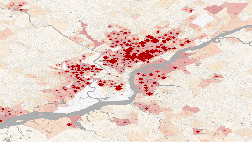
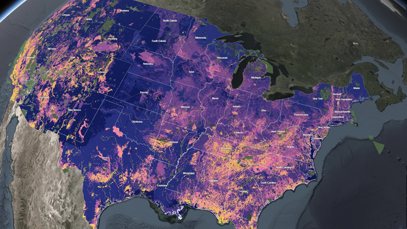
Sunny: My optimism here is off the charts. In my role at Esri, I have the honor of being able to work nationally here in the U.S. and witness a wide variety of efforts in this realm. Specifically, as it relates to EJ and how GIS can reveal our progress here, I have seen a movement to develop indices based on a combination of known environmental data and known socioeconomic data. These indices allow us to map and visualize very intuitive representations of which populations are disproportionately burdened by environmental hazards.
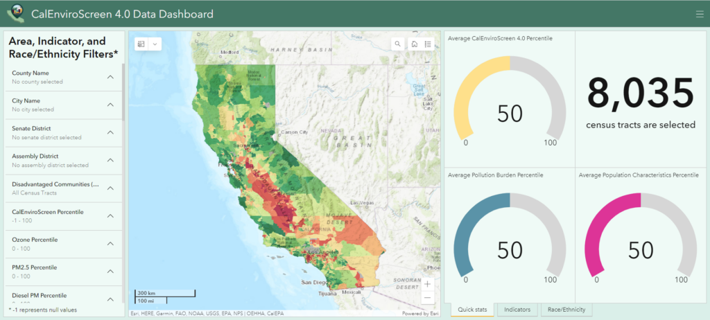
California’s EnviroScreen is excellent and has influenced versions of this across other states. They are now on their fourth version of this, ensuring that the data informing their indices is up to date.
A more recent example is Michigan’s MiEJScreen that also adopts the “indices” approach.
Sophia: What data sets do environmental professionals need to consider in order to enhance equity in this industry?
Sunny: It would be easy to say two types of data; environmental and socio-economic, but this would be only partway true. There is a third data set to consider and that is public feedback.
Fortunately, environmental organizations have access to geographic tools that allow them to bring these three datasets into existence and together. We gather information about our environment through field work, sensor networks and remotely sensed data. Esri’s tools such as ArcGIS Field Maps, ArcGIS Velocity and ArcGIS Image allow us to quickly centralize and process this information.
ArcGIS Living Atlas and ArcGIS Business Analyst provide these organizations with powerful data and applications to fold in well over 200 demographic variables.
Tools such as ArcGIS Hub allow organizations to inform citizens around these important initiatives as well as take advantage of tools like ArcGIS Survey123 to solicit meaningful feedback from all stakeholders.
Sophia: What federal requirements should be considered when addressing equity in this industry?
Sunny: Every federal agency has policies related to equity. In our first question I mentioned some of the language from the EPA but going beyond that what I found fascinating with the Bipartisan Infrastructure Law (BIL) and the Inflation Reduction Act is around this idea of recognizing the relationship between our environmental, economic, and social systems and codifying this at some level.
The BIL especially is a master class in messaging, in my opinion. The programs in that bill are largely existing programs, but the language of the bill includes consistent reference to “sustainability, resilience, and equity.”
Therefore, the takeaway is: we must continue to conduct business, but we must do it in such a way that we are sensitive to the impacts on our environment, understand how changes in our environment will impact us and our infrastructure, and be equitable in how we continue to conduct this business.”
Therefore, this requires a lot of innovation, and that innovation drives the need to look at GIS as the fundamental technology that brings together those three lenses.
Continuing the Conversation
In Sunny’s responses we see the thread of creating thriving communities by recognizing the importance of environmental justice, uplifting indigenous and community knowledge and how GIS is the technology that will lead us to a more just future. I would like to encourage you all to visit Esri’s equity strategic plan to start on your path in building a more equitable world.