Visit Esri at the Water Environment Federation Technical Exhibition and Conference (WEFTEC23) to learn how you can power your digital transformation with ArcGIS.
Esri’s ArcGIS technology is uniquely suited to serve as the foundation for digital water system transformation, with solutions built to be used by anyone on any device. Collect, display, and analyze data from various sources and leverage easy-to-use maps and apps to provide quick access to information across your organization.
Connect with Esri and our partners at booth #4026 to learn how ArcGIS can help power your digital transformation.
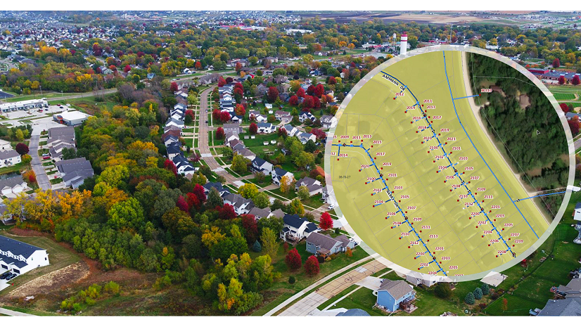
Mapping the points of opportunity
ArcGIS technology enables data integration, collaboration, and powerful analytics.
Network management
Update and integrate network data with ArcGIS to better model and manage network performance, network behavior, and the relationships between disparate network assets.
Coordinated operations
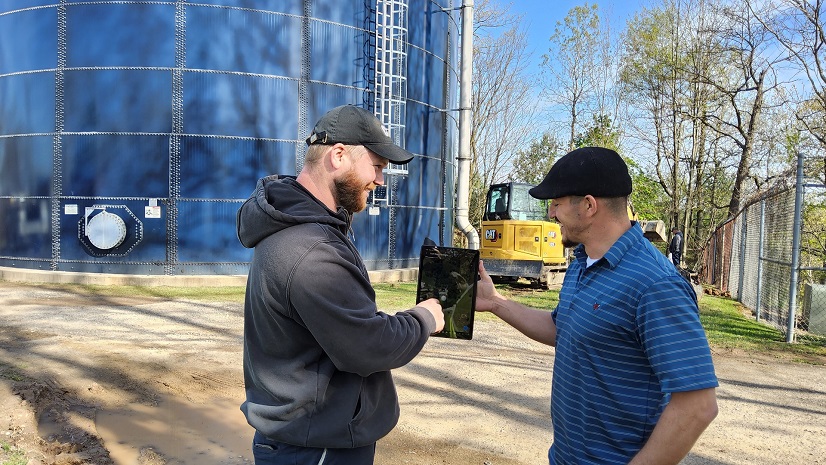
Put utility data into the hands of all staff members—mobile crews, customer service representatives, engineers, and financial planners—to ensure that everyone in the organization can access up-to-date information when, where, and how they need it.
Real-time situational awareness
Integrate, visualize, and analyze real-time data from various sources—supervisory control and data acquisition (SCADA) systems, Internet of Things (IoT) devices, weather forecasts, and social media—to help utilities understand all activity in their service areas.

Location analytics
Leverage embedded, industry-specific analytics to help utility staff make data-driven operational, planning, and investment decisions.
At The Expo
Visit booth #4026 to learn about products and solutions from Esri and our partners.
ITpipes: Pipe Inspections, Actionable Intelligence
Turn your pipe inspections into mapped, actionable intelligence! ITpipes provides you with planning, prioritizing, field collection and data management tools.
Eos Positioning Systems: GPS for water
Map your water and wastewater assets with survey-grade accuracy directly into Esri’s ArcGIS apps using Arrow Series GNSS receivers from Esri Gold partner Eos Positioning Systems.
1898 & Co.: Because the future won’t wait
As part of Burns & McDonnell, 1898 & Co. is a business, technology, and security solutions consultancy where experience and foresight come together to unlock lasting advancements..
BlueConduit: Let’s Get the Lead Out
Develop an Accurate Lead Service Line Inventory and Replacement Plan with BlueConduit. Let’s get the lead out of the ground to protect health, trust, and public funds.
Stay Connected with Esri’s Water Team
ArcGIS is an extensive information system that enables modernization of workflows with easy-to-use applications for the field and office. Strengthen your organization with smart water solutions that will increase efficiency and provide insight for decision-makers. Visit the Esri Water Utilities web site for more information.
Join the Water Utilities Community
Follow #EsriWater on social media: Twitter | LinkedIn
Subscribe to the Water Industry newsletter “Esri News for Water Utilities and Water Resources“
About the author