Overview of the Flood Forecasting Process
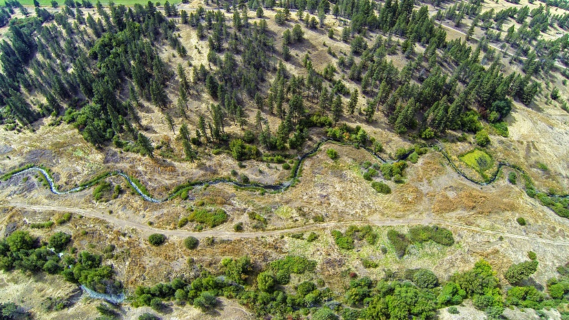
Every year, millions of people across the globe are affected by riverine flooding, and the extent, occurrence, and socioeconomic effects of catastrophic flooding seem to be on the rise due to climate change, greatly aggravating the impact this phenomenon is having around the world—as witnessed by the extraordinary flooding in Pakistan (2022), Yellowstone (2022), Guyana (2022), Brazil (2023), and Mozambique (2023).
Can we do a better job of predicting where flooding will occur and who will be impacted? Fortunately, we can, thanks to recent advances in GIS technology, water modeling, and data availability. Today, ArcGIS users have access to the basic tools and datasets required for forecasting the potential extent and the impacts of flooding for any place on earth—potentially saving lives and helping prevent damage to property.
The basic steps to forecast flood impacts are outlined below:

The first step is to identify the datasets to be leveraged for producing flood forecasts, such as digital elevation models (DEMs), impact layers, and river flow forecasts. In this blog post, we discuss the use of the following publicly available datasets:
- DEM—NHDPlus (US coverage, 10-meter resolution) or HydroSHEDS (global coverage, 90-meter resolution).
- River Flow—US National Water Model (NWM) Short-Range River Flow Forecast (US coverage) or the GEOGloWS river flow forecast (global coverage).
- Impact layers—These can vary, but they will normally include variables such as addresses, key infrastructure, population density, and crops. Some of the data is available in Esri’s ArcGIS Living Atlas of the World and can be extracted from OpenStreetMaps or other sources.

Using commercial data—or higher-resolution data not available to the public—can improve forecasting results.
The second step is to precalculate the extent and depth of flooding for incremental depths (e.g., 1 to 20 meters) using the DEM selected, as shown below:

Once the possible inundation extents are precalculated for each depth, they are overlaid on the impact layers to estimate impact by flooding depth, as shown below:

The third step is to convert forecasted river flow to potential flooding. Normally, this entails setting up a geoprocessing service that does the conversion at set intervals throughout the day.
The final step is to disseminate the forecasting results. This can be achieved by configuring maps and apps, such as map viewers or dashboards.
To illustrate this step, one of the outcomes could be a dashboard showing an area of interest, and for one-meter depth of flooding forecasted in eight hours, showing that 120 buildings, 50,000 people, and 350 acres of prime agricultural areas will be impacted.
Federal and state agencies in the US have recently tested the approach outlined above to
- Analyze flood forecasting model sensitivity in Yellowstone.
- Evaluate flood impacts in Guyana.
- Estimate flood impacts and trends over time in Texas.
Globally, ArcGIS users are tapping into these technologies to implement disaster monitoring apps. Esri recently completed a proof-of-concept for a regional agency in Africa where dashboards were developed to forecast the impact of flooding to infrastructure, population, and crops.
The methodology outlined – together with recent ArcGIS solutions developed by Esri and customers to assist first responders to estimate flood extents in the field – is being applied across several industries, from local governments, insurance, and transportation to agriculture, economic development, and dam operations.
Getting Started
All the modeling and analysis described herein can be done with ArcGIS Pro, leveraging the Arc Hydro toolset (freely available with an ArcGIS Pro license) and publicly available datasets. A high-level overview of a potential solution design is shown below:

ArcGIS users around the world can benefit from recent advances in GIS workflows, modeling, and public data to forecast the impact of flooding in ways that were not possible just 5 or 10 years ago. Hopefully, this translates into improved flood management and, down the line, lives saved and a reduction on property damage.
Learn more:
- ArcGIS Pro
- Arc Hydro
- Living Atlas of the World
- Living Atlas—Water Resources Layers
- National Water Model
- NHDPlus High Resolution
- GEOGloWS
- HydroSHEDS
Stay Connected with Esri’s Water Team
ArcGIS is a modern spatial system that provides you with solutions that meet your needs to monitor and assess conditions, perform research, and deliver information. ArcGIS provides scientific information to water resource managers, planners, and stakeholders and allows the community to engage, collaborate, and share with easy-to-use maps and apps.
Visit the Esri Water Resources website for more information.
Join the Water Resources community.
Follow #EsriWater on social media: Twitter | LinkedIn
Subscribe to the water industry newsletter, Esri News for Water Utilities and Water Resources.