Esri Young Professionals Network (YPN) is proud to feature Faces of YPN, an article series highlighting professionals early in their geospatial technology careers. In this series, we interview young pros from various sectors and work environments to learn the following:
- How they use geographic information system (GIS) technology in their careers
- What they love about GIS
- How they got their start in GIS
- What advice they’d like to give to other young professionals
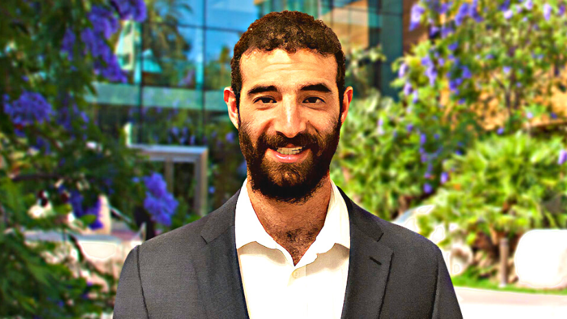
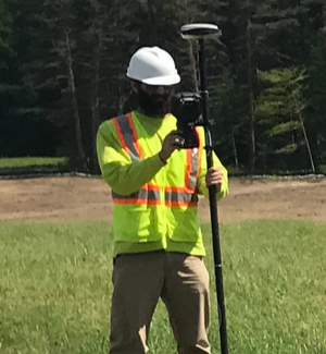
In this article, we interview Zach Jaffe, a GIS coordinator at LandTech Consultants, a civil engineering and land surveying firm. He uses his GIS to skills to produce project goods and services and for research and development.
The biggest training benefit in terms of training or courses that I’ve had in my career are conferences.
Q: What do you love about GIS?
A: Maps are awesome, plain and simple, and creating maps is even cooler. The majority of people don’t know or even think about how the maps they look at and interact with are created. Most people still don’t realize how just about any group, organization, or business can benefit from GIS and mapping. I love to learn about different industries and figure out how to best apply GIS to solve real-world problems.
Q: How did you get your start in GIS?
A: I got my GIS start studying geography in college. Taking a GIS course as a geography major is very standard, and so I took two GIS courses and liked it. GIS skills seemed very applicable in the real world. In college, I also did an internship that helped gauge what real-world projects are going on with using GIS. It helped me learn and realize what GIS really is in various professions.
Q: How are you using GIS in your current role?
A: I use GIS pretty much every day. We use an ArcGIS software-specific environment for our project [goods and services] in the infrastructure world. I focus on water, wastewater, and utilities as well as universities and campuses. I also use GIS to promote our various services as well as constantly using it for research and development to find new and cutting-edge technological solutions.
Q: What are some GIS projects you are currently working on?
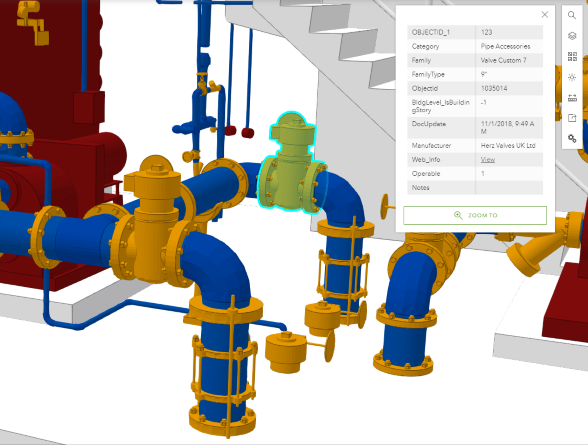
A: As of late, a lot of the projects I have been working on have been focusing on creating Digital Twins (or 3D models) for various facilities, including water/wastewater treatment plants. The models are created from a lidar survey/point cloud and BIM [building information modeling] and integrated with the Esri ArcGIS environment primarily for asset and facility management. These projects are fun to work on because it involves so many different technologies and software solutions that all meet in the Esri environment for the final deliverable.

Q: What advice do you have for students and young pros?
A: My best advice for other young pros is to network, go to industry events, and put yourself out there. I have learned more at conferences just by speaking to people than I did in the majority of my college courses. When you meet people, you learn their thought process and point of view and take that into consideration when forming your own. Not only does it make you more aware, but building those connections is a huge part of being successful in business. Having a contact to call or team up with on a project has allowed me to grow in my position.
Q: What’s the value in attending conferences?
A: For me, going to a conference was the biggest eye-opener because there is so much value in attending. At conferences, you hear from people in various industries and how they use GIS, and it helps me to think about how I can apply GIS in my own role.
When I started in my role, my company didn’t have a GIS division, so I helped to implement GIS. This is where going to conferences is really helpful, because it helps me to grow GIS in my own company and probably is the best thing you can do for yourself to grow personally and professionally.
I’m fortunate in that my organization finds a lot of value in me attending conferences. I am able to justify attending conferences by making connections to bring back leads, being a presenter, and setting up follow-up meetings with people I’ve met, because this can all become a source of revenue.
Q: How did you handle starting the GIS Division of your company?
A: It had its challenges, but I was lucky in my position to rely on my colleagues as subject matter experts, which helped guide me in what I should be doing in GIS. On the flip side, I didn’t have someone I can troubleshoot with when it came to the GIS technology. So when I run into issues, I would post it to the Esri Community web page, or directly contact people in my network. This is why I go to conferences. They help to build my network because I know at some point I will need to lean on other attendees for advice and have the opportunity to return the favor as well.
Q: What advice do you have for someone starting out in their GIS career?
A: Think about industry first, then GIS. For example, I knew I wanted to be in the water industry, and then I used GIS as a tool to get me into that industry. Go after the industry you like and want to work in and see how GIS is applied or how you can apply it. Reach out to other people in that industry through LinkedIn. Most people are responsive and want to help or answer your questions.

You can learn more about Esri Young Professionals Network on our web page.
Check out these resources for students in higher education or young professionals entering geospatial technology careers:
- Esri Community—Young Professionals Network (blogs, events, discussion)
- Esri YPN LinkedIn group
- Esri training courses
- Esri Technical Certification Program
- Esri student programs including internships and assistantships
- Esri recruiting events