Clark County Water Reclamation District (CCWRD) manages one of the largest wastewater systems in the Western United States, serving more than 260,000 accounts across Southern Nevada. With over 2,400 miles of pipeline, 52,000 maintenance holes, and six treatment facilities, the district plays a critical role in protecting water quality for the Las Vegas Valley and the Colorado River.
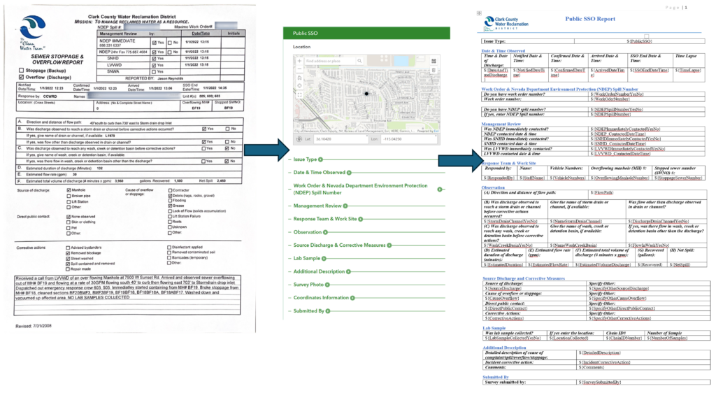
To meet state reporting requirements, CCWRD must document every sanitary sewer overflow (SSO) and submit detailed reports to the Nevada Division of Environmental Protection. But fragmented data systems, paper forms, and the absence of spatial context made this process slow, inconsistent, and difficult to analyze.
The district turned to ArcGIS and Microsoft Power Platform to build an end-to-end, automated workflow that transformed how SSO data is collected, reviewed, reported, and archived.
Building a Spatial Foundation for SSO Data
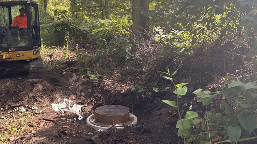
CCWRD faced limited visibility into sanitary sewer overflow incidents due to fragmented recordkeeping methods. The district’s geographic information system (GIS) team began by consolidating historical SSO records from multiple systems into a single, standardized dataset. Staff geocoded incidents; linked Maximo records using primary keys; and created a new feature class with complete attributes such as causes, corrective actions, and other essential information. Integrating this feature class into the enterprise geodatabase and within ArcGIS Online provided a reliable spatial foundation for ongoing analysis.
Digitizing Field Data Collection with ArcGIS Survey123
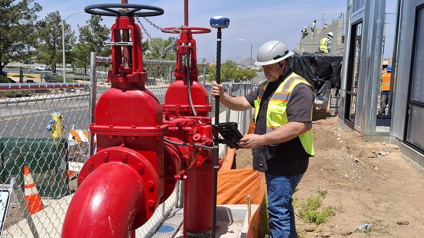
To replace paper forms, CCWRD deployed ArcGIS Survey123 to capture SSO information directly at the incident site. Field crews now submit:
- Photos
- GPS-accurate locations
- Overflow and inlet details
- Corrective actions
Real-time data submission means that supervisors can review incidents immediately, even after business hours. All collected data flows in to ArcGIS Online, where it appears on web maps for instant situational awareness.
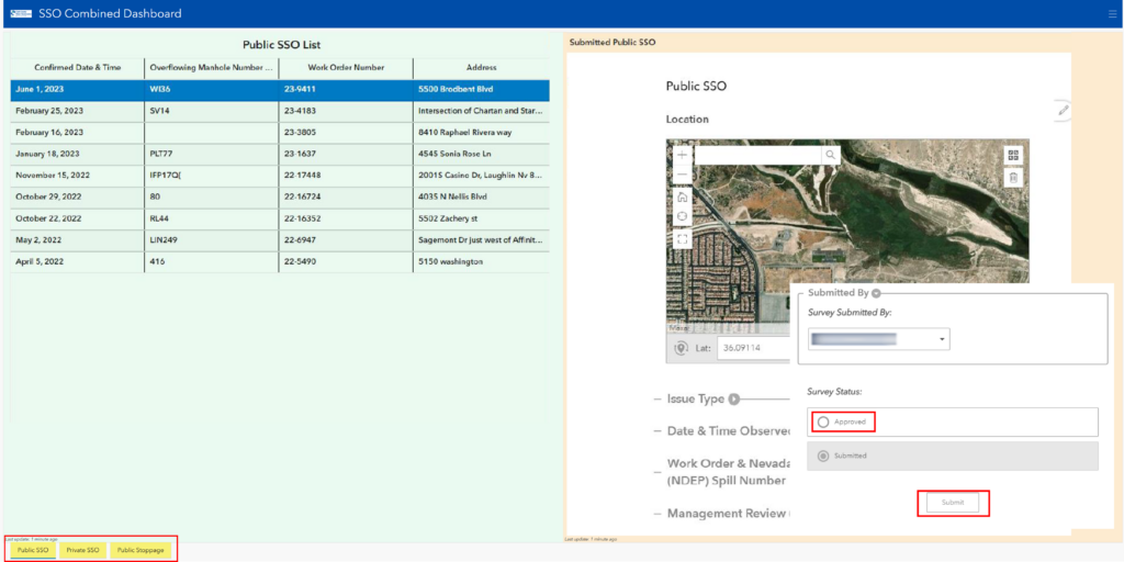
Automating Review and Reporting
Using Survey123 webhooks and Microsoft Power Automate; the district created an automated workflow that connects ArcGIS with the Microsoft ecosystem. This system:
- Routes submitted data into dashboards built with ArcGIS Experience Builder
- Enables supervisors to review and approve incidents
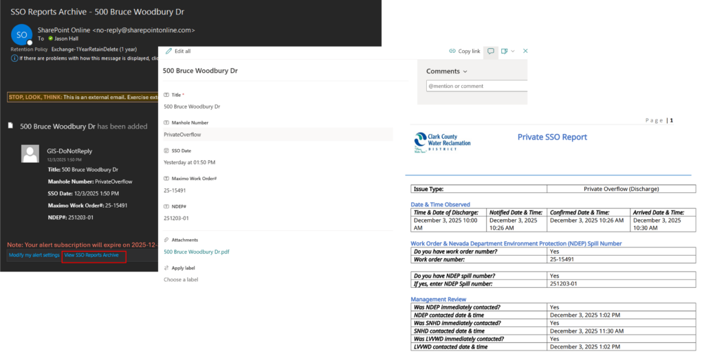
- Automatically generates final SSO reports
- Sends email notifications via Outlook
- Archives reports and key attributes in SharePoint
This automation has eliminated manual transcription and ensured consistent, timely reporting.
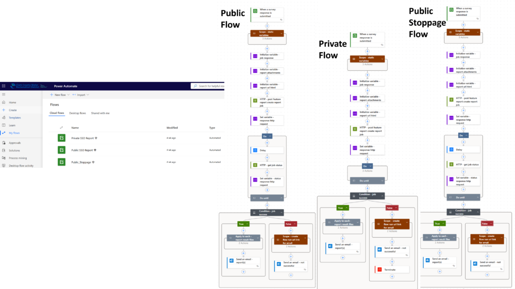
“By harnessing Survey123 webhooks, we transformed routine processes into dynamic, automated systems, turning data into action and ideas into impact.” —Jason Hall, GIS Supervisor, Clark County Water Reclamation District
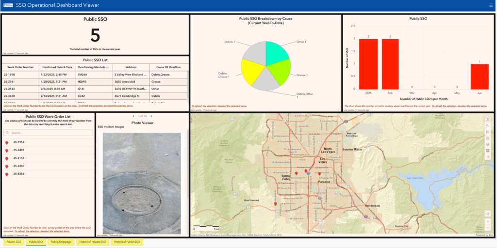
Visualizing Trends with ArcGIS Dashboards
To support operational decision-making, CCWRD developed a combined dashboard in ArcGIS Online that brings together all historical and current SSO data. Users can filter by SSO type, explore mapped locations, review photos captured in the field, and analyze monthly and annual trends. The dashboard provides a complete picture of system performance and helps staff identify recurring problem areas.
Faster Reporting, Better Data, Stronger Insight
Significant Time Savings
- Reporting time to Nevada Division of Environmental Protection dropped from 5 days to 1–2 days.
- Field crews no longer rely on paper forms.
- Supervisors review incidents in minutes.
Improved Accuracy
- Standardized categories and attributes
- GPS-enabled field data collection
- Automated quality control, ensuring consistent reporting
Operational Efficiency
- Approximately 200 staff hours saved annually
- Automated quarterly reporting through SharePoint
- End-to-end integration that supports proactive management
Looking Ahead
CCWRD plans to expand its GIS-driven approach by integrating hot spot analysis into capital improvement planning, incorporating rain gauge data to understand the impacts of storm events, and strengthening community education to reduce contractor-related SSOs.
By continuing to leverage ArcGIS and automation, the district is building a more resilient, data-driven wastewater management system for Southern Nevada.
“The introduction of GIS-driven automation has significantly enhanced the efficiency of SSO tracking, analysis, and reporting. Consequently, CCWRD personnel have nearly eradicated the reliance on paper documentation in all facets of its wastewater collection system operation and maintenance program.”—Rick Donahue, Assistant General Manager Collections System, Clark County Water Reclamation District

Stay Connected with Esri’s Water Team
ArcGIS is an extensive information system that enables modernization of workflows with easy-to-use applications for the field and office. Strengthen your organization with geospatial solutions that will increase efficiency and provide insight for decision-makers.
Visit the Esri Water Utilities web site for more information.
Follow #EsriWater on social media: X| LinkedIn
Subscribe to the Water Industry newsletter “Esri News for Water Utilities and Water Resources“
Learn more about how GIS supports digital transformation.