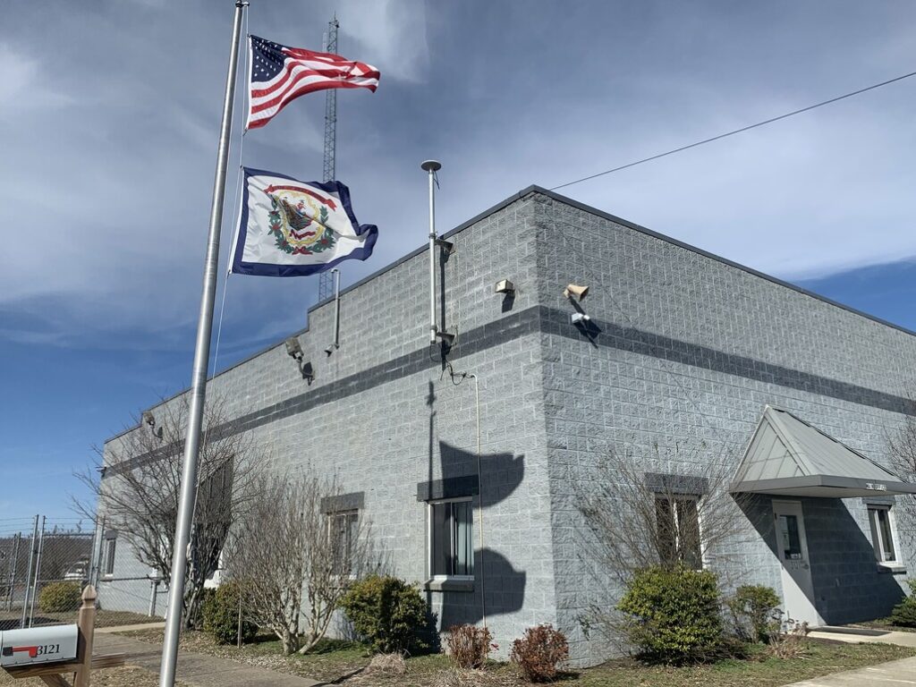
Nestled in the heart of south-central West Virginia, the 12-person Oak Hill Sanitary Board serves approximately 9,000 residents with wastewater services. Throughout the city, a forward-thinking culture allows Oak Hill geographic information system (GIS) coordinator Tyler Bragg, GISP, and the sanitary board to put proactive ideas into practice. This set the stage for a recent rehabilitation of both the data and infrastructure of one of the most rural portions of the city’s sewer system.
The Challenge: Inheriting a Rural System with Unreliable Legacy Data
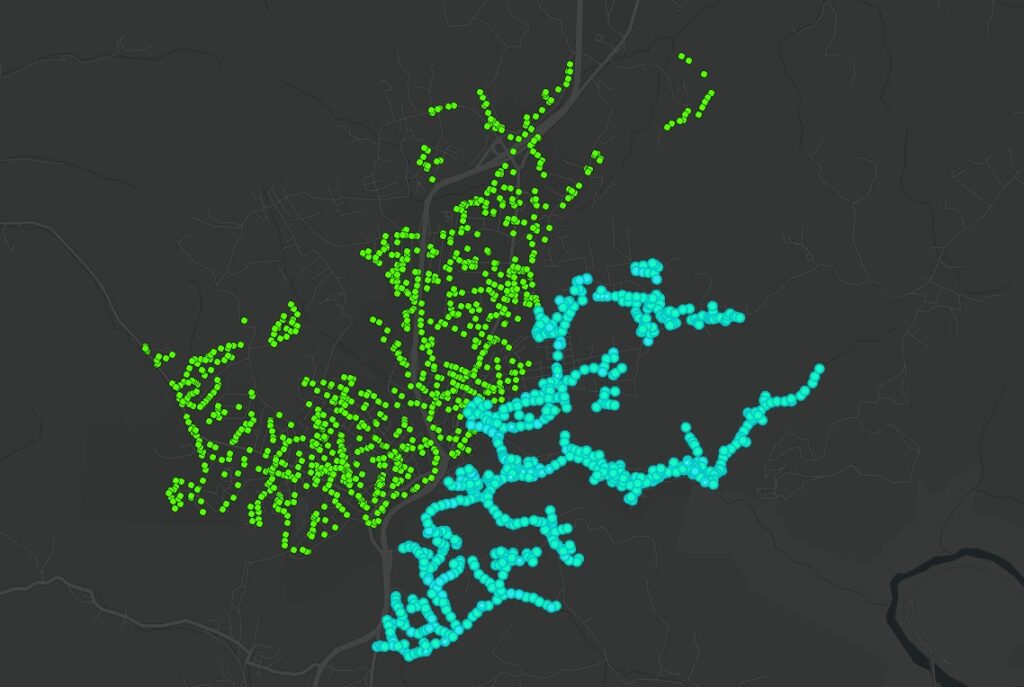
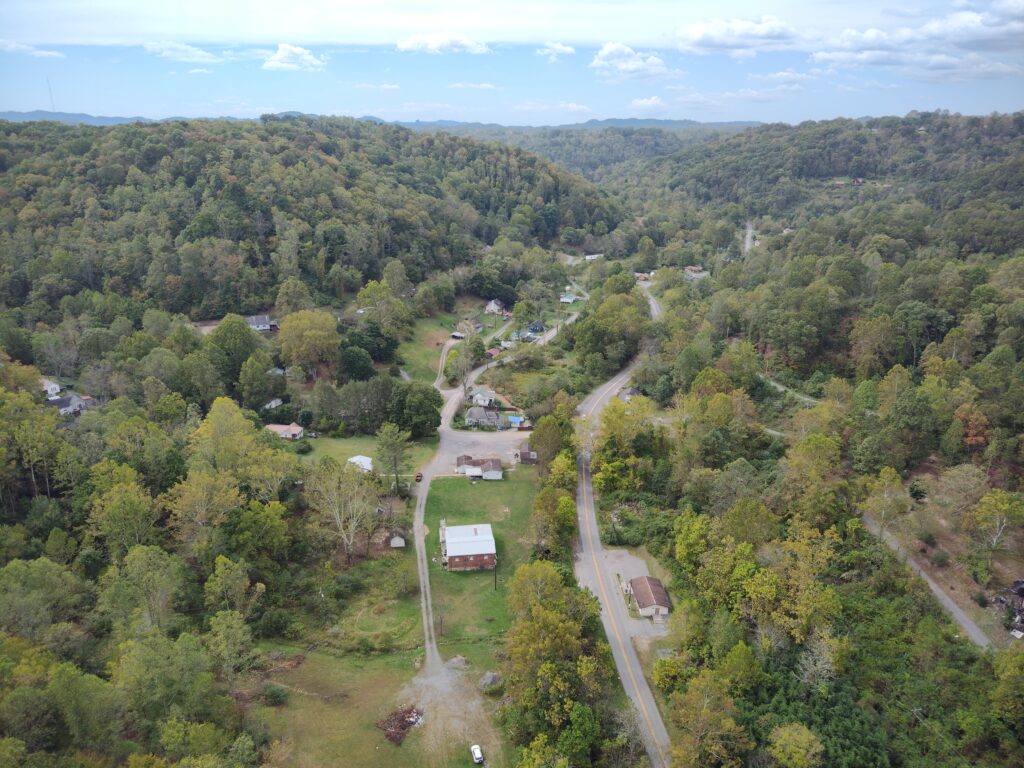
In 2017, the sanitary board acquired the rural Arbuckle sanitary network from a local public service district (PSD). The inherited system, which now represents just under half of the board’s total service area with one-third of the system’s total manholes, is a little different from the urban system. The Arbuckle sewer infrastructure sprawls across steep wooded hills and gravel roads and beneath dense canopy—conditions that make both maintenance and mapping extremely difficult.
A Landscape That Complicates Everything
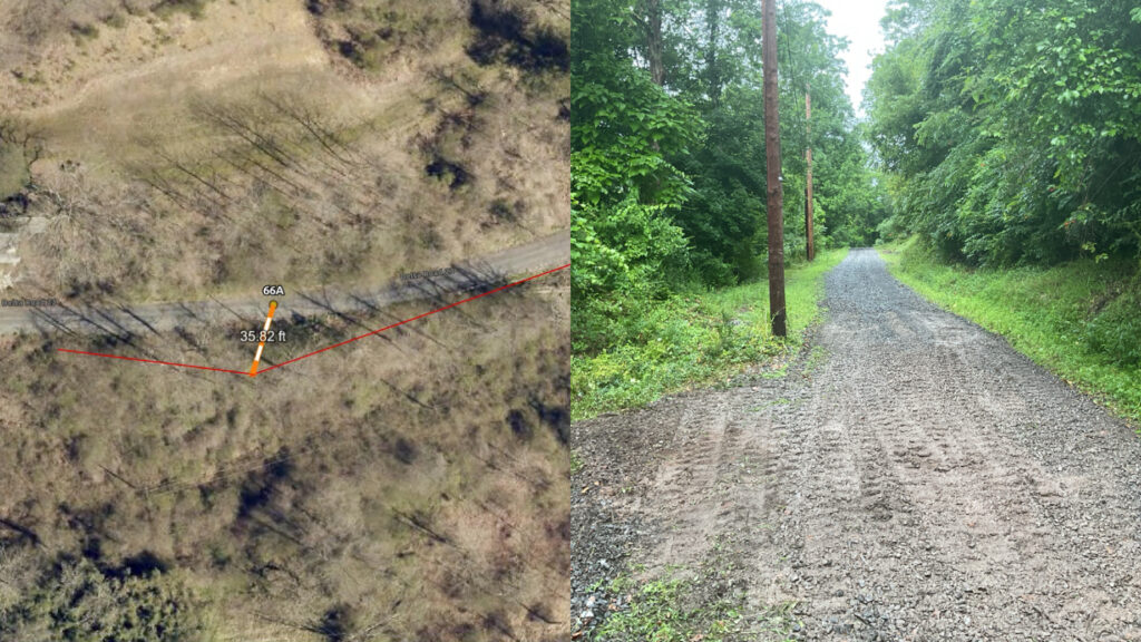
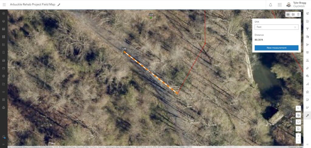
Finding manholes in this environment is often educated guesswork. Inherited mapping records, dating 2010–2013, were based on mixed survey methods that frequently contained locations that were wrong by 10–40 feet, with some manholes as far as 80 feet off. Much of this geospatial data came from older GPS equipment that performed poorly in the mountainous Appalachian woodland. With such dense canopy, even aerial images offer little help locating manholes.
“All of our infrastructure was on the map, but it wasn’t all field verified,” Bragg said. “Unverified data is less authoritative than if we got something that we had mapped with a high-accuracy location and could expect to find quickly again and again.”
Field crews routinely would spend hours trying to find lids supposedly located in briar thickets, gravel roads, or just somewhere in the woods.
“We’ve spent days looking for manholes,” Oak Hill collections system foreman Kyle Hobbs said. “You could be out there looking in the field, in a briar thicket where you can’t see anything, and meanwhile your truck could be parked right on top of it.”
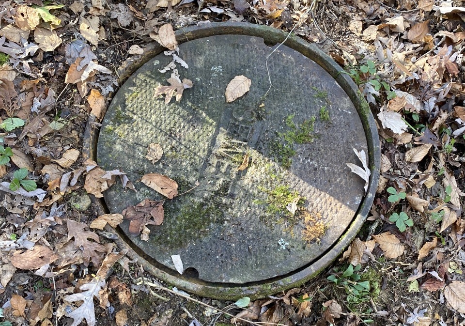
Sometimes the only solution to find a manhole was to run a camera and locator. While generally effective, this is a time-consuming and inefficient method to locate infrastructure that should be easily accessible, adding unnecessary time and frustration to daily operational tasks.
Aging Infrastructure and Inflow Problems
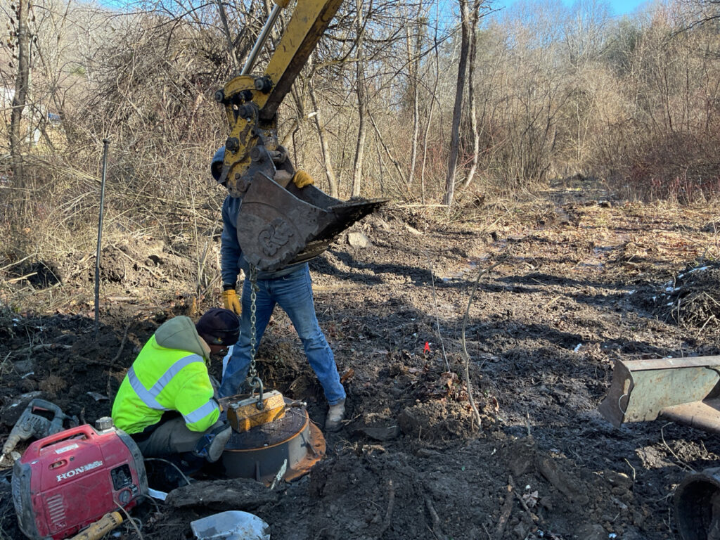
The Arbuckle network was built in the 1980s, when it was standard practice for manholes to have open ventilation. Today, such vents create infiltration and inflow (I&I)—when nonwastewater (e.g., stormwater, creek water, runoff) flows into the system. I&I adds volume, increases treatment costs, stresses the system, and increases the risk of backups.
The Solution: A Rehab Project Becomes a GIS Opportunity
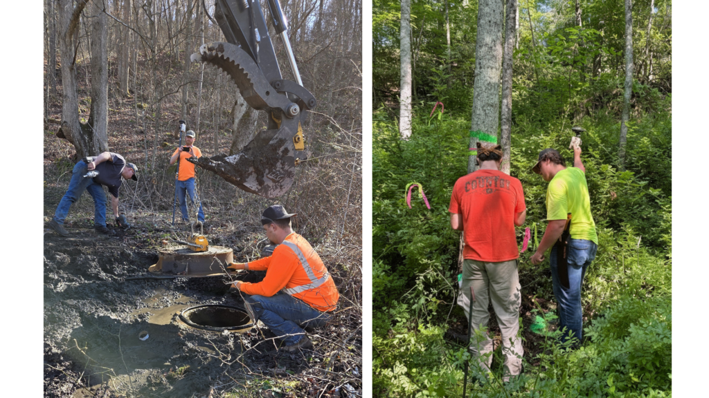
The sanitary board launched the Arbuckle Rehabilitation Project to evaluate and address every manhole’s needs. One treatment that every manhole got was replacing its lid and ring to drastically reduce I&I.
Because contractors and an engineering inspector would already be visiting all of the system’s hundreds of manholes, the city recognized a rare opportunity: to collect a complete, high-accuracy, standardized inventory of the Arbuckle network. This would allow Oak Hill to replace inconsistent legacy GIS data with a single, authoritative dataset, built for long‑term operations.
“This was a great opportunity to leverage the fact we’ve already got a contractor and engineering firm visiting each manhole,” Bragg said. “It adds two minutes at each manhole, but it saves days of work later on.”
The sanitary board already had a robust GIS workflow. Years of consistent use of apps like ArcGIS Field Maps and ArcGIS Survey123 meant that field crews were updating GIS data daily during routine fieldwork. Bragg in his capacity supports not just the sanitary board but also many municipal teams including police, fire, and parks and recreation.
“It took years to get where we are, but now the information in the GIS is updated daily by the field technicians,” Bragg said. “Every bit of the data we enhance in the system helps them when they get on-site for a reported issue.”
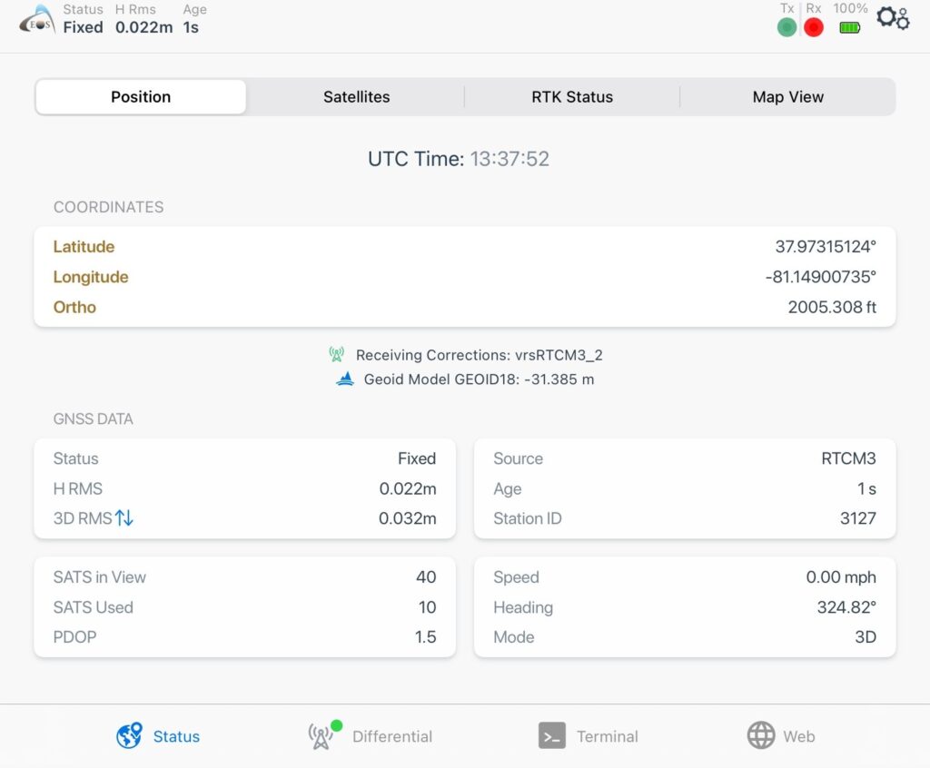
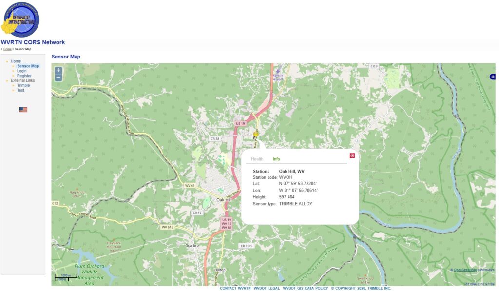
To further enhance the GIS, Bragg has also been using a high-accuracy Arrow Gold Global Navigation Satellite System (GNSS) receiver from Eos Positioning Systems. This helps him improve the location accuracy of certain infrastructure, such as critical sewer lines and underground taps. He connects the Arrow Gold receiver to the free, local West Virginia Continuously Operating Reference Stations (CORS) network for real-time kinematic (RTK) corrections, which deliver sub-inch accuracy in the city. Luckily enough, there’s even a CORS base station located right in town.
“We are lucky and blessed to have not only a state CORS network, but also that in the city of Oak Hill we have a GNSS base station right here in town,” Bragg said.
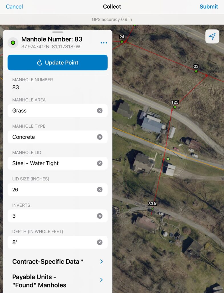
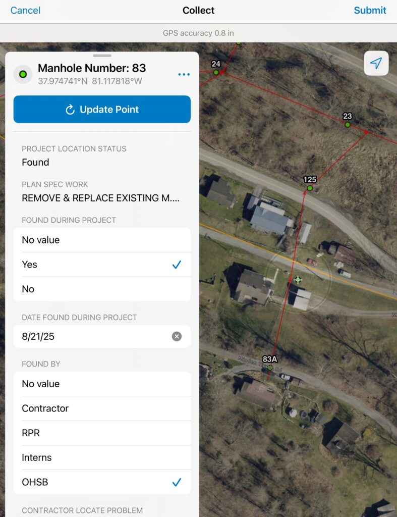
Because of staff’s experience with enhancing the GIS regularly, the city knew what type of data it wanted. For each manhole, staff wanted a high-accuracy GNSS position; at least one photo of the manhole and another of the surrounding area; and standardized attributes such as lid type, depth, number of inverts, and rehabilitation actions. Arbuckle would have the perfect dataset—making both the infrastructure and GIS future-proof.
The Workflow: Putting Maps in the Inspector’s Hand
To ensure that any contractor could bid on the rehab project regardless of GIS or GNSS experience, Bragg equipped the winning engineering firm, The Thrasher Group, with city‑provided technology and training.
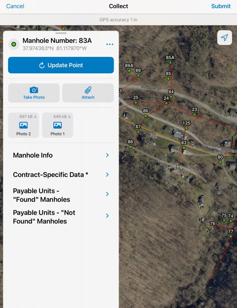
“We determined that the engineering inspector was the one who would do the data collection,” Bragg said. “The inspector would be looking at the completed manhole anyway, so we put a GPS and an iPad in his hand and asked him to take two extra minutes to collect our data.”
Bragg first created a full GIS replica of the legacy Arbuckle data so that the inspector wouldn’t edit the city’s live operational layers. This kept authoritative data protected while allowing new, high‑accuracy updates to be collected in ArcGIS Field Maps.
To streamline data entry, Bragg built a simple, standardized form for ArcGIS Field Maps. Drop‑down menus, radio buttons, photo prompts, and other required inputs meant all incoming data would meet basic city standards.
Ensuring High Accuracy in the West Virginia Woodlands
The city purchased a dedicated iPad and an Arrow Gold+ GNSS receiver, both of which would be folded into staff’s daily operations once the project ended. The Arrow Gold+ receiver connected to the West Virginia CORS network, and the proximity to the city’s base station meant no manhole in the Arbuckle system was more than three miles from the antenna. Even under challenging canopy and in deep valleys, this greatly improved the accuracy to just a few feet in the worst areas.
“When you get down into a valley, you lose accuracy pretty quickly,” Bragg said. “But with our proximity to the CORS network, it really did help with maintaining a higher level of accuracy.”
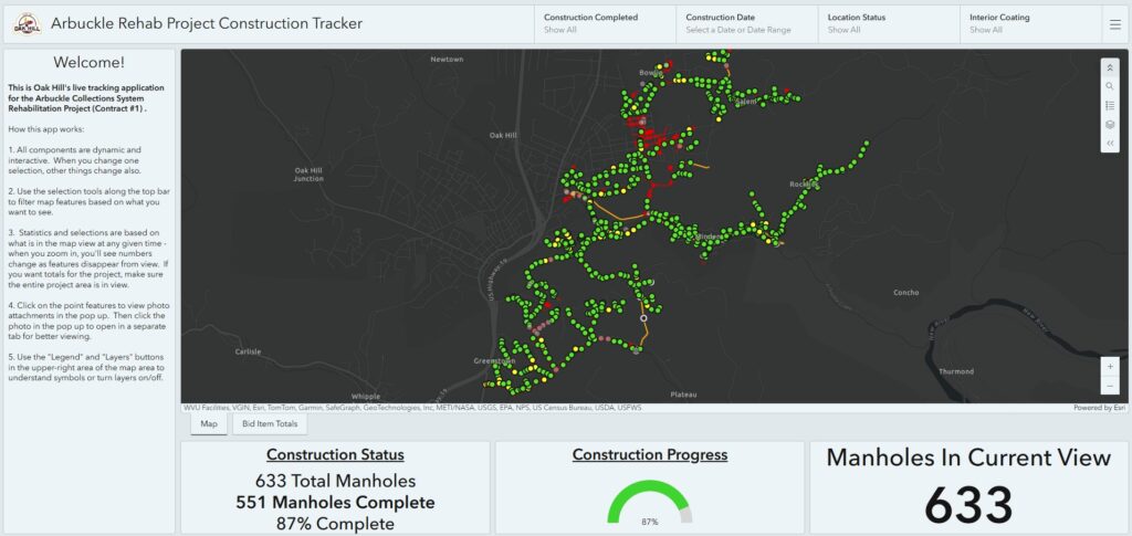
Meanwhile, Bragg used ArcGIS Dashboards to visualize construction status as data came in from the field. “Effectively, we created a live as-built drawing,” Bragg said.
A Full Feature Swap and a Clean Slate
Once the project was completed, Bragg reviewed the new data, resolved anomalies, and performed a snapping operation on new underground lines from the updated manhole locations. He then performed a full GIS swap by archiving the old data and christening the newly collected data as the authoritative operational GIS for Arbuckle. “It’s the clean slate we wanted,” Bragg said.
The Results: Accurate Data That Transforms Daily Operations
The Arbuckle Rehabilitation Project transformed the sanitary board’s GIS. What had once been a dataset full of mismatched coordinates, missing attributes, and inconsistent documentation became a precise, standardized, and fully verified system.
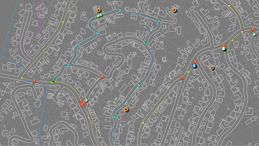
High-Accuracy Maps Across All of the System’s More than 630 Manholes
“You can see the difference between what they had in 2013 and what we have now,” Hobbs said. “The Arrow Gold+ really narrowed things in. Nothing from previous records compares.”
As Bragg put it, “Even two‑foot accuracy is better than 80-foot accuracy. If you get within two feet, you can find the manhole.”
Standardized Data for Every Asset
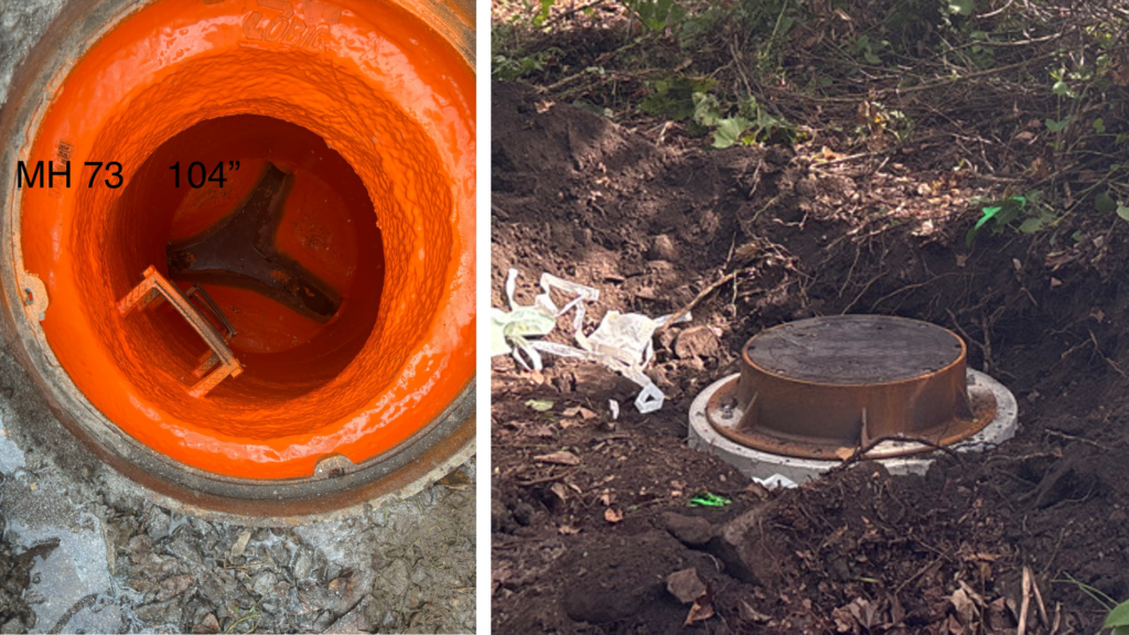
Beyond location accuracy, there’s now complete documentation for all structures. Each manhole now has standardized inside and outside photos, rehab notes, lid type, invert details, depths, and other essential attributes—captured uniformly across the entire system.
“What we had before were inaccurate locations and inconsistent photos and attributes,” Bragg said. “Now everything is standardized and accurate.”
Looking Ahead
Now, the sanitary board responds faster to GIS requests from third parties. “The Arrow Gold+ is already paying off,” Hobbs said. “We can answer engineering and design requests with confidence.”
The team expects field crews to spend less time searching for manholes and, as a result, be able to respond faster to incidents. The sealed lids will reduce I&I and associated costs.
Though Bragg acknowledges that this project came with its own share of challenges—ranging from figuring out how to set up the technology to communicating project information—he believes the payoff is tangible.
“Not everything is sunshine and roses, as anyone who’s been part of a project knows,” Bragg said. “There were growing pains and lessons learned. But we knew from the beginning that the headaches and heartaches were worth it. Now we’re going to be that much more prepared.”

Stay Connected with Esri’s Water Team
ArcGIS is an extensive information system that enables modernization of workflows with easy-to-use applications for the field and office. Strengthen your organization with geospatial solutions that will increase efficiency and provide insight for decision-makers.
Join the Water Utilities Community
Follow #EsriWater on social media: X | LinkedIn
Subscribe to the Water Industry newsletter “Esri News for Water Utilities and Water Resources“
Learn more about how GIS supports digital transformation.