Gruppo Tea is a leading public multi-utility company based in Mantua, Italy. With over a century of history, the group is dedicated to managing and delivering essential public services to the local territory. Through its specialized subsidiaries, Gruppo Tea operates across multiple vital sectors: integrated water cycle management (water supply and sewerage via its subsidiary AqA), gas distribution, district heating, and environmental services (waste management and urban hygiene). Strongly committed to sustainability and technological innovation, the company continuously invests in digital transformation to improve operational efficiency, protect natural resources, and enhance the quality of life for the communities it serves.
AqA, part of Gruppo Tea, manages the integrated water cycle for the Mantua territory in Italy. To modernize its operations, AqA launched the Water UN System project, transitioning its water network to a dynamic digital twin. This initiative, funded by the National Recovery and Resilience Plan (PNRR), aims to enhance water management through advanced geographic information system (GIS) capabilities, strict data integrity, and mobile workforce integration. Workflows include advanced web-based editing and field data collection seamlessly synchronized with enterprise management systems.
Challenge
Prior to this project, AqA relied on a legacy geometric network system that had reached its physical and logical limitations. The lack of strict topological rules resulted in structural data inaccuracies, and the architecture could not adequately support modern web editing or mobile field operations. Disjointed systems required technicians to rely on paper-based workflows, slowing down maintenance and leading to data synchronization issues with the company’s enterprise systems (SAP and Salesforce). The main business problem was the urgent need to establish a single, authoritative source of truth for the entire water infrastructure, while strictly adhering to the highly challenging timelines and delivery standards imposed by the European PNRR funding requirements.
Solution
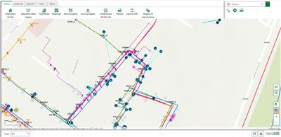
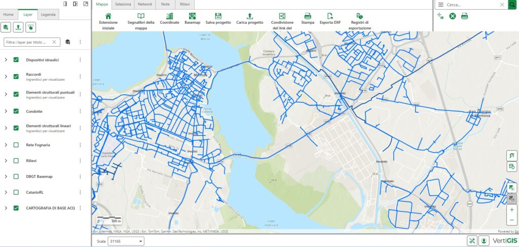
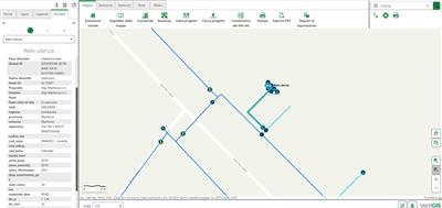
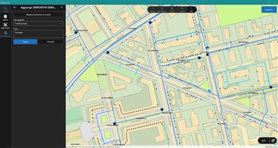
AqA implemented a comprehensive digital transformation by implementing ArcGIS Utility Network, establishing a real physical model of the water assets. The technology stack features ArcGIS Enterprise and ArcGIS Pro hosted on Google Cloud Platform (GCP) with PostgreSQL. To enable distributed management, the company implemented VertiGIS Studio and VertiGIS Networks for advanced web editing. For field operations, VertiGIS Studio GO was deployed, allowing technicians to input georeferenced annotations directly via mobile devices. The GIS was established as the “master” topological database, fully integrated with SAP ERP for master data and Salesforce for workforce management, creating an uninterrupted flow of data from the field to the back office.
“The new mobile workflow revolutionized our field operations. Real-time georeferencing eliminates paper notes, empowering technicians to actively build an accurate digital twin of our network.”
Operations Technician, AqA
Partner
Esri Italia played a crucial role as a strategic and technical partner throughout the entire project life cycle. Their comprehensive support included the architectural design and the technical implementation of ArcGIS Utility Network. To ensure a smooth transition, Esri provided extensive training support, delivering dedicated training sessions tailored for both administrators and end users. Furthermore, Esri’s commitment continued with dedicated post go-live support and shadowing, assisting operational teams in the field and in the back office to maximize the value of the new digital infrastructure.
Project Team
A cross-functional team drove success: Gruppo Tea IT (GCP, SAP/Salesforce integration, and ArcGIS Utility Network transition), AqA Management (strategy and PNRR compliance), AqA Engineers, and AqA Technicians (field workflow and VertiGIS mobile adoption)
Results
The project achieved a successful go-live for the water network within just 14 months, perfectly meeting the strict PNRR deadlines. The entire infrastructure is now operating securely in the cloud. Gruppo Tea’s ArcGIS Utility Network implementation delivered unparalleled topological precision, establishing a true digital twin. Field operations have been revolutionized: Paper has been eliminated, and technicians use a real-time mobile workflow where field annotations are verified and validated in ArcGIS Pro before updating the master database. What used to take several weeks is now completed in just a few hours. This drastically improved data quality and update speed. The integration ensures that work orders in Salesforce instantly access the correct asset data from GIS, maintaining perfect alignment with SAP. This success sets a new standard for Gruppo Tea.
“Integrating Esri [ArcGIS] Utility Network with SAP and Salesforce established a reliable single source of truth, streamlining our IT architecture and ensuring we met strict PNRR deadlines.”
IT Manager, Gruppo Tea

ArcGIS is an extensive information system that enables modernization of workflows with easy-to-use applications. Strengthen your organization with geospatial solutions that will increase efficiency and provide insight for decision-makers. Visit the Esri Water Utilities web site for more information.
Download the Building a Modern Network Information Management System eBook
Stay Connected with Esri’s Water Team
Join the Water Utilities Community
Follow #EsriWater on social media: X | LinkedIn
Subscribe to the Water Industry newsletter “Esri News for Water Utilities and Water Resources“