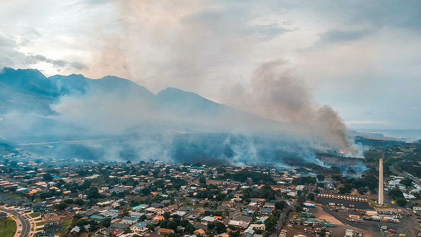
If you’ve ever spent hours chasing new ignitions after a lightning bust (fun times), or stood in a grocery store parking lot staring at a column and muttered, “Where is that actually burning?” then this one is for you.
There’s a quiet, interagency effort that puts very smart eyes in the sky to find new fires, map established ones, and deliver intelligence fast enough to inform tactics. It isn’t flashy. It doesn’t get a lot press conferences. But it’s the backbone for wildfire detection and situational awareness across the U.S.
It’s called the Incident Awareness and Assessment program or IAA for short. If that name is new to you, you’re not alone. This post is my attempt to shine a light on the capability that the entirety of the United States relies on daily, whether you realize it or not. I described this program very briefly in a wildfire intelligence blog series here, but honestly, it deserves its own story.
What “IAA” Means and Why it Exists
IAA adapts a Department of Defense concept for use in wildland fire: use aircraft, satellites, and increasingly, ground-based cameras to collect geospatial intelligence and get it to the people who need it. You can think of it as the front door for firefighters ordering airborne intelligence that gets actionable products back to dispatchers, Incident Management Teams (IMTs), and fire management programs in near real time. The value of having a system where a group of diverse stakeholders can all leverage the same imagery and the products derived from that imagery helps to create a Common Operating Picture (COP) within ArcGIS.
At a glance, the IAA ecosystem includes:
- IAA Operational Support/Reconnaissance – fixed wing aircraft with gimbal EO/IR sensors and a fire-qualified liaison onboard (agency-dependent), focused on new-start detection and rapid situational awareness.
- NIROPS (National Infrared Operations) – the national, night-flying perimeter mapping mission for large incidents.
- FireGuard– Air National Guard powered, 24/7 satellite monitoring that flags heat (not perimeters) at 15-minute intervals.
- Ground-based/portable cameras – a growing piece of IAA. Think ALERTCalifornia system, but orderable to fires like we utilize Remote Access Weather Stations (RAWS) today.
- Ordering and Mission Management Infrastructure– there’s an IAA Hub where requests are submitted and tasking is coordinated (requires a NIFC AGOL login).
Operational Support/Reconnaissance: Find Fires (and their context)
The primary mission of IAA operational support and reconnaissance is to detect new ignitions quickly. A good example of an IAA reconnaissance mission is when lightning occurs over a large geographic area and we need to understand if any of that lightning caused new fires. This is an attempt to help fire managers develop suppression strategies sooner and keep fires small.
When there is a lack of new fire detection work, IAA operational support services provide targeted mapping. The program produces maps, images, and short video products for emerging/ongoing incidents. Interestingly, there is no cost to fire departments or land management agencies requesting IAA operational support/reconnaissance capabilities but more on that later!
The Crew
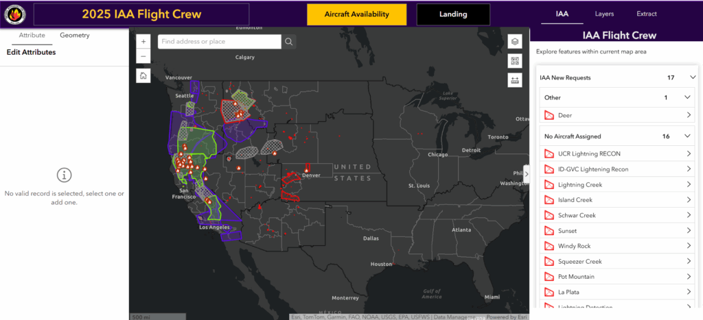
Every national IAA operational support or reconnaissance mission pairs a mission sensor operator with a fire-qualified liaison. This is typically a single-resource boss at minimum, but often a Task Force Leader, Division/Group Supervisor, or Air Tactical Group Supervisor. The liaison helps talk to air assets over the fire to deconflict the IAA mission from the primary aerial tactical mission. They also help translate heat signatures and fire behavior on the screen into actionable intelligence and recommendations that firefighting operations can leverage. All IAA aircraft typically work above the Temporary Flight Restriction (TFR), roughly 17–24k feet (agency-dependent), so they’re not interfering with fire suppression aircraft. The crew is able to visualize their assigned missions via the ArcGIS Dashboard. This application provides textual mission information, as well as a geospatial map that provides downloadable layers for other navigation and management applications. They can also receive, and accepted new missions mid-flight allowing for more efficient use of their flight time.
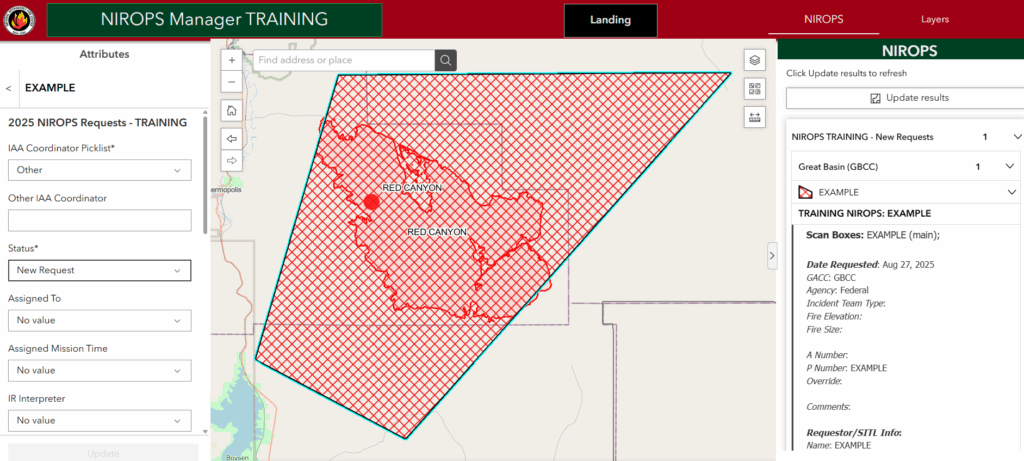
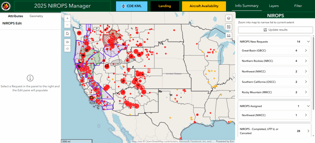
How a Request Becomes an Intelligence Product
Just because we are collecting data or imagery doesn’t mean that it is immediately useful for firefighting operations. That data needs to be vetted, interpreted by someone familiar with the data type, and then crafted into a product like a fire perimeter map. Thankfully, the IAA Program in concert with the National Interagency Fire Center (NIFC) has a mature process for receiving requests, assigning resources, and delivering products to firefighters.
- Login with your NIFC Account and Request support in the IAA ArcGIS Hub.
- Answer questions about where you’re located, what kind of mission you’re requesting, and how you want your intelligence delivered – almost DoorDash style to a dispatch center or a designated point of contact.
- Next, just draw a polygon around your Area of Interest (AOI) needing a flight or indicate the incident for which you need mapping.
- A flight gets assigned and that tasking goes to the assigned resource. Thanks to Starlink, crews can accept a new mission in the air, pull current layers (24/72-hour lightning, existing fires, any current perimeters for context), and push updates.
- Any new detections the crews discover will get a Survey123 initial attack size-up (agency-dependent) that auto-associates to the correct dispatch center using the coordinates of the fire. This keeps radios clear when you’ve found, say, 26 fires over a couple of hours.
- Narrated or un-narrated video and imagery are operational support products that can be requested for a mission.
- Operational support and reconnaissance products land in EGP (Enterprise Geospatial Portal), and the requester gets a close-out email indicating their mission has been completed.
How it Happens at Night
- Get in your requests for an accurate nighttime NIROPS flight early as the cutoff is 15:30 MT. This is a hard line so flight plans can be filed and infrared interpreters (IRIN) queued.
- Platforms: Three fixed-wing aircraft are in the program (agency + contracted). NIROPS also coordinates a DoD satellite for out-of-reach incidents. Note that this is separate from FireGuard and has different capabilities.
- Sensors: Line scanners sweep (“mow the lawn”) and can cover huge acreage per hour, stitching strips into a coherent scene. IR technicians in the air ensure collection quality and troubleshoot.
- Pipeline: Imagery drops via Starlink to the repository, IRINs process it, then SITLs/GISS pick up products for the incident. Deliverables typically include geospatial data and a short IRIN log.
IAA: NIROPS (National Infrared Operations)
NIROPS has roots back to early USFS IR work in the 1960s and has carried the “NIROPS” name since the early 2000s. It’s the national perimeter-mapping mission after dark. Priority goes to incidents with Complex Incident Management Teams (CIMTs), and large fires (≥300 acres in grass/brush; ≥100 acres in timber), with flexibility for Type 3s organizations when capacity allows.
Night crews usually show around noon MT, plan in the afternoon, and launch at or just after sunset. Depending on workload, imagery can flow to interpreters from roughly 2300–0400. Some nights finish earlier; some push later. The goal is simple: morning briefing maps reflects last night’s reality.
How IAA Operational Support/Reconnaissance Products differ from NIROPS Products
Operational support and reconnaissance products use a gimbal sensor and a human digitizing the heat edge which is great for new fire detection, quick situational awareness and targeted video. NIROPS uses a line scanner at night to “mow the lawn” across big areas and produce authoritative perimeters at a rate of 300,000 acres/hour. Different tools for different jobs.
Midday inversions? Smoke Column burying the line? IR still sees the heat. Rachael shared two scenarios that I think demonstrate the value of IAA reconnaissance capabilities: she found a dinner plate-sized smoldering fire in the middle of the day in a desert under a bush while flying at ~19,000 feet. This is a fire you may never see even if you were walking alongside it. Another ignition was found on a snag in the middle of a lake. Each fire got laser-rangefinder (LRF) coordinates so crews could go straight to them.
IAA Priorities and Why “UTF” happens
IAA operational support mission triage is simple: (1) detection/reconnaissance, (2) IA/emerging incidents, (3) large fires. After a heavy lightning bust across multiple geographic areas, aircraft can be tied up covering huge AOIs reporting multiple new starts. This makes for the kind of day where for every new fire IAA finds, two more await discovery.
Given the amount of work and new fires, it can outstrip our national capacity to map them. It’s just math. More fires than we have aircraft occasionally happens and when it does it’s classified as an “unable-to-fill” or a “UTF.”
Who Pays?
For national IAA operational support and reconnaissance assets, flights are covered, no incident billing to the requester. It is Federal assets, but only because State aircraft policies can vary. However, NIROPS (nighttime large fire mapping) is still billed to the incident so factor that in as your request flights.
FireGuard
FireGuard is Air National Guard wildfire intelligence capability using satellite capabilities to flag heat detections. It’s not necessarily a perimeter-mapping service, rather think high-cadence situational awareness. DoD analysts sanitize sensitive data and share declassified fire spread products via interagency channels. Much has been written on FireGuard and this is another capability that deserves its own spotlight. Stay tuned for that story coming in a few weeks!
Camera: A Growing Piece of IAA
Ground-based cameras are being integrated into the IAA ecosystem with the intent that temporary deployments can be requested when/where they’ll help most. That workflow is still maturing; the aim is to make cameras another tool you can pull through the same request system as you would other intelligence.
Where To Get The Data Products
If you’ve used the Wildfire Enterprise Geospatial Portal (EGP), there is a chance that you’ve already touched IAA outputs. Products land there so the interagency community can find them and not get buried in someone FMO’s email attachments – I’ve been guilty of this a time or two. In September of 2025, legacy EGP was replaced with Wildfire SA Advanced as the new common operating picture application.
NIROPS products continue to be stored and accessed via the FTP site. However, the U.S. Forest Service is working toward replacing the FTP with a more secure data transfer and storage solution.
Interagency Collaboration Is the Fuel For This Program and It’s Working
This program runs on interagency muscle memory: daily coordination across federal programs and multiple states; a working group that syncs regularly; and a shared commitment to deconflict flights and share SOPs. Oregon, Washington, California (OES/CAL FIRE), Montana, and Colorado operate multi-mission aircraft today, with Utah and Texas working to build programs. This collaboration within ArcGIS allows bidirectional information flow from States to Feds and from the Feds to States helping to facilitate learning from seasoned partners so we cover the most ground with the fewest redundancies.
If you’re a fire manager, dispatch, on an IMT, or leading IA resources after a thunderstorm, use this program. Draw the polygon. Ask for the flight and be ready to leverage ArcGIS for your work. When the email lands, pull the map/video and move. That hidden dinner-plate ignition doesn’t stand a chance.