I entered the field of GIS with the desire to one day work at the intersection of equity and GIS. While state and local governments can incorporate community engagement and equity, nonprofits and community groups have always been at the forefront of change. A great example is the labor movement, we can thank labor groups for the 40-hour work week, weekends, health plans through your employer, Labor Day as a federal holiday and many other benefits. Collaborating, finding partnership with nonprofits and government, provides an opportunity for our leaders and community members to engage and work on improving our communities together.
In 2016 I was able to witness a historic meeting between Jack Dangermond, Esri President, Dolores Huerta, social justice icon, and one of the founders of the UFW Foundation. Mr. Dangermond talked about how he wanted to have Esri software accessible to all communities around the world. Dolores wanted to organize the world and empower communities to utilize their voice, their knowledge to better their local communities. Four months later I took a leap of faith, changed my career, and began working with the Dolores Huerta Foundation, a 501cs nonprofit dedicated to “Inspiring and organizing communities to build volunteer organizations empowered to pursue social justice.”
Six years later and I am now working at Esri as the Industry Equity Lead working to uplift equity and GIS stories across disciplines from our global customer base. If you have been following along to our Equity Across Industries blog series, you will find this piece inspiring as we learn how GIS technology advances nonprofits initiatives forward. I sat down with Esri’s Emily Swenson, Nonprofit Program Lead to explore how community organizations are creating a world we want to see with GIS. Let’s dive in!
Sophia: When I think of nonprofits I think of community leaders, philanthropy, and trusted messengers. Can you tell us of some of the sector’s nonprofits using GIS fall under?
Emily: By definition, nonprofit organizations are not dedicated to private or financial gain, but to the advancement of public interest. And their work spans all industries- including public policy and administration, humanitarian relief, community development, arts and culture, environment, health, transportation, education, you name the industry and there are nonprofit groups positioned to funding, researching, convening, delivering services, and advocating in that area. And I think because of the mission driven nature of nonprofits, like you were just saying, Sophia, so many of these organizations are also at the forefront of equity work for those they serve. And for the industries and causes that they’re aligned with.
Sophia: Nonprofits have been leading the way in equity for decades. What is new to the profession is the incorporation of GIS into their work. Why is it important that Nonprofits utilize GIS to enhance their work?
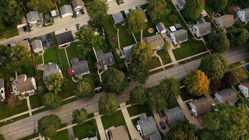
Emily: With equity being the recognition that not all people start from the same place, and we must first recognize that so we can adjust the imbalances both collectively and intersectional. location matters! So, the geographic approach provides a framework for nonprofits to understand the root cause of equities and inequities through data and spatial analytics. Nonprofit organizations are using GIS to make decisions, foster understanding, engage communities, and consider the role of location in people’s day-to-day lives and their experiences. I think it’s also important to note here that nonprofits are working at all levels, locally to globally to address some of the world’s most complex challenges. And GIS allows nonprofits to put their work into context and see it as part of a larger system or larger systems so that their efforts can address those root causes as well as the human experience. We know, for example, that global sea level rise or pollution, are patterns influenced by climate change. The science that is GIS is helping us to understand that and GIS also helps us to understand how those challenges create implications in communities because in each of these cases there are communities, families and individuals that are being confronted by those threats. For example, there may be a farming family in Louisiana that’s losing their land and livelihood because of sea level rise or an elementary student that’s sitting out of gym class because the asthma that they’re dealing with because of air pollution.
So, nonprofits are using GIS to help empower and mobilize community-based action by capturing local data, designing interventions, and engaging policymakers with the information needed to act to mitigate challenges like that, as well as to understand you know, what’s happening at all scales. I think that what I’m getting at here is, yeah, nonprofits are operating at many levels to solve these challenges and geography and GIS is providing a framework and tools for understanding interconnectedness and tackling them at every level, as well as ensuring positive practice when it comes to equity in decision making.
Sophia: What nonprofits have been pioneering GIS and equity work?
Emily: So, there are many organizations pioneering this work, but I will highlight a few:
Trust for Public Land is working to connect everyone to the outdoors and recognizes there are inequities in access. They have created the Park Serve app to uncover those and identify areas for parks considering factors like income, race, age, health.
Food banks, including feeding America Riverside San Bernardino are recognizing where there are people with disabilities in their service area and using GIS to mobilize volunteers to help make food deliveries. Another food bank in North Carolina has been using GIS to identify languages spoken at home so that they can make their information and outreach accessible based on language.
YMCA of the USA is focused on accelerating progress toward racial parity at the highest levels of their network. In support of those efforts, they have developed and enhanced tools to help local YMCAs make data-informed decisions as they implement strategies to hire, promote and retain staff of historically underrepresented staff at all levels. Their work has focused on understanding the barriers to having a vibrant and diverse hiring pool and then looking to solutions to help overcome those gaps upstream, through programs like education.


WK Kellogg Foundation is activating stakeholders in communities by providing resources and tools to identify opportunities, report on progress, and share narratives.
Milwaukee Foundation focuses on early childhood education equity and uses spatial analytics to inform their efforts and communicate them out to the public.
Self-Represented Litigation Network is advocating for state level policy around broadband and internet access by mapping coverage compared to underlying demographic and socioeconomic information to see that marginalized groups – based on race, age, and socioeconomic status – are adversely affected. They look at the intersections off all these things to see where inequities are most prevalent.
National civil rights and advocacy organizations like UnidosUS and the NAACP are using GIS to increase civic engagement and participation so that they can build power for communities.
And Native Lands, National Trails is an Indigenous mapping and research project of the Partnership for a National Trail System to present resources designed to inform the public advance the knowledge of Indigenous ancestral lands.
Sophia: Can you explain what the Esri nonprofit program is and why it is important?
Emily: As many know, Esri has a long practice of providing our technology to organizations that are doing important work in the conservation, humanitarian, and community development spaces, and in 2010 we founded this program that would make it easier and remove some of the barriers including cost for nonprofit organizations across the board.
The program provides deeply, deeply discounted access to our software offerings, training, data, as well as creates a community of organizations that are also using GIS in their work. Today, there are over 13,000 organizations that participate from around the world, and it’s been really exciting to see what’s possible when an organization is able to apply GIS to their mission.
Sophia: We are hearing from state and local government professionals the desire to work with community nonprofits in their community engagement work. How can governments partner with nonprofits for community engagement using GIS?
Emily: Jack says during his UC plenary that “collaboration happens at the speed of trust,” and I think that resonates so much here from what I’ve seen with nonprofit organizations and community organizations that are working on the ground. So, when you have that level of advocacy and understanding from a community organization, paired with government resources you enhance the ability to drive change at a larger scale. The public sector and nonprofits can really work together in an amazing way which results in a sort of relationship that builds trust in the public sector and helps them influence their communities. Then bringing in GIS and sharing spatial content makes that collaboration even more valuable and transparent for community members.
I think a way that state and local governments can partner with nonprofits is by helping them get on board with the use of GIS. While there are 13,000 nonprofits in the Esri nonprofit program today, there are over 1,000,000 nonprofits across our country and even more around the globe. So, there are so many that can still benefit from building skills around GIS and getting connected into the ecosystems that governments are using to support their initiatives.
A great example of this sort of collaboration is exemplified in the 2020 census efforts, NAACP launched a geospatial strategy for increasing participation from Black and African American citizens in the census because historically there are families and communities that are undercounted. And we know that when people are not accurately represented on the census, that is funding from the federal government that is not going into these communities. So, you can imagine how a process like the census count can perpetuate inequities. Now, the NAACP took a brilliant approach, which was using an ArcGIS Hub to disseminate information on where there are communities with a high number of Black and African American households and getting their affiliates and their chapters on the ground to get out and knock on doors and educate those households on why it’s important to complete the census and how it directly impacts their families and communities in terms of resource allocation. This approach builds trust.
Creating the World You Want to See
Nonprofits are operating at many levels to solve complex world challenges and GIS is providing the framework and tools for tackling them at every level, as well as ensuring positive practice when it comes to incorporating equity into decision making. Esri recognizes the power of applying a geographic approach to complex problems and has therefore continuously tried to make its software available to community organizations. This is essential to ensure these organizations are leveraging technology that move their initiatives forward in a meaningful way. If you are a nonprofit looking to make a difference, please visit Esri resources that are available to you and get started on your equity strategic plan today.