Gestagua, a leading company in integral water cycle management, has innovated by integrating building information modeling (BIM) technology with its GIS platform, developed by Esri Spain. This strategic integration enhances data interconnectivity and operational vision, providing detailed digital representations of water infrastructure.
The Challenge
Gestagua faced the challenge of improving the efficiency and safety of its water infrastructure maintenance. The need for a new solution arose from the desire to enhance planning, design, and operational decision-making through real-time data access. In practice, newly onboarded staff were not sufficiently familiar with the site and unsure which specific elements to operate during an intervention, or how to distinguish between identical assets—such as pumps—where a scheduled intervention was planned for a particular unit. By leveraging BIM, these challenges are significantly reduced, as the visual model makes it much easier to identify and locate the correct elements.
“The integration of BIM and GIS technology significantly improves the maintenance and management of water infrastructure, ensuring a safe and efficient water supply for over 630,000 inhabitants.” —Guillermo Alonso Navajo, Hydraulic Models Technician at Gestagua
The Solution
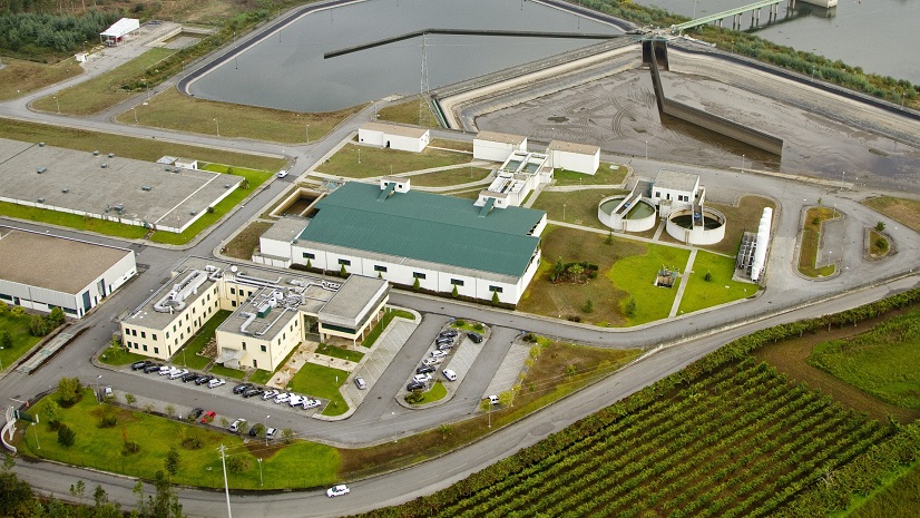
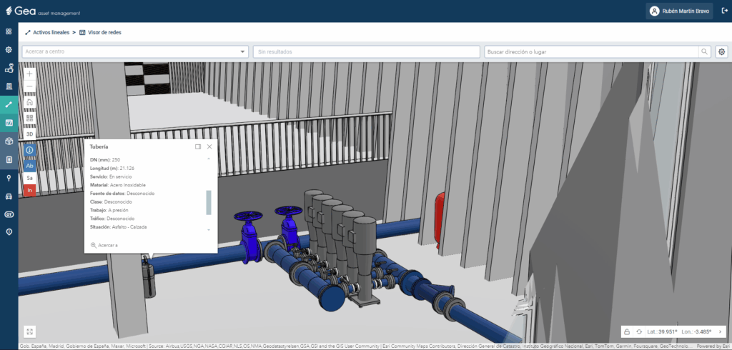
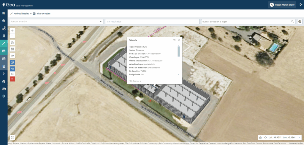
To overcome this challenge, Gestagua implemented BIM technology and integrated it with its ArcGIS platform. The pilot project at the Ocaña reservoir in Toledo involved creating a 3D model of the reservoir and its associated pumping system using Autodesk Revit. For this purpose, the installation was scanned using laser technology to generate a 3D point cloud, which was then digitized in Revit. A digital twin of the conduits and hydraulic elements was subsequently created in ArcGIS Utility Network, enabling linkage between the BIM model and the ArcGIS database. The BIM model was then imported into the Gestagua enterprise geodatabase and published to the ArcGIS Enterprise portal. This service is consumed through the GEA platform, Gestagua’s asset management system based on Esri technology, allowing the integration of all GEA functionalities within the BIM model. The integration provides real-time access to centralized data, combining both the BIM models and the network, and allows switching between 2D and 3D views within the enterprise geodatabase. This approach eliminates information silos by unifying BIM data with the rest of the water asset database.

The Results
The integration of BIM and GIS resulted in several benefits:
- Efficiency in maintenance: The 3D representation of infrastructure elements facilitates the identification of maintenance tasks, reducing incident response times and costs.
- Improved planning and safety: Enhanced space planning and safety evaluations, including virtual training for staff, improved preparation, and safety during interventions. Staff can also review and assess installations directly from the office, reducing the need for on-site visits and minimizing potential risks.
“With BIM integrated into the Esri platform, all relevat data is centralized and easily accessible, breaking down silos and promoting a holistic view of assets” — Rubén Martín, responsible for GIS at Gestagua

Stay Connected with Esri’s Water Team
ArcGIS is an extensive information system that enables modernization of workflows with easy-to-use applications. Strengthen your organization with GIS-based solutions that will increase efficiency and provide insight for decision-makers. Visit the Esri Water Utilities web site for more information.
Follow #EsriWater on social media: X | LinkedIn
Download the Building a Modern Network Information Management System eBook
Subscribe to the Water Industry newsletter “Esri News for Water Utilities and Water Resources“