The Municipal Authority of Westmoreland County (MAWC) in Pennsylvania has over 2,400 miles of water main with nearly 125,000 water service customers. Three water treatment plants provide water for almost all these services and can push water in such a way that they can supplement each other’s service area to a degree. Although there is an element of redundancy, round-the-clock leak detection efforts minimize nonrevenue water.
Challenge
During a drought event affecting the reservoir of one of its treatment plants that serves 45 percent of its total number of services, nonrevenue water became a critical issue. As much water as possible needed to be kept in the system so that withdrawals from the reservoir could be limited. The authority went so far as to declare a Conservation Notice, asking the public and local businesses to reduce their consumption. During this notice, MAWC staff needed to find ways to identify and repair leaks in the system so that it could continue providing water for its customers. Efforts needed to be ramped up to search for leaks in a multipronged approach.
Solution
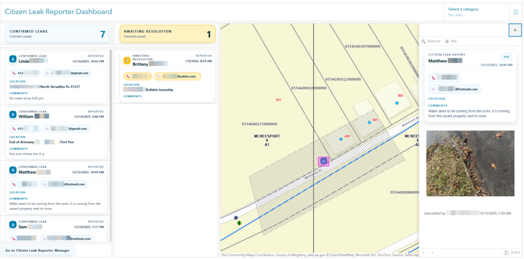
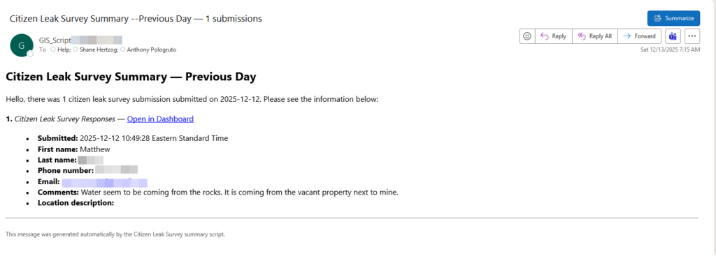
Using out-of-the-box Esri products including ArcGIS Survey123, ArcGIS Dashboards, and ArcGIS Field Maps, MAWC was able to publish a public-facing app that harnessed the power of the crowd to report and identify surface leaks. The app providing a mobile-friendly smart form that allowed the end user to pinpoint where they spotted the water and attach photos. Staff were then notified of the potential leaks via email using scripts. Within the email were the important details along with a link to a dashboard where staff could pan and zoom to the location. Field staff were then dispatched to investigate. Nearly 70 percent of citizen-reported leaks turned out to be true leaks on MAWC main lines.
“As the monitor and responder of the Citizen Leak Reporter Dashboard, I have found it to be incredibly simple to find the location of the leak and for our customers to give important details to help locate a leak. It has been instrumental in notifying us of main line leaks very early on, allowing us to keep water loss at a minimum.” —Darlene R. Testa, Operations Manager, Inside & Outside Commercial Department, MAWC
Simultaneously, another group of field staff were tasked with walking along a cross-country transmission main to look for visible leaks. To keep the crew on target, workers used the Field Maps app to see their location in respect to the water line. Starting at opposite ends of the line, two groups began surveying the line, looking for any surface water that could be the result of a leak. The accuracy of the app allowed the two groups to meet in the middle.
Results
This multipronged approach focused field staff to areas where known leaks needed repair and helped supervisors monitor leaks that were potentially affecting the reservoir under the drought conditions causing the Conservation Notice. The Citizen Leak Reporter app became so useful, MAWC decided to keep it operational even when the drought conditions were resolved.
The ability to stand up public-facing apps quickly allowed MAWC to respond to and address issues affecting its water supply in a time of reduced capacity. Public reporting effectively identified leaks and led to repairs 66 percent of the time. Without apps like ArcGIS Dashboards, Survey123, and Field Maps, MAWC would have had less success identifying and stopping nonrevenue water loss.
“The innovative products developed through Esri have proven to be a valuable tool for our forward-thinking GIS staff. The improvements this partnership has provided in the efficiency of our Distribution Department, from time management to water loss prevention, cannot be overstated. I speak for my entire team when I say that we appreciate the support we have received to date and look forward to the exciting possibilities that the future holds!” —Joe Ponzetti, Operations Manager of Distribution, MAWC

Stay Connected with Esri’s Water Team
ArcGIS is an extensive information system that enables modernization of workflows with easy-to-use applications. Strengthen your organization with geospatial solutions that will increase efficiency and provide insight for decision-makers. Visit the Esri Water web site for more information.
Follow #EsriWater on social media: X | LinkedIn
Subscribe to the Water Industry newsletter “Esri News for Water Utilities and Water Resources“