Introduction
Metro Water Services (Metro) is the public utility department for the Metropolitan Government of Nashville and Davidson County, providing water, wastewater, and stormwater services across Davidson County. Its Stormwater Division manages runoff and flood-risk responsibilities including drainage maintenance, development regulation, pollution prevention, floodplain support, and stormwater infrastructure planning. After several severe localized flooding events occurred in quick succession, Metro Water Services needed a scalable system—based on geographic information system (GIS) technology—to inventory, assess, and model one of the nation’s largest municipal stormwater systems. Barge Design Solutions used ArcGIS Dashboards, ArcGIS Experience Builder, survey-grade GNSS workflows, and custom data review tools to improve data quality, accelerate project delivery, and support flood-risk reduction across Nashville. The work is helping Metro move from reactive response to proactive stormwater management for a system serving more than 700,000 residents across Nashville and Davidson County.
The Challenge
Metro Nashville’s stormwater system spans approximately 525 square miles and 32 watersheds, with a planned inventory of about 180,000 assets. The effort followed several severe, localized floods in quick succession, prompting the Nashville City Council to recognize the need to move from reactive response toward proactive stormwater planning. Before this program, Metro relied on incomplete legacy GIS records, aging and undersized infrastructure, fragmented field documentation, and limited visibility into the assets it owned and maintained. Metro needed a defensible, countywide master plan that could prioritize watersheds, identify flood risks, support development review, and direct limited capital funds toward projects with the greatest public benefit. The program was subsequently established through a city council ordinance to develop a stormwater management plan for the entire Metro Nashville service area.
The Partner Involvement
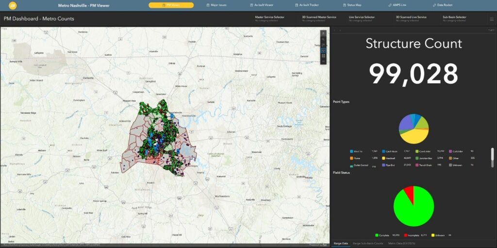
Barge’s teams created key solutions using ArcGIS Online and ArcGIS Field Maps configured with structured forms, ArcGIS Arcade expressions, and survey-grade GNSS workflows to collect consistent asset locations, elevations, dimensions, condition information, and supporting media in the field.
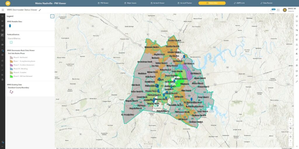
Barge developed ArcGIS Experience Builder web apps powered by ArcGIS Dashboards that provide Barge and Metro teams with a centralized view of inventory progress, condition, and an automated email notification workflow to flag significant field findings and major issues.
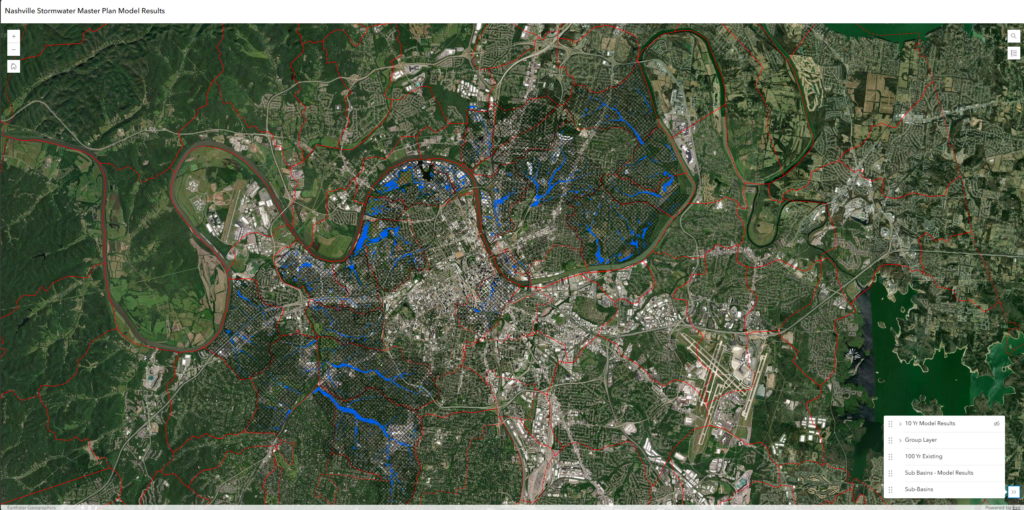
These GIS tools are integrated with PCSWMM, a hydraulic modeling software, and Barge’s master planning workflows, creating a repeatable path from field collection and data quality review through condition assessment, flood-risk evaluation, alternative development, and capital improvement planning.
The Solution
Barge and Metro built a GIS-centered stormwater master planning workflow that connects basin prioritization, field inventory, condition assessment, hydraulic modeling, capital improvement planning, and enterprise data delivery. Watersheds were prioritized to establish a phased schedule for the multiyear program.
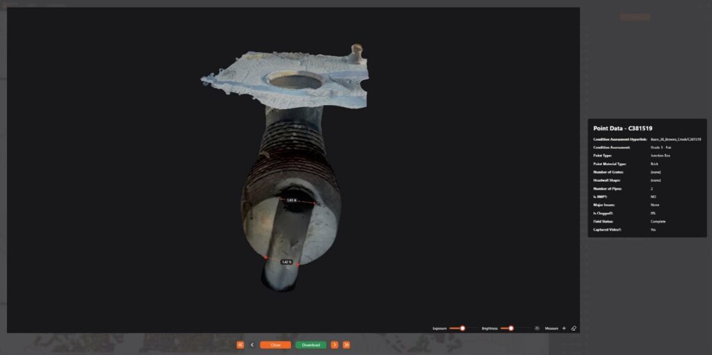
By evaluating Metro’s legacy inventory, Barge designed a GIS schema to serve as the backbone for all phases of the project and provided support with integrating 3D scans and 360 videos into Data Rocket, a custom desktop application that brings ArcGIS Online feature services, Insta360 video, and Polycam 3D scan data into one review environment for office verification and condition assessment.
Each structure is graded and major issues such as safety hazards, structural failures, illicit discharges, and complete clogs automatically generate notifications to Metro staff for timely response.
The Results
The program is already improving Metro’s ability to understand, operate, and invest in its stormwater system. As of June 2026, the overall master plan was approximately 50 percent complete and on track for 2028 completion. Field crews have identified more than 98,000 structures, with the total inventory expected to reach approximately 180,000 assets by project completion.
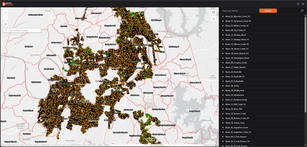
Metro’s GIS database now stores 7.4 terabytes of photos, videos, and 3D scans. The master planning effort has already informed more than 400 completed or active projects and identified approximately 350 capital improvement projects, with additional projects expected as countywide master planning continues.
“This project has transformed how we manage stormwater infrastructure. For the first time, we have a systemwide understanding of our assets, their condition, and the data needed to make proactive, defensible investment decisions,” said Ricky Swift, PE, CFM – Stormwater Assistant Director Metro Water Services.
The solution gives Metro a repeatable, data-driven path from field collection to actionable capital planning to improve confidence in project sizing and prioritize investments that reduce risk.
“The GIS tools developed through this project have changed how I manage capital projects. Having current asset data, field photos and videos, condition information, and project data in one place gives me the information I need to evaluate needs, develop projects, and make decisions with much greater confidence.” —Matt Tays, PE, CFM – Sr. Project Manager, Metro Water Services

Stay Connected with Esri’s Water Team
ArcGIS is an enterprise geospatial platform that enables modernization of workflows with easy-to-use applications for the field and office. Strengthen your organization with geospatial solutions that will increase efficiency and provide insight for decision-makers.
Visit the Esri Water Utilities web site for more information.
Join the Water Utilities Community
Follow #EsriWater on social media: X | LinkedIn
Subscribe to the Water Industry newsletter “Esri News for Water Utilities and Water Resources“