Overview
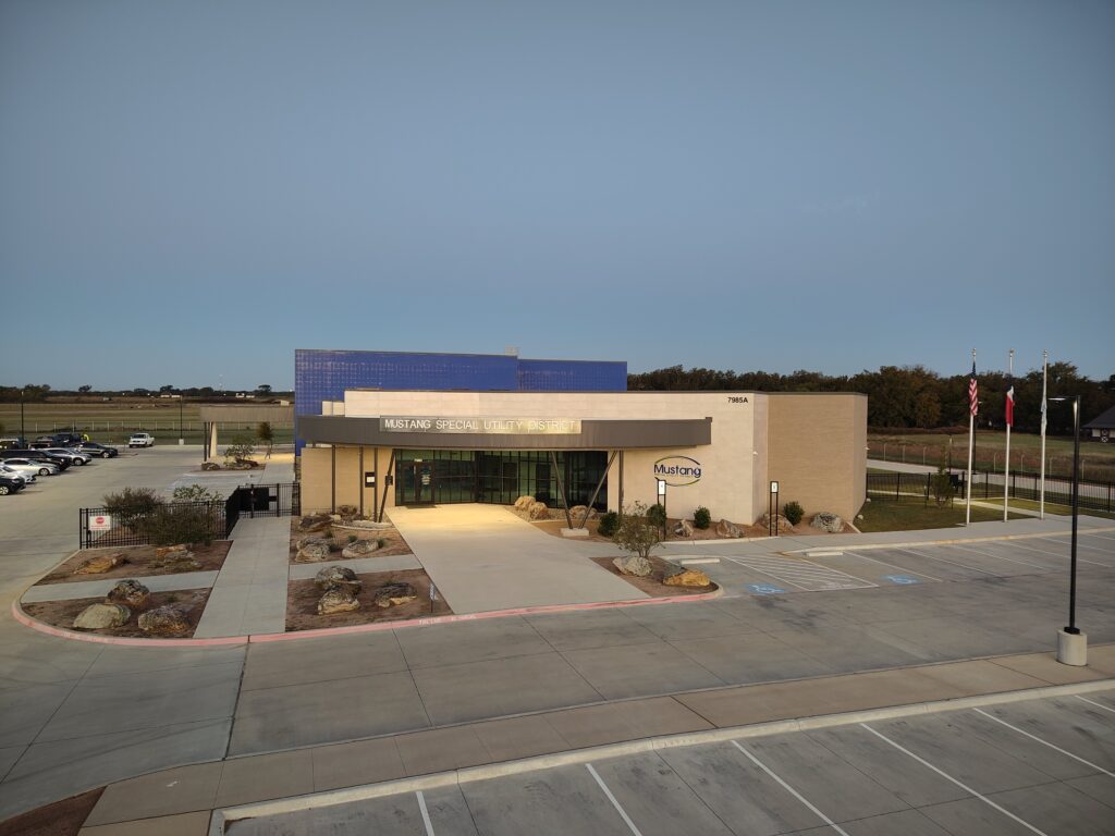
As one of the fastest-growing utilities in North Texas, Mustang Special Utility District (SUD) serves more than 220 square miles across communities including Aubrey, Pilot Point, Gunter, Sherman, and Celina. Rapid growth has created increasing demands on infrastructure planning, construction oversight, data collection, and operational decision-making. To address these challenges, Mustang SUD established an in-house drone program integrated with GIS, enabling staff to capture current imagery, validate construction activities, improve safety, and provide decision-makers with timely, reliable information.
The Challenge
Managing utility infrastructure across a large and rapidly expanding service area presents significant operational challenges. Mustang SUD must oversee new developments, verify that infrastructure is installed according to engineering specifications, and ensure assets are accurately documented before being accepted into the system. At the same time, staff must maintain visibility into construction activities occurring simultaneously across numerous project sites.
Prior to implementing drones, inspectors and GIS staff relied heavily on field visits and traditional data collection methods like photos from phones or tablets, and GPS devices. While effective, these approaches required significant time and effort and could make it difficult to capture conditions before infrastructure was covered during construction. Safety concerns were also a factor, particularly around deep trenches and elevated facilities that required physical inspection.
“We have a team of two inspectors and sometimes they don’t catch everything. If we can help them capture something that may go missed before it gets covered up, we’d like to help with that,” explained Jonathan Denton, GIS Manager at Mustang SUD.
The Solution
Recognizing the need for more current information and greater visibility into field activities, Mustang SUD invested in an enterprise drone program managed by its GIS department. The organization uses an Autel EVO Max 4T drone, processed through Esri’s Site Scan for ArcGIS, to capture high-resolution imagery, create orthomosaics and 3D models, and support construction management, inspections, and planning activities. Four licensed drone operators support the program.
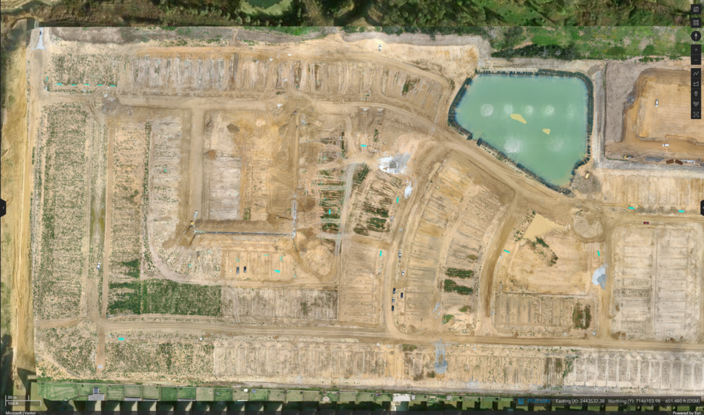
When developers begin construction projects, Mustang SUD’s drone team is deployed to document site conditions and infrastructure installation activities. Drone imagery is brought into GIS, where staff compare current conditions against engineering plans and as-built drawings to ensure assets are being constructed correctly. The captured information is then shared across departments for review and decision-making.
“The ability to capture data at a more detailed and efficient level for making decisions has been the biggest impact for us,” said Denton.
Improving Construction Oversight
One of the most valuable applications of the drone program is construction management. By providing an aerial perspective of active projects, Mustang SUD monitors installations, can verify compliance with specifications, and proactively identify any potential issues before they become costly problems.
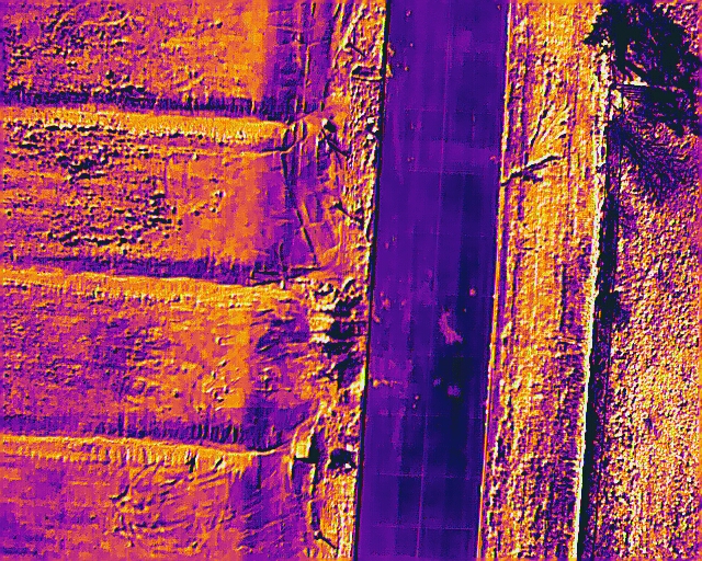
Drone imagery has helped staff identify incorrectly placed magnetic tracer tape, missing pipe spacers beneath road crossings, and improperly installed manhole lids. In another instance, drone imagery revealed workers operating in a 17-foot-deep trench without proper trench boxes, enabling staff to address a significant safety risk.
The technology also supports construction planning through cut-and-fill analysis. For a pressure-reducing valve vault project, Mustang SUD used drone-derived elevation data to estimate earthwork requirements and determine the amount of aggregate and backfill material needed, improving project planning and reducing uncertainty.
Enhancing Safety and Operational Awareness
Safety has become a major benefit of Mustang’s drone program. Crews can inspect elevated storage tanks without immediately requiring personnel to climb structures, allowing potential issues to be identified before workers are exposed to risk. Drones also provide visibility into active trenching operations and hazardous construction environments.
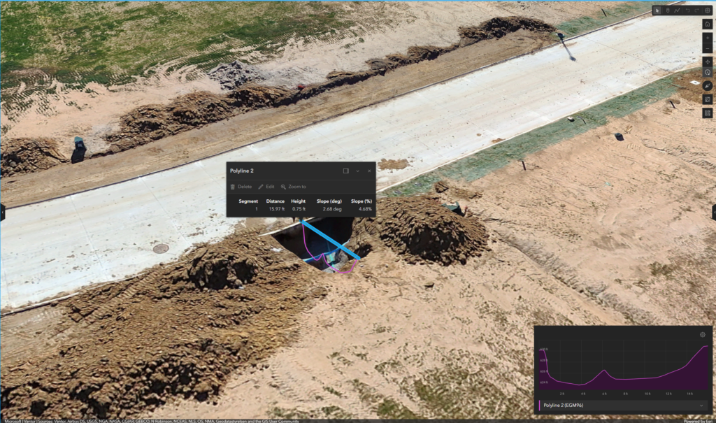
Mustang SUD is also using thermal drone technology to assist with leak detection. The utility currently uses thermal imagery to investigate water loss and identify potential leaks across its system and is exploring future applications to assist customers experiencing unusually high water bills.
As the program continues to evolve, Mustang is evaluating additional applications, including confined-space inspections, atmospheric gas monitoring, automated drone deployment, and underwater drones for storage tank inspections.
Supporting Better Decisions with GIS
The integration of drones with GIS has created a shared operational picture across multiple departments. Construction inspectors, engineering staff, wastewater collections crews, and leadership teams can access the same drone-derived information, enabling faster reviews and more informed decisions.
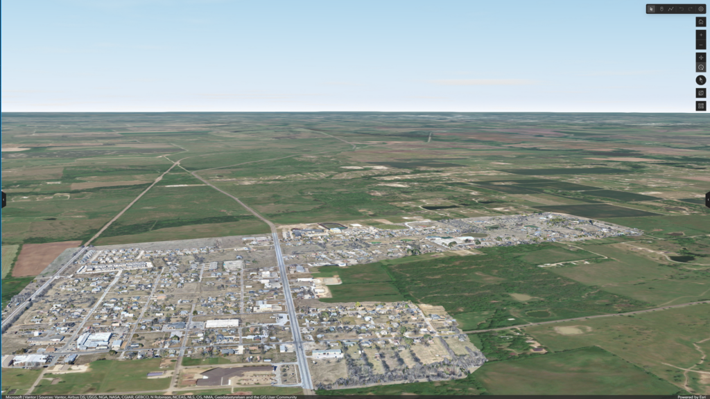
Using Esri’s Site Scan for ArcGIS, Mustang SUD publishes both 2D and 3D products that can be reviewed simultaneously by multiple stakeholders. This capability shortens review cycles, improves collaboration, and helps departments identify issues that may otherwise go unnoticed.
“Many people are still very new to GIS and the amount of power behind it. Site Scan offers a easily digestible entrance into GIS by allowing them a 3D visualization of the drone data we captured. It has provided valuable data for departments in our organization, that allow them to worry less about getting certain measurements or verifying the location of assets, and focus more on what to do with that information.” – Liliana Ruelas, GIS Analyst
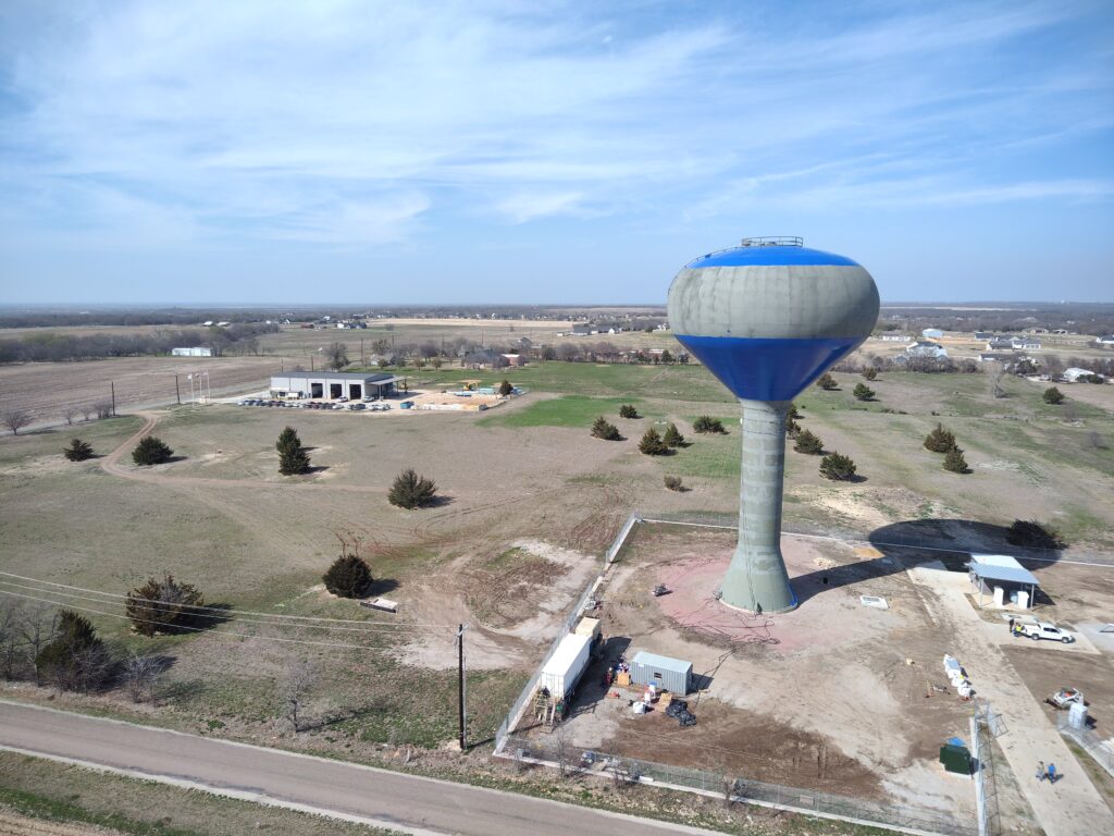
“Site Scan can not only help us create a topographic profile of the area, but also measure objects that we may not have the ability to physically reach. For example, we can calculate the volume of a water tank just by scanning the outside of it.” – Clay Bertotti, GIS Technician
The utility has also leveraged drone-derived elevation data and 3D modeling to support rehabilitation planning within recently acquired service areas. In the City of Gunter, elevation information helped staff validate manhole locations, analyze wastewater flow paths, and plan future gravity mains, force mains, and lift stations. According to Denton, the elevation data collected through drones has delivered some of the greatest value realized by the program to date.
“Drones have made a significant impact on my day to day work as a GIS technician. With the constant need to go out into the field to verify asset existence and location, it has allowed hard to reach locations and large areas become easily more accessible. They have minimized the amount of time needed in the field collecting accurate data, so now more time and energy can go to the spatial analysis that is needed for a successful GIS database.” – Liliana Ruelas, GIS Analyst
The Results
While Mustang SUD is not formally tracking performance metrics yet, the organization has already realized significant operational benefits:
- Improved visibility into active construction projects.
- Faster access to current, high-resolution imagery.
- Better validation of engineering plans and as-built infrastructure.
- Enhanced collaboration between GIS, engineering, construction, and operations teams.
- Improved identification of safety hazards and construction issues.
- More efficient collection of elevation and asset data across large service areas.
- Better support for infrastructure planning and future growth.
“The greatest value is getting a bird’s eye view for an area that may be difficult to navigate on foot. Whether it is a leak, construction site, or asset, getting an aerial view is simply easier than navigating on foot. Having this information in a digital file that can be shared and accessed later also provides a major advantage over other mapping methods.” – Clay Bertotti, GIS Technician
Looking Ahead
Mustang SUD views drones as an increasingly important component of its digital infrastructure strategy. Future initiatives include automated drone response to operational events, AI-assisted inspections, expanded thermal leak detection, confined-space inspection capabilities, and underwater asset inspections.
For a utility serving one of the most rapidly developing regions in Texas, the ability to quickly gather and share accurate information has become critical.
“Start with a small problem you can solve practically, then scale out to all of the possibilities,“ said Denton. “The efficiency in field data collection is the champion, especially when you’re collecting data across huge areas.”
By combining drones with GIS, Mustang SUD is creating a more complete view of its infrastructure, improving safety and oversight today while building a foundation for smarter, more automated utility operations in the future.
Stay Connected with Esri’s Water Team
ArcGIS is an enterprise geospatial platform that enables modernization of workflows with easy-to-use applications for the field and office. Strengthen your organization with geospatial solutions that will increase efficiency and provide insight for decision-makers.
Visit the Esri Water Utilities web site for more information.
Join the Water Utilities Community
Follow #EsriWater on social media: X | LinkedIn
Subscribe to the Water Industry newsletter “Esri News for Water Utilities and Water Resources“