When you’re a growing utility like Mansfield Municipal Light Department (MMED), not having an accurate fiber GIS mapping system it can turn a simple outage into a multi-day headache. That was the reality facing the New England town as its network grew beyond what spreadsheets could handle. The challenge wasn’t just about infrastructure; it was about risk, accountability, and missed opportunity.
In today’s world, small towns like Mansfield face mounting pressure to deliver fast, reliable internet—but are often without the same resources as larger cities. Mansfield Municipal Light Department, a municipal utility in New England, was expanding its fiber network, but legacy systems and disjointed records stood in the way. As the complexity of the network grew, so did the risks. That’s when a partnership between Phoenix Communications, Axis Engineering, and mPower Innovations (mPower) stepped in—bringing together field expertise and geospatial technology to rebuild Mansfield’s fiber records from the ground up.
The Challenge: Fragmented Data, Real-World Consequences
Mansfield’s network expansion was installed for business economic development reasons. But while fiber was being laid and connected, the utility needed a better way maintain accurate documentation. The existing network mapping and operation was managed by Phoenix Communications using AutoCAD and a manual mapping and modeling system. With no centralized and advanced software platform to manage the infrastructure, teams were often working with incomplete or outdated information. It wasn’t always clear which strands were live, which ones were dark, or where critical connections existed.
This lack of clarity created a host of issues. When outages occurred, crews had to spend valuable time manually tracing lines to identify the problem. Leasing spare fiber was nearly impossible because available capacity couldn’t be confirmed. And when it came to planning future upgrades, staff had limited tools to model what was already in place. Mansfield needed more than better maps—it needed a smarter system.
The Fix: Ground Truth Meets Smart Mapping
Phoenix Communications launched a hands-on effort to document the network’s true state. Their field crews examined each pole, splice case, and cabinet—physically verifying how fibers were routed and where connections were made. At the same time, Axis Engineering entered the data collected into mPower’s FiberProTM platform. mPower didn’t just deliver software; they helped structure how information flowed from boots on the ground into a GIS system Mansfield could rely on every day. This framework ensured the right details were captured once—and used many times across departments and functions. With secure file transfer protocols in place, mPower delivered models that Mansfield could use within their existing IT environment, avoiding unnecessary infrastructure changes.
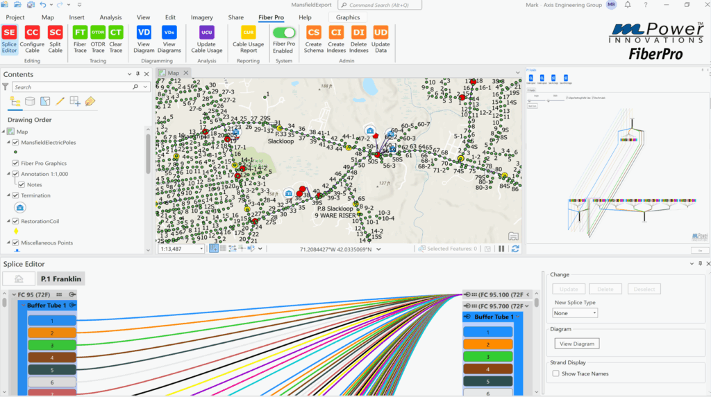
What GIS Brought to the Table
This project wasn’t simply about digitizing paper maps. GIS gave Mansfield a new way to understand how fiber connected across neighborhoods, facilities, and municipal departments. It allowed the Engineering & Operations team to see not only where cables ran, but how they related to other assets—like water plants, streetlights, or electrical substations.
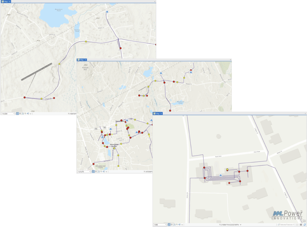
Spatial analysis played a key role in restoring visibility. With GIS, crews could trace the path of a strand, locate nearby splice points, and check for available capacity—all from a tablet in the field. They could also view fiber routes in relation to roads, easements, and municipal boundaries, giving planners a real-world sense of where and how to grow. Instead of reacting to issues, Mansfield gained tools to anticipate and coordinate upgrades and maintenance more effectively.
Real Outcomes in the Real World
Today, Mansfield is on its way to having better confidence in its network records. That’s made a measurable difference. Having mPower FiberProTM mapping software, Mansfield can now resolve outages faster because they know what’s in the ground and how it connects. The utility is now able to lease dark fiber because they can verify what’s available. And departments beyond telecom—like water and public works—have started using the GIS tools to manage their infrastructure more effectively.
“Having an accurate, real-time view of our fiber network will dynamically
“Having an accurate, real-time view of our fiber network will dynamically improve how we operate,” said Joe Sollecito, General Manager at Mansfield Municipal Light Department. “We’ve reduced downtime and can finally put underused assets to work.”
Mark from Axis Engineering added, “Without mPower’s platform and the integration with ArcGIS, we wouldn’t have been able to deliver this kind of result. We went from rough sketches to a trusted system that Mansfield uses every day.”
A Flexible Framework for Other Communities
Mansfield’s approach wasn’t one-size-fits-all—it was built with flexibility in mind. The rollout happened in phases, starting with the fiber serving water treatment facilities. From there, the focus shifted to connecting town hall, and next, to other departments. That phased method made the project more manageable and easier to budget over time.
What worked in Mansfield is already being repeated elsewhere. Axis and Phoenix have since applied the same audit and GIS-driven design process in neighboring communities. As more towns look to expand broadband access or improve their infrastructure, this model offers a practical and proven path forward.
Stronger Together: The Role of Partnership

This wasn’t a vendor-client relationship, it was a coordinated effort among all parties involved. Phoenix brought deep construction knowledge. Axis translated field work into usable plans. mPower connected it all through technology. And Esri’s ArcGIS served as the foundation, tying together data, workflows, and user access in one system.
Frequent communication helped the project stay on track. Regular check-ins ensured feedback loops stayed tight. The outcome? A shared understanding among everyone involved—and a product Mansfield could trust.
What’s Next
Mansfield Municipal Light Department ’s story is one of progress and success, but certainly not perfection. Their GIS-based system continues to grow as the network evolves. New assets are added, existing routes are refined, and the utility is better equipped for what comes next.
Other municipalities now have a clear example to follow. With reliable data, smart tools, and the right team in place, digital infrastructure doesn’t have to be a guessing game. For Mansfield, the transformation started with a field audit. Where it leads from here is entirely up to them.
In the end, projects like this show what’s possible when communities embrace the tools that connect people, systems, and infrastructure. It’s not just about mapping, it’s about empowering utilities to operate smarter and serve better.
Resources:
Learn more about Esri in Telecommunications
Learn more about mPower Innovations
Learn more about Phoenix Fiber
Editor’s note (2026): mPower Innovations is now part of Render Networks following its acquisition in April 2026. References to mPower in this article reflect the company at the time of the project.