Have you ever wondered where your wastewater goes after flushing the toilet? How about where the clean water comes from that you use in your home? Or the electricity that is magically waiting at the light switch in your living room? How about the roads you drive on each time you leave and return to your home? All of this infrastructure requires a path that includes both a legal right (e.g. easement, deed) and physical location (land) to service you and your family – collectively, this is known as Right-of-Way.
The Five W’s of Right-of-Way that keep our lights on and the water flowing.
As our nation focuses on rebuilding and expanding infrastructure management, it is becoming increasingly important to understand where Rights-of-Way currently exist and where more might be needed. Although many of us take for granted necessities such as sewer, water, gas, electricity, and roads, will always be there, it is important to understand that tremendous amounts of resources go into planning for the maintenance and expansion of these facilities. One fundamental step in the process is securing the necessary Right-of-Way.
What does this look like?
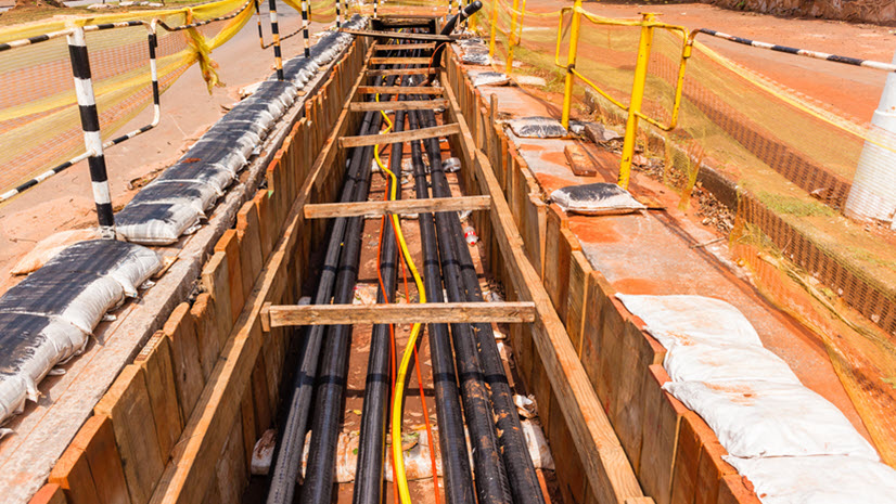
Pretend for a moment we are a local government responsible for collecting and treating sewage in our community. A new wastewater treatment plant is needed to meet the future demands forecasted by community planners and engineers. After extensive analysis, a new site has been identified, but it will require an extension of the transmission main. This brings us to the first “W” question in the Right-of-Way process – WHERE?
Pre-Negotiation Planning
Prior to beginning any negotiations for obtaining the Right-of-Way, we first need to understand some things about WHERE the project (transmission main in this case) should be built. Geographic information systems (GIS) provides an efficient, effective way to do this. Fundamental data layers such as aerial imagery, tax parcels, and topography can be overlaid for a quick visual inspection and preliminary spatial analysis to identify the most efficient route from a construction cost and maintenance perspective. Once a preferred route is identified, the question of WHERE must be further refined. To accomplish this, the data layers used for the preliminary evaluation can again be used to plan the land surveying activities. This is necessary for researching and storing the land records and ownership documents and performing field surveys to accurately define the existing property and Right-of-Way boundaries.

As the survey information comes in from the field, it can be integrated into GIS containing the original planning information so the next question, WHO, can be answered. Who has the Right-of-Way, if any exists? Who has infrastructure already in the Right-of-Way? Are there any encroachments?
GIS integrates many types of data to help answer the question, WHO. For example, drones are an efficient way to evaluate existing infrastructure and encroachments and the data can be easily used in GIS. How was it acquired? Are the appropriate rights in place? Is it well-defined? More likely than not, some additional Right-of-Way will need to be acquired to accommodate the route identified for the transmission main.

Which brings us to the next question – WHAT. What Right-of-Way acquisition is needed for the project? How many properties are impacted? How much Right-of-Way is needed from each property? What will be temporary in nature and what needs to be permanent? What impacts will this project have on each landowner (e.g. landscaping loss, access constraints, etc.)? What will it cost to secure the Right-of-Way for the project? These questions can all be answered by overlaying spatial data layers in GIS. And, by storing the resultant information in the GIS, it can be quickly retrieved, visualized, and presented to key stakeholders via web apps, dashboards, and the like.
Now that three of the key “W” questions have been addressed, what about– WHEN. When is the project scheduled to be bid (generally dictated by program funding)? When does the final Right-of-Way settlement need to occur, so the project is not delayed? By using GIS, the project timeline can be visualized to maintain a realistic schedule, provide accountability, and maintain communications with all stakeholders.
Active Negotiation
Once the timeline has been established it is time to start negotiations, which brings us to the WHY question. When negotiating with landowners it is important to efficiently and effectively tell the project story. Answering questions such as why the project is happening, why additional Right-of-Way is needed, and why it needs to come from their property goes a long way to ensuring a successful negotiation. Presenting the answers to these questions graphically, with web apps or story maps, can accelerate understanding and give context to what is being asked. Using production automation tools provides a quick way to generate the exhibits needed to support the transaction.

Right-of-Way negotiation is an iterative process with many moving parts. GIS can play a critical role in managing it by easily tracking the steps of the process. On a large project, there can be hundreds—or even thousands—of landowners impacted, which means scheduling a meeting with each, documenting items that were negotiated/agreed upon, tracking the execution of paperwork, monitoring compensation, following the recording of official documents, and ensuring the process complies with all regulations. Easily configured web maps and dashboards can be used to quickly evaluate where each property is in the process and how many have been completely settled. This is particularly important in gauging whether or not Right-of-Way negotiations are on schedule.
There is a bonus “W” – WHAT IF? As landowner negotiations progress, there will inevitably be holdouts and those who ask that alternatives be considered – these are the what ifs? GIS is the perfect tool for quickly vetting and managing these alternatives dynamically.
Post-Project Management of Right-of-Way
For government agencies and utilities, managing projects successfully with limited resources requires the ability to track Right-of-Way. Gone are the days of blanket easements being granted over hundreds of acres. Land is a finite resource, particularly the land needed to support long linear projects, such as roads and utilities. GIS offers many opportunities to support Right-of-Way acquisition and management. Most of us who have been involved in the Right-of-Way process would agree that settling the last property needed for a project to move forward, is an achievement. By using GIS and the five W’s, your next Right-of-Way project can have less stress and more success!
To learn more about GIS solutions to help better manage Right-of-Way acquisition and management processes, check out Esri’s Right-of-Way page .