Easy-to-Configure Public Safety Partner Engagement
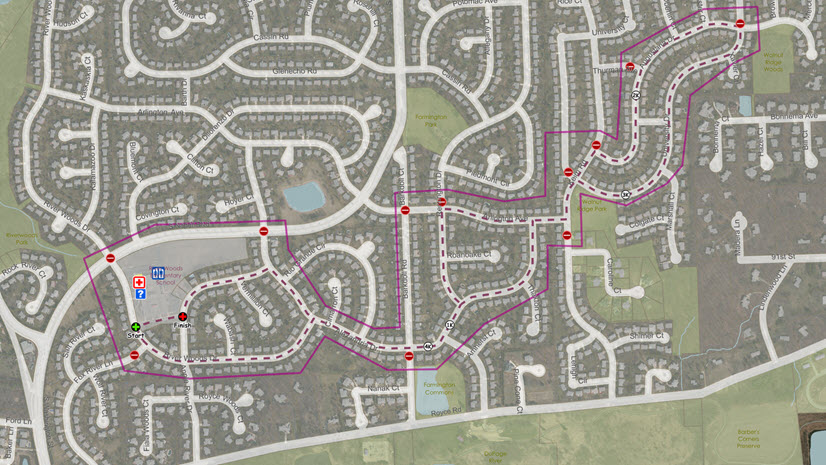
Around the world, public safety answering points (PSAPs) and command and control centers are looking for more cost-effective, efficient ways to create, maintain, and share massive amounts of information with their internal and external partners. Whether you are sharing your locally authoritative address data with regional partners or resolving boundary issues with street names, ArcGIS Hub can help you share information more efficiently and provide a framework for communication, best practice collaboration, and pertinent training initiatives.
ArcGIS Hub for the PSAP provides an easy-to-configure stakeholder engagement platform that organizes people, data, and tools through information-driven initiatives. Data is vital to decision-making. Whether you are evaluating calls for service by service area or considering changing the boundaries of service districts, we can help. Having stakeholders aware of and reliant on authoritative data are foundational to success.
Inside Hub you can create as many websites and web pages as you need with no coding required. Perform a simple drag-and-drop operation to move components. You can add your agency logo and style to match existing internal and public-facing websites and share data, maps, and apps. You can use these sites to actively engage your internal partners and colleagues and open parts of your hub site to the public for social interaction.
PSAPs can use Hub to organize other stakeholders around specific initiatives such as migrating regional address databases to Next Generation 911 requirements. Using Hub provides a pathway to sharing best-practice and address data, the first step of the journey to effective collaboration and engagement. By giving your data purpose, you align it with your organization’s top priorities. Any PSAP related issue, mission, or project can become an initiative on your hub site.
Hub makes it easy to create teams composed of staff members, external communities or vendors, or both. You can invite trusted members to collaborate with your PSAP, which will increase your staff’s ability to solve problems. Together, the initiatives you work on can drive engagement by giving team members a goal to rally around as well as a focused way to participate. Hub allows you to provide charts, maps, and stories to make the task more understandable and achievable.
Unlike other solutions that require piecing tools together, ArcGIS Hub comes with everything you’ll need to be successful: integrated event management, surveys, and more. All work done in Hub can feed directly back into your PSAP’s operational systems. Learn more about Hub and how you can leverage your existing data and technology while working together with internal and external stakeholders to track progress, improve outcomes, and create vibrant PSAP partnerships.
Watch for our other videos explaining how GIS benefits the PSAP/command and control center, and please reach out to us if you’d like more information.