Skip to Content

Community Risk Reduction

Assess, prioritize, reduce, and evaluate risk

A heat map in yellow and red, overlaid with a photo of a fire responder standing beside an apartment building using a tablet

Community risk reduction (CRR) coordinates emergency operations with prevention and mitigation efforts across the community and at the fire department level. Involvement of frontline personnel is critical for field data collection. A comprehensive CRR program improves the health of the community, firefighter safety, and the accreditation process. With GIS technology, your agency can more effectively identify hazards and develop an efficient CRR response strategy designed to reduce the risks facing occupants and firefighters.

Integrated solutions for community risk reduction

Implement a community risk reduction strategy

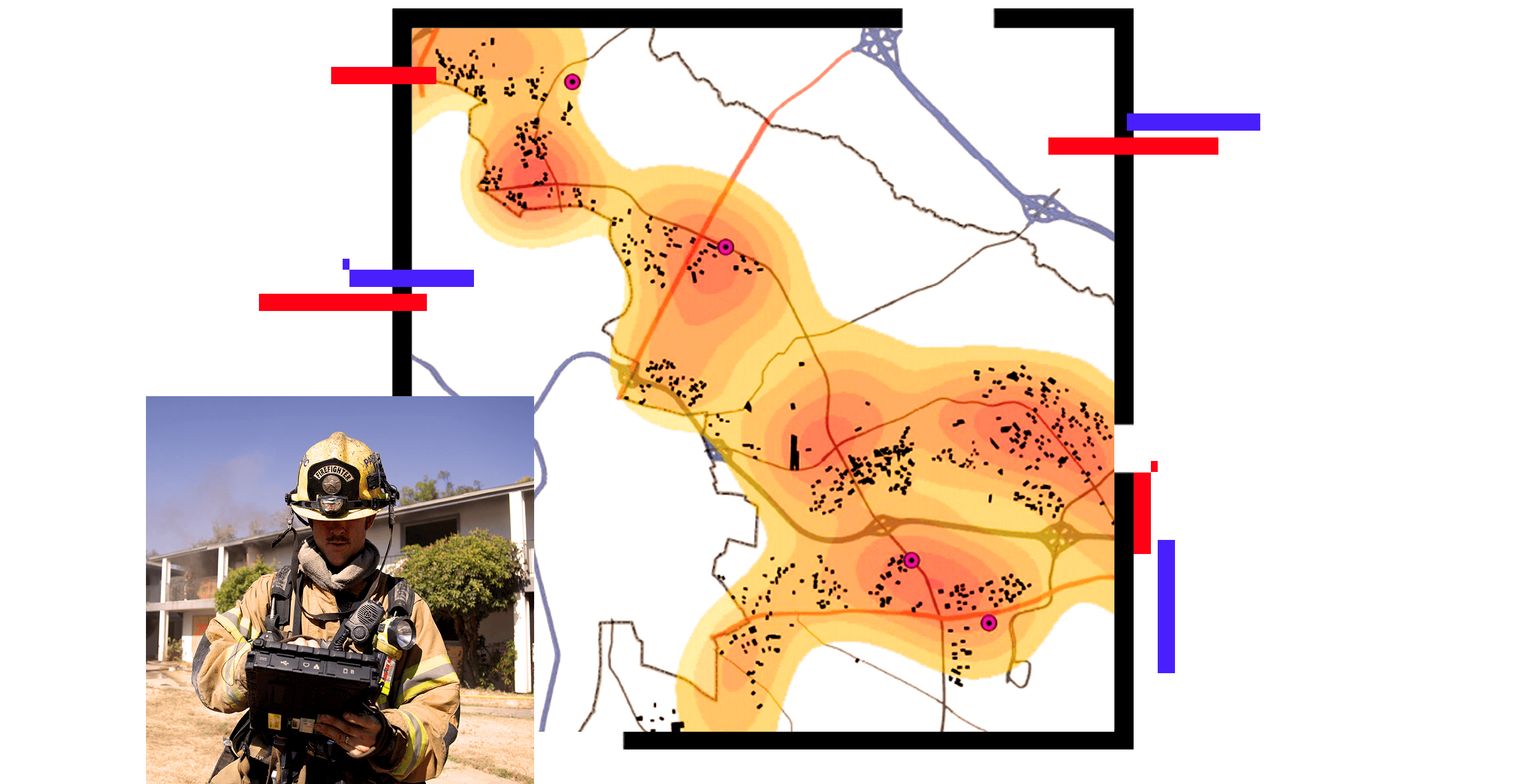
Fire departments can use location intelligence to coordinate the functions of the community risk reduction cycle. Personnel can share risk assessment data seamlessly; assign CRR activities; and evaluate performance measures through planning, operations, and program review activities.

A graphic of a computer monitor displaying a fire safety dashboard, alongside a tablet and mobile phone showing coordinating data

Coordinate to facilitate the CRR process

GIS can manage the creation and assignment of community risk reduction activities. These applications help fire service command staff and departments identify where high levels of risk are located, assign work to appropriate fire personnel, and review performance measures.

A graphic of a laptop monitor displaying a pre-incident plan dashboard, beside a mobile phone displaying coordinating data

GIS assists mitigation activities

GIS applications provide a focused approach to reducing risks. The process begins with the risk assessment. These risks can be human made or naturally occurring. The assessment identifies risk in the community and allows public safety agencies to prioritize those risks. This initial step in preparedness allows for mitigation efforts, planning, and the ability to make data-driven decisions to deploy resources.

A graphic of a laptop monitor displaying an opioid treatment locator dashboard

RECORDED WEBINAR

GIS for Reducing Risk in the Community

Learn how ArcGIS supports the process of community risk reduction and helps departments develop a more proactive posture.

ArcGIS Solutions for community risk reduction

Previous
Next

Fire, Rescue, and EMS strategies

Previous
Next
Fire, Rescue, and EMS overview

Related public safety industries

Previous
Next
Public safety sector overview

Contact sales

Contact us

Outside the United States

Connect with the Esri public safety team