Skip to Content

Emergency Response

Safety cones lining a sinkhole that broke off a two-lane highway, and an aerial map showing the red routes caused by the obstruction

Public works professionals are called to duty in emergency management situations ranging from severe weather conditions to natural disasters and health crises. The best public works emergency response software informs plans and preparation, allows for real-time decision-making, optimizes resource allocation, includes damage assessment software, and provides a platform to keep the public informed. GIS is the foundational tool that allows public works staff members to operate on the front lines alongside their peers in public safety, with tools for data collection, coordination, and situational awareness.

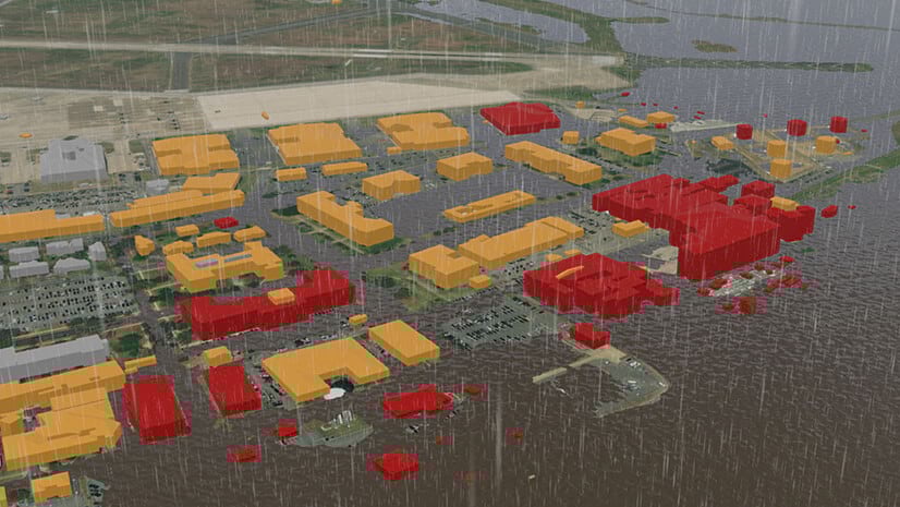
Activate resources in inclement weather

Staff can address safety concerns during severe weather with a location-centric approach. GIS supports planning and response based on weather, traffic, and demographic data that informs which actions should take priority. From snow removal to flood mitigation, damage assessment, and the process of connecting the at-risk to cooling centers, GIS can help you protect lives.

A desktop computer showing a map with bright activate resource locations indicated on a dark background

Strengthen planning and mitigation

Public works staff play a major role in emergency response during snowstorms, wildfires, hurricanes, floods, and earthquakes. Use data to mitigate impacts. Identify at-risk populations, create evacuation plans, and verify asset sustainability. Create resiliency plans for unplanned incidents such as vector-borne disease, pandemics, and climate-based impacts.

A desktop computer showing a map with highlighted areas that were affected by floods and other watershed

Support incident command

Geospatial data is the common denominator for emergency preparedness because location is essential to every part of planning, response, and recovery. With location-aware dashboards, incident command center leaders allocate teams and resources where they are most needed. With GIS, public works officials can coordinate with other agencies and stakeholders. 

A desktop computer showing an incident status dashboard that shows the area affected in purple, the number of open shelters, weather warnings, active incidents, road closures, and more

Improve public notification

An informed community is a safe community. Apps can push location-based notifications about road closures, shelter locations, storm warnings, and more. By using residents' location in relation to the threat, GIS allows you to notify just the residents affected. But emergency response is a two-way street. GIS allows residents to give feedback on outages, damage, and more. 

A desktop computer showing a map of hazard information with red lines indicated traffic areas, red dots showing collisions, and other locations marked for important destinations such as hospitals and shelter locations

ESRI BLOG

Florida visualizes future weather conditions

Mitigation managers in Florida adhere to the Federal Emergency Management Agency mandate with interactive mapping technology.

Read the story

Products and ArcGIS Solutions

Explore ArcGIS Solutions and product offerings that enhance emergency response.

Previous
Next
Explore more solutions

Contact sales

Contact us

Outside the United States

Connect with the Esri public works team