
Commercial Growth

Leverage Esri's spatial technology for cost-effective rail facilities and targeted expansion

Montage of a white map with blue and green lines, and an aerial view of a rail yard with several trains

Drive commercial growth with GIS

Top industries worldwide use GIS for spatial analytics to identify the best combinations for expanding shipping businesses. Esri’s spatial technology aids in cost-effective and sustainable locations for rail facilities, as compared to trucking.

How GIS can support commercial growth

See supply chain & logistics

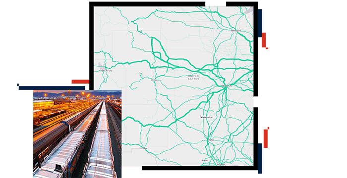
The transportation industry widely embraces GIS, enabling companies to track shipments across the supply chain and share location data from many modes of transportation. This provides customers with a comprehensive view of distribution, enhancing visibility and enabling shippers to quickly address shipping issues in real time.

Rail yard with freight cars on a track, with stacks of shipping containers on either side

Geoenable customer sites

GIS is a valuable tool for sales teams looking for facilities in close proximity to their network and customers. Instead of relying on traditional tabular data for business-to-business (B2B) intelligence, visualize and query data across an entire network. Prioritize facilities that are most suitable for rail service. Additionally, analyze shipping customer data for geographic market research and analysis to aid in business growth.

Black map of the United States with clusters of red indicating desirable rail sites

Improve customer service

Optimize facility capacity and improve customer service within internal operations using GIS. It helps identify constraints and suggests areas for improvements. Aerial imagery provides customers with a better understanding of optimal flows and patterns.

Railroad track in the high desert with snow-capped mountains in the background and the title in a black box over it

Discover geographic patterns

ArcGIS Living Atlas of the World provides a growing collection of publicly available data that can be used for spatial analysis. This includes commercial datasets such as commodity flows, housing and population growth predictions, and automobile purchasing trends. By overlaying this data on a network and comparing it to existing locations, potential areas for rail growth can be identified.

Dark map with shaded areas in light purple, along with US Zip codes and red and purple bar graphs with dollar amounts on top

CASE STUDY

OmniTRAX drives efficiency across the organization

OmniTRAX is using GIS to consolidate and organize information about its property holdings, manage assets, and improve customer service.

Read the case study

Products for commercial growth

Drive exponential commercial growth in your organization with these leading Esri products

Previous
Next

Sign up for our newsletter