Skip to Content

Environmental Sustainability

Montage of a dark map with yellow lines with colored dots; train tracks going into a distance of trees and hills

Achieve rail environmental sustainability with GIS

GIS technology offers effective strategies to address the impacts of extreme weather and environmental issues. By integrating environmental, network operations, and engineering data, GIS provides a collaborative platform for stakeholders, facilitating better planning and response to disruptions.

How to achieve environmental sustainability with GIS

By incorporating GIS, gain insights into the location, proximity, and future impacts of various factors.

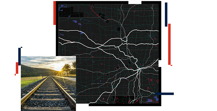
Rapid response to incidents

Significantly improve response time and recovery in and around an incident by having comprehensive knowledge about the conditions. ArcGIS Living Atlas of the World provides valuable environmental information about wetlands, drainage, community surroundings, and weather, which are crucial for incident response. First responders and emergency operations centers can directly access this information to make well-informed decisions.

Large number of workers in hard hats massed in a wide, muddy ditch

Mitigate environmental impact

Use real-time dashboards to monitor air and noise quality sensors to mitigate the impacts on employees. Different agencies monitor environmental conditions such as air and noise quality, river and stream elevations, wind speed, and precipitation. Assessing this information and monitoring conditions will help protect the health and well-being of employees.

A flooded railway bed under a partly cloudy sky, with water reflecting clouds and nearby utility poles

Reduce disruptions

Incorporate publicly available environmental datasets during planned construction stages to address and improve potential concerns and minimize project disruptions. Environmental impact statements and environmental assessments require information about many types of environmental factors and their potential impacts from construction activities. Esri's spatial analytics tools can be used to analyze these datasets consistently and uniformly across the extensive network of railroads.

Terrain map of the United States with selected major cities marked and project status information to the right

Enable remote sensors

Reduce emissions and fuel surcharges by quickly intervening in issues such as prolonged idling of trucks and equipment. The implementation of spatially remote monitoring allows users to track the operational status of assets, ensuring compliance with local emissions regulations.

Two small sensor boxes, labeled R4 and S5 respectively, alongside a rail bed

Facilitate cargo movement

Identifying locations within a railroad’s operating property can be challenging due to unclear street addresses. To fix this issue, GPS devices and latitude and longitude coordinates are used to facilitate operations, particularly when third-party vendors need to locate equipment or make pick-ups or drop-offs. Esri's suite of field applications allows for the precise sharing of location information and provides real-time updates on the status of projects or job timelines.

A man standing beside a forklift, ready to operate it and handle heavy loads efficiently.

Products for environmental sustainability

Lead the way towards environmental sustainability in your organization with the help of these leading Esri products.

previous
Next

Sign up for our newsletter