Incidents and Events

Critical infrastructure protection and incident management

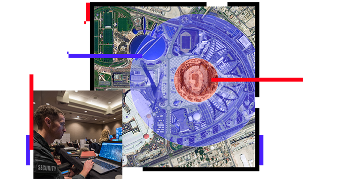
Aerial view of a large public space and people in a central operations center looking at smart maps

Deliver shared situational awareness

Prepare for all scenarios—from planned events to unplanned catastrophes

Natural disasters, active assailants, political unrest, crime, and terrorism reflect the heightened need for coordinated preventive and response efforts as well as critical incident management. Location intelligence enhances your ability to protect employees, customers, organizational assets, and the public. Protecting critical infrastructure and special events demands planning, collaboration, and access to information. A geographic information system (GIS) unifies security teams, supports the early indication of risk, and aids rapid response and incident closure.

Early detection and rapid response

Understand your area of operation (AOO)

Protect critical infrastructure with powerful map visualizations and incident data that evolve with your event security needs. Ensure safe and efficient mission execution with configurable security plans to support high-risk operations. Effectively organize people, processes, and threat data in real time.

Map of an area with a gas leak

Design operational plans in advance

Leverage a fully integrated framework to design digital pre-plans and site surveys for any facility or event. Location-based technology helps guide the planning, preparation, and execution of security operations for critical incident management. Share plans with authorized personnel in both your organization and partnering organizations.

Person looking at an indoor map

Quantify risk

Securing special events requires a connected environment and a common operational view for all mission participants. Enable persistent communication to enhance incident management. GIS allows you to quickly quantify risk through a continuous connection between the field and the command center, and from peer to peer.

Map of an active shooter threat

Build a tactical response

Manage planned and unplanned incidents with adaptable and configurable response plans. ArcGIS delivers connectivity between the command center and the field to provide security personnel with up-to-date information. Staff can then build and modify security plans in real time to support the shifting dynamics of an evolving tactical situation.

Map of a pipe bomb incident and safe evacuation distance

Deliver shared awareness and collaboration

Integrate information from varied sources and across multiple applications. ArcGIS supports visualization in a single display to give you a live, dynamic view of any threat landscape. Align overlapping security missions by providing simple mechanisms for trusted organizations to collaborate, share, and view data for complete operational awareness.

Esri Command Center Dashboard with map and charts

ARCGIS BLOG

Streamline security operations with ArcGIS Mission

ArcGIS Mission offers an all-in-one solution for enhancing real-time communication and situational awareness in security operations.

Go to the blog

Products for incident management

Previous
Next

Contact us to get started

Contact us

Outside the United States

Connect with the Esri public safety team