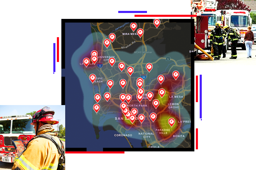
Store
|
Contact Us
|
Careers
Home
Industries
Products
Training
Support
Services
Events
News
About
GIS in Public Safety
Wildland Fire Management
Overview
ArcGIS as a System
How GIS is Used
Success Stories
Events
Demos
Brochures/White Papers
Partner Solutions
Resources
Newsletter
Licensing
Public Safety Tools
Connect with Others
Ask Our Experts
Disaster Assistance
Success Stories
Learn how organizations benefit from the use of geographic analysis and GIS.
California Flames and Oregon Plains: Fire Risk Maps and Air Quality Effects
High-tech maps keep track of Colorado wildfires
Feds Divulge Sensitive Mapping Data To Head Off Colorado Wildfires
How to Track Colorado's Waldo Canyon 'Super Fire' (and Others)
Dynamic Maps Track Colorado Wildfires
High Tech Maps Keep Public Safe From Fire
Incident Geeks Wanted
Forestry Commission Improves Smoke and Fire Management
Revisiting the Glenrosa Fire
Mobile GIS Aids Victoria Bushfires Search Operations
Seeing Through the Smoke with GIS
Making Place-Based Decisions in the Face of Catastrophe
Enterprise GIS Helped Agencies Battle California's Zaca Fire
GIS Teams Map the Zaca Fire
Déjà Vu
For San Diego, California, Preparation Plays Paramount Role During Recent Wildfires
Firefighter Inspires New Mapping System to Help Assess Risks, Map Fires, and Allocate Resources
<p><a href="http://www.boldchat.com" title="Live Chat"><img alt="Live Chat" src="http://vms.boldchat.com/aid/8858911578188219738/bc.vmi?wdid=2353104919931895250" width="1" height="1" style="border:0;" /></a></p>
<div><img alt="DCSIMG" id="DCSIMG" width="1" height="1" src="//statse.webtrendslive.com/dcs3q2ol0vz5bdznfnf3ifnxf_8i8d/njs.gif?dcsuri=/nojavascript&WT.js=No&WT.tv=9.4.0&dcssip=www.esri.com"/></div>