A New, Scalable System for Nationwide Biodiversity Monitoring
To document and monitor thousands of species across regions, it’s imperative to have tailored GIS to integrate and harmonize the data.
Spring 2026, Vol.48, No.2
To document and monitor thousands of species across regions, it’s imperative to have tailored GIS to integrate and harmonize the data.
When planners can see their communities’ plans in context, they’ll be able to gauge the effects across counties, nations, and regions.
Learn more about AI in ArcGIS, check out ArcGIS Pro Shorts for quick tutorials on key tools, and see what innovation award Esri won.
Using GIS and predictive modeling, NatureServe shows where conservation efforts matter most.
Tucked in ArcGIS Living Atlas of the World, they are ready to extract features and classify pixels from imagery and other geospatial data.
The rapid progress of AI has produced a new type of model that promises to revolutionize Earth observation—and Esri is at the forefront.
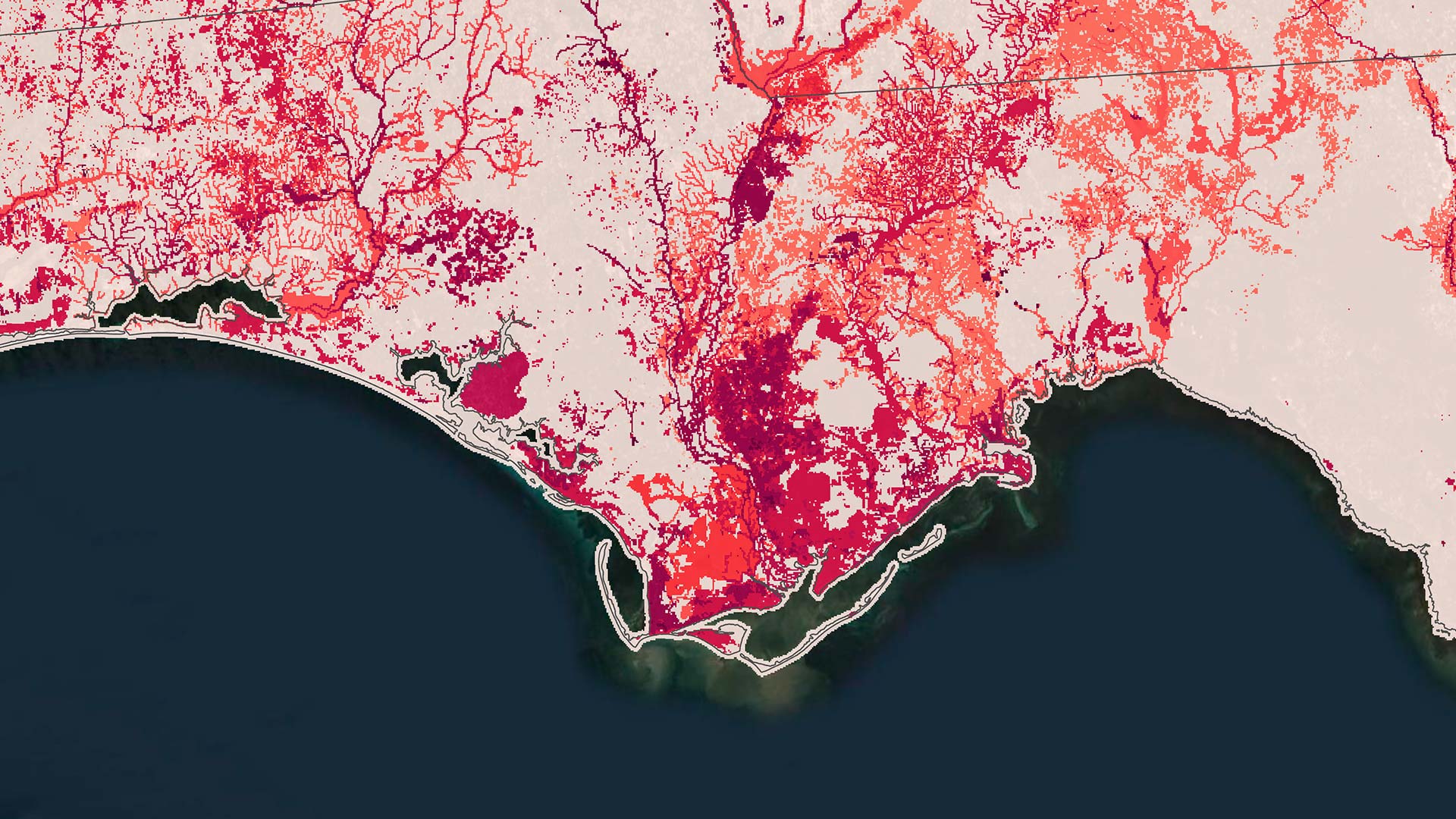
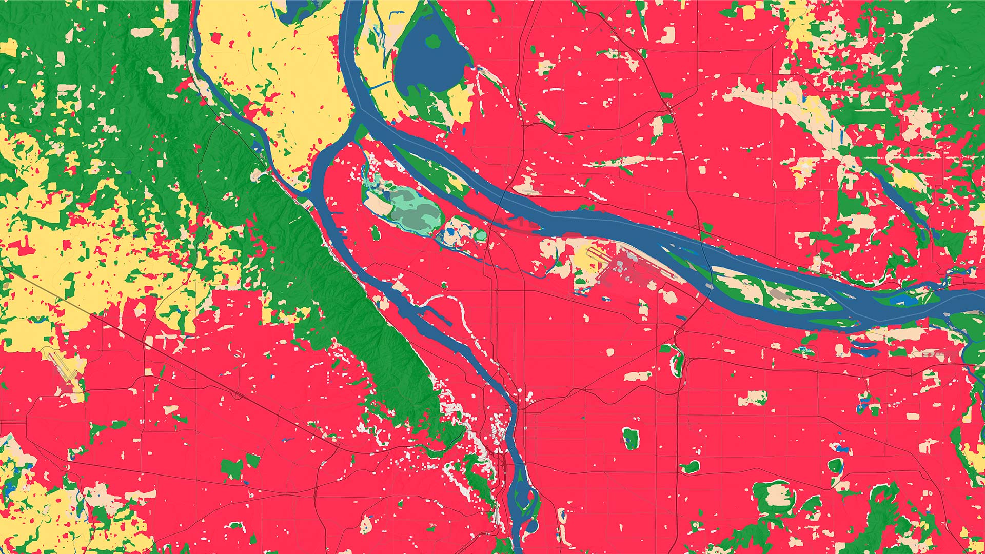
Anybody can drill in to a location of interest anywhere in the world to conduct land-cover analysis from 2017 through 2025.
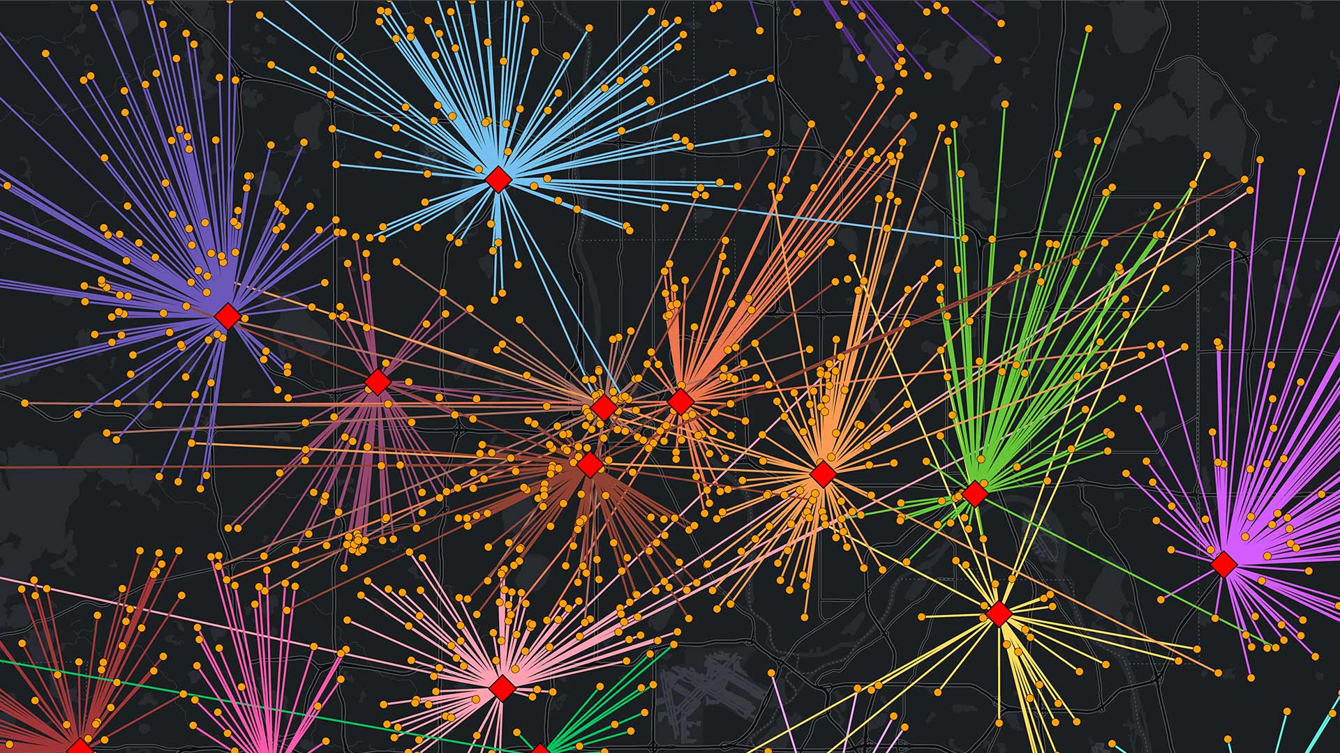
The explosive growth of data centers and AI workloads has changed how power is consumed, planned, and priced—and these maps show it.
ISO 27001 provides additional data protection assurances for organizations around the world that use ArcGIS Online.
After migrating to ArcGIS Pro, the Albuquerque Bernalillo County Water Utility Authority used its own data to train staff on the new system.
Colombia’s second-largest mass transit system has saved millions of dollars by using advanced GIS to manage its real estate.
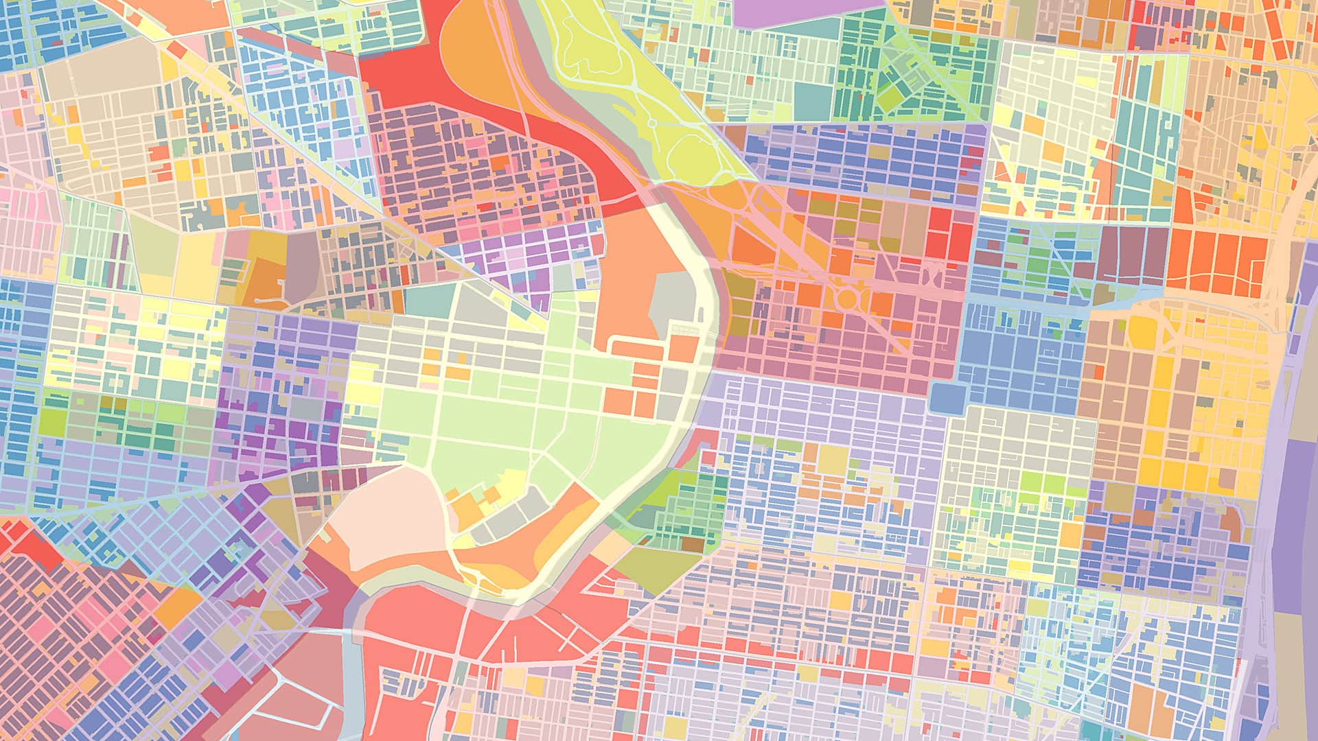
Interactive maps help the economic development authority support initiatives ranging from affordable housing to small business growth.
Campers enjoyed taking an ArcGIS StoryMaps workshop, where they explored a range of topics and built map-based narratives about them.
African People & Wildlife works with Maasai pastoralists in Tanzania to use GIS to document phenomena and share their knowledge of the land.
As technology at Jefferson County evolved, the GIS team used this opportunity to rebuild relationships with partners and stakeholders.
Using ArcGIS Knowledge, the GeoCommunities initiative maps shared research questions and educational activities.
At Tufts University, 600 students have completed GIS training, building spatial literacy that transforms them into astute global leaders.
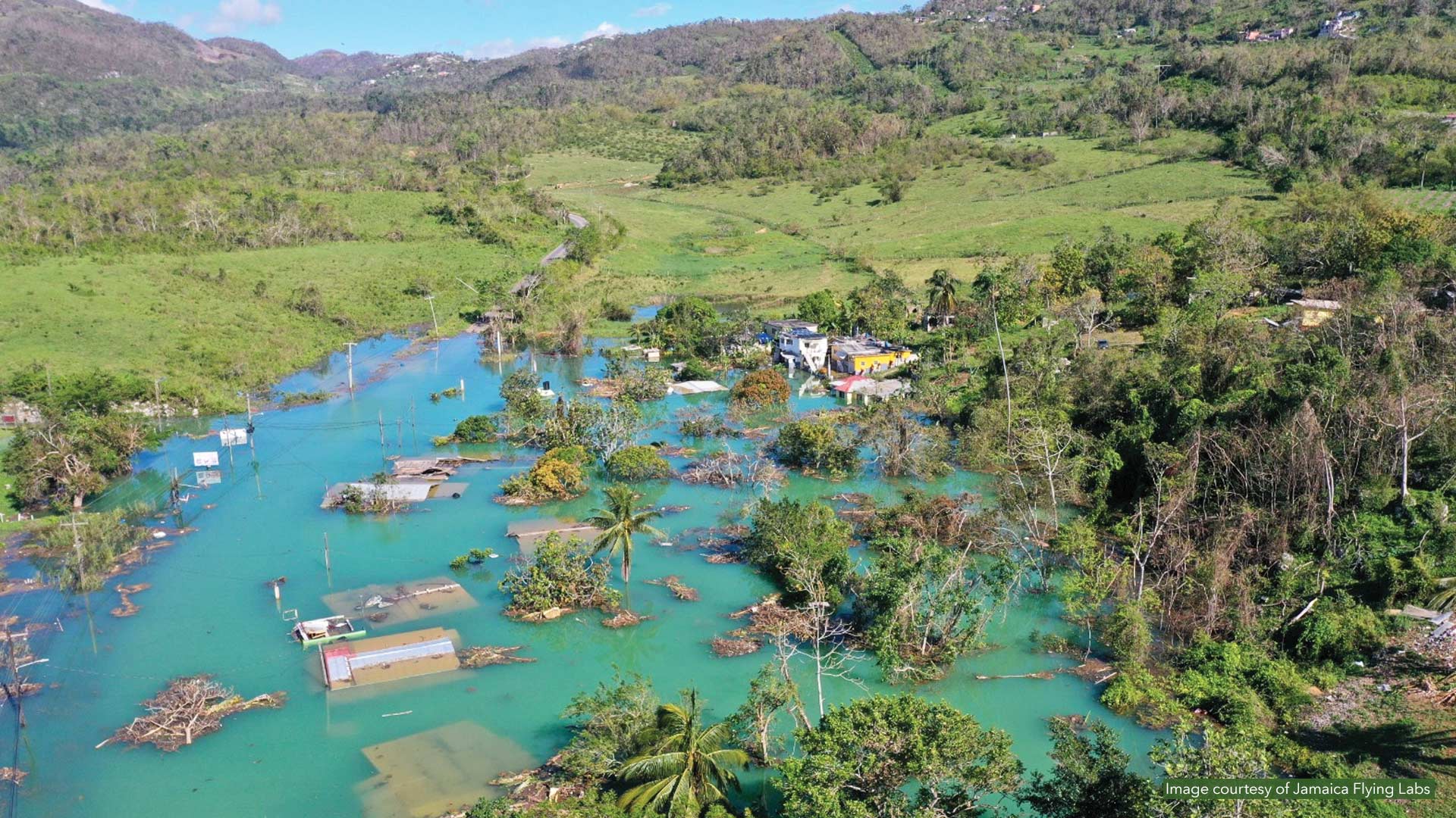
When Category 5 Hurricane Melissa slammed into Jamaica in October 2025, Alicia Edwards and her team moved quickly to assess the damage.
Cuyahoga County, Ohio, has convinced 59 different entities—each with its own priorities—to adopt a collaborative geospatial ecosystem.
It has ready-to-use teaching models that bring modern GIS techniques and spatial data science into the classroom.
Humans have more details than ever before, but we increasingly struggle to grasp the bigger picture.
This collection of programs and resources supports organizations that seek to create a more sustainable future.
The City of Starke, Florida, transitioned from analog processes to a digital-first approach—without going over budget.
Discover how four partners collaborated with customers of varying sizes to ensure everyone has the geographic context they need.
Data from Esri partner Data Axle has more than 14 million verified business records with valuable information, such as sales volume counts.
Learn to work with imagery and remote sensing data, and get primed on how to read and understand maps.
Explore working with imagery and lidar data, take a MOOC on building geospatial apps, and find out about a new certification for developers.