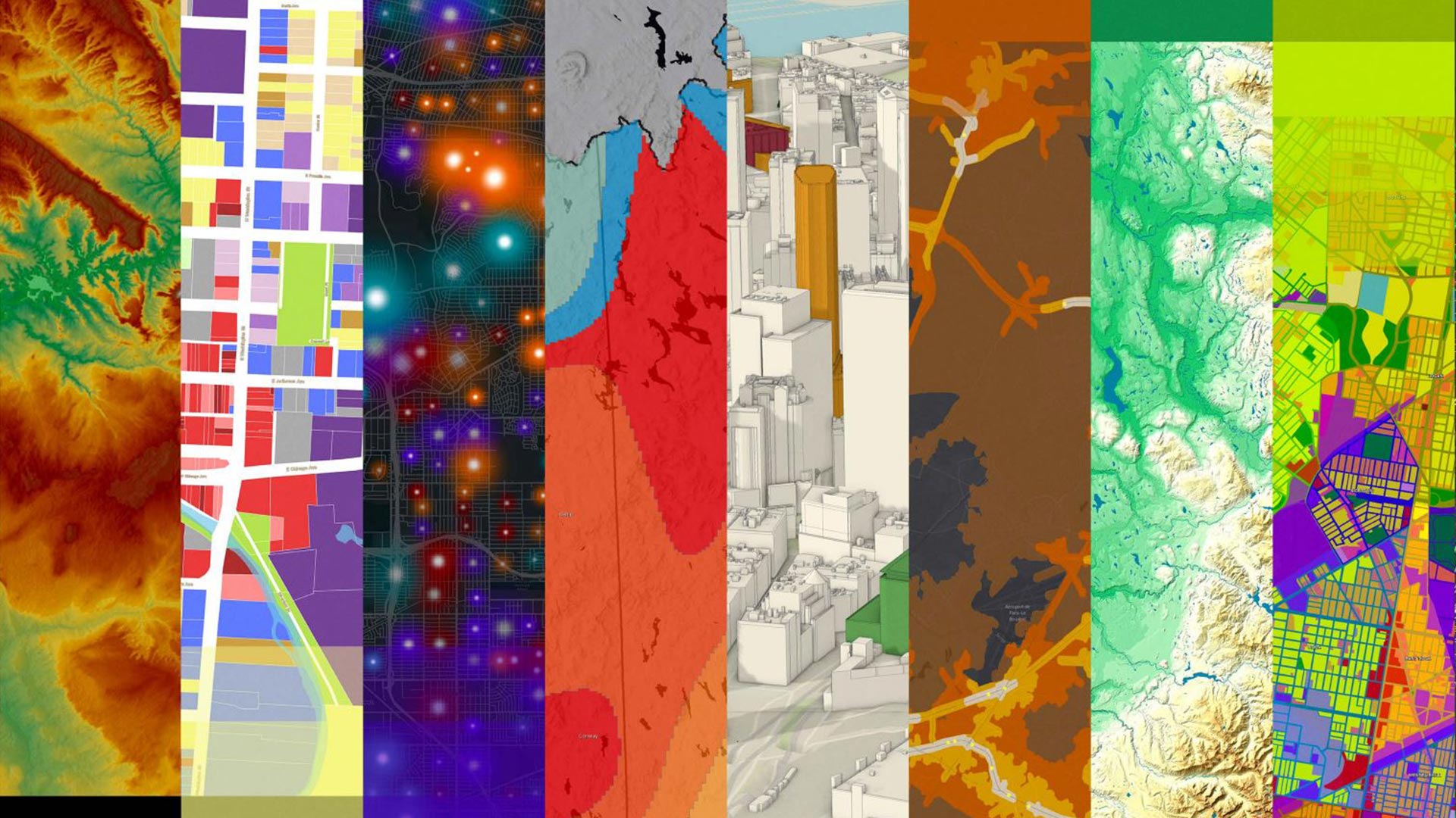
GIS Day is less than a month away, so now is the perfect time to plan how you will participate in the event and educate others about how GIS technology benefits our society and planet. GIS Day will be officially celebrated on November 17, 2021, but some people will choose another day or host a weeklong program. Need ideas on how you can take part in this global celebration of GIS? Below are 99 suggestions compiled by a team at Esri. You can take your pick or come up with your own unique ways to share your knowledge about geography and GIS.
To register your event with Esri, fill out this ArcGIS Survey123 form. The form includes a section that lets you map your event on the GIS Day website.
- Volunteer to give an online presentation at a school, a library, or your place of work.
- Write a blog post on the benefits of GIS and share it on social media (don’t forget to include the hashtag #GISDay).
- Create a GIS Day poster, or print one of ours.
- Offer to give a speech at your alma mater on your career and achievements in GIS.
- Tell your family about GIS and show the ways in which it’s helping to create a better future.
- Open a conversation about GIS with a child or loved one.
- Contact a local school, and talk to administrators about the free ArcGIS software package for K–12 schools.
- Forward your favorite geography video or map to a friend.

- Host a GIS Day event in your organization to celebrate your work, and register your event with Esri.
- Set up a poster display of your GIS work in the lobby at your workplace or in your home office.
- Petition for your local government to proclaim November 17, 2021, as GIS Day.
- Send a thank-you note to a GIS or geography teacher.
- Join Esri Community, a website where you can share ideas, collaborate, and find solutions.
- Write a letter to the editor of your local newspaper about the importance of supporting GIS Day.
- Write a song about GIS Day.
- Tell a friend about Esri’s massive open online courses (MOOCs).
- Send a note complimenting a coworker on their GIS work.
- Make a map for a friend to promote geography awareness.
- Join the Urban and Regional Information Systems Association (URISA).
- Explain the difference between longitude and latitude to a friend and describe how coordinate systems work.
- Post local GIS job opportunities to social media.
- Offer to make a GIS presentation to a community organization.
- Volunteer to make an interactive map and an app for a nonprofit organization.
- Volunteer to crowdsource data in your community or participate in citizen science.
- Sign up to volunteer for GISCorps.
- Submit an abstract on GIS to your local trade group.
- Donate a personal copy of a GIS book you’ve read to your local library.
- Submit an article on your use of GIS to a trade journal.
- Visit the online Esri Map Gallery collection to get inspiration and ideas for your own maps.
- Start reading ArcGIS Blog on a regular basis.
- Thank your GIS mentor.
- Host an online map gallery and invite your colleagues to view it.
- Share your favorite GIS article among your coworkers.
- Start a virtual GIS meetup group.
- Talk about GIS to members of another department within your organization.
- Submit a GIS image for potential use at the Plenary Session of the next Esri User Conference (Esri UC).
- Join the Community Maps Program and start sharing your community data with others in the ArcGIS community.
- Visualize and share how your neighborhood has changed over time, using the World Imagery Wayback app.
- Make a map to explore current events using ArcGIS Living Atlas of the World content. You can use authoritative live feeds or other content in your map, from flood conditions to earthquake information. Read the ArcWatch tip Map the Weather in a Minute to learn the steps to follow to create your map.
- Offer to mentor college students who are learning GIS.
- Start a high school or college GIS club.

- Search for a GIS job.
- Use the Relationship mapping option in ArcGIS Online to visually explore the relationship between two data layers to see if there is a correlation. Read how to do this in the ArcGIS Blog post, How to Smart Map: Relationships.
- Visit a peer government to learn what it is doing with GIS.
- Subscribe to ArcNews or read it online at esri.com/arcnews.
- Subscribe to ArcUser or read it online at esri.com/arcuser.
- Subscribe to ArcWatch or read it online at esri.com/arcwatch.
- Submit a GIS article about your organization’s GIS work to an Esri publication.
- Run an ArcGIS Business Analyst report for a local business.
- Wear an I Love GIS button, then pass it on to a friend.
- Create a story with the ArcGIS StoryMaps app to honor local veterans.
- Attend a GIS Day event. Many of the events, including the dates and times, are currently displayed on a map on the GIS Day website.
- Document your return on investment from using GIS, then share it using the hashtag #GISDay.
- Use this day to tell your Esri account executive why you should be considered for a Special Achievement in GIS Award.
- Use the ArcGIS StoryMaps app to create a story that documents a recent road trip, then share it on social media using the hashtag #GISDay.
- Promote your team’s GIS work on social media with the hashtag #GISDay.
- Praise an executive who supports GIS on social media.
- Build an interactive map to promote local businesses (just in time for the holidays).
- Livestream your GIS Day event, and share it using the hashtag #GISDay.
- Teach yourself a new GIS skill by taking a course at the Esri Academy.
- Wear your Map Man, Map Woman, The Science of Where, or other favorite GIS T-shirt.

- Join the Esri Young Professionals Network (YPN).
- Invite an elected official to join your virtual GIS Day event.
- Take a moment to think about your favorite GIS project and then share it.
- Praise a GIS up-and-comer.
- Apply for your geographic information system professional (GISP) certification.
- Produce a video of a day in the life of a GIS professional, and share it using the hashtag #GISDay.
- Frame your favorite map and hang it on the wall.
- Look for inspiration and just enjoy historical maps by browsing through the David Rumsey Map Collection.
- Build a top 10 list of things you want to do with GIS in 2021 or 2022.
- Give a shout-out to a GIS professional on social media.
- Use GIS to highlight a community concern at your next local city council meeting.
- Post an Instagram story on what you’re doing on GIS Day, and share it using the hashtag #GISDay.
- Share your photo with a GIS user who inspires you and include the hashtag #GISDay.
- Wear an Ask Me about GIS button.
- Give an award to a local GIS hero.
- Register for a webinar on a new GIS topic you’re interested in.
- Attend Esri’s digital GIS Day experience!
- Suggest setting up a GIS division/department/specialty within your organization.
- Invite a retired GIS pioneer to present on their path to a career in GIS.
- Bake a GIS Day-themed cake or cupcakes.
- Share your favorite GIS article among your coworkers.
- Put a GIS sticker on your laptop.
- Write a blog post on why you started a career in GIS, then share it using the hashtag #GISDay.
- Post a YouTube video about your GIS work.
- Share a favorite video from Esri cartographer John Nelson’s YouTube channel that inspires you.
- Use ArcGIS Hub to set up an open data site.
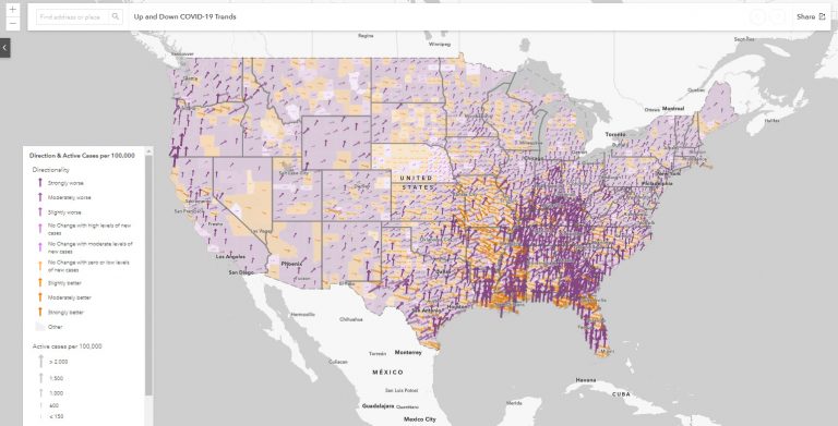
- Email one or more maps from the Esri Maps for Public Policy collection to your elected officials, such as the Up and Down COVID-19 Trends map, which shows which areas of the United States are higher or lower active cases of COVID-19.
- Learn how to say “geographic information system” in another language. For example, in German it’s geographisches informationsystem.
- Give a friend an ArcGIS for Personal Use subscription.
- Join Esri’s Early Adopter Community to test a new GIS product.
- Complete a Learn ArcGIS lesson.
- Watch Esri President Jack Dangermond talk about the meaning behind GIS Day in this video.
- Host a workshop session at your organization to showcase your team’s GIS work.
- Make plans to attend the annual Esri User Conference.
- Study for your Esri Technical Certification, which helps employers verify proven ArcGIS skills.
- Try something new. Instead of making a traditional presentation, use ArcGIS StoryMaps to share information.
- Join the Community Map Program so that your authoritative datasets or maps can be considered for inclusion in ArcGIS Living Atlas of the World and be used by others.
- Listen to your favorite GIS podcast. Start here by tuning in to Esri & The Science of Where podcast and the new Field Notes podcast.
- Challenge your colleagues to see who can check off the most items from this list.
- Mark your calendar for GIS Day 2021 (November 17) and GIS Day 2022 (November 11).