Fighting Fire with Maps
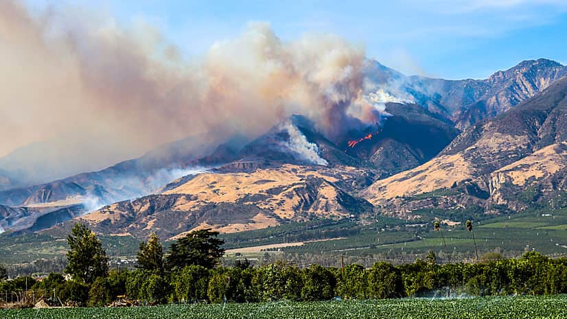
The Ventura County Fire Department in California used GIS to create maps of the Thomas Fire, providing valuable situational awareness.
The Ventura County Fire Department in California used GIS to create maps of the Thomas Fire, providing valuable situational awareness.
Data Appliance 7.0 for ArcGIS plugs into an internal, secure network, delivering preloaded imagery, basemaps, and reference layers.
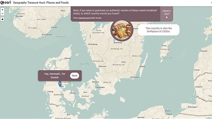
Go on the Geography Treasure Hunts and test your geographic knowledge about beaches, cuisine, mountains, cities, and world heritage sites.
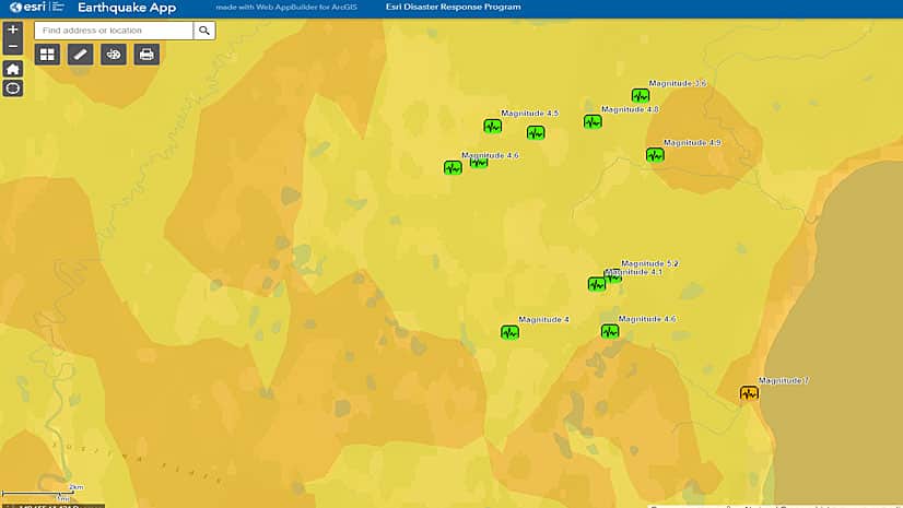
Visualize the recent earthquakes in Alaska with an app built with Web AppBuilder for ArcGIS.
Esri ArcGIS powers the maps on the Smithsonian WILD website, where you will find more than 200,000 images of animals...
Your map seems perfect. Then you realize the names of features such as oceans, mountain ranges, and neighboring states are missing.
A web mapping application from Esri Canada Limited displays in detail the 16,800-kilometer route of the Trans Canada Trail.
The National Ice Center (NIC) uses an ArcGIS extension to process satellite imagery of polar regions.
This tip uses live web maps to demonstrate how to use the Ocean Basemap in combination with ArcGIS Online to visually analyze data.
ArcGIS for Server lets you zoom in and clearly see each of 100,000 images that make up the photomosaics.
Learn to create a vector flow map to help your audience visualize geographic phenomena such as wind, water, or gravity.
Electronic navigation charts (ENCs) created using ArcGIS guide a growing number of commercial vessels up and down the Changjiang River in China.