Journey into Mapping with Explorer for ArcGIS
Esri just released the Explorer for ArcGIS app for iOS devices. Read this article to learn how you can use this app to work with maps and data...
Esri just released the Explorer for ArcGIS app for iOS devices. Read this article to learn how you can use this app to work with maps and data...
Esri just made making Map Tour story maps a very simple process, thanks to a new streamlined workflow...
Learn how to use two symbol transparency methods—layer and color transparency—and how to choose between the two depending on what information...
We did some digging and created a list of the top 10 apps and data services that have you talking—and shopping the Marketplace.
Urban Observatory creates an interactive museum experience that uses digital maps and geospatial analytics to bring cities to life.
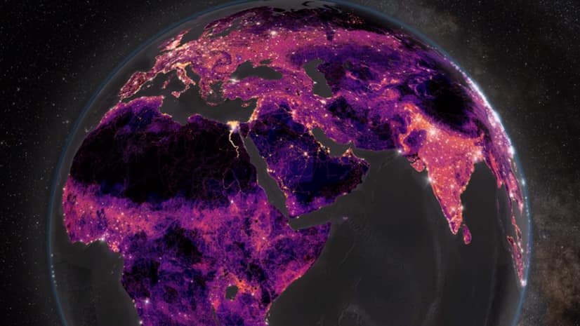
Esri’s Greyson Harris walks you through how to construct eye-catching, animated spinning globes using ArcGIS Pro.
Thomas Crowther talks about how location intelligence can be used to target reforestation efforts to reduce the impact of climate change.
Esri’s Chris Andrews and Don Kuehne talk about why integrating GIS and building information modeling (BIM) technologies is important.
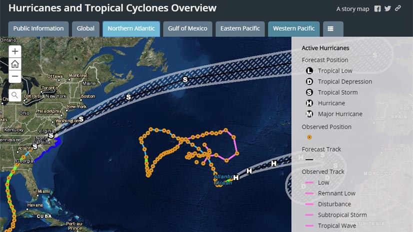
When hurricanes and other disasters strike, the Esri Disaster Response Program (DRP) steps up to help with data, software, and configurable apps.
Esri offers Arxys servers preinstalled with ArcGIS Enterprise software. Use this solution to complement or upgrade your GIS infrastructure.
Planning for the future will require innovative technologies and design ideas, which will be topics of discussion at the 2019 Geodesign Summit.
Allen Carroll of Esri states a strong case for using a story map to share information about your nonprofit group.