Learn to Use ArcGIS to Share GIS Content
This course teaches you how to share geospatial resources to an ArcGIS Online organizational site or an ArcGIS Enterprise portal website.
This course teaches you how to share geospatial resources to an ArcGIS Online organizational site or an ArcGIS Enterprise portal website.
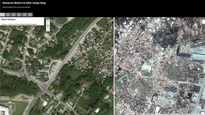
Using imagery from the Maxar Open Data Program, an Esri Story Map Swipe app reveals the devastation to the Bahamas caused by Hurricane Dorian.
With the Trimble R1 GNSS receiver, you can collect accurate location data with your iOS or Android device running Collector for ArcGIS.
Find out about the new capabilities in Navigator for ArcGIS, a turn-by-turn voice guided navigation app for iOS and Android devices.
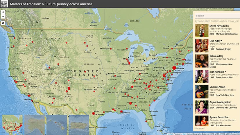
The Masters of Tradition: A Cultural Journey Across America story map profiles more than 125 artists from diverse cultures.
In this tip, you will learn how to use the Attachment Viewer configurable app template to view photos and other feature attachments.
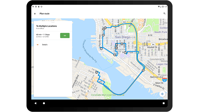
Scottsdale Fire Department used Esri technology rather than paper maps to quickly route paramedics to medical calls at a PGA golf tournament.
A non-profit in New York uses Esri technology to analyze data on homeless children, producing maps and infographics to inform policy decisions.
Download the City Transformation Starts with a Hub e-book to learn how to use a hub framework and easy-to-configure platform for collaboration.
On the agenda for the Esri Oceanic and Atmospheric GIS Forum: User presentations, workshops and learning labs.
Kristian Ekenes from Esri walks through how to use ArcGIS API for JavaScript to create histograms as legends.
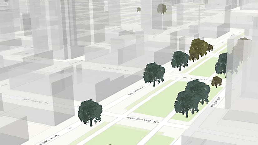
In this Learn ArcGIS lesson, you will learn to turn 2D tree data into 3D scenes of trees using Scene Viewer in ArcGIS Online.