Learn How to Process Drone Imagery Using ArcGIS API for Python
Learn how to use ArcGIS API for Python to automatically orthorectifiy drone, satellite, and aerial imagery.
Learn how to use ArcGIS API for Python to automatically orthorectifiy drone, satellite, and aerial imagery.
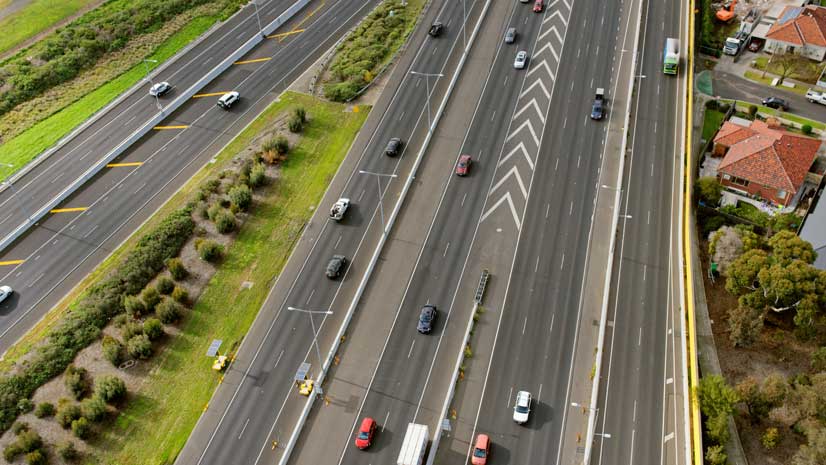
The North East Link Authority and GHD Digital in Melbourne, Austrialia, created an Esri Story Maps app to show the public a freeway plan.
Try four different layouts for your stories about places using the tools in ArcGIS StoryMaps.
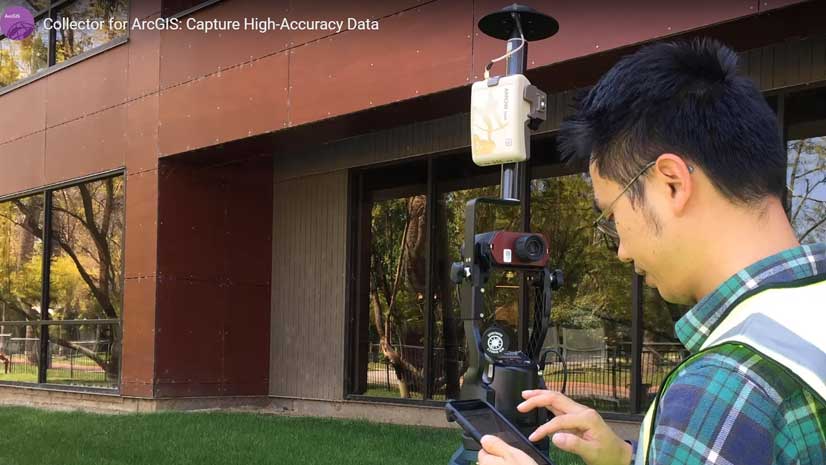
Esri product engineer Kevin Burke explains how to get the most out of the high accuracy data collection capabilities in Collector for ArcGIS.
If you work in retail development or commercial real estate, you are constantly on the go, looking for new locations to expand your business...
Esri has built the framework for a rivers and streams map that makes real-time stream and river gauge information accessible to ArcGIS Online...
Esri has launched the ArcGIS StoryMaps beta. Mix and match all the best experiences from the classic templates and create express maps.
Esri Canada used an Esri Story Maps app to create a colorful and handy guide to the nation’s forests and trees.
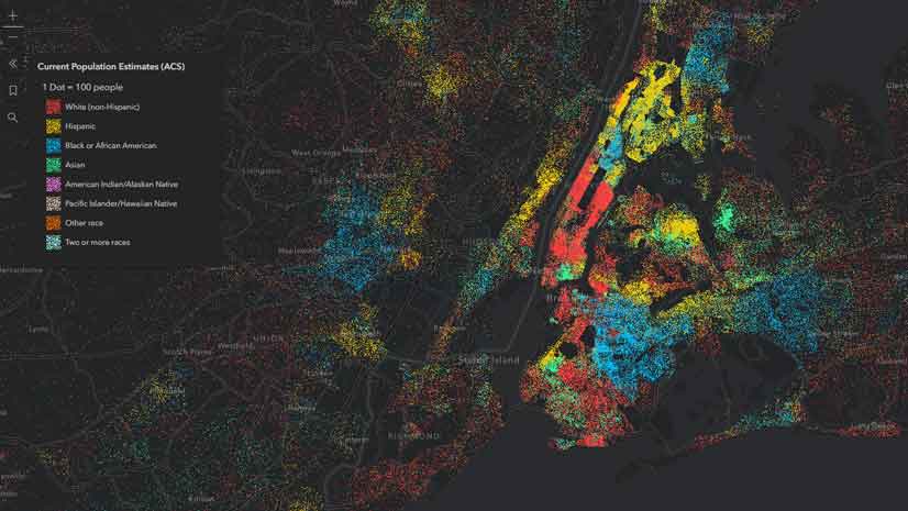
The DotDensityRenderer, new in ArcGIS API for JavaScript, gives you the ability to create striking dot density visualizations.
Learn what cool new capabilities have been added the latest release of 30 Esri software products, including AppStudio for ArcGIS and ArcGIS Pro.
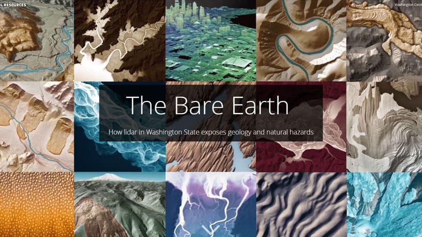
See how using lidar in ArcGIS Pro can reveal geology and natural hazards such as landslides and volcanic activity in Washington State.
Former Maryland Governor Martin O’Malley, author of the forthcoming Esri book Smarter Government, discusses how data improves decision-making.