Visualize Large Feature Datasets in 3D
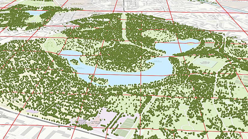
Changes to ArcGIS API for JavaScript means that you can now use 2D data to create a 3D view of your cities.
Changes to ArcGIS API for JavaScript means that you can now use 2D data to create a 3D view of your cities.
Learn to create a Layer Showcase app in ArcGIS Online and share it with colleagues, who can then create new maps or scenes based on the layers.
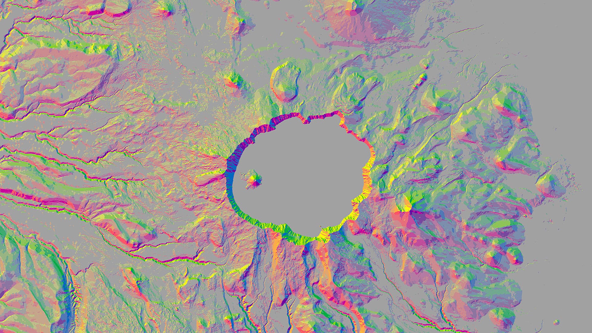
You can use aspect-slope maps to identify landscape features such as ridges or predict fire risk. Learn how to make one using ArcGIS Pro.
Livia Betancourt Mazur experimented with creative styles, finally using the George Washington style to make a map of the University of Minnesota.
Get advice on how to author story maps that will wow your audience from Allen Carroll and Bern Szukalski from the Esri Story Maps team.
Do you have a publicly accessible ArcGIS organization? Here’s some sage advice how to make your organization easier for others to discover.
With the Trimble R1 GNSS receiver, you can collect accurate location data with your iOS or Android device running Collector for ArcGIS.
Learn how to set up Operations Dashboard for ArcGIS to automatically focus on the latest event like an earthquake.
Esri will require TLS 1.2 connections for ArcGIS Online services as of April 16, 2019 for security reasons. You may need to take action sooner.
Esri technology evangelist Bern Szukalski shows you how to enable social network logins for your ArcGIS Organization.
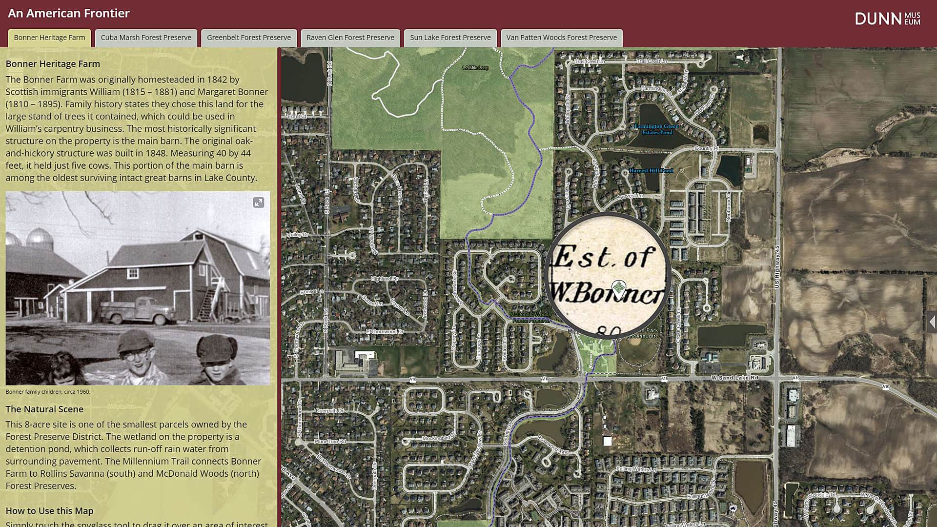
The Bess Bower Dunn Museum in Illinois uses Esri Story Maps to teach visitors about the people, events, and history that shaped Lake County.
You can tap the app's globe to identify features, take pictures when creating a tour, and more.