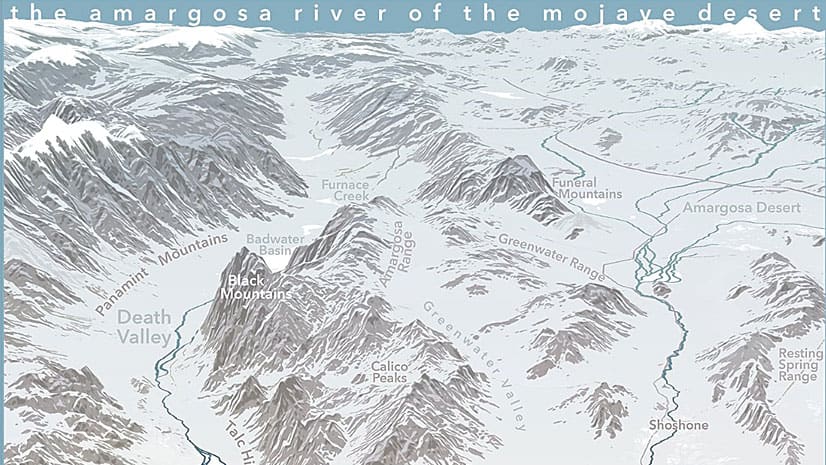
Make a Vintage Map Poster of Yellowstone National Park
Esri cartographer John Nelson walks you through how to craft a stunning vintage-style poster of Yellowstone National Park.
Esri cartographer John Nelson walks you through how to craft a stunning vintage-style poster of Yellowstone National Park.
Get tips on how to use ArcGIS Pro and Adobe Photoshop to create a map that expresses the feeling of a location.
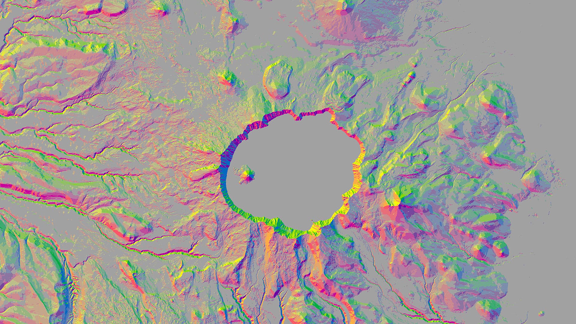
You can use aspect-slope maps to identify landscape features such as ridges or predict fire risk. Learn how to make one using ArcGIS Pro.
Livia Betancourt Mazur experimented with creative styles, finally using the George Washington style to make a map of the University of Minnesota.
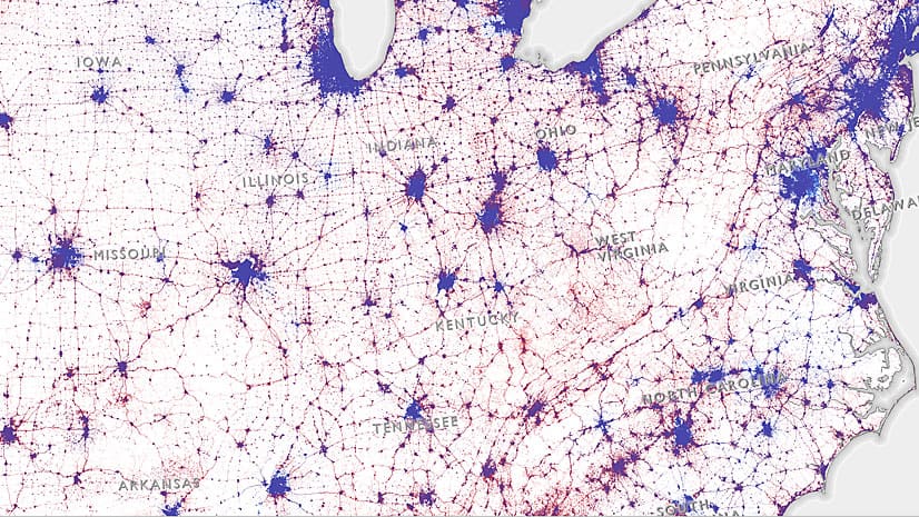
This dasymetric map illustrates the distribution of votes across the United States during the 2016 presidential election.
Learn to create a minimalist map graphic for your website that has what Esri cartographer John Nelson calls a “spatio-technical vibe.”
The basemap gallery in ArcGIS Online offers nine great basemap choices including the World Topographic Map and the Light Gray Canvas Map.
Feathering is a technique that makes the area you want to highlight on your map stand out and helps your audience focus on what’s important...
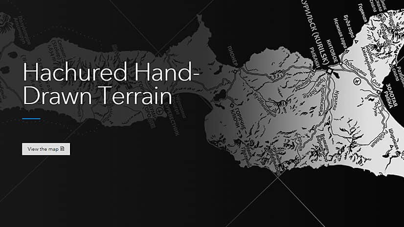
This black and white map of the island of Iturup, created with ArcGIS Pro, gives off a cool vibe with its hand-drawn, hachured mountains.
Your map seems perfect. Then you realize the names of features such as oceans, mountain ranges, and neighboring states are missing.
Placing a true north arrow on your map often improves its accuracy and quality.
Electronic navigation charts (ENCs) created using ArcGIS guide a growing number of commercial vessels up and down the Changjiang River in China.