Create a Curated Gallery to Feature Your Best Group Content
Esri technology evangelist Bern Szukalski lays out a few simple steps to highlight specific content on your ArcGIS Online groups page.
Esri technology evangelist Bern Szukalski lays out a few simple steps to highlight specific content on your ArcGIS Online groups page.
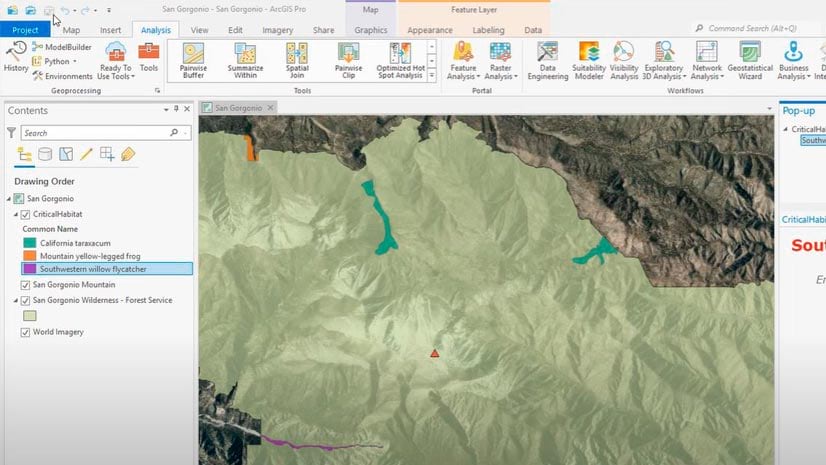
A tutorial clearly shows every step in the process of creating a project using ArcGIS Pro.
Esri technology evangelist Bern Szukalski walks you through how to use ArcGIS Dashboards to create a dashboard that lets you visualize your data.
In the Configuring an ArcGIS Online Organization web course, you will learn to navigate and manage settings for your ArcGIS Online organization.
William Shuart uses drones and the latest Esri technology to help students at VCU bolster their skills for their future careers.
Three newly-minted graduates who studied GIS at their colleges and universities offer some sage educational advice.
Two Esri Press books highlight the GIS trailblazers among us, real and fictional.
The Esri User Conference will be virtual again this year. But there’s still a lot of fun and learning in store.
Nate Ebel was 13-years-old when he gave a presentation at the 2002 Esri User Conference. What he did with GIS from then on impacted him greatly.
Esri Press published a children’s book series aimed at piquing young people’s interest in science, technology, engineering, the arts, and math.
Business schools at colleges and universities are increasingly integrating location analytics into the curriculum. How will this help students?
A no-cost online course teaches advanced techniques to uncover hidden patterns and improve predictive models.