Time Is on Your Side
Now you can more easily manage date and time data using new field types available in ArcGIS Online.
Now you can more easily manage date and time data using new field types available in ArcGIS Online.
Learn how you can leverage Forms in Map Viewer to elevate, customize, and optimize your data editing experience.
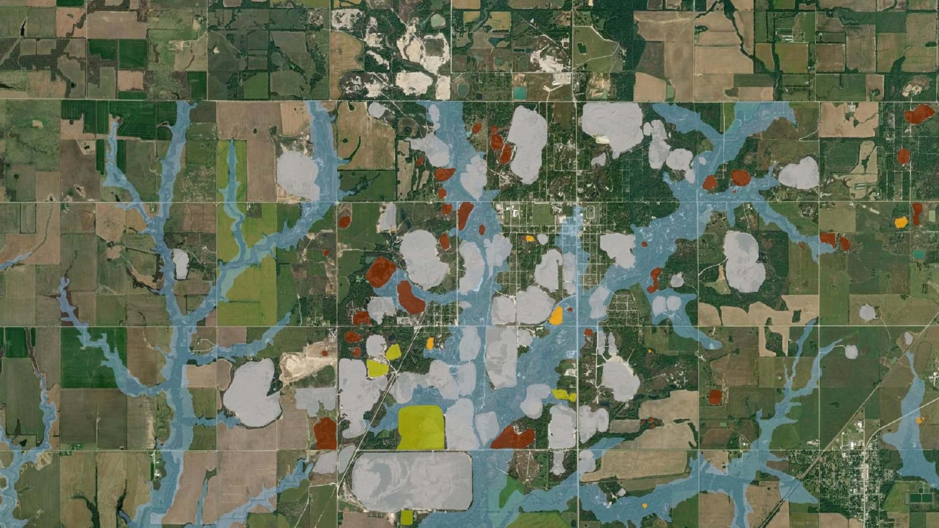
The Tar Creek Superfund site created one of the most toxic floodplains in the US. LEAD Agency is using GIS to advocate for environmental justice.
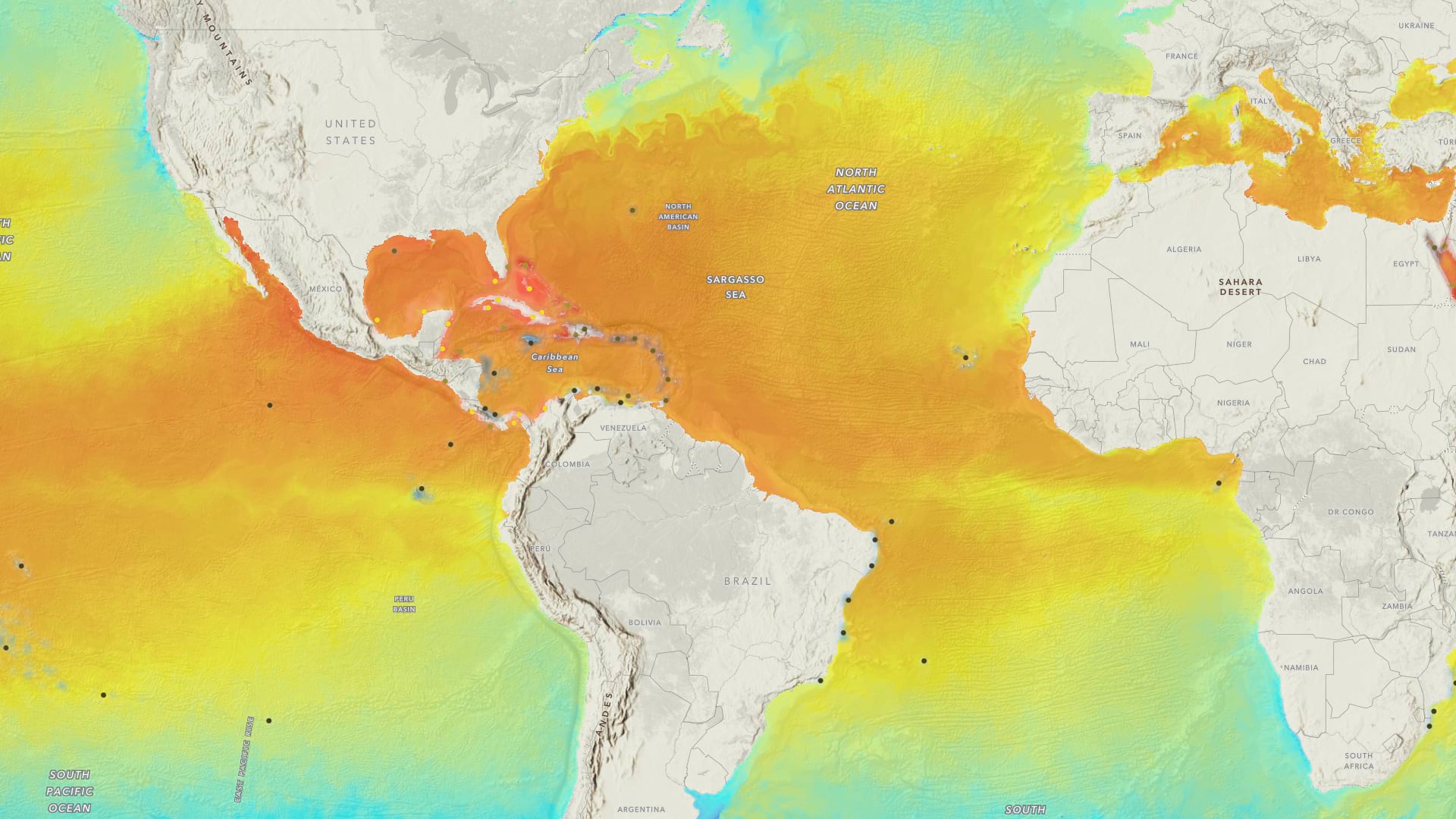
Learn to make a sea temperature and coral bleaching map in a minute using ArcGIS Online and ArcGIS Living Atlas of the World.
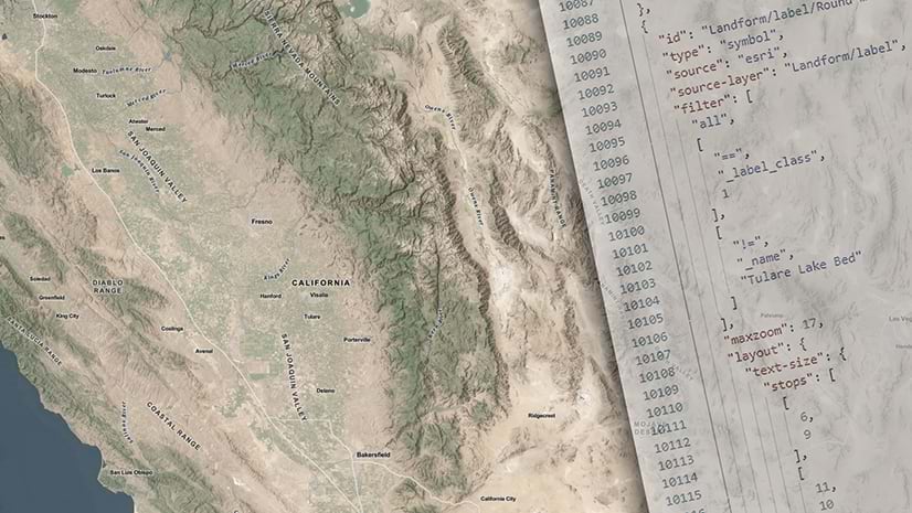
Edit and customize base labels and blur the lines of what's possible with your basemap.
Learn to efficiently manage members in ArcGIS Online, including assigning licenses, adding members to groups, and allocating credits.
Get started using spatial analysis tools in ArcGIS Online Map Viewer to answer questions and solve problems based on spatial criteria.
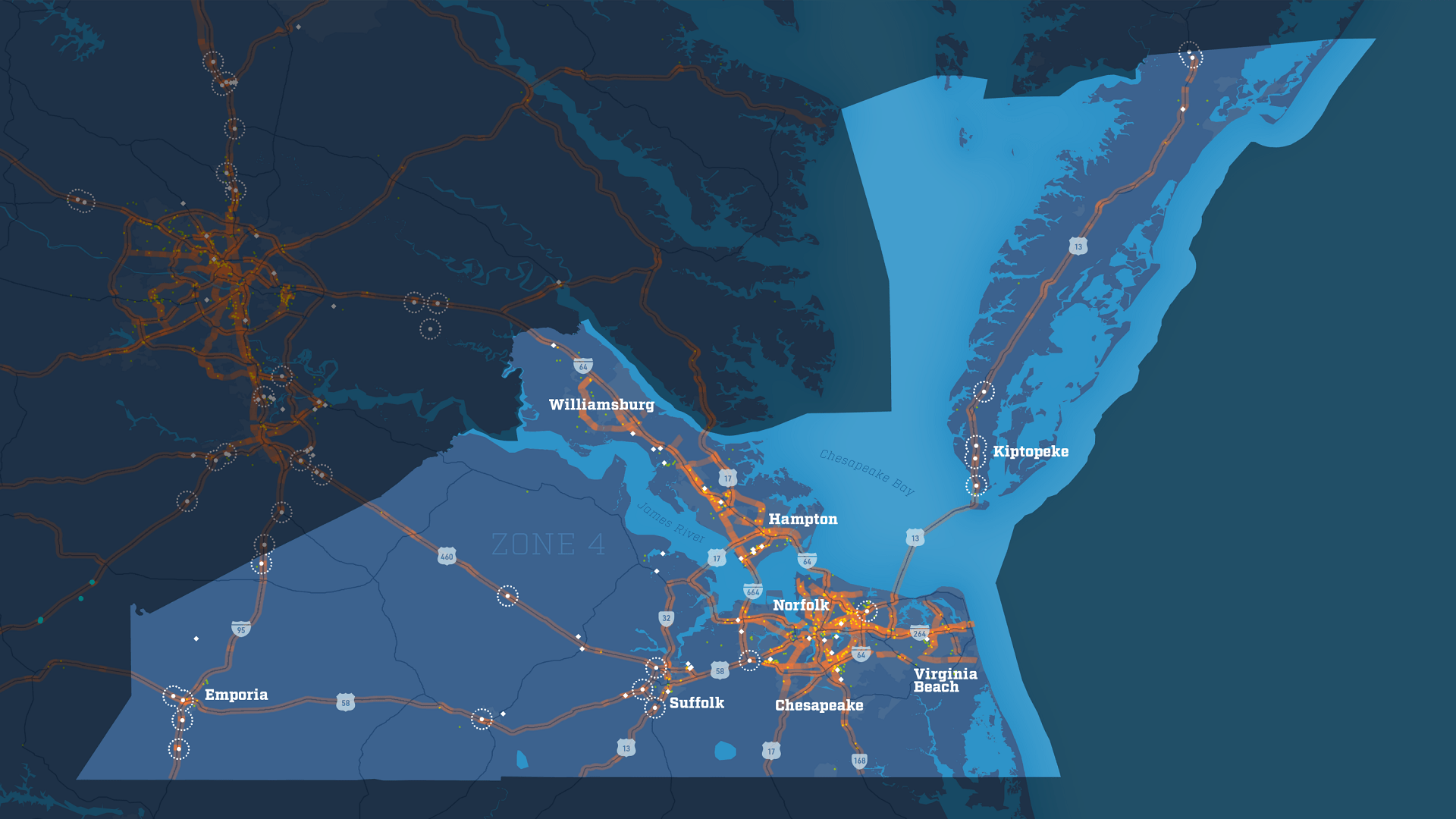
With the Virginia Department of Transportation's truck parking data viewer, the state can better evaluate the needs of Virginia truck drivers.
In this tutorial, learn to export a copy of a feature layer to your account. Publish the copied data as a hosted feature layer owned by you.
An auto-rotating globe is a fascinating way to view our planet. Make your own in a minute using ArcGIS Online and ArcGIS Living Atlas.
Learn about the new pop-up design updates to ArcGIS Online and ArcGIS Maps SDK for JavaScript.
URL parameters can be used with Scene Viewer to create or modify scenes. Learn how from these examples.