

September 12, 2023 |
Brooks Patrick | Urban Planning
November 3, 2025
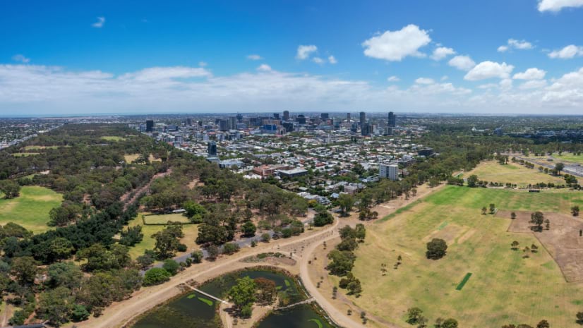
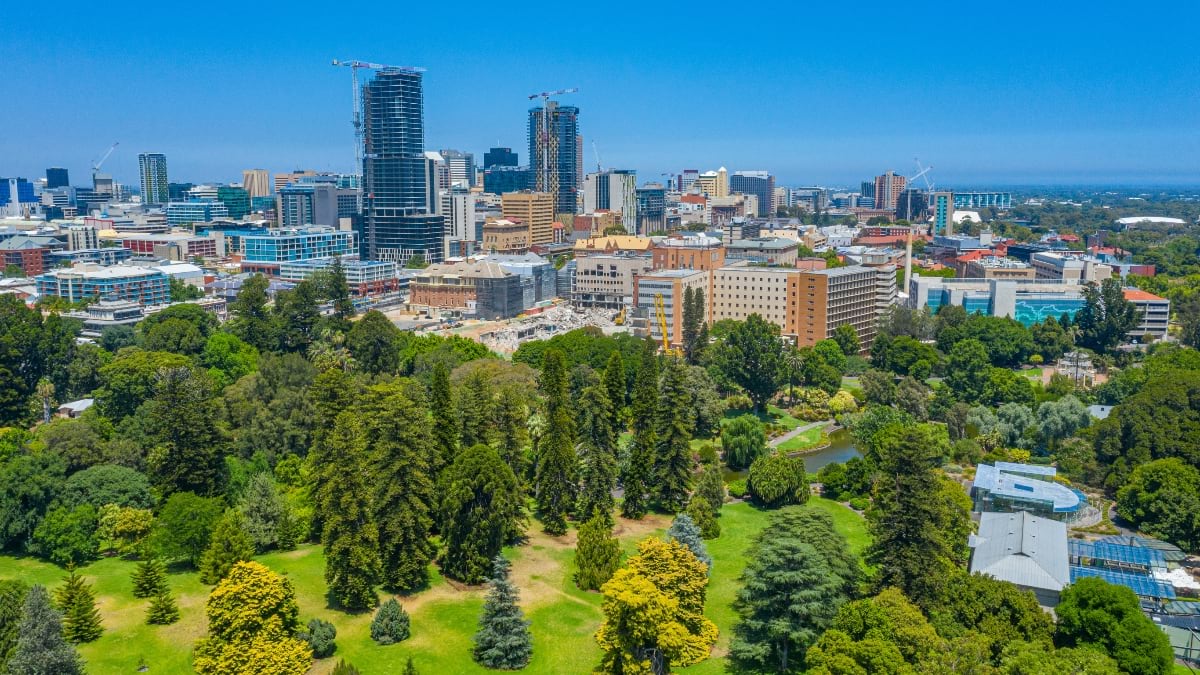
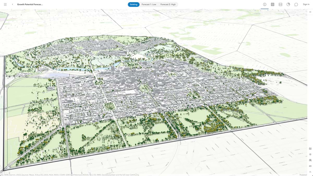
South Australia’s cosmopolitan coastal capital and the fifth most populous city made a bold decision to grow rapidly but delicately. In its recently released comprehensive plan, Adelaide opted to double the population in its downtown core to 50,000 people by 2036—adding housing density near its green spaces and historic neighborhoods.
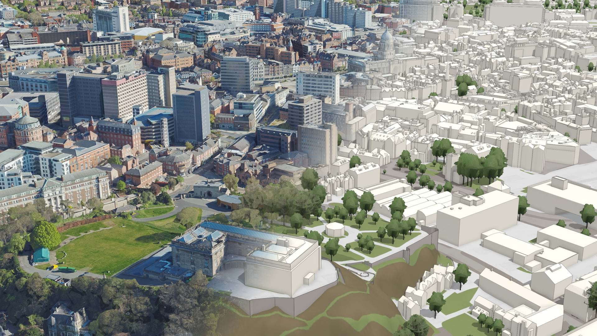
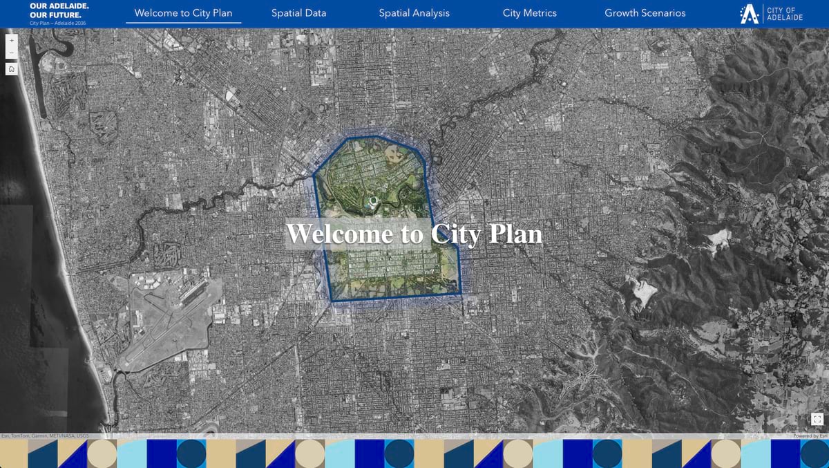
To navigate competing demands—growth versus green space, density versus character—Adelaide needed a new approach to planning. Arup, a global engineering and design consultancy, worked with Adelaide’s planners, tapping geographic information system (GIS) data and tools to create a digital plan of the city.
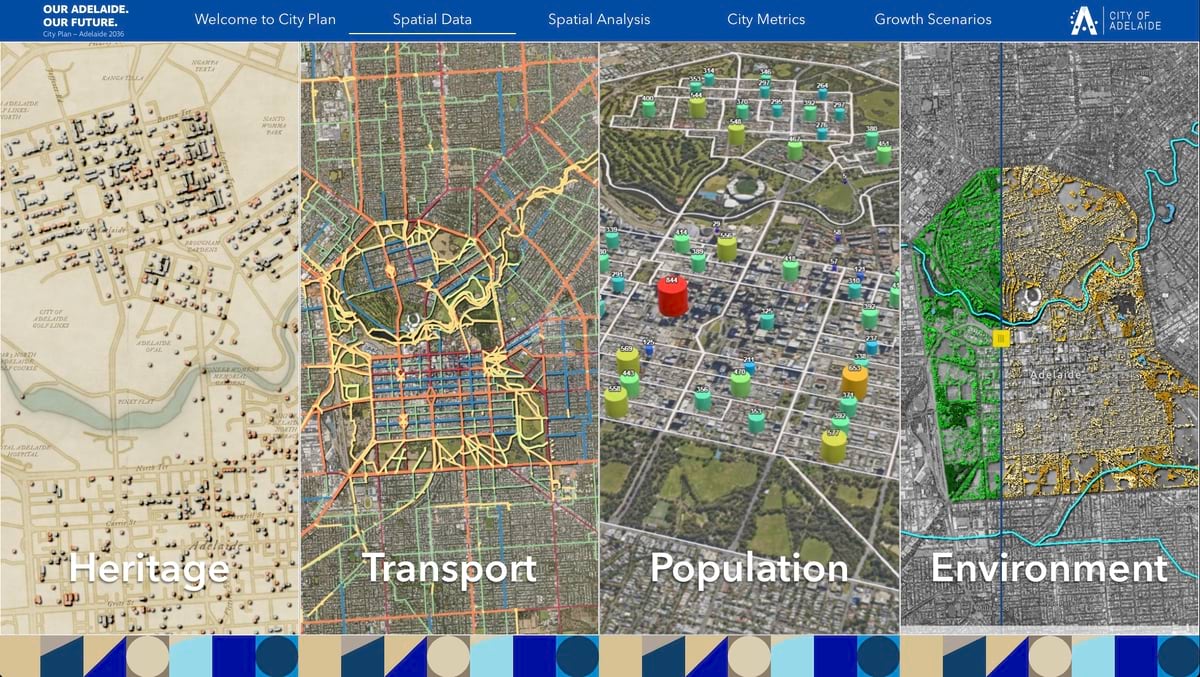
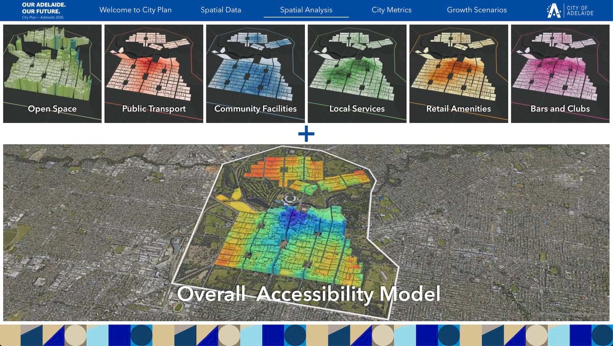
The city provided data for three critical dimensions of Adelaide: the physical infrastructure (roads, utilities, buildings), the environmental systems (parklands, waterways, vegetation), and the social fabric (demographics, income, vulnerability).
“We were given more than 400 datasets,” said Lina Gonzalez, a GIS specialist at Arup. “We used the data to examine existing conditions and to help shape ideas about the future of the city.”
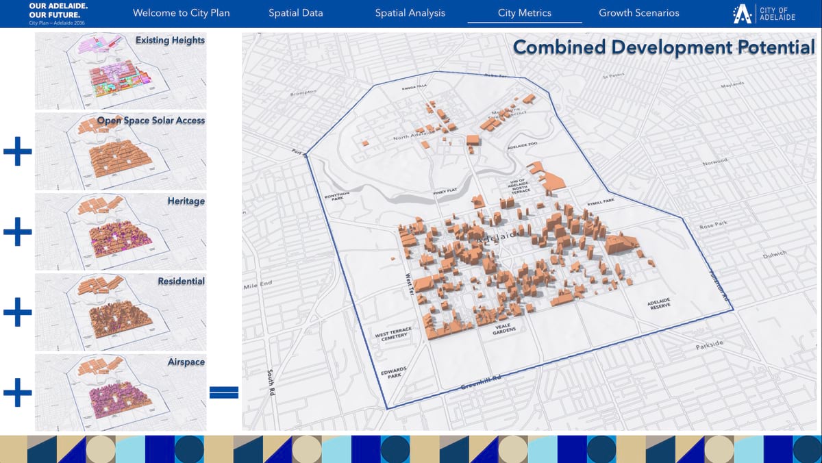
By analyzing all this data in the context of location, the Arup team helped the city’s planners visualize growth that focused on the people who live there and the things they value. They looked at mobility and accessibility, creating maps for each neighborhood to determine 15-minute walkability zones. They considered water resources to see where new trees might thrive in this drought-prone city. They monitored heat, humidity, and air quality collected by a network of 30 sensors that ring the city.
The digital plan tested growth scenarios, while also serving as a living document that could be queried to support planning decisions as the city grows. Ultimately, a map emerged that showed livability scores for each neighborhood and where to expand in areas with the most comfortable conditions.
Adelaide’s accelerated development was spurred by Australia’s federal government, which set an ambitious target of 1.2 million new homes across the country by 2029. This goal was particularly challenging for Adelaide, which faces unique constraints among Australian cities.
The city’s crown jewel—932 hectares of parks designed by Colonel Light when the city was founded nearly two centuries ago—winds through Adelaide in a figure-eight pattern. Serryn Eagleson, digital advisory lead at Arup, noted that the green spaces create an essential cooling infrastructure for the city. As extreme heat events intensify, these parklands lower ambient temperatures to soften the impact of heat waves and serve as critical infrastructure for stormwater management and air quality.
“Climate resilience is a key part of their planning strategy,” Eagleson said.
The digital plan and sensor data are being used to design “cool routes” to help residents navigate extreme heat events. The city also plans to integrate more sensors, so the digital plan gets updated with current conditions.
The use of the digital plan to examine possibilities for each neighborhood helped planners determine changes to enhance quality of life. The analysis identified where major transformations make sense, where the city’s character should be preserved, and where subtle enhancements would be better than renewal.
The West Terrace neighborhood emerged as a prime candidate for reshaping. Modeling showed how a corridor of low-rise commercial buildings could be transformed with trees and taller mixed-use buildings. Many vacant parcels could be used for more housing, while protected cycling lanes could calm traffic.
King William Street, Adelaide’s central boulevard, showed promise for the conversion of offices into residential buildings. An east-west path is planned to enhance connectivity for pedestrians and cyclists. The analysis showed that the area’s existing public transport service could support denser living.
In contrast, the analysis showed that heritage neighborhoods like Wellington Square in North Adelaide should see little change. Rather than more density, the focus here would be on active transport links to the main artery of O’Connell Street and better access to the Adelaide Park Lands.
O’Connell Street represents a middle path. The Women’s and Children’s Hospital was recently torn down to make way for more housing, while the low-density historic character of surrounding residential streets will be maintained.
Even in lower-growth areas like the East End—well-served by retail and green spaces—the digital plan revealed opportunities for shop-top housing conversions and more cycling lanes.
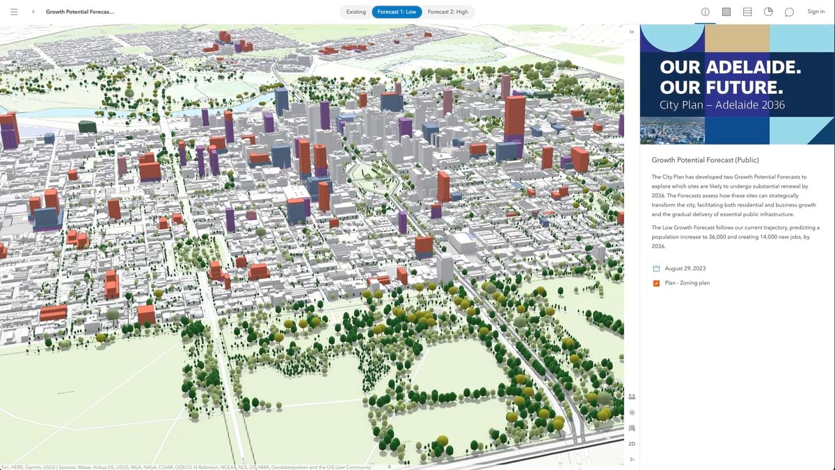
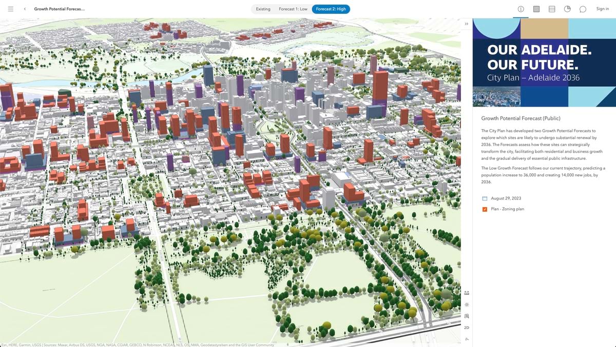
With scenarios modeled and data analyzed, the next challenge was communicating these complex possibilities to residents and decision-makers. Arup used ArcGIS Urban to communicate slow and high-growth scenarios to stakeholders.
“This was provided to the community to convey what the city was moving towards,” Gonzalez said. “Residents could explore it to understand how planning decisions would affect their daily lives.”
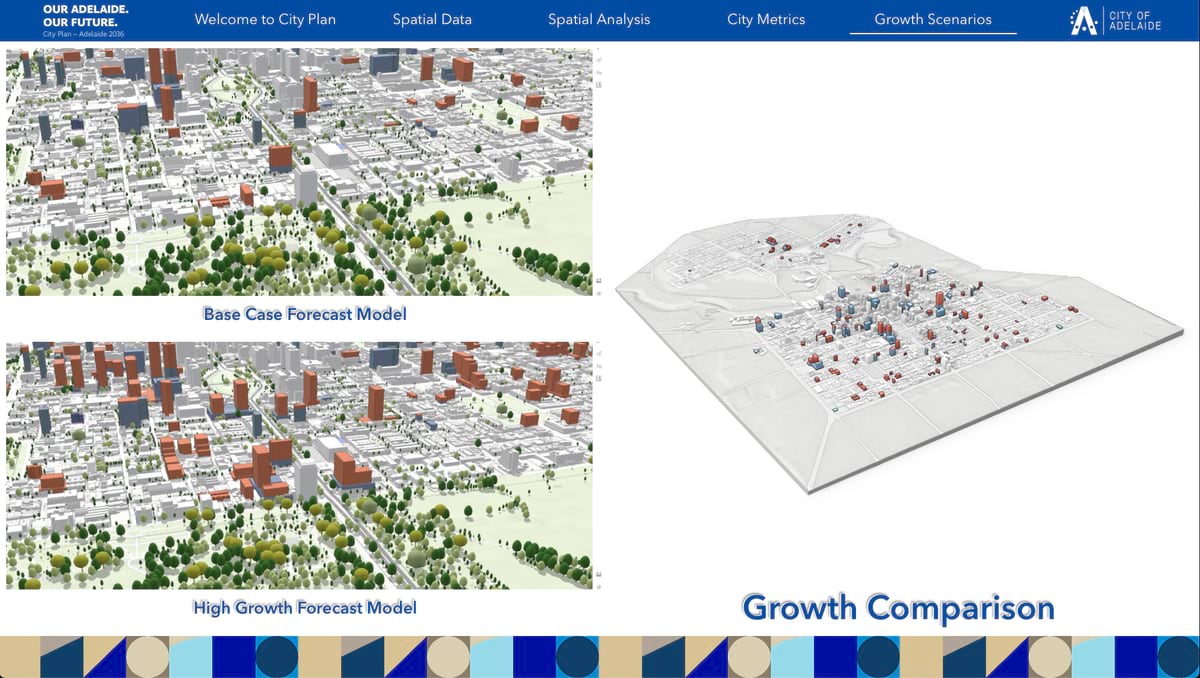
The interactive visualization enabled Adelaide residents to compare different possible futures. The slow-growth scenario focused on incremental development that prioritizes current character while meeting basic housing needs. The high-growth scenario embraced denser development to address housing affordability with larger population increases.
This visual approach made complex planning data clear and easy to follow for residents and decision-makers.
The city used the digital plan as a platform for community engagement. In March 2024, the team conducted mapping surveys to gather resident insights about current conditions. In April 2024, they convened local area focus groups that brought neighborhood voices into the planning process. Public consultations in June and July 2024 gave residents time to explore the scenarios in 3D. Interactive exhibitions in government buildings allowed anyone to explore what each growth scenario would mean for them.
Beyond visualization, the digital plan included sophisticated analysis tools that allowed stakeholders to test different priorities. “They could change the different weightings,” Gonzalez said. “They can play around and make adjustments, such as prioritizing public transport or open spaces.” This helped reveal the inherent tradeoffs and budget considerations.
This capability proved essential for understanding how community values would shape development outcomes. Residents could see in real time how prioritizing nightlife access versus quiet residential character would affect their neighborhoods’ livability scores.
The Adelaide City Council officially approved the plan in September 2024. The appeal of a denser core downtown won out over a sprawling city that can be more isolating for people and more expensive to maintain.
Adelaide’s approach shows how a digital plan can help guide hard decisions, amplify community voices, and create shared understanding of complex urban futures.
As the Lord Mayor of Adelaide, Dr. Jane Lomax-Smith wrote, “City Plan 2036 allows us to choose our own future. Everybody in South Australia needs a capital city that works well and delivers opportunities for all citizens. The onus is on us to leave a legacy.”
Learn more about how ArcGIS Urban transforms urban planning and design.