July 14, 2026| Sunny Fleming | Conservation Maps Went into Bwindi Impenetrable Forest. A Chimpanzee Count Came Out.
June 9, 2026| Lance Owen, PhD | GIS for Good Mapping UNESCO's Sites Revealed What Decades of Paper Records Couldn't
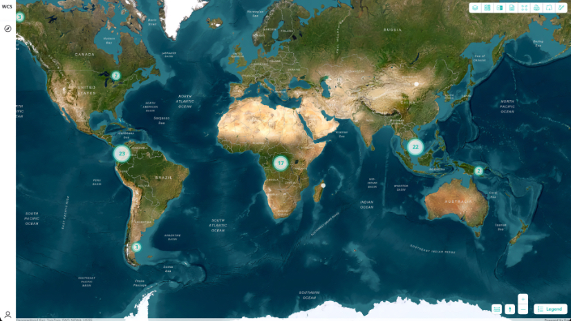
May 26, 2026| Sunny Fleming | Conservation Measuring Conservation Impact: Maps Turn Complexity into Clarity at a Global Scale
June 30, 2026| Rebecca Kahrhoff | Natural Resources Freeport-McMoRan Stewards the Land Beyond the Mine
May 13, 2026| Olivier Cottray | Public Safety The Strongest Hurricane in Jamaica's History Met Its Match in a Local Drone Nonprofit
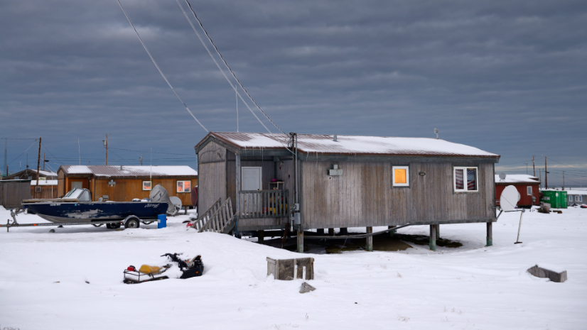
April 28, 2026| Carrie Speranza | Public Safety Forty Villages, No Roads, Two Storms: Alaska’s Race to Respond
March 31, 2026| Ryan Lanclos | Public Safety How High-Tech Maps Helped Team Rubicon Mount One of Its Biggest Aid Efforts
May 15, 2026| Multiple Authors | Infrastructure The Largest Wind Project in the Americas Required a New Way to Build
January 22, 2026| Katie Olson | Infrastructure Video: From Wildfires to Water—Why Data Integration Matters Now
January 8, 2026| Patricia Cummens | Urban Planning Montana Zoning Atlas: Mapping Drives Bipartisan Housing Reform
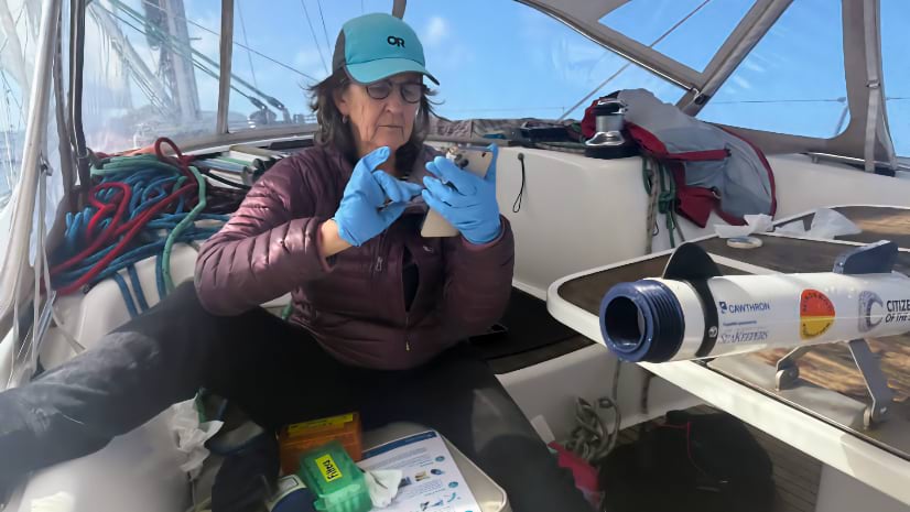
July 5, 2026| Dr. Dawn Wright | Mapping Crowdsourcing Ocean Research: How Sailors Are Filling a Gap for Science
June 23, 2026| Lain Graham | Mapping Drone Mapping and Local Voices Help Document and Preserve Ancient Maya Cities
April 30, 2026| Dr. Dawn Wright | Mapping Florida Maps the Seafloor by Air and Sea With Help from Crewless Boats
June 30, 2026| Rebecca Kahrhoff | Natural Resources Freeport-McMoRan Stewards the Land Beyond the Mine
May 15, 2026| Multiple Authors | Infrastructure The Largest Wind Project in the Americas Required a New Way to Build
May 12, 2026| Nick Short | Natural Resources Years Ahead of Regulation: Inside Bunge’s Traceability and Monitoring Platform
December 9, 2025| David Gadsden | Conservation From Forest to Fretboard: How Taylor Guitars and Scientists Protect Ebony Trees in Africa
July 21, 2026| Carrie Speranza | Resilience In North Carolina, a Drone Pilot Maps the Coast as the Sea Swallows Homes
June 16, 2026| John Beck | Public Safety Redrawn: How Baltimore Police Department Used Data to Rethink Territory and Officer Workloads
May 13, 2026| Olivier Cottray | Public Safety The Strongest Hurricane in Jamaica's History Met Its Match in a Local Drone Nonprofit
May 5, 2026| Anthony Schultz | Public Safety One Digital Tool Unites 35,000 Firefighters Fighting America’s Wildfires
July 21, 2026| Carrie Speranza | Resilience In North Carolina, a Drone Pilot Maps the Coast as the Sea Swallows Homes
June 9, 2026| Lance Owen, PhD | GIS for Good Mapping UNESCO's Sites Revealed What Decades of Paper Records Couldn't
April 7, 2026| Dr. Dawn Wright | Mapping Mapping Greenland’s Fjords and Glaciers: Three Ice Tongues and the Secrets of the Seafloor
March 12, 2026| Carrie Speranza | Public Safety How Virginia Beach Built a New Emergency Operations Platform in 18 Months
June 1, 2026| Christian Carlson | Urban Planning Urban Planners Harness Data for Smart Growth and Community Impact
March 17, 2026| Christian Carlson | Urban Planning Cities Embrace Green Space to Create Healthier Communities
January 8, 2026| Patricia Cummens | Urban Planning Montana Zoning Atlas: Mapping Drives Bipartisan Housing Reform
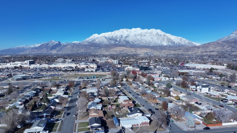
January 6, 2026| Patricia Cummens | Mapping How Utah—America’s Most Urban State—Uses Data to Solve Housing Affordability
June 25, 2026| Katie Olson | Video Video: How the US Census Keeps Up with Rapid Growth Across the Country
June 11, 2026| Katie Olson | Video Video: Communities Map Scotland’s Walking Paths One Step at a Time