


April 23, 2018 |
Brooks Patrick | Urban Planning
With the boom of Amazon, Microsoft, and the many internet and health care companies that call the Seattle area home, the city has added 138,000 new residents since 2010 and is the decade’s fastest growing US city .
The 23 percent growth in population over ten years has been driven by a 30 percent increase in employment. The jobs bring people and economic rewards for the city as well as several planning-related challenges. City planners juggle the need to absorb 60 new residents daily while maintaining housing affordability and balancing the impacts of a widening prosperity gap.
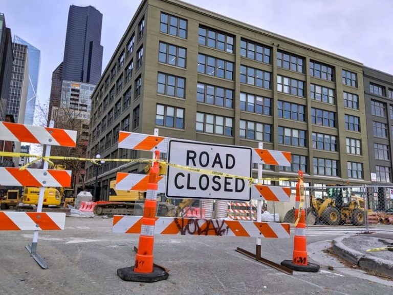
“We’ve had the highest number of tower cranes than any other US city for years,” said Jennifer Pettyjohn, senior planner at City of Seattle. “If you’re walking around downtown, you constantly have to cross streets because the sidewalks under the cranes are closed. We’re suffering from kind of a collective PTSD of construction.”
The constrained topography of the city fosters density.
“We’re a very small city,” Pettyjohn said. “Austin is three times bigger than us geographically but with only a slightly larger population.”
The state of Washington passed the Growth Management Act in 1990, stipulating that fast-growing cities and counties complete comprehensive plans and regulate development to guide future growth.
“When you’re in the city, it feels like a city, and when you’re in the country, the farmlands and open space are still there,” Pettyjohn said. “That wouldn’t be the case if we hadn’t done comprehensive planning.”
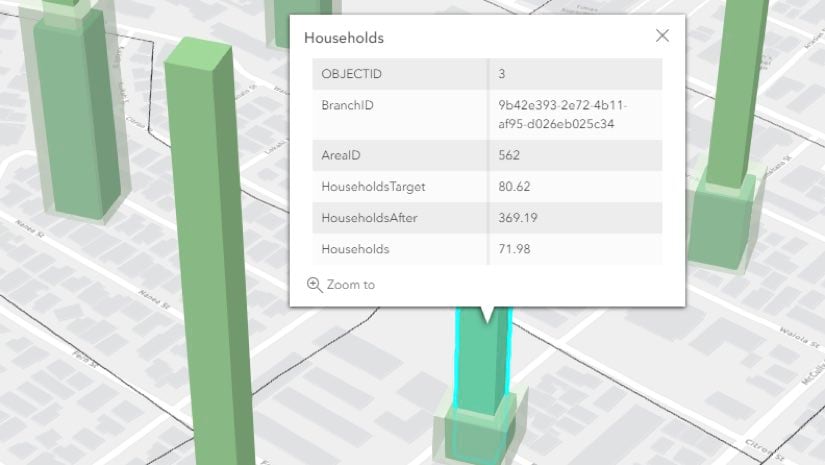
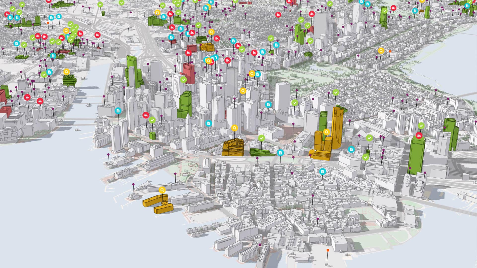
The growth management legislation also requires an inventory of available land every seven years. The buildable lands inventory measures development and reviews resultant population densities against the prior plan’s growth forecast.
“It’s an exercise for each jurisdiction to look at its land base, what’s currently there, and what restricts growth,” Pettyjohn said. “We then layer our zoning regulations on top to understand where we can put more people. If we find that we don’t have enough room, then we need to look at zoning changes.”
Some neighborhoods are more growth constrained than others.
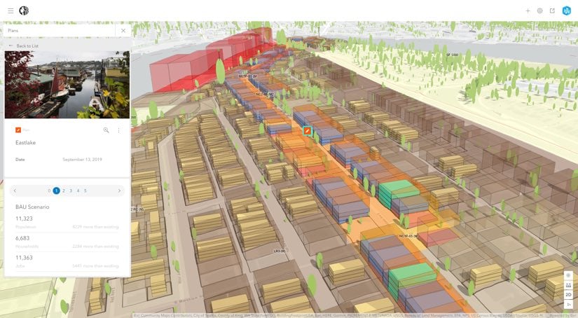
Seattle’s fastest growing area, South Lake Union, is where Amazon grew up. Development driven by Amazon is a hot topic among citizens and city leaders who want to gauge impact on housing prices, the job market, homelessness, and other issues.
Before becoming a hub for coveted technology jobs, the area Amazon now occupies was once dotted with low-lying buildings that served light manufacturing and warehousing businesses. Microsoft’s cofounder Paul Allen and his investment company Vulcan owned a great deal of land in the neighborhood. The relationship between the two companies radically transformed the area.
“I have worked for the city for 30 years, and I’ve lived here longer than that,” Pettyjohn said. “I walk around the neighborhood now, and I get lost because everything is so different there.”
As Amazon grew, it needed more space and eventually built three skyscrapers in the area.

To meet the state mandate of increasing housing capacity while protecting resources and controlling urban sprawl, city officials rely on zoning as a primary tool to guide density decisions.
The neighboring state of Oregon recently banned single-family zoning as a means to guide greater density, which yields efficiency in infrastructure use and lower housing costs. Critics of single-family zoning point to diminishing housing affordability, increasing carbon emissions, fewer economic opportunities, and worsening sprawl.
In its effort to create more housing choices for people of all incomes, Seattle passed a zoning change that allows for taller building heights and requires developers to create affordable housing.
In recent years, Seattle has pursued several strategies to encourage more accessory dwelling units (ADUs) in single-family neighborhoods, including removing regulatory barriers, streamlining the permitting process, and piloting an affordable financing tool. These take many forms, such as garage or basement conversions, backyard cottages, and additions often called mother-in-law suites. ADUs can provide new, space-efficient rental homes in neighborhoods where housing is often unaffordable to most people. And for their owners, ADUs offer flexibility to meet changing household needs or generate supplemental income. The goal has been to make these benefits available to a wider range of residents.
“We have to do some creative thinking to understand the implications of the new zoning rules,” Pettyjohn said. “As we get into our next planning phase, there’s going to be some reflection to learn the impacts of what we’ve done in the past.”
In the mid-1990s, Seattle established an urban village zoning plan that called for greater concentration around commercial and higher-density residential development. This move fostered investments in public amenities such as transit, parks, and community centers in each urban village.
“During that time, we gave each community the money to hire their own consultants, and we gave them access to our data and [geographic information system] GIS to guide plans that were important for each community,” Pettyjohn said. “We then folded all the recommendations back into the comprehensive plan.”
Recent revisions to the buildable lands reporting requirement have prompted state officials to ask city planners why specific properties were redeveloped. That’s a tricky question, requiring planners to dig deeply into the history of every parcel that has changed.
“Because we’re a city that’s already built out, individual property decisions guide all growth,” Pettyjohn said. “We’re talking to developers and property owners to look at data to understand why properties have redeveloped in the past.”
There’s also a need to understand the impact of new development and what happens to people and jobs when buildings and neighborhoods transform. The impact of gentrification and whether it factors into the growing homelessness problem are of particular concern.
“We’ve had to bring in a much deeper understanding of the demographics of people in an area,” Pettyjohn said. “We’ve created things like a displacement risk index to understand the pressures on each community. For the first time a rezoning plan will include analysis of the jobs created and workforce requirements through an equity lens. We also look at our education system and job training to connect growth in employment back to our citizens.”
Seattle plans to share its technical and methodological advancements with its regional peers to help them compose their buildable lands report. Having both a visual and quantifiable backdrop for long-range planning will help the region balance growth with social equity.
“We’re really hoping that the framework that we build with the technology can help other jurisdictions down the road,” Pettyjohn said. “The concepts are generally the same, although we all approach it a bit differently. The tools and parameters are flexible enough for any jurisdiction.”
Learn more about Esri’s smart city planning solutions.