Canadian Scientists Collaborate to Map Biodiversity and the Human Footprint
By Ryan Perkl
Every year, the Alberta Biodiversity Monitoring Institute (ABMI) sends more than 60 field technologists across the province in a massive effort to collect samples of biodiversity. They measure habitat characteristics at monitoring locations from a province wide grid of 1,656 randomly selected sites.
For more than a decade, this unique undertaking has involved ABMI field and laboratory staff entering data into a geographic information system (GIS) about the characteristics of habitats and species of plants and animals found. This is a large inventory, mapping, and monitoring effort that many governments have talked about, but few have been able to build. Thanks to the long-term commitment of the Government of Alberta and a consortium of scientists, knowledge of biodiversity and impacts continue to grow.
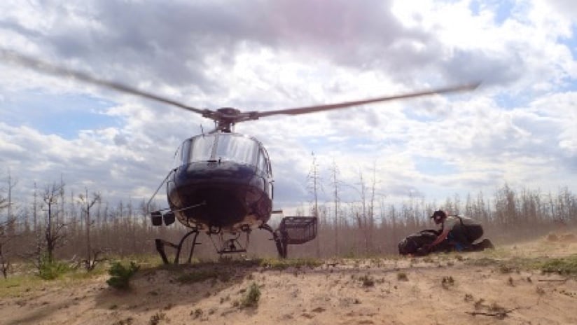
ABMI’s appetite for data is omnivorous, encompassing everything from soil microbes to apex predators. ABMI equips its field technicians with mobile devices and trains them in scientific sampling methods and backcountry skills. The months-long field deployment may involve daily commutes by helicopter to get to the remote areas where samples are needed.
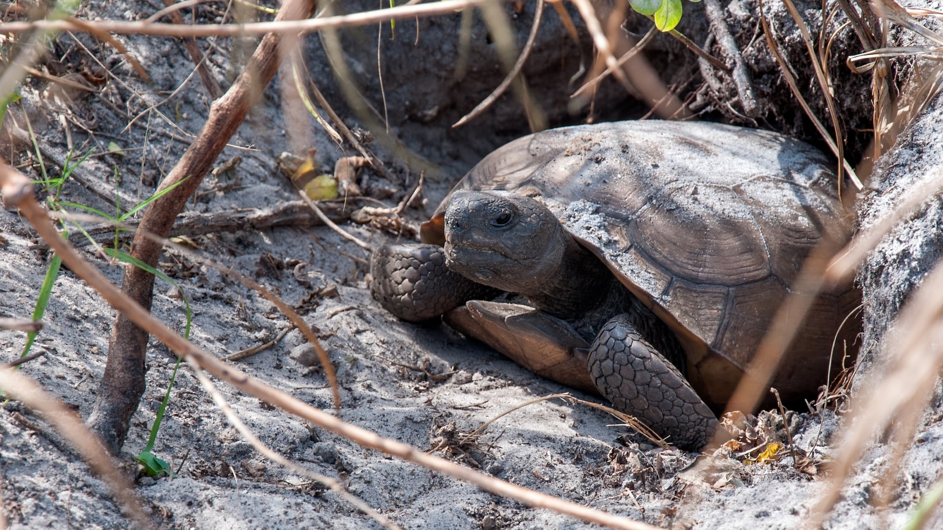
Since its inception in 2007, ABMI has captured measurements in all the different ecosystems across the province of Alberta, from the grasslands in the south to the boreal forests in the north. ABMI collects data on a range of species (plants, animals, birds, and more) and maintains records on more than 3,000 species. More than 1 million specimens have been processed, yielding discoveries of several species new to science.
The resultant data is used in a variety of ways including to formulate regional and subregional plans, evaluate development impacts, and fine-tune sustainable practices. It’s also been used by local governments to guide urban expansion.
Collecting the Facts to Mark Change
ABMI is a scientific partnership between InnoTech Alberta, the University of Alberta, and the University of Calgary. The biodiversity work had been under way for seven years when funding came from the Alberta Ministry of Environment and Parks (AEP) to establish the Alberta Human Footprint Monitoring Program (AHFMP). The program is a joint effort between AEP and ABMI to map and monitor land transformation and assess the impact of human development over time.
“There was a lot of discussion early on about how we brand the initiative,” said Jim Herbers, executive director of ABMI. “Words like human disturbance would automatically alienate half the people we want to work with. So, we landed on the term human footprint. It talks about the activity, the changes to the landscape, in a value-neutral way that is inclusive.”
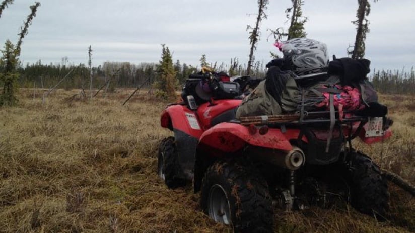
Helicopters, ATVs, and the amphibious all-terrain vehicle called the Argo are used by the field team to reach monitoring locations. (Images courtesy of the Alberta Biodiversity Monitoring Institute.)
...
...
There are sensitivities in Alberta—as anywhere—about capturing the facts and not coloring them with a bias that favors or disfavors any one industry or people, including Indigenous groups.
“We need to understand everything that’s happening on the land surface, from natural dynamics to land-use-driven changes,” said Jahan Kariyeva, director of the Geospatial Centre at ABMI. “Although we’re not making or proposing land-use decisions, we use the data to assess how the habitat has changed.”
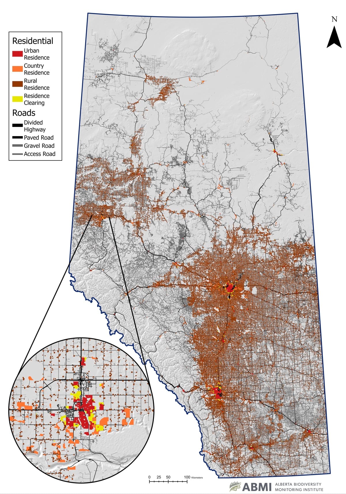
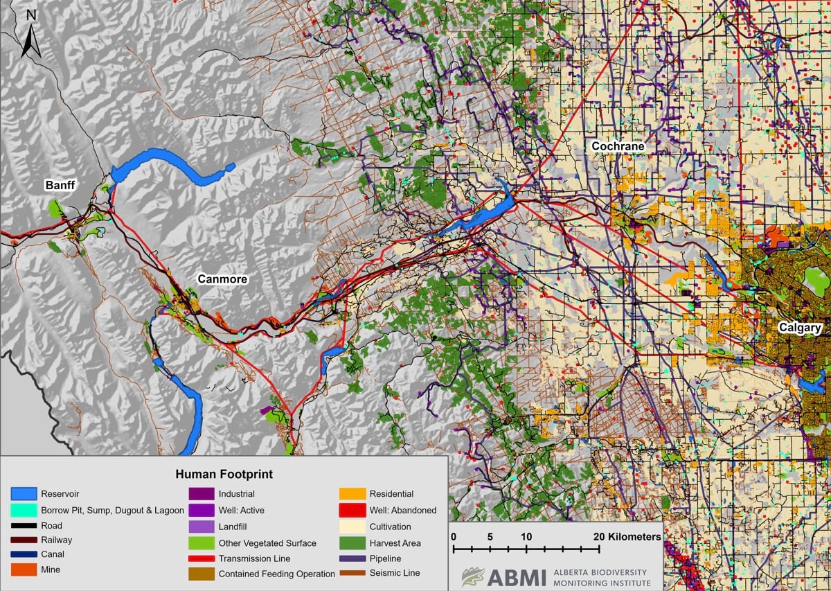
Including the human footprint in ABMI’s province-wide monitoring efforts meant adding data in GIS that denote human activity—reservoirs, roads, railways, mining, timber harvesting, oil and gas, and industrial sites. Prior to AHFMP’s creation, the human footprint was only captured for project sites and a few study areas. There was also a lack of sustained monitoring and standardization regarding what constitutes the human footprint.
Fit for All Purposes
From the oil and gas sector, AHFMP has gathered the footprint of over 350,000 well pads and 308,000 kilometers of pipeline corridors. Users of ABMI data can examine these features to gain an unbiased picture of how humans have changed the land over time. The data supports all questions and eliminates the more nuanced record keeping of different domains, such as how a forest access road might be recorded. In the AHFMP database, evidence of the road will always remain even if it is now unused and overgrown.
“We work with stakeholders to see if we can incorporate their data,” Kariyeva said. “If it’s not possible or feasible, we reach out to subject matter experts to verify and validate our work.”
ABMI makes the data available for free in multiple formats to be explored and queried by domain experts, policy makers, and anyone interested. For everything it records, ABMI provides the raw data that anyone can search and download by species and habitat.
In addition to data of what’s on the land, ABMI has developed a number of province-wide data products about the land that can be explored using GIS. This includes map layers about soil and climate and a recently completed wetland inventory.
“ABMI and Ducks Unlimited Canada developed a partnership and recently invited Alberta Environment and Parks to join us,” Kariyeva said. “Together, we all work toward one single wetland inventory that supports everybody’s needs.”
ABMI's sampling sites are all across the map, and kept private to protect the science. This photo of the historic site of Head-Smashed-In Buffalo Jump shows the typical southern Albertan prairie, and depicts an early human use of the land.
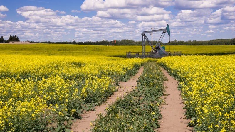
Here, the human footprint includes this well pad and a field full of canola.
Albertan mountain terrain is represented here by the beautiful Moraine Lake in Banff National Park, seen here on a snowy morning.
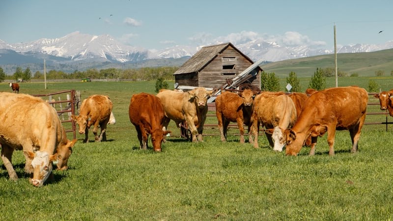
The human footprint includes agriculture, such as this cattle ranch.
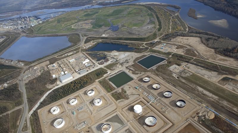
More intense land use is shown here in the oil sands
Classifying Location Data to Ask Questions
ABMI works to turn its data into knowledge through products like the Status of Human Footprint in Alberta report. The data supports queries about the impacts of different industries on different types and classes of species. It’s also used to perform cumulative impact assessments for specific industries.
A recent project assessed the impact of beef production on biodiversity in Alberta. Other projects take longer, such as monitoring caribou and rare animals in Alberta’s boreal forest. In the ecological recovery realm, ABMI assesses regeneration of disturbed areas to understand how quickly the forest recovers after disturbance.
The data helps to answer many questions about human activity or to isolate and remove human activity to better understand natural processes and disruptions. ABMI’s Biodiversity Intactness Index does just that: it compares the concentrations of species across regions to predict the abundance of species if there was zero human footprint.
In a recent development, the data may inform several subregional plans that involve broad stakeholders, including industry and Indigenous groups. The effort involves gathering more granular data about the human footprint.
Through the ABMI effort, and the partnerships across multiple stakeholders, Albertans have gained the ability to answer questions about biodiversity and how the human footprint has affected the surroundings.
Dr. Perkl is Esri's green infrastructure lead, the ArcGIS GeoPlanner product lead, the industry practice lead for geodesign and planning, and a principal consultant in the Professional Services Division. He provides thought leadership throughout Esri and manages a wide portfolio of high-profile environmentally focused consulting projects.