December 16, 2019 |
Scot McQueen | Natural Resources
The revolution of precision agriculture—with its continuous mapping and monitoring of crop needs and drone-guided planting, weeding, and fertilizing to improve crop health—has arrived in the forest.
Just like farmers use mapping to optimize growing conditions, foresters can apply sophisticated tools to better plan and manage the forest.
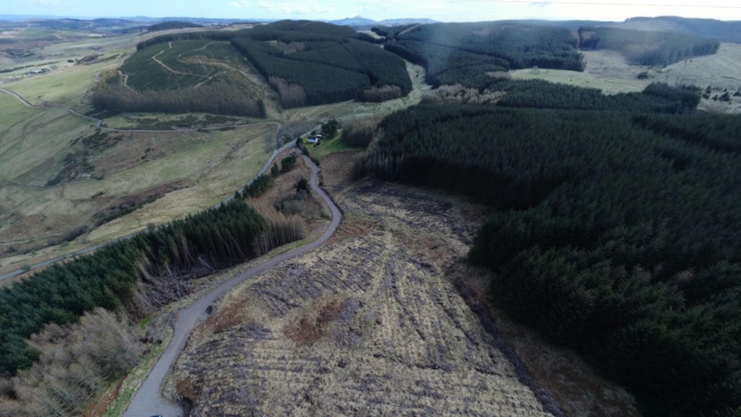
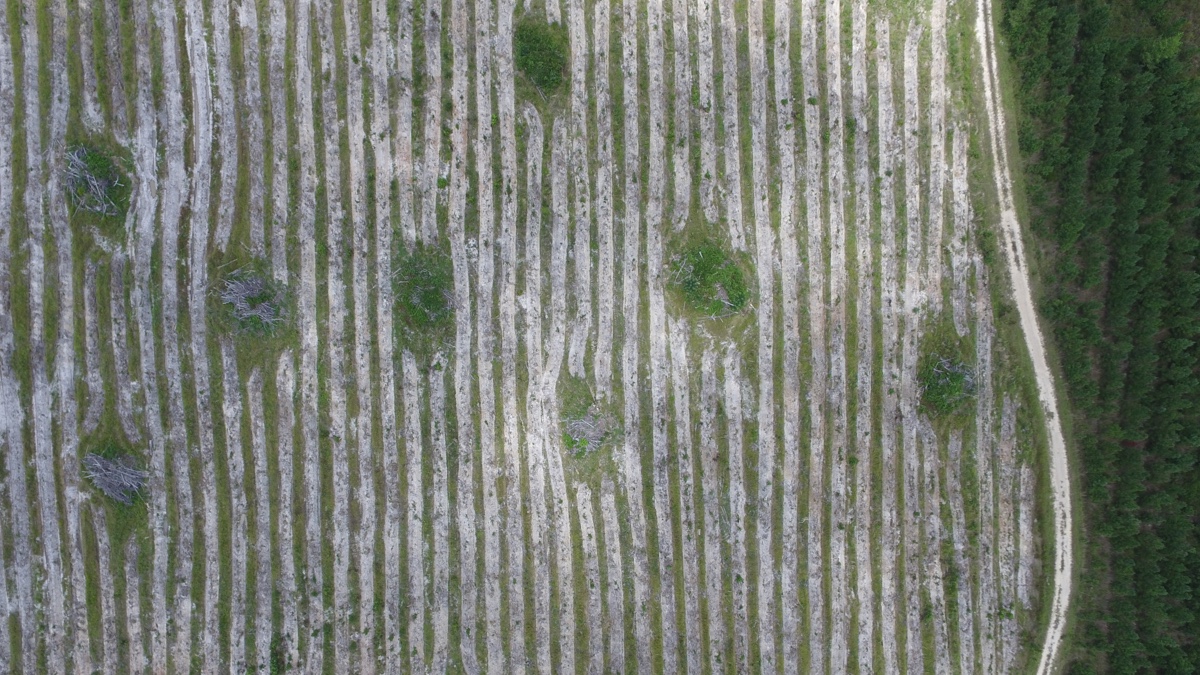
F&W Forestry Services, for one, applies a geographic information system (GIS) approach to assess the health of clients’ forests and maximize lumber yield. F&W’s forest consultants are increasingly using drones to capture details to guide forest management plans and to simply provide a top-down view of the forest.
“Landowners can see the quality of the work from the air,” said Bryan Croft, regional manager at F&W. “And they learn a little bit more about their property too.”

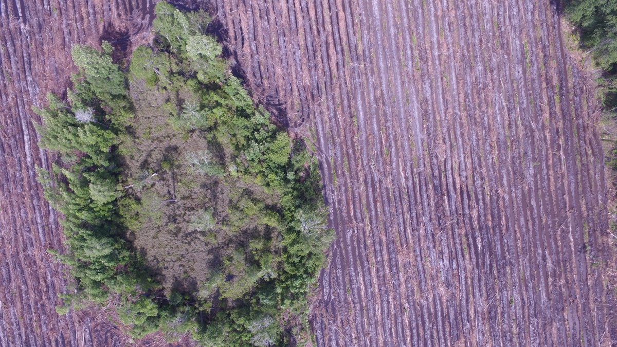
F&W manages hundreds of thousands of acres of privately owned yellow pine plantations in southeast Georgia and northern Florida. Much like farming, it’s not a plant and watch practice; much can be done to improve the health and yield of each tree. The company does a lot of mechanical work, guided by maps, including dragging a drum chopper behind a tractor to knock down brush, preparing seedling beds by mounding topsoil in rows, and spot raking to increase bed quality.
Each of these tactics has been shown to improve yield, sometimes dramatically. One study from the 1970s showed a 76 percent increase in pine growth with a program of fertilizer and bedding. That impressive yield led to the quick spread of the practice. Yellow pine forests have been farmed for the past 200 years in the region known as America’s wood basket, and it didn’t take long for tree farming practices to spread. Many owners apply all these practices in their highly managed forests.
“We have some of the most productive soils in the southeast,” Croft said. “We can really grow trees fast.”
Pine plantation forests are planted with precision with special tractors that evenly space seedlings. Some are even hand planted for further control and consistency. “All the bedding work is done with GPS, and the beds are very straight, very consistent,” Croft said.
The precision work is guided by maps that F&W creates. The maps contain details about soil type, vegetation health, and topography.
F&W also uses GIS to record all the services it applies to each forest tract. Drone mapping provides owners with an added assurance that the work that was contracted has been applied. “When you’re communicating with a forest owner 1,000 miles away, and you’re telling them, ‘Hey, it rained six inches yesterday, there’s water flowing down the road, and it’s too wet to work,’ it’s nice that you can fly up above and take a picture to show them,” Croft said.

Drone mapping provides other important capabilities that F&W consultants are just beginning to exploit.
“Using the drone to quickly take a couple of shots for our inspection reports has been an eye-opener for a lot of landowners,” Croft said. “In today’s real-time world, the quicker you can get information out that’s accurate, the better off you are.”
The flexibility and low cost of launching a drone and the data drones can gather are why they’ve become essential to field operations at F&W and elsewhere.
“We’re flying drones in the southeastern United States out to Arkansas, Texas, the northeast around New York and Vermont, and we’re flying a lot in the United Kingdom,” said Collier Kidd, a GIS and mapping specialist at F&W who also manages the drone mapping program.
In June F&W had its busiest flying month with 119 flights, because it’s easiest to see forest health before the heaviest growing months of summer. Kidd estimates that the F&W team has flown more than 50,000 acres since the drone program began in earnest a few years ago. The drones provide imagery and mapping for site prep work and maintenance and to prepare for planting season. They also help plan for harvest, which occurs year-round, depending on the market and the interest of the owner.
“Most landowners are growing timber to around aged 20 to 25 years, before clear cutting and starting a new plantation,” Croft said. “We’re thinning timbers as early as the age of 8, and often do a second thinning after 16 to 18 years.”
F&W planted roughly 24,000 acres last year for clients in Croft’s region, which equates to roughly 38 square miles of new forest, to meet the demand for lumber to build housing and other structures.
Croft credits F&W’s growth to adding mapping and drone imaging capacity to its consulting services.
In F&W’s real estate business, the imagery and point clouds captured of forest tract are often enough to convince a person to buy. “If you’ve got somebody interested in a property we have for sale in Virginia, but they live in Texas, you can save them a trip to look at the property. The imagery is that good,” Kidd said. He sees a future in using the drones for marketing materials and connecting with potential buyers.
Croft has hopes for more 3D viewing of the land and trees and the ability to analyze how trees respond to treatments.
“I think there’s potential to jump into changes in leaf area index after fertilization applications and maybe even seeing changes in foliage color to forecast growth and yields,” Croft said. “The holy grail would be the ability to conduct an inventory without sending a forester.”
For Croft, the convenience of a drone to cover more ground and gather more input is probably the most important factor.
“On those days when you want to look at something off in the distance, and it’s either 100 degrees or it’s knee-deep in water, it’s a nice tool to have,” he said. “You can never really predict when those days will come, so it’s good to have it in the truck with you at all times.”
Learn more about how GIS helps maximize the value of timber assets.