

April 2, 2024 |
Geoff Wade | Natural Resources
Mining is often measured in what comes out of the ground. For Freeport-McMoRan, a quieter accounting runs in the other direction—the long work of identifying where past industrial activity may have affected surrounding communities and making it right. That work demands precision, persistence, and a data infrastructure built to last for decades.
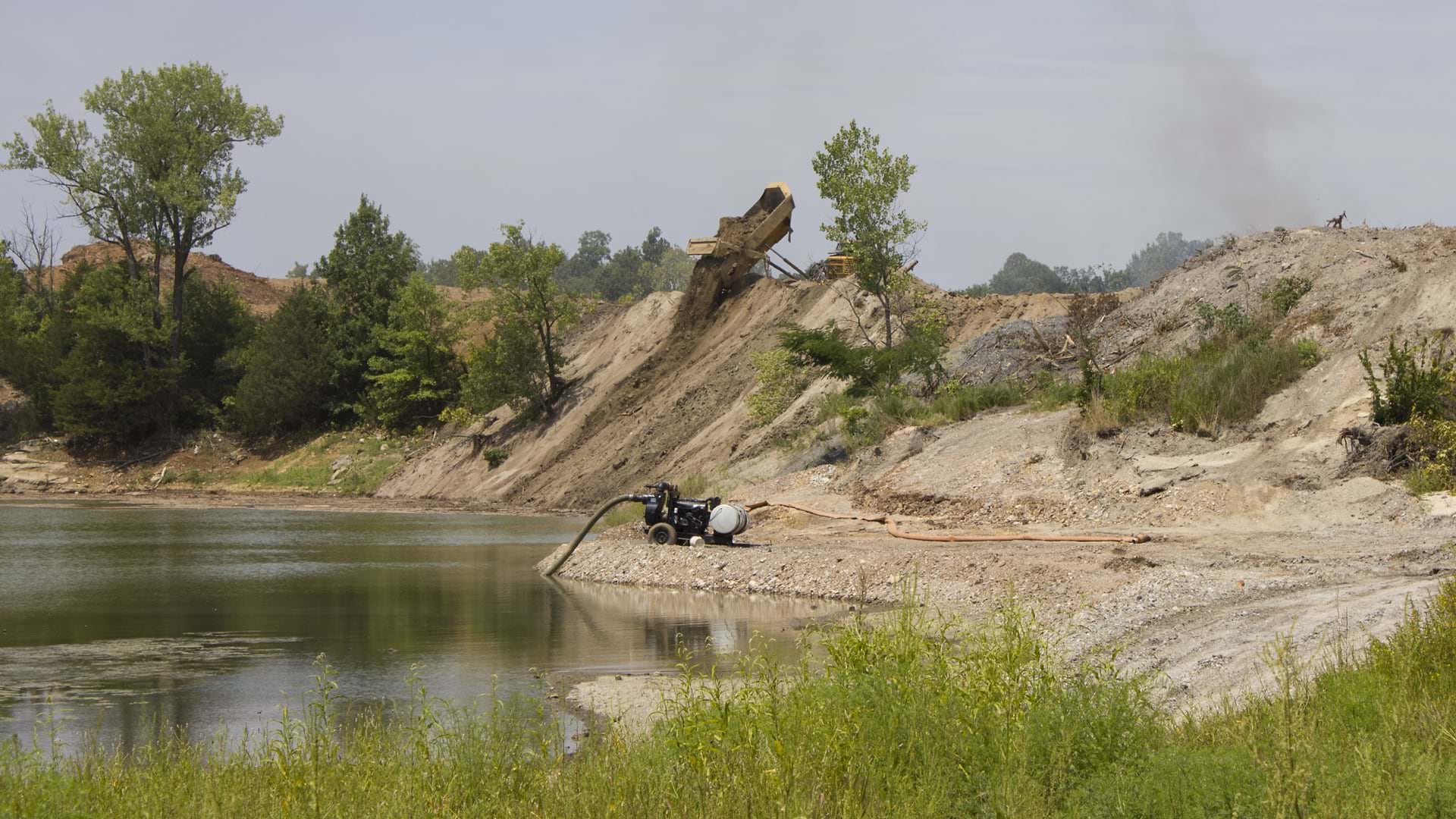
Freeport calls this work townsite remediation. It involves assessing and cleaning up residential areas near legacy sites that the company acquired through past mergers, under state or federal oversight. The contamination in these cases is typically airborne. Metals carried downwind from smelter stacks settling into the soil in nearby neighborhoods over years of operation. Environmental standards have tightened substantially since those operations were active.
Freeport’s program works through communities methodically—knocking on doors, requesting access, sampling soil, and removing material where the chemistry calls for it. When the work is done, yards are restored, soil is replaced, patios are restored or landscapes are replanted. Properties are returned to residents in better condition than when they were found.
The company manages many active sites, each involving hundreds of residential parcels and environmental consultants in the field. Bryce Romig, who manages Freeport-McMoRan’s remedial project programs across multiple states and jurisdictions, describes the data as something that has to live on a 50-year timeline. Records, workflows, and decades of property history—all in one place. He calls that priceless.
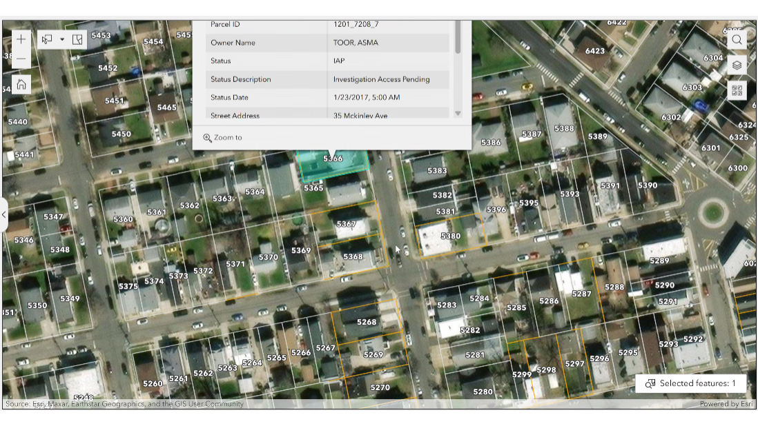
That system is TIA, the Townsite Information Access platform, rebuilt as part of a broader shift toward enterprise GIS at Freeport. Records had existed in many places: scanned paper from former programs, databases managed by outside consultants, and an earlier digital platform built on an aging architecture. By moving everything onto systems it owned, Freeport solved two problems: keeping the data accurate and accessible for decades.

The task of rebuilding TIA landed in the hands of Joshua Dunsmoor almost immediately after he arrived at Freeport. A software consultant by background, he’d spent years building GIS applications and was confident Freeport could bring the work in-house.
The earlier system was parcel based but lacked map context, requiring a unique identifier before anything could be found. The new TIA puts every parcel in geographic context, allows field teams to navigate on a map, and connects the spatial layer to the full depth of data beneath it.
GIS and geology both examine the earth in layers. Sediment, fill, contamination, and time each tell part of the story of what happened and when. GIS adds the built environment on top: property lines, structures, land use, and the neighborhood that grew up around a former smelter stack. That shared organizing principle makes geospatial technology a natural fit for mining and environmental work, where the ground itself is the record.
In practice, field data flows back in real time. Consultants inspecting a property use the ArcGIS Survey123 app to capture the condition of the exterior, interior surfaces, vegetation, and hardscape—all geotagged and tied to that parcel. When soil sampling begins, workers use ArcGIS Field Maps to mark the precise location of each excavation, dropping a pin at every hole. Samples are sent to labs under a chain-of-custody workflow tracked in the system. Results flow back into the same platform, flagging exceedances relative to threshold cleanup levels and triggering the next step. “All of it ends up back in this dashboard,” Dunsmoor said. “It’s end to end.”
TIA holds the full paper trail of the homeowner relationship: permission to access a property, sampling results, signed work plans, and confirmation of completion. TIA also records promises made and kept, along with a property-by-property account of completed work.
That record matters in ways that only become clear over decades. Environmental cleanup standards shift as science evolves and regulatory agencies update their guidance. When a site cleaned years earlier comes up for review under new Environmental Protection Agency (EPA) guidance, a company needs to know exactly what was done, parcel by parcel: Where was soil removed, what chemistry was left in place, and which properties were sampled and which were not?
Romig’s team can answer all of it. “We’ve got that catalogued,” he said, “in a place where we can access the universe of unsampled properties, sampled properties, properties cleaned to a particular standard, and properties where we may need to go back.”

The system also captures gaps. When a homeowner declines access, that property is noted. If standards tighten and the program returns to a community, those are the first addresses on the list. When a recent call came in about a property the program had worked on years earlier, Freeport pulled up the record: soil values, the work completed, and when it was done.
The GIS layer also let Freeport look ahead. Freeport can model what happens if cleanup standards change: which parcels need work, and what that work would cost. TIA now supports management briefings and regulatory conversations. What began as a document warehouse has become a planning tool.
That growth reflects how Chris Franks, director of land resources at Freeport-McMoRan, anticipated the value the platform would bring. He participated in the company’s GIS architecture from the start, solving real problems for specific teams and letting results build the case. “We’re using GIS and geospatial technology as the center point of doing the work, displaying the work, and collaboratively sharing, which creates better and more informed decision making.,” Franks said. What started with a handful of GIS users has grown to more than 1,500 across Freeport’s operations, with TIA among the most concrete examples of what that platform can support.
Out in the field, the work continues. More than 250 contractors operate across multiple states under this program, performing inspections, sampling, and excavations in residential backyards where that information is kept private. Romig said he feels fortunate to have spent his career getting communities cleaned up, one property at a time. What keeps him most attentive is the people doing the physical work, as contractors across a dozen states are out of direct sight. The system documents what they do. Keeping them safe is the other half of that obligation.
Learn how mining companies use GIS across the full life cycle, from mineral exploration to mine remediation.