
May 2, 2023 |
Anthony Schultz | Public Safety
August 19, 2025
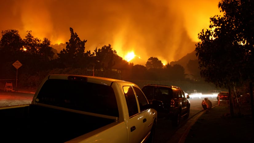
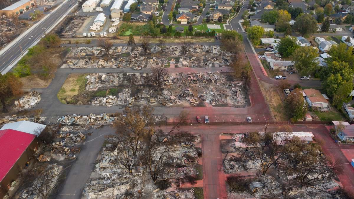
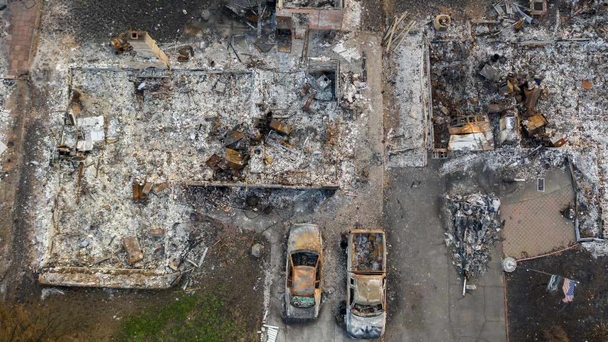
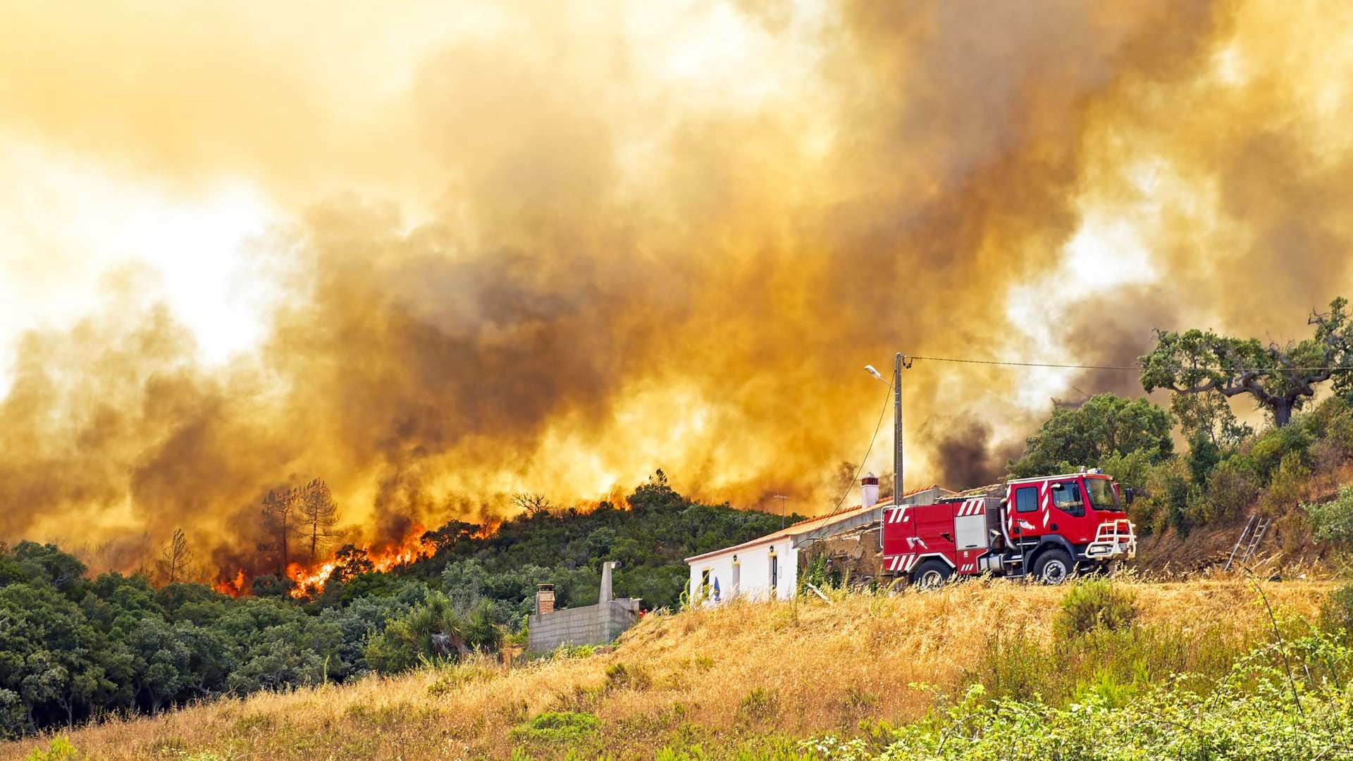
The deadly Los Angeles wildfires that claimed 30 lives, destroyed 15,000 structures, and burned 37,000 acres in January 2025 forebode Southern California’s year-round risk. Rugged terrain, fierce winds, and prolonged drought have made more intense fire occurrence the new normal—and unified first responder coordination a matter of life and death.
At least four million California residents live in hazardous areas, according to recent analysis from California’s Department of Forestry and Fire Protection, known as CAL FIRE.
Now, three Southern California sheriff’s departments—in Orange, Riverside, and San Bernardino Counties—are working together to hasten fire evacuations and heighten situational awareness. Each has developed mobile apps powered by geographic information system (GIS) technology for location-specific public safety. They share a common GIS toolbox and goal: using location intelligence to act faster and communicate better.

For years, evacuations had Orange County Sheriff’s Department (OCSD) deputies shuffling paper maps, handwritten forms, and radio chatter.
“It was challenging,” said Charles Volkel, assistant emergency manager. “You’d hear radio traffic and have no idea where people were evacuating.”
To nonresidents, Orange County might conjure images of beaches and palm-lined streets. But inland, the terrain shifts—steep slopes, winding canyons, and dry brushlands border the Cleveland National Forest. People who live in these wildland-urban edges face the greatest threats. The county’s long and complex street names only add to the confusion.
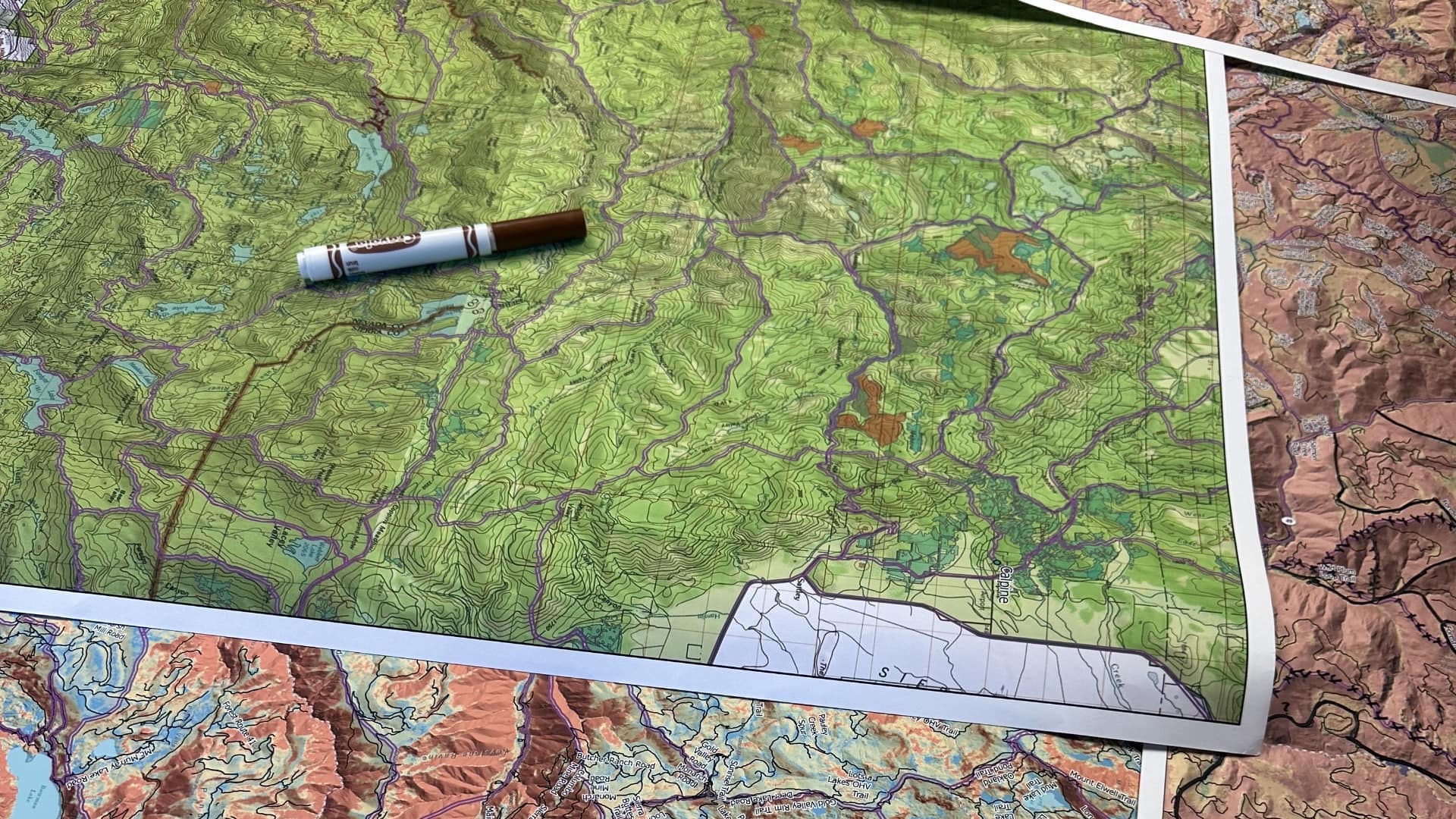
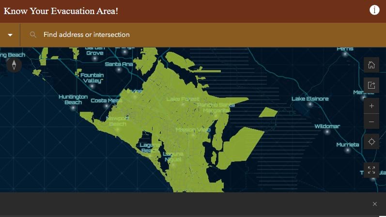
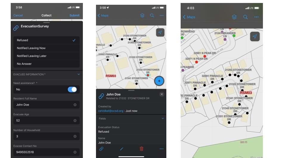
These challenges prompted OCSD to create an evacuation app to modernize communication and reduce duplicated efforts. The turning point came after the 2018 Holy Fire, which burned for 151 days, forcing the evacuation of 20,000 residents. Working with OCSD’s technology division, Volkel and a colleague created a countywide set of evacuation zones. These zones were drawn along natural boundaries and major roads. Each zone got a simple code, like LGW-01, so everyone spoke the same language.
“The goal was to streamline communication. If a dispatcher, deputy, or firefighter said, ‘LGW-01,’ everyone—from deputies to management to dispatch—would know exactly what area was under evacuation,” Volkel said.
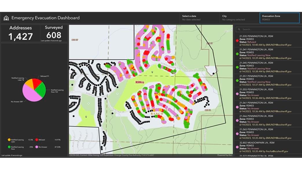
Next, the OCSD evacuation app enabled deputies to log evacuation statuses with locations in real time. Deputies could mark homes as no answer, leaving now, or refusing to go with color-coded responses to update live dashboards. The dashboard is accessible to Emergency Operations Center (EOC) staff and executives, preventing duplicate efforts and guiding strategic resource allocation, such as flagging whether a household needs evacuation assistance. The dashboard also provides critical documentation and after-action reviews.
“We were able to archive data, track refusals, and show exactly who was contacted and when,” Volkel said. “That’s huge for both public safety and accountability.”
The evacuation app was beta tested in functional exercises across cities like Yorba Linda and Rancho Santa Margarita, including rural areas with limited cell coverage. Tests confirmed the app would store data locally when offline and sync once reconnected, ensuring progress is monitored regardless of internet connectivity.
Since its success during functional testing, the app has been used for large-scale wildfires, flood evacuations, and smaller incidents like barricaded suspects or shelter-in-place orders. Field units and command post personnel were able to share evacuation maps for increased awareness and collaboration.
“It’s about everyone working from the same sheet of music,” Volkel said.
Public communication is also built into the app. Residents can identify their zone and current evacuation status using the app’s public-facing address locator.
The department is even exploring the idea of placing zone stickers on trash bins to boost awareness for residents. Future app enhancements include integrating drone imagery and GPS tracking of patrol vehicles for advanced situational awareness.
Just east of Orange County, Riverside County spans deserts, mountains, and densely populated suburbs, each area with its own evacuation challenges. Before GIS, police dispatchers would manually log hundreds of radio calls into their computer-aided dispatch (CAD) system, often missing or garbling critical updates. When an evacuation was ordered, the Emergency Management Department would send alerts to personnel via text or over police radio. Deputies had to go door to door, calling in updates over the police radio. Dispatchers manually entered addresses and notes into CAD.
“They’re getting hundreds of calls in quick succession, and a lot of things would get missed,” said Chase Van Schoonhoven, GIS analyst for the Riverside County Sheriff’s Department.
This changed after the 2022 Fairview Fire burned 28,000 acres, killing two people. Van Schoonhoven was called in to create paper maps for deputies to check off as they cleared homes. The experience sparked a broader conversation: How could they use technology like GIS to improve the process, reduce radio traffic, and track events in real time?
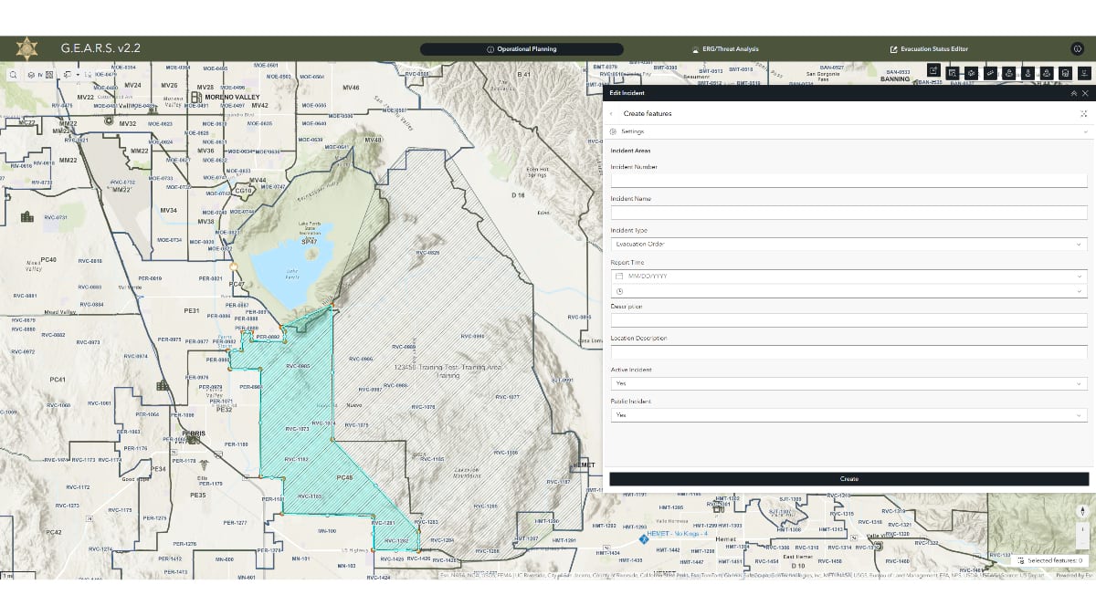
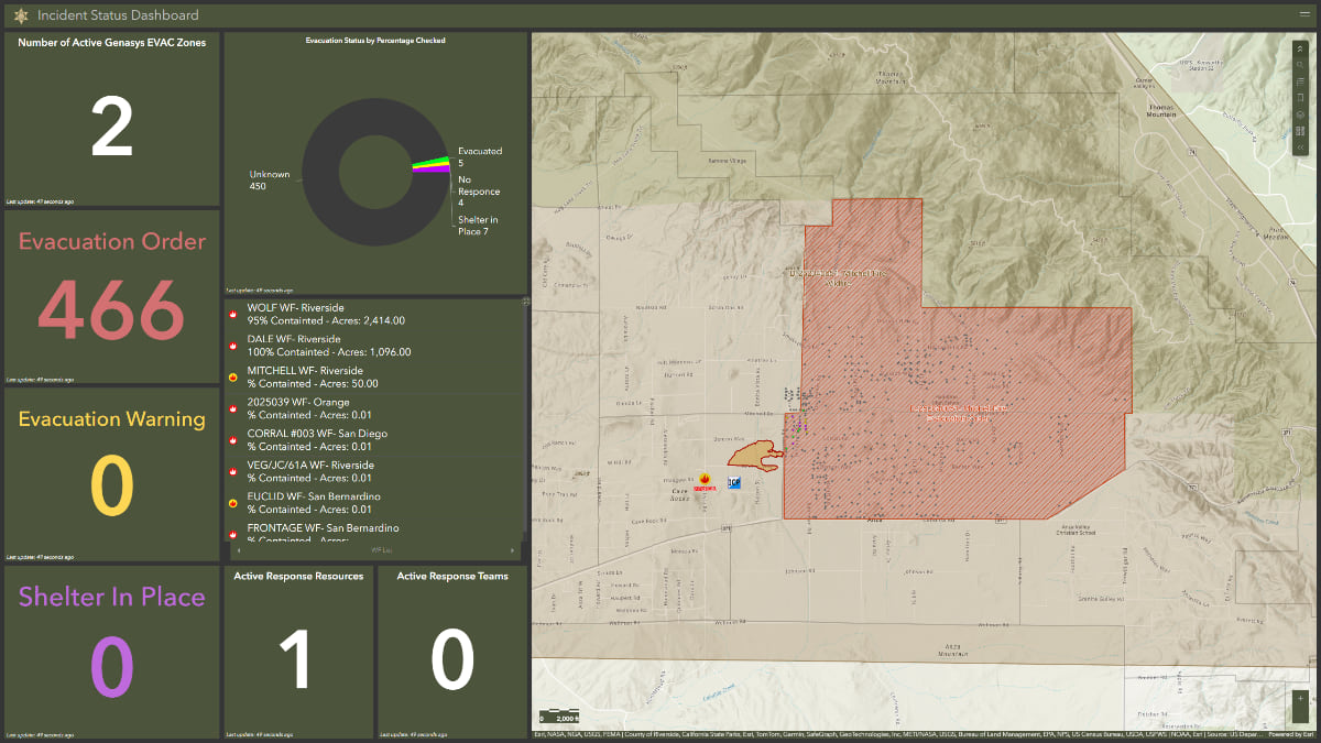
The result was GEARS—short for GIS Emergency Applications for Sheriff’s Response. This secure web application helps deputies, dispatchers, and emergency teams coordinate evacuations and share real-time updates with neighboring Orange, San Bernardino, and San Diego Counties.
“We wanted something simple that deputies could use in the field and that we could also share with other counties,” Van Schoonhoven said. “Fires don’t care about jurisdictional boundaries.”
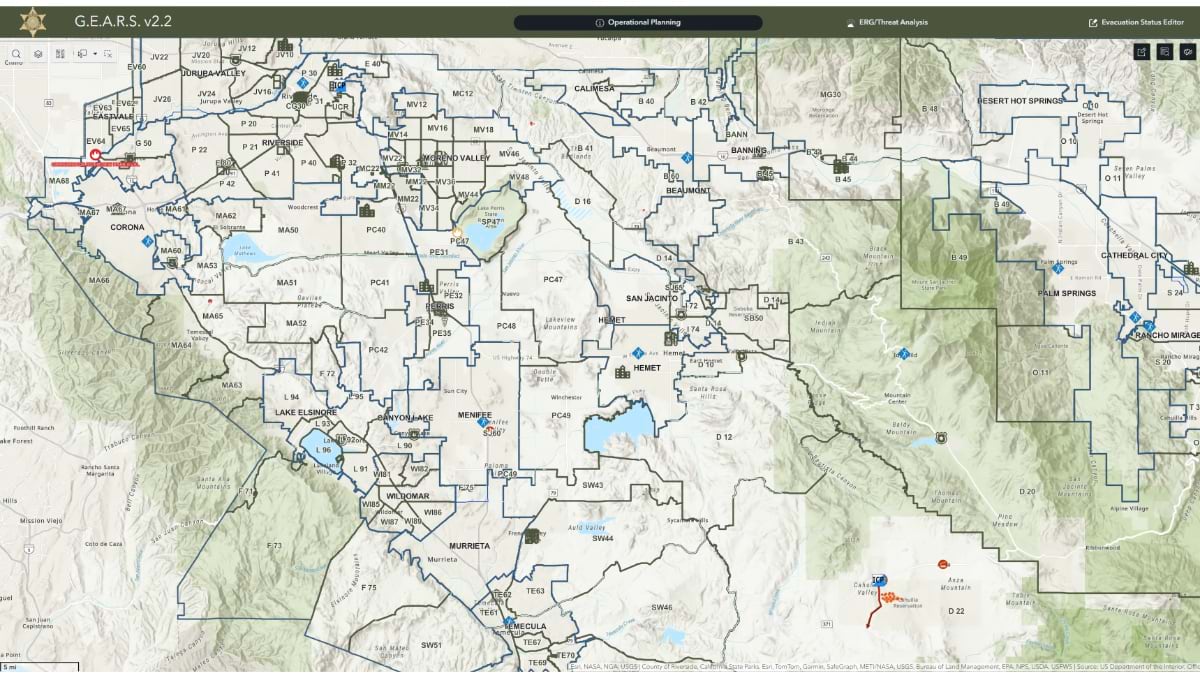
Now, when an evacuation zone is activated, the GEARS app automatically pulls in address data for the affected area. That information forms the foundation for field operations and briefings.
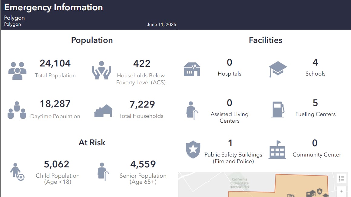
The app also equips emergency teams with solutions for planning response zones, analyzing threats, and tracking evacuation progress. Crews can map fire perimeters, road closures, and staging areas, while built-in tools estimate how many people and critical facilities are in the fire’s path. A status editor allows dispatchers to update which homes have been evacuated, refused to leave, or still need to be contacted.
Increasingly, these updates are made in the field. Deputies use mobile devices to mark statuses, with their real-time locations tracked for coordination and safety.
“We tried to make as many options as possible so that even the most technologically unsavvy person can get this done,” Van Schoonhoven said.
All data feeds into a dashboard that gives command staff a high-level view of progress, such as the number of homes contacted and the percentage of evacuations completed. One of the next enhancements for the app is the ability to flag addresses where residents may need extra assistance due to mobility challenges, medical conditions, or other factors. The team is also working to digitize how personnel check in and out during large-scale incidents—replacing paper logs with real-time tracking.
“Every incident teaches us something new,” Van Schoonhoven said. “We’re constantly refining the system so it works better the next time.”
Covering 20,000 square miles—America’s largest county by size—San Bernardino County needed something simple. Its vast geography, including popular mountain towns and remote desert communities, combined with a dry climate and flammable vegetation, creates ideal wildfire conditions.
Over the years, the San Bernardino County Sheriff’s Department (SBCSD) has tracked evacuations using paper forms and radio calls to police dispatch. This process transformed when SBCSD emergency services coordinator Frank Kams, inspired by a county fire damage assessment dashboard, asked whether the same approach could be adapted for evacuations.
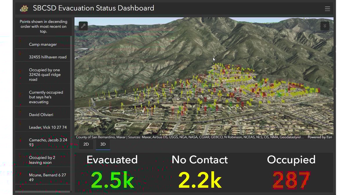
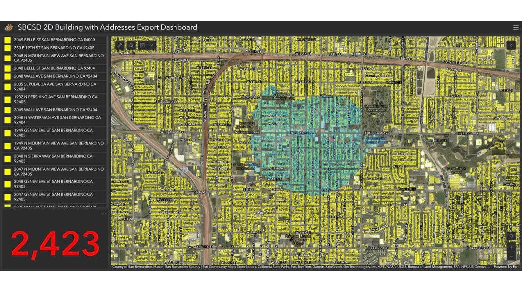
Working with GIS specialist Natalie Campos, the SBCSD team developed a three-button mobile evacuation app deputies could use to report whether a resident is staying, going, or has not been contacted.
“We wanted to keep it very simple, quick, easy, kind of foolproof,” Kams said.
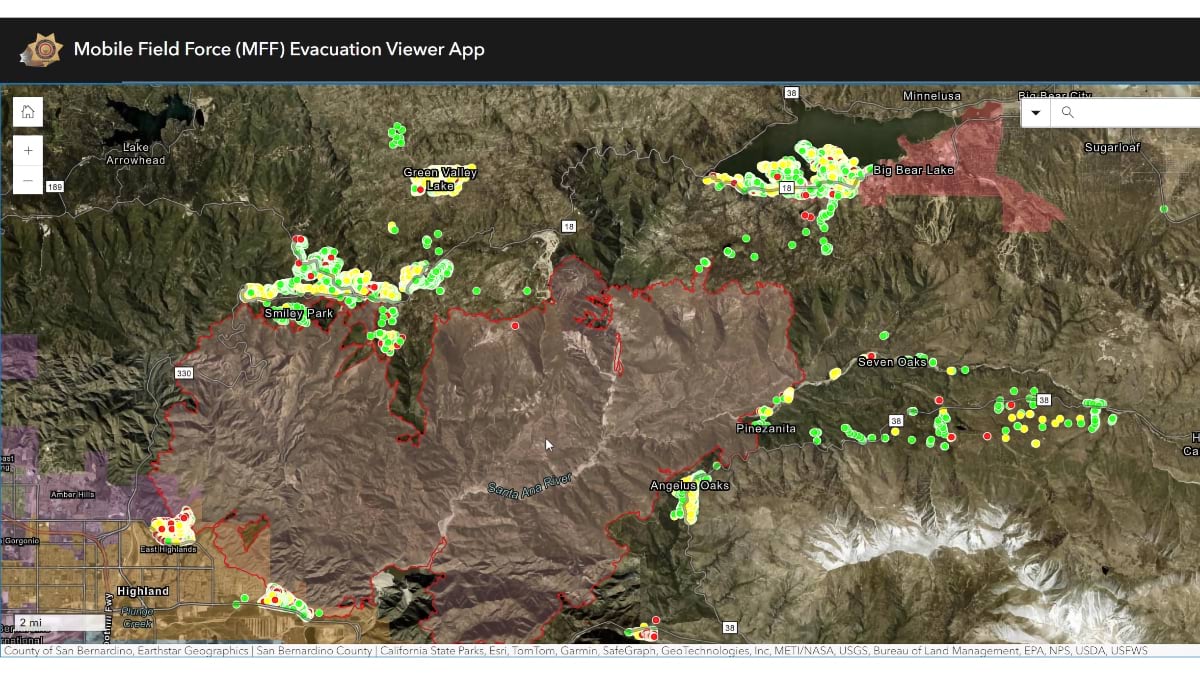
When evacuations are ordered, the app mobilizes deputies from all over the county, including those working in correctional facilities. The data they collect appears in a command post dashboard to help supervisors monitor activity and track progress.
“We could see at the command post that maybe these guys missed a street and then we could redirect them there,” said SBCSD Sergeant Kyle Glozer. Complex terrain makes some of the county’s mountain communities “look like spaghetti” on a map, according to Glozer, which means real-time coordination is essential.
First deployed during the 2022 Sheep Fire, which burned 865 acres near the community of Wrightwood, the evacuation app quickly proved its value. With each subsequent incident, the SBCSD team has enhanced the app. While originally designed for wildfire evacuations, the app has also supported responses to floods and potential mudslides—demonstrating its adaptability as an all-hazards tool.
During a 2024 training exercise with the county’s mobile field force team, Campos and Kams added new capabilities to the app to further support field reporting, including photo capture and note entry.
These features proved pivotal during the 2024 Bridge and Line fires, which ignited the same week and scorched the Angeles National Forest and San Bernardino National Forest, threatening nearby communities. SBCSD supervisors could see their teams’ progress directly from their phones— enhancing situational awareness and reducing the need for radio check-ins. This visibility ensured that personnel could be safely evacuated when fires got too close. Additionally, the app allowed SBCSD staff to track both fires simultaneously using split-screen views on the dashboard.
Another essential element during these fires was the app’s performance in areas with limited connectivity. “Whether they have connectivity or not, our deputies are going to do what they need to do for evacuations,” Kams said.
During app testing in the mountain towns of Big Bear and Mt. Baldy—areas known for limited cell coverage—teams could record data while offline and have it upload automatically. “Just having that data available to us, real time or not, is critical,” Kams said.
The app supports both after-action reviews and public communication. It archives evacuation data and generates public-facing maps that let residents check their evacuation status in real time. The information can also be shared with San Bernardino County Fire and other entities needing to know who is where.
Like Riverside and Orange, the SBCSD team aims to identify residents with special needs or mobility challenges. This will help mobile teams provide better support and allocate enough time for safe evacuations.
“We’re trying to get ahead of things instead of just responding to [hazards] and GIS is 100 percent essential to that shift,” Glozer said.
Southern California agencies know wildfires don’t follow boundaries, so they need shared maps to track them effectively.
For the sheriff’s departments in San Bernardino, Riverside, and Orange Counties, GIS maps have become the common language that connects field teams, command posts, and partner agencies. Whether it’s a deputy marking a home as evacuated, a supervisor tracking progress from a dashboard, or neighboring counties coordinating across borders, maps ensure everyone sees the same picture and works together effectively.
Each department built a custom GIS solution focused on clarity, adaptability, and simplicity. The result: faster response times, lives saved, and coordinated action amid chaos.
Learn more about how agencies can manage wildfire evacutions and other field operations from beginning to end with GIS.