September 25, 2018 |
Esri & The Science of Where Podcast |
Every day, the global population increases by around 200,000 people. Most live in urban areas, so for perspective, imagine a city the size of Seattle sprouting every four days, or a new Tokyo every month. By 2050, Earth is projected to be home to ten billion people. To feed them, we will need to increase crop production by at least 60 percent. Yet climate change, water scarcity, and soil erosion will force us to rethink how we grow crops. And rampant urbanization, with so many people living far away from agricultural areas, will force us to find more efficient ways to distribute food.
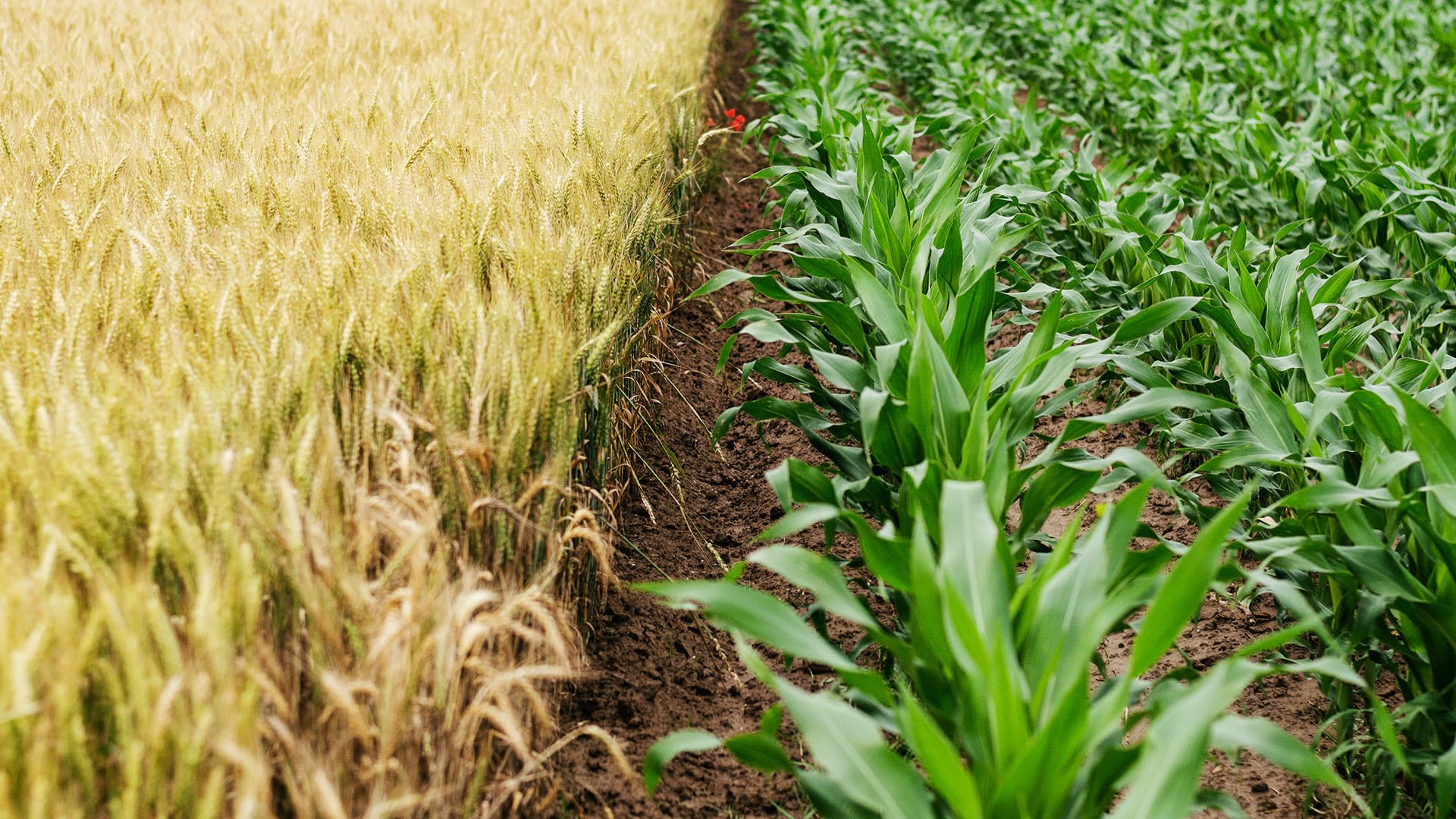
The first agricultural “Green Revolution” met the challenges of the post-World War II era with breakthroughs in pesticides, fertilizers, and irrigation. These methods helped feed a growing population, but their environmental impact made them unsustainable. The second Green Revolution was largely concerned with maximizing output using crop selection and eventually genetic modification.
A new method of farming emerged in the 1980s, based on a combination of biological inputs and location intelligence. Known as precision agriculture (PA), this innovation reconfigured farms of all sizes. And now, location and mapping technologies are enabling farmers to use just enough resources, allocated where they are needed. It’s a new agricultural revolution—one that aims to fuel prosperity while also maintaining environmental sustainability.
The third green revolution builds on established PA practices, while creating a larger picture of the agricultural landscape farmers are operating within. Precision sustainable agriculture (PSA) methods combine PA with advances in big data analysis. The result is a holistic approach to farming that unites isolated agricultural sites into a sustainably global whole.
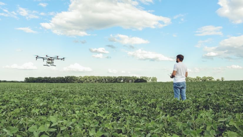
Just as the first green revolution depended on advances in several disciplines and technologies, PSA leverages advances in automation, artificial intelligence (AI), and networks of sensors linked by the Internet of Things (IoT). PSA systems apply this spatial approach to all levels of the agricultural process—even on the molecular level—to better understand the biological systems in play.
PSA emphasizes the spatial component of data, gathered, processed, and stored by a geographic information system (GIS)—software that displays location-specific data on the familiar canvas of a computer map. GIS dashboards allow a user to separate datasets into layers that can be combined and reconfigured to examine a situation from different perspectives.
GIS is invaluable for processing information. Everything from current soil conditions to humidity levels can be integrated into a GIS, while site-specific historical data can also be added for deeper context. The large amount of data often necessitates the use of machine learning, a subset of AI that refers to computers learning to recognize shapes and patterns and identifying “hotspots” within enormous datasets.
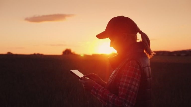
Cloud-based GIS applications provide a common framework for collecting and sharing data. Most importantly, cloud computing allows users to access, use, and analyze this data, anywhere, at any time, and from any device. Some of these apps even allow offline work capabilities. This is an important attribute, since the aim of PSA in general is to gather information and draw conclusions that transcend any single farm.
A larger problem with prior technological approaches to agriculture involves the tendency for IT and data formats to become siloed. This inhibits the development of “networks of networks” that provide a broad view of farming practices. GIS platforms for agriculture not only allow farmers, agronomists, and scientists to share data in a central hub, but they automate production recommendations based on location and loads of qualitative data.
Farmers who have adopted PA techniques are already using some of the most sophisticated spatial technology. PSA builds on this knowledge, allowing farmers to become active participants in developing agricultural systems and practices. With cloud-based GIS powering it, PSA fosters the development and application of new analytic approaches to farming.
The United States Department of Agriculture is putting PSA to the test with a pilot program in Maryland that focuses on a community of farmers growing “cover crops,” plants cultivated in the off-season to protect the soil. The major components are a sensor network and geographic information system (GIS) software. The sensor network tracks variables like humidity, soil temperature and water levels. Sensor-equipped tractors measure the crops’ height, greenness, and biomass. And a weather station gathers data related to wind, rain, and temperature.
“Our goal is to have at least 80 percent of the continuous monitoring data we’re collecting in the field transmitted to our cloud and GIS-based infrastructure,” says Mike Buser, head of the USDA’s Partnerships for Data Innovations (PDI) and National Program Leader for Engineering. “We would collect near-real time data, process the data through a semi-automated quality assurance and quality control software. This system would make the data accessible to the agricultural community more rapidly, while automatically informing researchers when there are potential in-field sensor problems.”
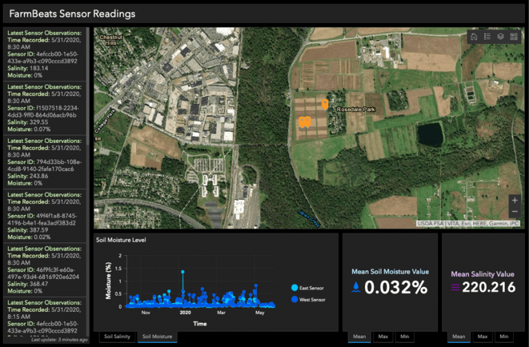
The technology that uploads and processes this data integrates FarmBeats, a Microsoft cloud-based platform with GIS software. The GIS provides the backbone for the USDA Agricultural Research Service’s Agricultural Collaborative Research Outcomes System (AgCROS), a digital hub that welcomes location-specific data from various sources. It is a place to share data on everything from crop yields to nitrous oxide in the soil. A centralized GIS provides a way to both store the data and visualize it on maps. Farmers can use this spatially diffuse data to learn more about growing crops in their specific locales.
The more data farmers can access, the closer farming itself can achieve what technologists call a digital twin. As the term implies, that would mean that any development in the physical world—from the molecular level to large harvests—will register as a change on a dynamic, virtual model. Digital twins could allow for simulations of new ideas that can be tested to determine their environmental impact before potential real-world implementation.
Ultimately, this integration would give the farmer a virtual, dynamic model involving each component of the agricultural ecosystem. And because this system contains predictive capabilities that understand patterns in weather, growth, and land composition, it can provide authoritative intelligence on the best ways to plant, cultivate, and harvest crops.
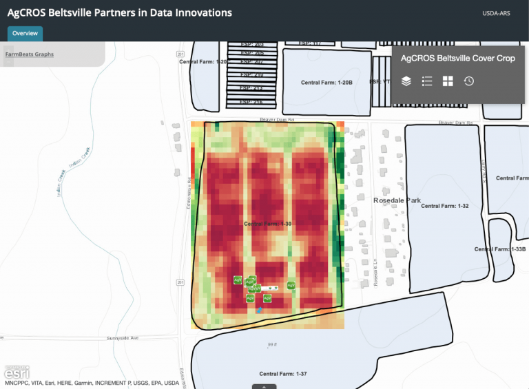
“Farming is knowledge-intensive,” Steven Mirsky, a USDA research ecologist said recently. “Therefore, we need to understand how climate, soil, and topography interact spatially. We do this by reimagining the farm landscape as a living laboratory. AgCROS is the type of cyber-infrastructure system scientists like me need to achieve such goals.”
It’s still early days for the project, but the USDA has big plans to build on its PDI and PSA frameworks. Based on the results from the Maryland farm, the network of cover crop farming will expand to around 200 research farms around the United States. The network will test one of the primary PSA concepts, the sharing of information, combining various forms of local knowledge into a repository of information. The plan is to use farms of various sizes, from small family plots to large agribusinesses.
The optimal outcome is for the PDI program and FarmBeats to inspire similar PSA programs, with everything connected. Constructing new practices in the virtual world will reduce the time it takes to deploy innovative practices that lead to better environmental outcomes. If farmers are to feed ten billion people by 2100 while preserving the environment, the next green revolution must be tested in digital twins. The cover crop network could hopefully serve as a catalyst for this type of massive change in farming, seeding the ground so that PSA practices expand worldwide. However, it will be a means, not an end to meeting the new challenges of global population growth and climate change. A platform like FarmBeats, Buser says, “is one tool in our toolbox.” Feeding billions of people without a massive expansion of resources is no small task. With technologies like GIS at their disposal, agencies like the USDA can literally see how to accomplish it.
Learn how new practices that focus on soil health are producing record yields and how John Deere, a long-time technology leader, is driving productivity and sustainability in agriculture and farming with advanced analytics.”