
Jio’s senior management knew from day one that we need to rely on systems like GIS to build and operate our network efficiently.
senior vice president, Jio
Milind Deshpande
October 16, 2019
Reliance Jio Infocomm Limited recently became the largest mobile network operator in India and the second largest in the world—reaching the milestone of 350 million customers—less than three years after launching commercial operations.
To make this ambitious leap, Jio uses location intelligence to connect and coordinate all the steps of building the network and marketing its services.
“We start with nothing more than a standard map,” says Milind Deshpande, senior vice president at Jio. “It gets enriched by adding how many customers we can reach, how many towers we need to build and connect, how much cable we need, and so forth—always keeping the where dimension in the picture.”
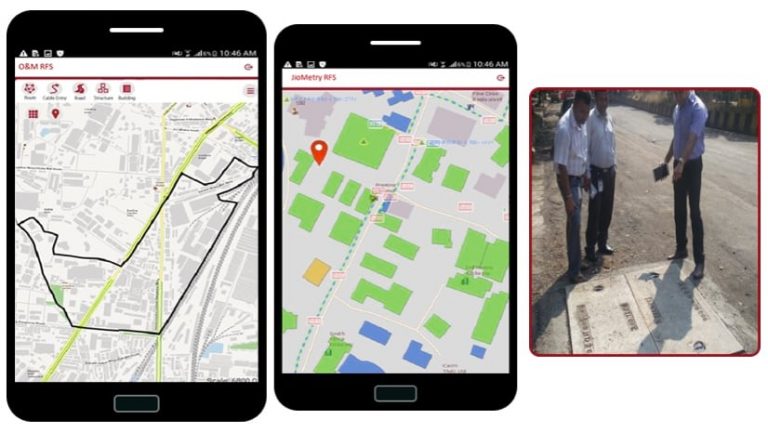
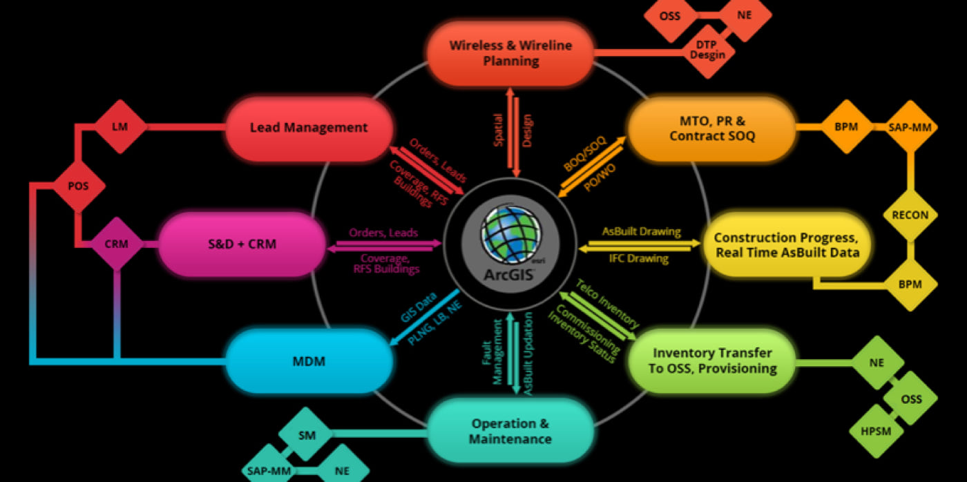
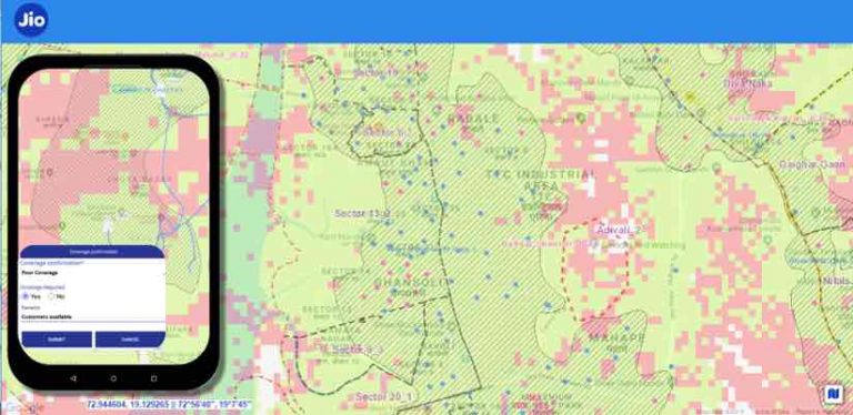
Jio’s maps are made using a geographic information system (GIS), a technology that enables location intelligence across the company. Decision-makers at Jio use it to model and test the best sites to locate towers for optimum coverage. Jio operators use that same technology to coordinate materials for just-in-time deliveries and to dispatch crews for network construction when and where they are needed. The company’s marketing executives also use GIS to understand the demographics of the population and target outreach efforts. And Jio’s sales team analyzes data on a GIS-based smart map so that salespeople can knock on the most promising doors to sign new customers.
Automating Workflows
Jio’s journey to build a countrywide 4G LTE wireless network started in 2012 with little infrastructure in place. Jio built out its initial network quickly, launching wireless service in September 2016. The company has made amazing progress, bolstered by an innovative marketing strategy, and has achieved market dominance in under three years.
Jio is building on this extensive network to address the growing demands of India’s digital consumers by connecting homes and enterprises to an ultra-highspeed fiber backbone in 1,600 cities across the country. The extensive “Fiber to the X” (FTTX) network aims to serve 20 million customers.
“This growth was possible because of extensive automation on all fronts of the business,” Deshpande says. “GIS covers almost 50 percent of the functions that are automated.”
The automation involves triggering individual actions—throughout network implementation—at each location in a phased sequence that makes it mandatory for everyone to capture correct data specific to each task before declaring that their work is complete.
“You get your task, you finish your task, and the next person gets the notification and gets the following task. It just keeps on until the chain ends,” Deshpande says. “Our work processes are so tight that you cannot go outside your driving lane; you have to complete your work and provide accurate data.”
Jio’s senior management knew from day one that we need to rely on systems like GIS to build and operate our network efficiently.
Not all of the workflows are GIS-centric, but at Jio, multiple enterprise systems are tightly integrated so that all benefit from the accurate location data contained within the GIS. Additional systems that use the location information include sophisticated network planning applications, the materials management enterprise resource planning (ERP) system (built on SAP), and the customer relationship management (CRM) system.
“In other telecommunications companies, work orders are sent via email, but it’s too easy for things to slow or stop if people say they never received an email,” says Yogesh Dhomkar, vice president at Jio. “We have eliminated ad hoc communication to fast-track network implementation, operations, and even marketing through internally developed end-to-end automated business processes. We automatically create tasks based on the data pulled from various systems. Each of our 20,000 field users receive tasks on their mobile devices, and we ensure their on-time performance by monitoring each process.”
The Importance of Accuracy
To date, Jio has installed more than 250,000 cell towers around the country and has plans for an additional 50,000 towers. The GIS was used to capture each component for each phase of network construction, and as a result, the precise positions of more than 14 million pieces of network equipment are contained in Jio’s GIS database.
Given the tight coordination of tasks, as well as the increasing expertise of crews, the time it takes to construct each tower has dropped dramatically. To launch the network, Jio built 100,000 towers in three years. The next 100,000 towers took just one year. By the end of this year, another 100,000 towers will be completed and 4G LTE tower construction will be complete.
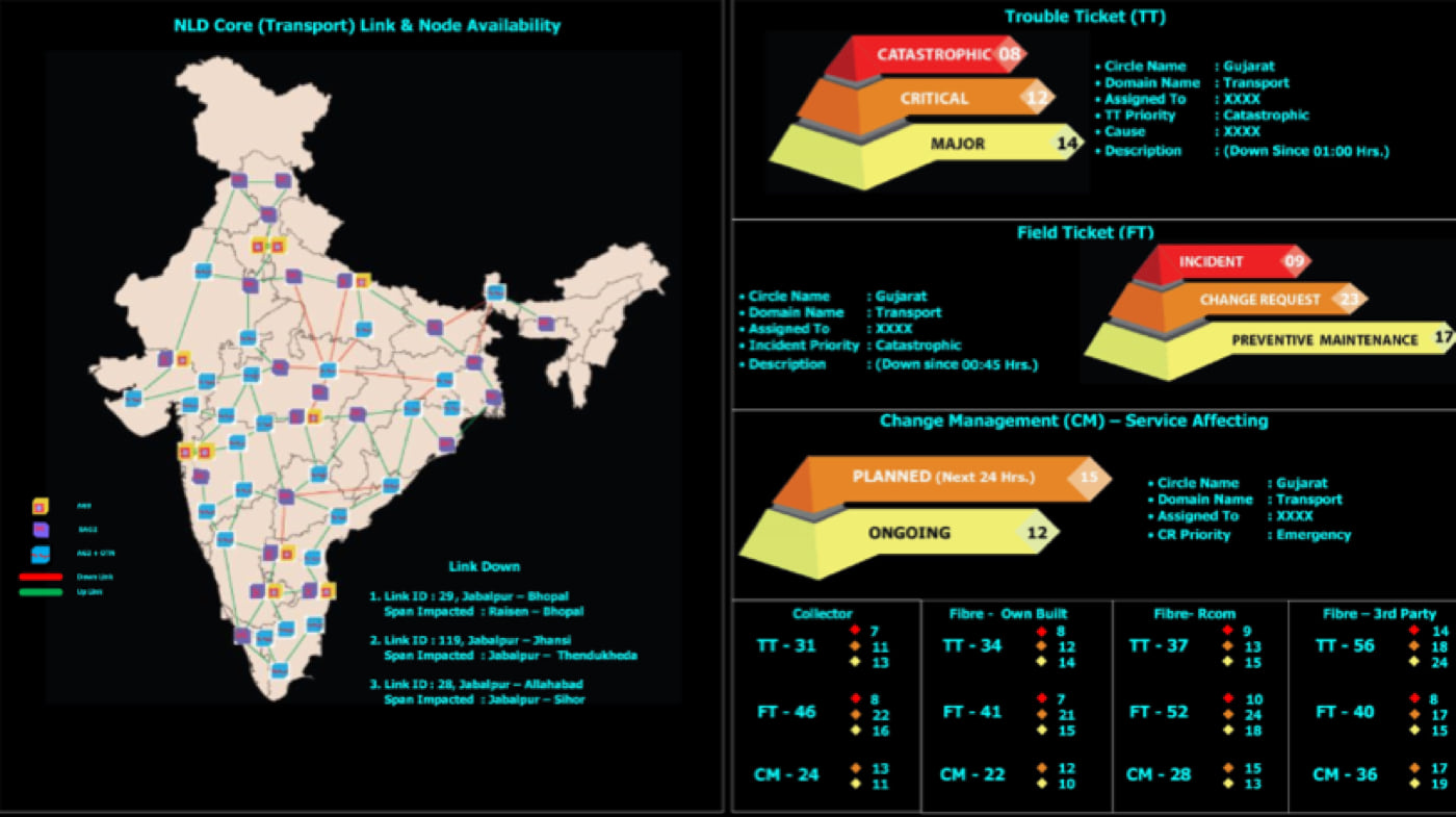
Accurate data of what gets built and where becomes crucial for maintenance, as nothing gets built exactly as designed.
“When the system is energized and the people start getting service, we move into maintenance mode,” Dhomkar says. “Somebody is going to dig up your cable, and it’s going to break. Our maintenance operation staff use the system to find out where the problem is and get it repaired, and they feed information back, making sure the system remains up-to-date with what is out there in the field.”
Location is a key factor in most workflows, including a crew that patrols the streets where the network has been laid to see if any unauthorized digging is happening or if any vehicle accidents have damaged the network. These network monitoring crews charge by the kilometer, and the tools they use keep track of where and how much they drive, which automates payments.
“Concentrating on individual functionalities and tasks is what improves the overall productivity of the entire organization,” Deshpande states.
Learning from Other Business Lines
Deshpande and Dhomkar are part of a larger GIS team that has worked together for 20 years, applying the technology to various business lines of Reliance Industries, the parent company of Jio. GIS plays a role in Reliance Retail (India’s largest retail chain, with more than 3,800 stores), Reliance Logistics (a supply chain business), and Reliance’s oil and gas exploration businesses.
“Jio’s senior management knew from day one that we need to rely on systems like GIS to build and operate our network efficiently,” Deshpande says. “GIS was in the initial business plan and was in place as we began building the network.”
To provide the bandwidth needed to achieve 4G speeds and connectivity, Jio links each cell tower with fiber-optic cable. The company has expanded this fiber network, adding 400,000 kilometers (250,000 miles) of fiber to launch Jio Fiber, an FTTX offering.
The rollout of Jio Fiber uses the same task-oriented system used to build Jio’s 4G LTE network. With the infrastructure in place, Jio Fiber is expected to deliver broadband services to 20 million households by the end of 2019.
Referring to the oversight that the system provides on all aspects of the operation, Dhomkar comments, “Jio manages projects by absolute facts and figures.” The system collects a clear picture of all the work that’s being carried out, and spatial analysis and statistical tools help the team determine if any inefficiencies can be corrected.