Mapping UNESCO's Sites Revealed What Decades of Paper Records Couldn't
By Lance Owen, PhD
For decades, the United Nations Educational, Scientific and Cultural Organization (UNESCO) relied on paper maps—some dating to the World Heritage List’s first entries in 1978. The organization knew what was on its list. But the precise boundaries of more than a thousand World Heritage properties, hundreds of Biosphere Reserves, and a growing network of Global Geoparks were fragmented across paper records and scattered files.
“Of course, we all knew where the Colosseum in Rome was on the map,” said Fernando Avakian, the project manager behind the UNESCO Sites Navigator. “But how can we make sense of the scattered data that describe it, and link it with other World Heritage sites or protected areas, whether they overlap or not?”
The UNESCO Sites Navigator brings together the georeferenced boundaries of UNESCO sites into a single interactive system. The data is sourced and validated by each country and site managers, then verified by UNESCO—authoritative enough to carry the weight of international law. Having it all in one place makes possible what scattered paper records couldn’t: deeper analysis, better planning, strong impact assessments, and conservation at global scale.
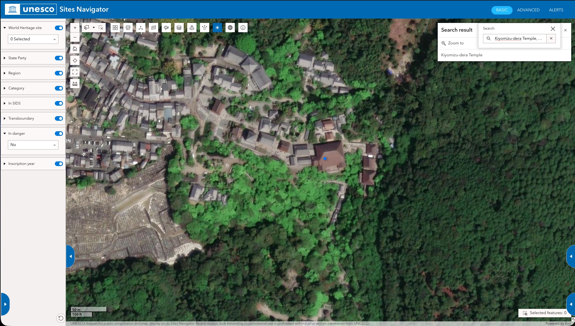
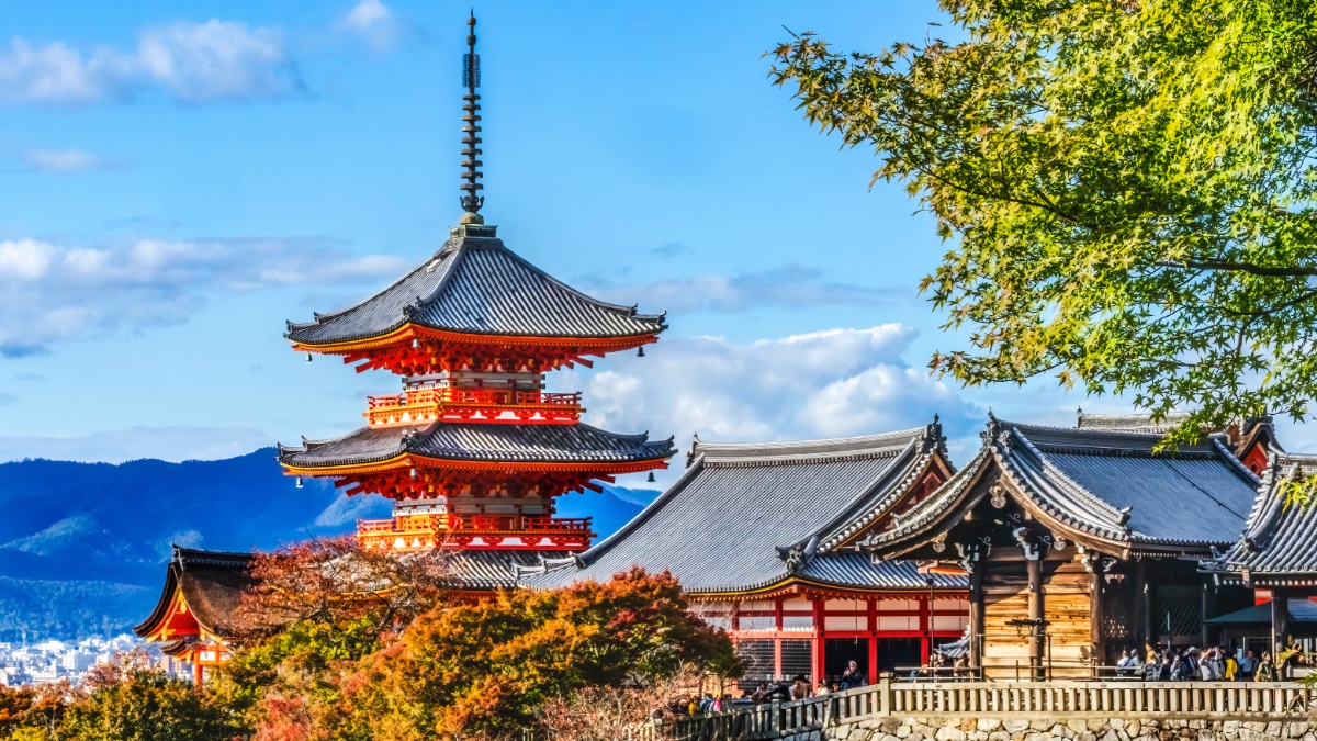
The UNESCO Sites Navigator maps the precise boundaries of Kiyomizu-dera Temple, part of the Historic Monuments of Ancient Kyoto — one of the more than 1,200 World Heritage properties now tracked for monitoring and conservation.
World Heritage sites like Kiyomizu-dera Temple in Kyoto, Japan, are no longer just dots on a list—the Navigator gives each a precise spatial footprint, enabling real-time monitoring of the conditions around them.
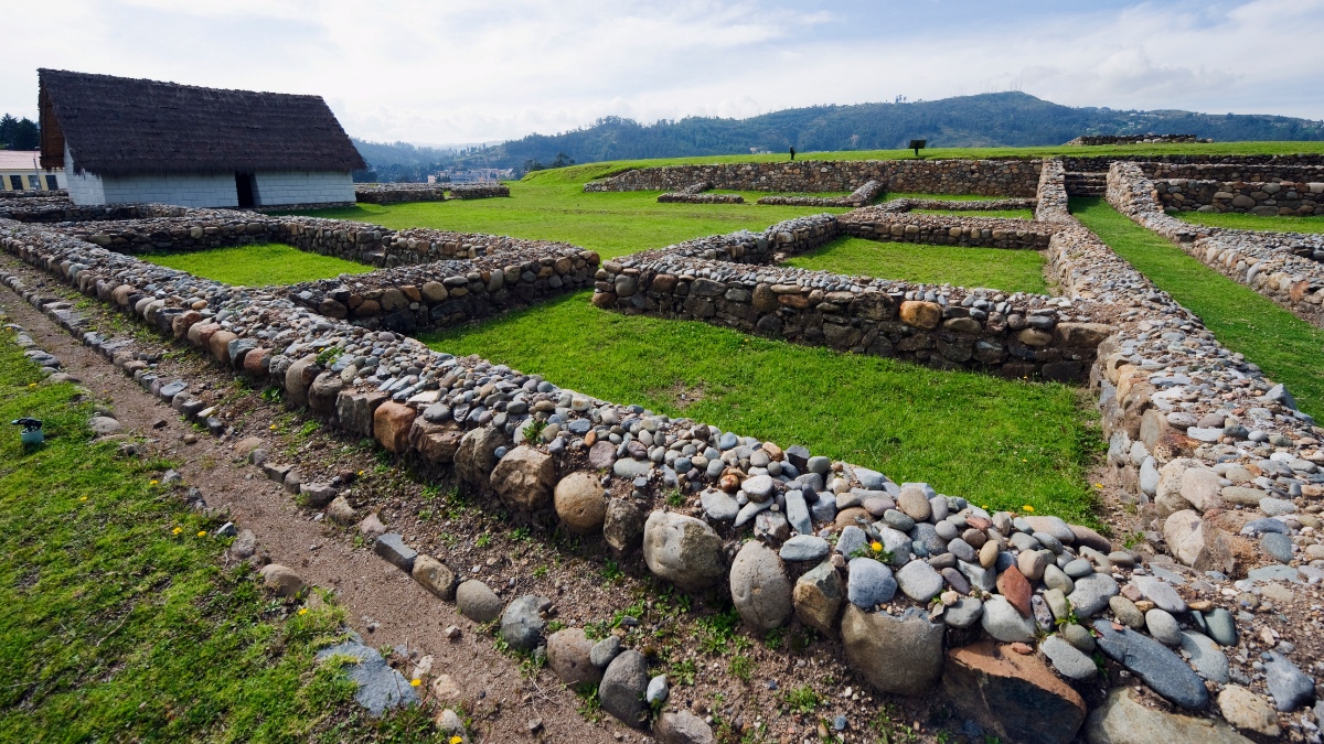
Ingapirca, Ecuador's most significant Inca archaeological site, is among the World Heritage properties the Navigator monitors for threats ranging from seismic activity to slow-onset vegetation disturbance.
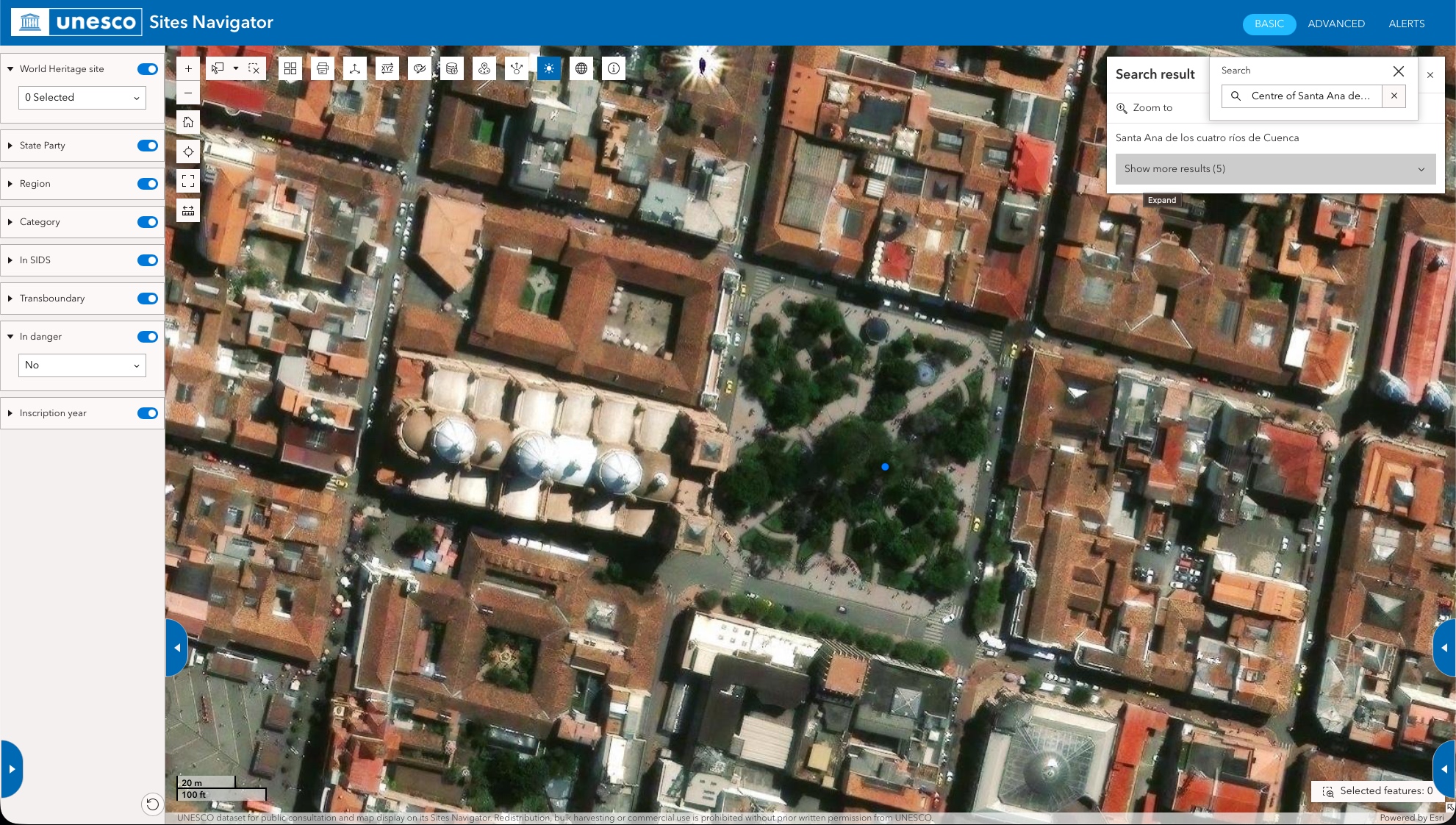
The Navigator pinpoints Santa Ana de los Cuatro Ríos de Cuenca, Ecuador's historic colonial city—one of thousands of sites now searchable, mappable, and monitorable from a single platform.
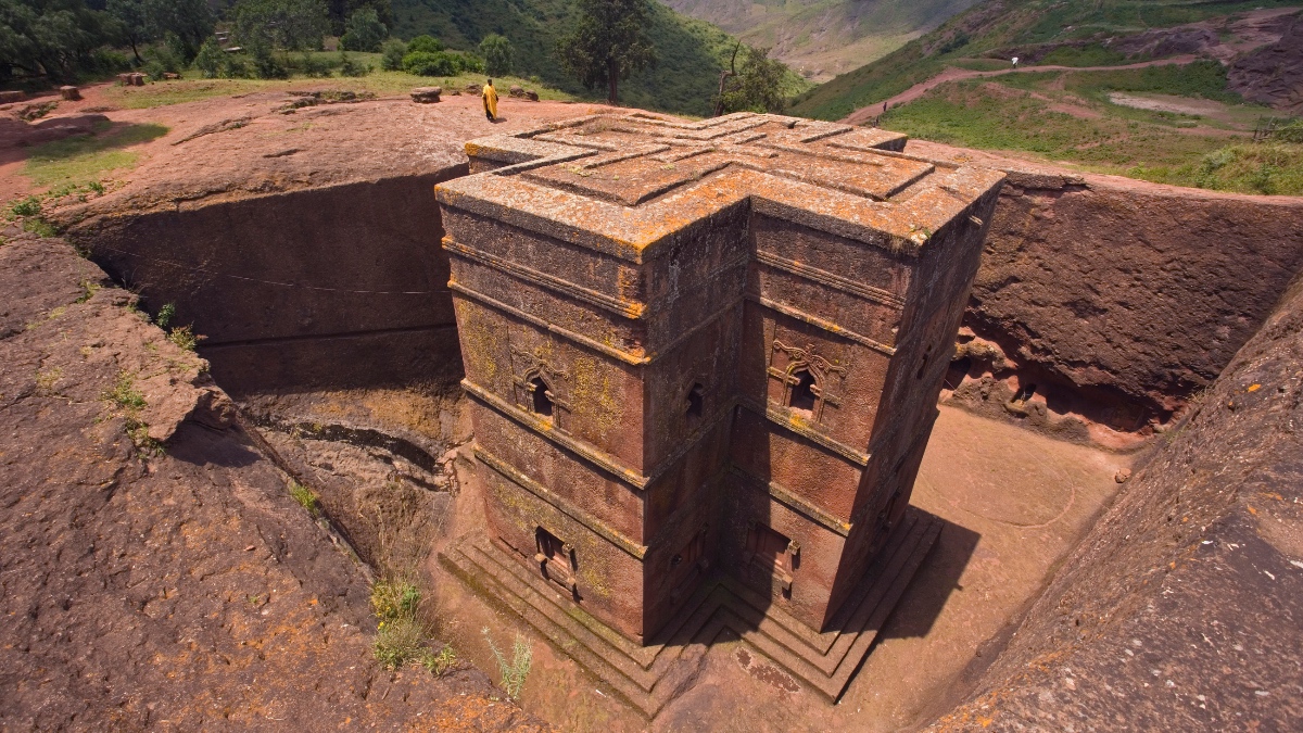
The Rock Hewn Churches of Lalibela, Ethiopia, carved from solid stone in the 12th century, are among the World Heritage properties the Navigator watches for earthquake damage and other sudden-onset threats.
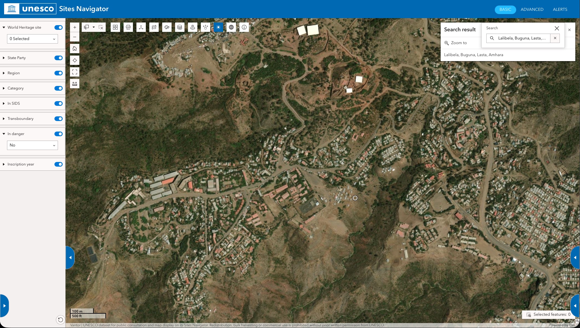
The Navigator locates the Rock Hewn Churches of Lalibela in Ethiopia's Amhara region—precisely mapped so that any seismic event or emerging threat can be assessed against the site's exact boundaries.
The Discovery
For 50 years, UNESCO kept its designations in separate categories—cultural heritage in one program, natural sites in another, Biosphere Reserves in a third. Mapping them together helped understand their relationships, with the overlaps revealing connections that these categories had obscured.
The Pyrenees straddle the border between France and Spain. They simultaneously form a mixed World Heritage site—recognized for both natural and cultural value—a Biosphere Reserve, and a Geopark. The mountains give rise to the biodiversity. That biodiversity shapes the culture. “The terrain is the key to both things,” Avakian said. “In this context, any clearcut distinction between nature and culture is essentially artificial.”
Local and Indigenous communities living within such sites around the world have always understood the connections. The Navigator made that knowledge visible at the institutional level.
That visibility now serves a global conservation mandate. The Kunming-Montreal Global Biodiversity Framework committed countries to protecting 30 percent of the planet’s land and ocean by 2030—the “30×30” target. Meeting that target demands a way to see protected areas, ecosystem health, and threatened species. Where are wildlife corridors breaking down? Where should restoration go?
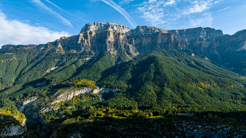
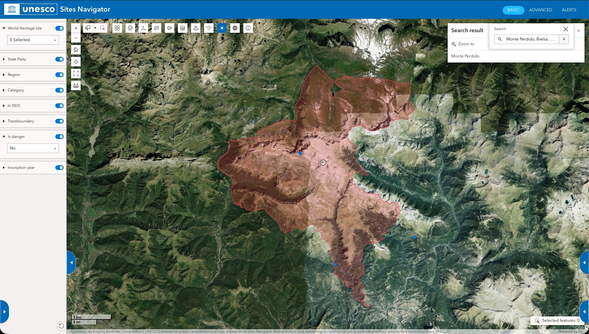
Where France meets Spain, Mont Perdu in the Pyrenees holds a rare triple designation: World Heritage site, Biosphere Reserve, and UNESCO Global Geopark—all tracked together in the Sites Navigator.
The Navigator's boundary polygon for Pyrenees - Mont Perdu shows the full extent of this transboundary site—a vivid example of how the platform makes overlapping designations visible in one place
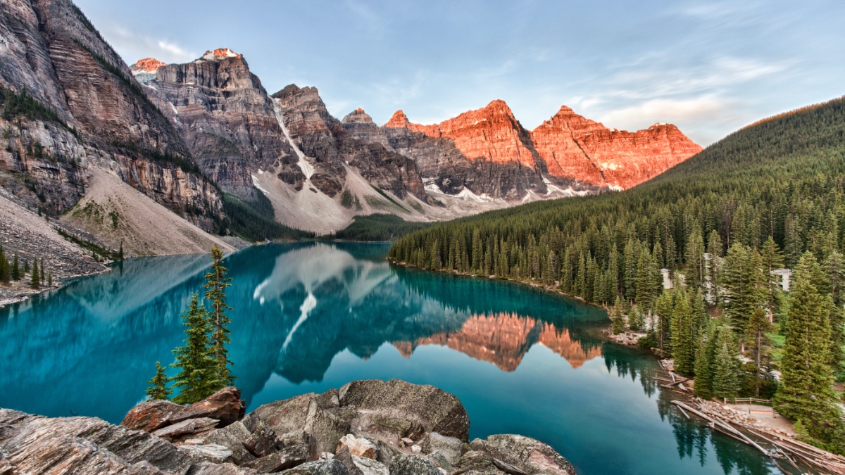
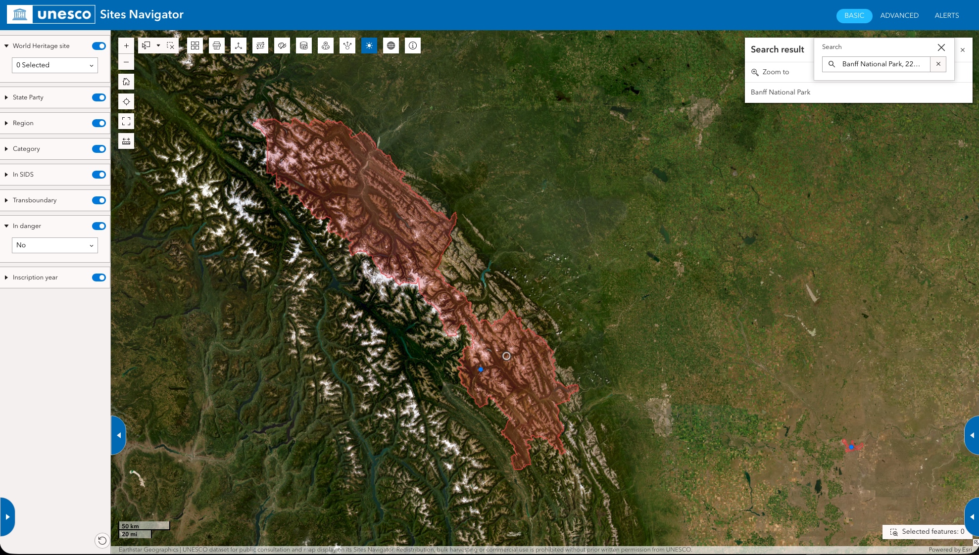
Banff National Park in Canada's Rocky Mountains is part of a World Heritage site the Navigator monitors for wildfire, flood, and habitat disturbance across its vast mountain and forest terrain.
The Navigator's boundary polygon for Banff National Park, within the "Canadian Rocky Mountain Parks" World Heritage site reveals the full scale of this property—and the scope of what must be watched when fire season arrives in western Canada.
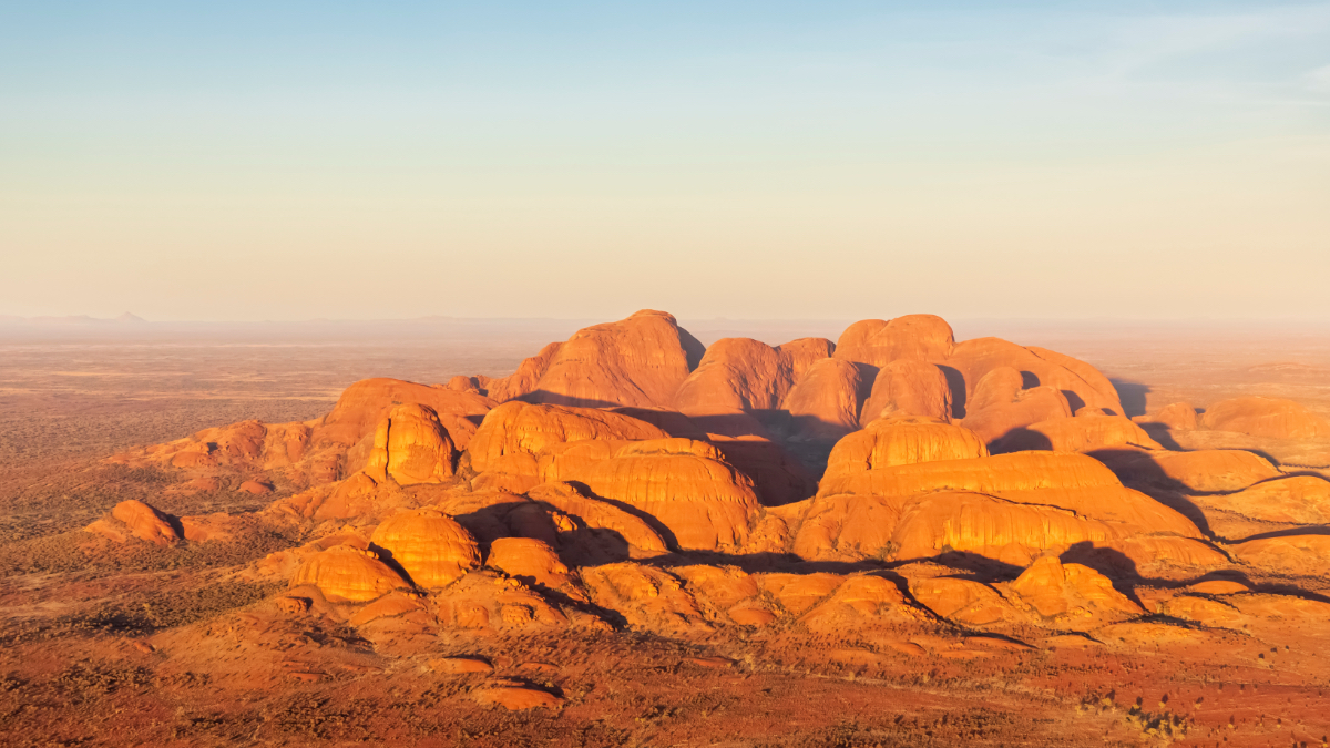
Kata Tjuta is part of Australia's Uluru-Kata Tjuta National Park, a World Heritage site sacred to the Aṉangu people — and one the Navigator monitors for fire and vegetation disturbance in the outback.
From space, Uluru is unmistakable. The Navigator maps it precisely—giving site managers and UNESCO a shared spatial reference for monitoring this sacred landscape in Australia's Northern Territory.
The team is building pressure profiles that track habitat fragmentation across the corridors species rely on for mating, migration, and survival—not just within protected sites, but between them. They are also outlining how to track, globally, whether restoration projects deliver results over the three-to-five-year timelines ecological processes require.
“Too often, UNESCO-designated sites are viewed primarily through the lens of vulnerability to climate change,” Avakian said. “Yet these sites are also among our most powerful allies in addressing the climate and biodiversity crises, delivering benefits that extend far beyond their boundaries.” From carbon storage and biodiversity conservation to ecosystem resilience and sustainable livelihoods, UNESCO-designated sites provide essential services that help communities adapt and thrive in a changing world.
A newly published UNESCO global assessment—People and nature in UNESCO-designated sites: Global and local contributions—puts figures to what the Navigator makes visible. While global wildlife populations have fallen 73 percent since 1970, populations within UNESCO-designated sites have remained comparatively stable.
Yes, sites need protection. But they also provide it.
The Watch
The World Heritage system recognizes a standard list of threats and factors affecting sites, consisting of a series of 14 primary factors—from buildings and development to armed conflict and extreme weather (see sidebar). The Navigator automates detection of some of the threats that can be mapped and pairs each with scientific thresholds that separate routine from danger.
For example, savannas are meant to flame under certain circumstances. Temperate forests need periodic burns. The challenge is distinguishing routine from crisis. “We run the risk of having alert fatigue by fake positives,” Avakian said. “Not every fire is an alert. Not every earthquake is a threat. Alerts must be meaningful.”
To calibrate when an event becomes a threat, the team draws on scientific expertise from across UNESCO—specialists in oceanography, hydrology, biodiversity, Geoparks, and disaster risk.
When alerts trigger, the team can contact site managers, the country’s national commission or field staff to verify conditions on the ground. For example, during recent fires in South America, that meant contacting teams first to ask if they were safe, then to assess damage. Ninety-nine percent of the work is done by the people who know these places intimately, experts and local communities.
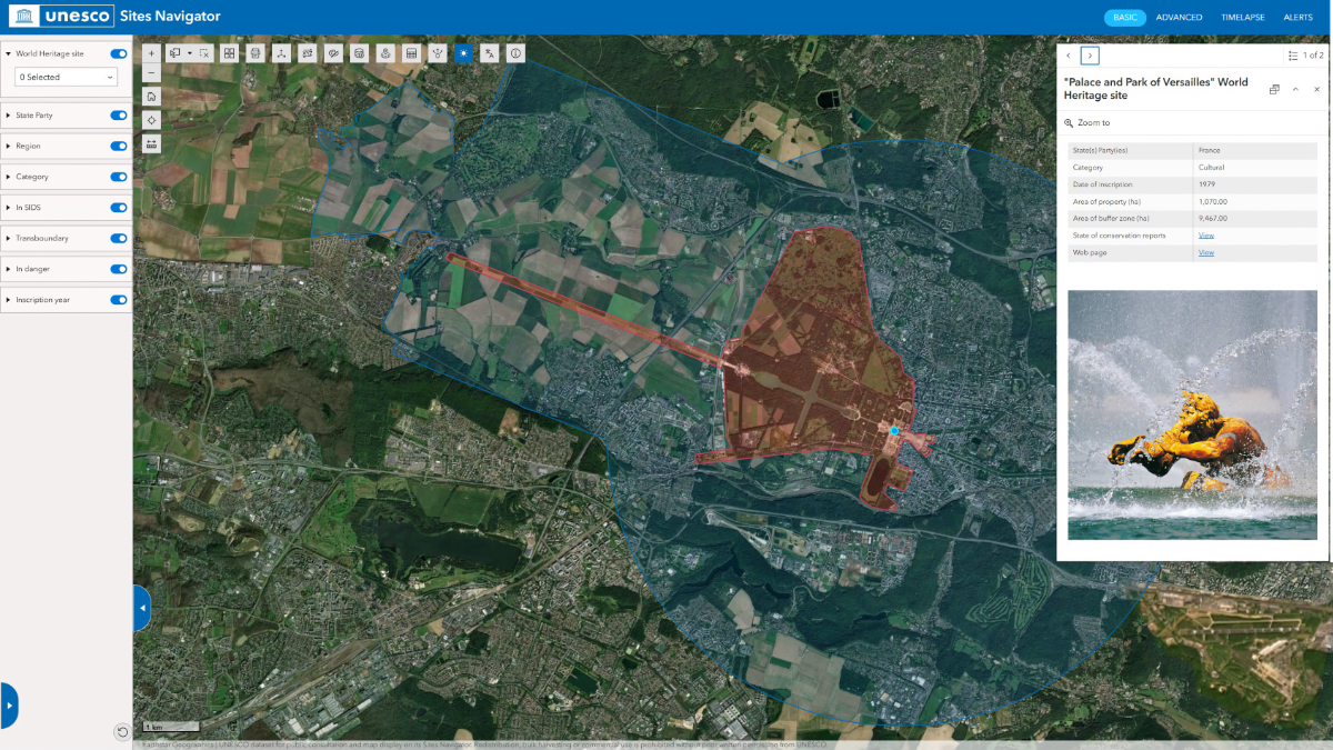
The Navigator's Basic view maps the Palace and Park of Versailles—its 1,070-hectare core (in red) and 9,467-hectare buffer zone (in blue). The boundary carries legal weight: no high-rise construction is permitted in the buffer zone.
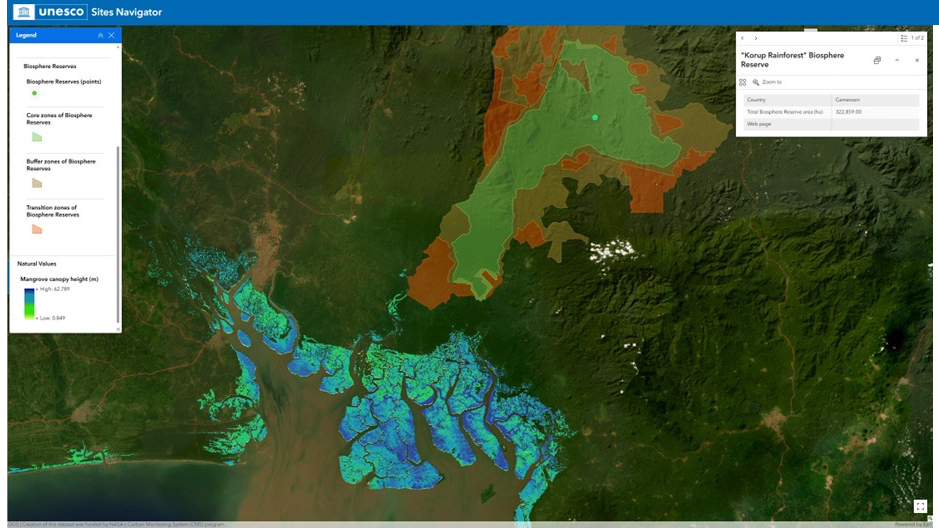
The Advanced view layers mangrove canopy height data over Cameroon’s Korup Rainforest Biosphere Reserve—one of Africa’s oldest rainforests. The color gradient tracks height from low (green) to high (blue) across the reserve and its surrounding estuary.
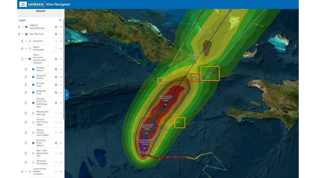
As Hurricane Melissa tracked through the Caribbean in October 2025, the Navigator overlaid the storm’s forecast cone on UNESCO-designated sites—orange boxes marking properties in its path. Situational awareness before landfall, not after.
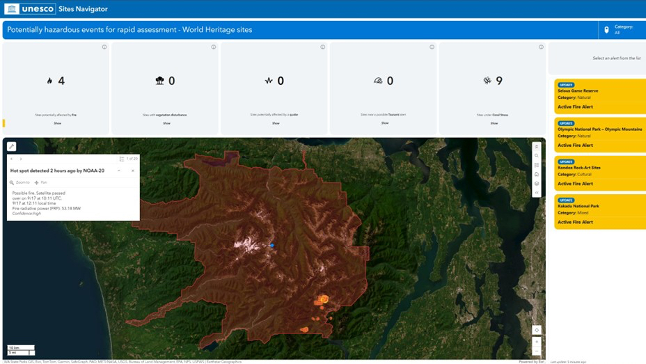
The Alerts dashboard flags an active fire at Olympic National Park, detected two hours earlier—showing fire radiative power, overpass time, and confidence level. That morning, fire alerts were active on three continents. UNESCO saw all of them at once.
Daily coral bleaching data from the US National Oceanic and Atmospheric Administration (NOAA) feeds into the Alerts dashboard. Waters near New Caledonia and Shark Bay, Western Australia, are under Watch, with sea temperature and heat stress on display. Nine sites were flagged globally that morning.
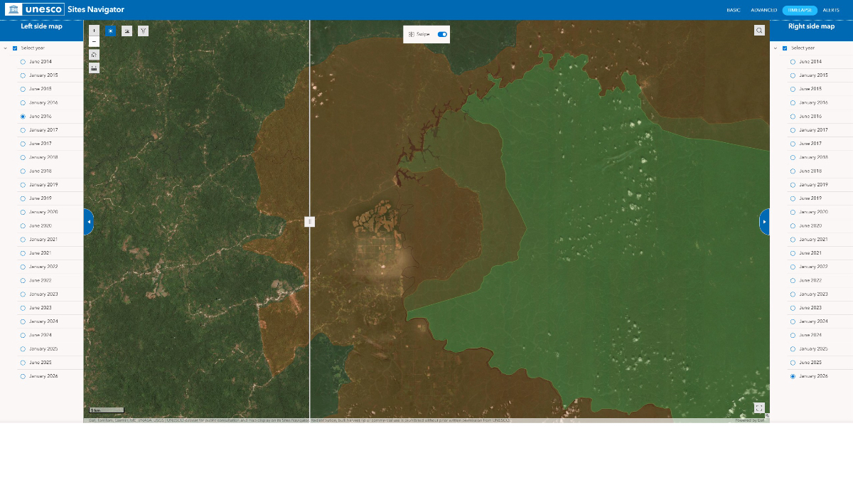
Rubber plantation expansion along Cameroon’s Dja Biosphere Reserve—also a World Heritage site—tracked across a decade. Left: June 2016. Right: January 2026. The slow replacement of forest is the kind of pressure satellites catch before damage becomes irreversible.
The team watches the slow-moving pressures most closely—the ones that haven’t yet crossed a boundary line. “It’s saddening to visually track vegetation disturbances, even if it’s outside of the protected areas,” admitted Avakian. “But it means that these events are getting closer to protected sites.”
The Invitation
The Navigator is public. Anyone can open it to discover the more than 1,200 World Heritage properties, 784 Biosphere Reserves, and 228 Geoparks that exist worldwide or to watch a threat unfold.
When fires swept across Patagonia in early 2025, the Navigator captured the full scope of what was at stake. In Argentina, flames tore through Los Alerces National Park—a World Heritage site sheltering some of the oldest trees on Earth. The same year, in Chile, fires pressed against a number of Biosphere Reserves in the south.
“Being myself from South America, it was heartbreaking to see all those places that I personally had been to being burned,” Avakian said. The fires are now under control, but the scars remain on the landscape—and in the data.
Months later, by chance during a holiday in Slovenia, he checked the Navigator on his phone and found a Biosphere Reserve he’d never heard of nearby—a ski area that bans artificial snow because of its protected status.
Lance Owen serves UNESCO and global organizations in their use of Esri's ArcGIS ecosystem, connecting geospatial technology to the people and institutions worldwide working to preserve cultural heritage, assess and mitigate risk, and manage sites. He holds a PhD in Geography from the University of California, Berkeley, where he specialized in historical urban geography. His Executive MBA research at the Vienna University of Economics and Business focuses on stakeholder capabilities in digital transformation, with emphasis on geospatial technologies in cultural heritage management.