

August 4, 2021 |
Mike Bialousz | Conservation
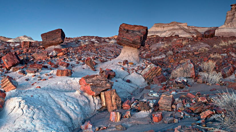
The Petrified Forest National Park in Arizona contains a colorful concentration of 225-million-year-old petrified wood fossils. (Public domain photo courtesy of the National Park Service)
Waterfalls, geysers, sprawling canyons, and snow-capped mountains are the natural treasures typically associated with US national parks. Mostly unseen are the prehistoric relics—the fossils. They indicate where and how ancient life lumbered, burrowed, swam, slithered, and thrived millions of years ago.
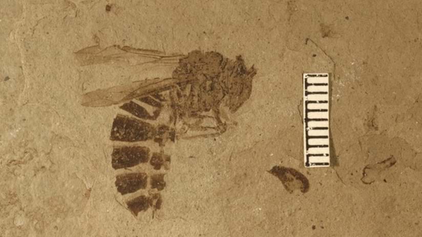
It’s only through fossil discovery and preservation that people know about prehistoric butterflies frozen in volcanic ash in Colorado; North America’s oldest human footprint in the sands of New Mexico; a herd of more than 200 ancient horses in Idaho; or entire petrified forests in Wyoming.
National Park Service (NPS) staff don’t just do conservation and education—they also manage and protect fossils found in national parks. In recent years, NPS has been working on a standard way to track and document these fossils using geographic information system (GIS) technology. This helps them preserve ancient treasures and share what they learn.
Before 2005, park staff relied on handwritten notes for fossil records. When new discoveries were made, they’d search through old paperwork, consult land surveys, and ask longtime employees about similar finds in the area. This manual approach often led to duplicated work and errors.
There had to be a better way. That was the thinking among park staff in the Glen Canyon National Recreation Area, as well as the NPS Paleontology Program and the geographic resources division of the park system’s Intermountain Regional Office. Together, staff at these locations began developing a new standard for keeping track of fossils, one that would allow for better visualization of a park’s paleo resources, the ability to ask broad questions of the data, and help in making decisions about monitoring and managing those resources.
That’s when Amanda Charobee was hired as a GIS specialist for the Intermountain Regional Office. She worked closely with Glen Canyon to create a standardized solution for fossil data collection and collation that could be expanded to other parks in the region.
The NPS paleontological team, based in Washington, DC, frequently works with individual parks when a need arises, especially in parks that don’t have paleontologists on staff. That need sometimes occurs when there’s a major construction project in the park, where erosion or changing lake water levels have increased, or when the park’s staff develop plans to inventory and monitor their paleo resources. While large fossil-rich parks have their own paleontologists, other parks partner with outside experts like state geological surveys to document discoveries.
To bring the needed uniformity to how fossil discoveries are documented, Charobee worked with fellow NPS GIS specialist Meghan Thompson. Their system uses a mobile app that any staff member can download to a phone or tablet to collect and record data about a found fossil. The mobile app, created with ArcGIS Survey123, syncs to a shared GIS database.
To build the app and database, Charobee worked with rangers and paleontologists to identify a total of 55 key data fields, including survey routes, search areas, fossil locations, specimen details, photos, and monitoring information.
Thompson then took that foundational plan and created a more general standard for all parks in the region to follow.
At Glen Canyon, Charobee and Thompson faced a major challenge: The park has 770 different locations where fossils have been discovered since 1928, requiring them to organize a massive amount of data and details, including more than 2,500 photos.
So far, Thompson and the team developing the new data management system have worked with 34 parks in the eight states that make up NPS’s Intermountain Region, collating all existing paleontological data and uploading it to a secure shared site.
The region includes Arches National Park, Bryce Canyon National Park, Colorado National Monument, Grand Canyon National Park, Petrified Forest National Park, Yellowstone National Park, and Zion National Park—all of which are well-known for their paleontological findings. Of the region’s 87 parks, 74 have paleontological resources. Eventually, Thompson plans to connect with parks nationwide to collect and manage paleontological data.
Standardizing data, formats, and technology, Thompson says, will strengthen fossil protection in parks and eventually make it possible to more easily identify imperiled fossil sites based on the locations of other fossil finds.
Privacy, even within individual parks, has been a top priority for fossil information. Information about exactly where fossils reside is strictly guarded to prevent theft or damage. Fossils have official protection under a law passed in 2009 called the Paleontological Resources Preservation Act.
“Fossil theft is a huge problem,” Charobee said, not only inside the national parks but around the world. The database is hosted on the park service’s secure server for sensitive GIS data, with each participating park assured that its data will remain viewable to only those who need access.
To learn from a fossil, it is essential to know exactly where it was found. Once removed from its original location by a collector or tourist, a fossil loses valuable clues into how the animal may have behaved when it was alive and what the environment was like, Charobee said.
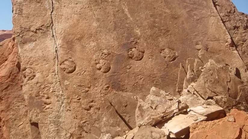
Here is a perfect example of the value of preserved context: Workers at Glen Canyon, which spans parts of Arizona and Utah, recently found fossilized dinosaur feces.
How exactly did the dinosaurs relieve themselves? Researchers had a better idea after observing well-preserved tracks near the fossilized waste (coprolites). Seeing how the tracks and coprolites were arranged led paleontologists to theorize that the dinosaur had crouched.
Now, those dinosaur footprints and fossilized feces are among the fossil resources recorded in the NPS paleontology program records. Parks can use this knowledge to improve awareness, resource management, and education.
Ultimately, park staff can use the fossil collections and related data to provide immersive and interpretive experiences for national park visitors.
Learn how parks use GIS to protect natural and cultural resources.