December 5, 2019 |
Dr. Dawn Wright | Mapping
Contrary to its reputation as a peaceful, meditative realm, the undersea world is a nonstop sonic party. Oceanographers call it the marine soundscape.
So what’s the best way to understand an important phenomenon like El Niño? Scientists are finding that the answer is to listen closely.
El Niño—the interaction between the atmosphere and warm regions of the Pacific Ocean, usually occurring around December—makes an enormous impact on global weather. Predicting that effect is notoriously difficult.
“Billions of kilojoules of energy in warm water sloshing back and forth across the Pacific can cause droughts and famines and floods and entire economies to collapse,” Chris Verlinden said. “But we can’t even say if it’s going to happen, because we just don’t know the ocean well enough.”
Verlinden, an oceanographer and acoustician, is the chief technology officer for Applied Ocean Sciences (AOS). He and his colleagues study how sound behaves in the ocean, both as natural occurring events and as incursions from the outside world. That means they can determine whether a US Navy ship at one spot on the ocean will “hear” a submarine through sonar sounding—and also what influence sonar will have on sea life.
AOS scientists construct models to better understand undersea sound behavior. “Whether you’re the Coast Guard monitoring an area for illegal fishing or a marine biologist who hears a whale call and wants to know where it is, you need to know what the noise is and where, and to discover that you need to do acoustic simulations,” Verlinden said.
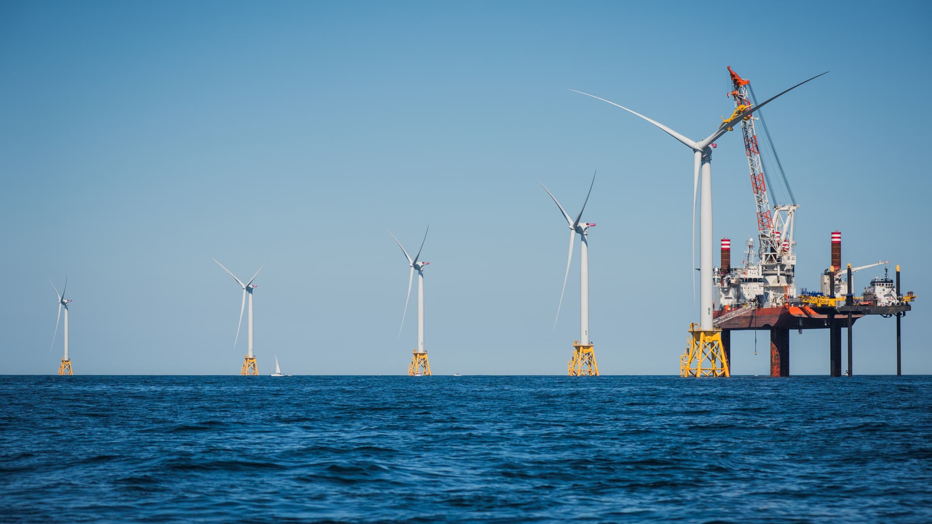
A recent scientific paper, coauthored by Kevin Heaney, president of AOS, listed a few contributors to the marine soundscape: animals (from shrimp to whales), earthquakes, storms, icebergs, submarines, ships, and turbines. “Even silent things, such as a piece of muddy seabed or a parcel of warm water, may affect the soundscape, because they affect sound propagation,” the paper states.
There’s also the wind. The ambient whoosh you hear while snorkeling or scuba diving “is actually the accumulating wind noise from breaking waves, tens or even hundreds of kilometers away,” Verlinden said.
Sonic Truth
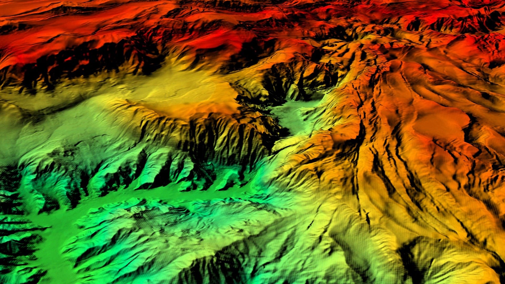
The truest way to understand the ocean in its entirety could be through sound. The behavior of sound as it travels through the water is affected by salinity, temperature, pressure, and the condition of the ocean floor. Careful acoustic analysis can determine the values of those variables.
“You really can’t ‘see’ the ocean,” Verlinden said. “Radiofrequency electromagnetic radiation doesn’t propagate. You can’t use lidar. You can’t use radar. You can’t use cameras for more than a few tens of meters. But you can understand the ocean and interact with the ocean entirely through sound.”
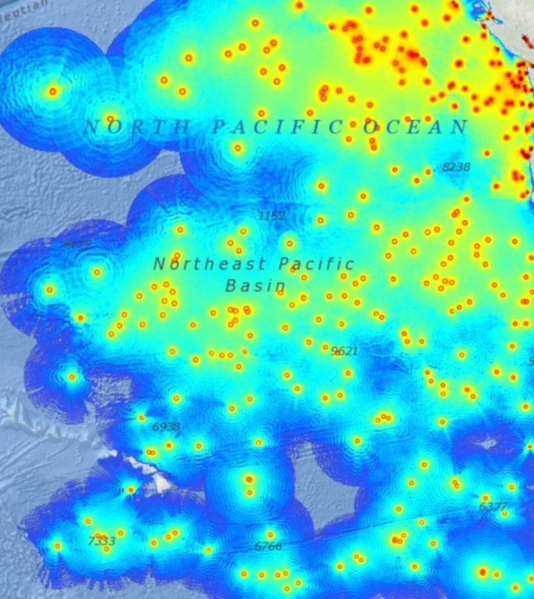
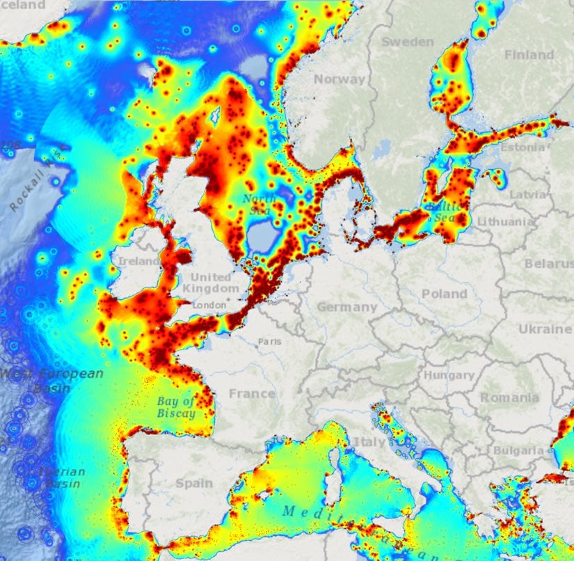
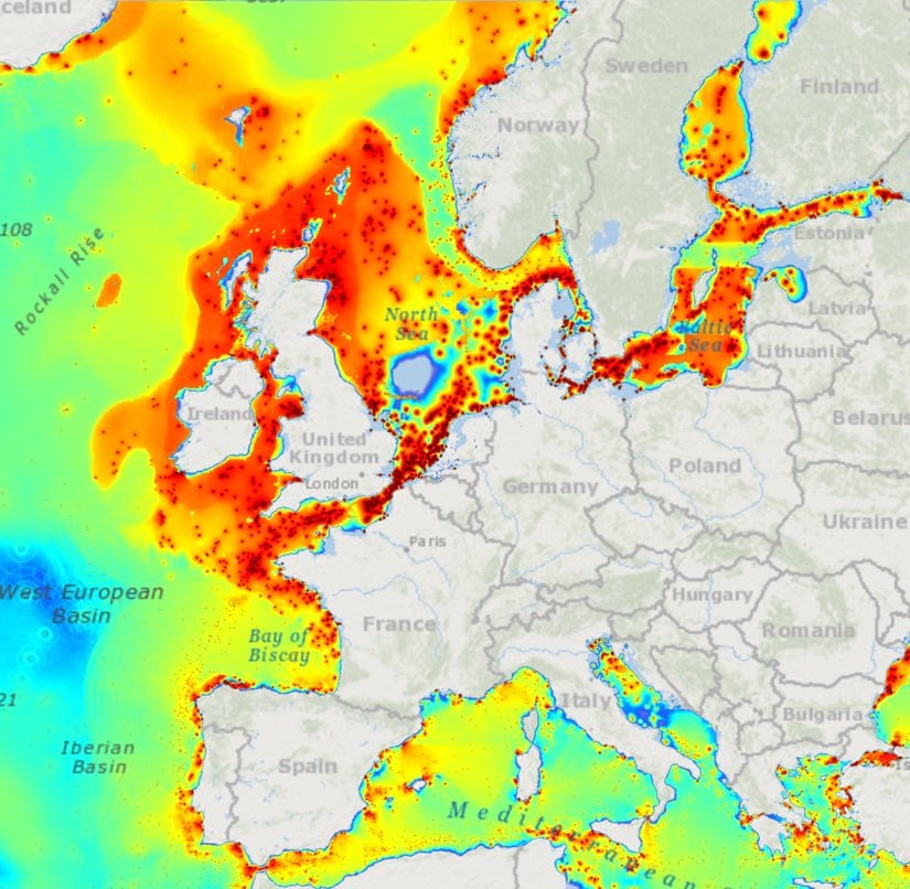
Verlinden thinks acoustic analysis could eventually unlock the El Niño enigma. Through the work of organizations like the National Oceanic and Atmospheric Administration (NOAA), hydrophones—underwater devices that gather acoustic data—are proliferating around the world. A large-enough hydrophone network could, in effect, give the ocean a full-body physical exam and diagnose its condition.
“There’s nothing in the laws of physics or mathematics that says El Niño is an intractable problem,” Verlinden said. “If we could measure the whole ocean everywhere, it’s not crazy to think that someday we could predict El Niño’s effects.”
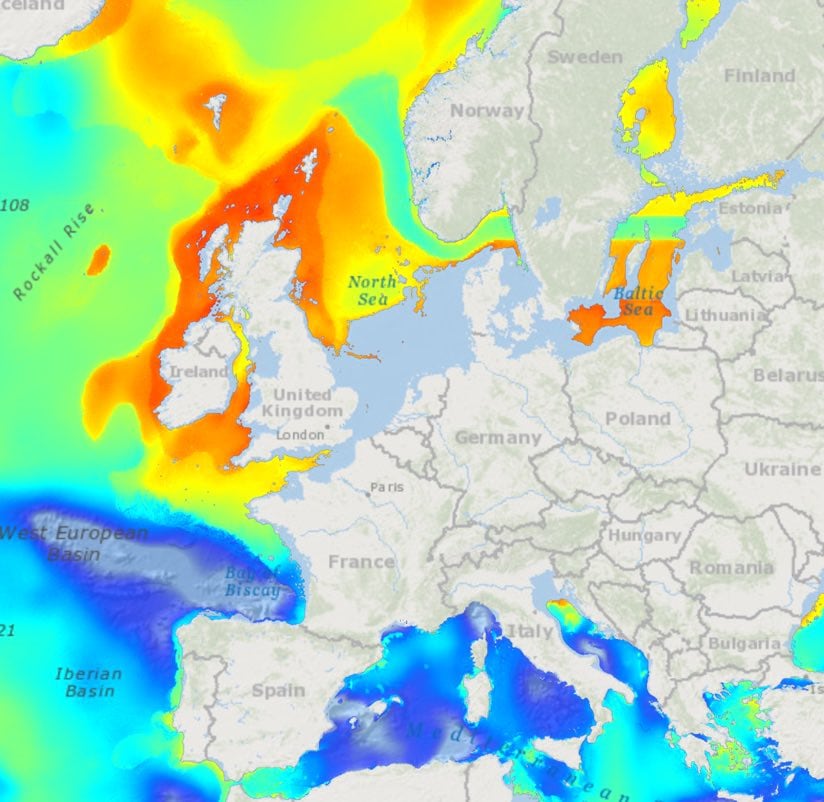
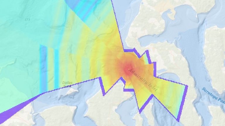
Sound is, by definition, an abstract concept. Yet Verlinden and his team wanted a way to display their data in a way nonexperts could grasp. They used geographic information system (GIS) software to construct visual maps of ocean sonics. For the many AOS clients who already use GIS, the technology also provides a seamless way to share and transfer information.
“Acoustics is a really specialized field and not something that’s accessible to all ocean science disciplines,” said Sarah Rosenthal, AOS’s GIS expert. “By lowering the barrier of entry to using high fidelity ocean acoustics models, we broaden its scope. You can really start to see a whole picture of what’s going on right now or even predict future environmental conditions underwater.”
The addition of GIS to the applied scientific and mathematical work at AOS is opening new opportunities for analysis and communication for the organization.
“Our math is very good, and we’re proud of it, but that’s where our expertise ends, except for Sarah,” Verlinden said. “Sarah’s been teaching us that communicating the results of what we’re doing is one thing that GIS is good at. The way to actually deliver our math to the people who need it to do good things, like NOAA, is to put it in a platform they already have—GIS.”
It was the controversy and confusion surrounding potentially damaging effects of the US Navy’s use of sonar that first drew Verlinden to study the problem, and eventually led him to become a Navy acoustician. In its work with the defense community, AOS promotes passive sensor methods, which involve no interference with the ocean—as opposed to active sonar, which requires emitting a signal.
“I am the most ardent conservationist you’ll ever meet, but I was in the military for 15 years,” he said. “I don’t find those pursuits to be incompatible. When I was 25 years old and became aware of the controversy surrounding active Navy sonar, I had two choices. I could say, ‘Boycott the Navy!’ But the Navy is never going to not need to find submarines as part of its important mission set. Or I could spend five years of my life creating a passive localization algorithm that works just as well, making those other methods obsolete.”
AOS’s passive methods are often applied to data gathered by hydrophones, yielding a nuanced refinement of existing models for understanding ocean sonics.
Heaney, AOS president, offered the example of large vessels and the effect they have on migrating whales and other sea creatures. Maps depicting shipping lanes tell an incomplete story. “When you actually figure out the acoustics, you realize there are no ‘thin lines’ in the ocean,” he said. “Sound isn’t confined to those shipping lanes. The ocean is impacted everywhere by those ships going by.”
The simple formulas that calculate the effect of underwater pile driver operations are another cautionary tale. “They don’t account for how much energy is absorbed by the sea bottom or reflected off the top or being refracted around islands,” Verlinden explained.
Sometimes the hydrophones yield sonic Easter eggs—like the time Verlinden and his team stumbled onto the secret language of walruses.
“It turns out walruses make this noise to communicate,” Verlinden said. “Nobody had ever heard it—and we weren’t even trying to find it!”
Learn more about the use of GIS for maritime charting and navigation.